Travels in the Southwest: March & April, 2023 (#3)
Section #3
(Too much fun for just one blog post)
Theme #3: Transient Communities
Nomad: an individual who roams about. (Merriam-Webster dictionary).
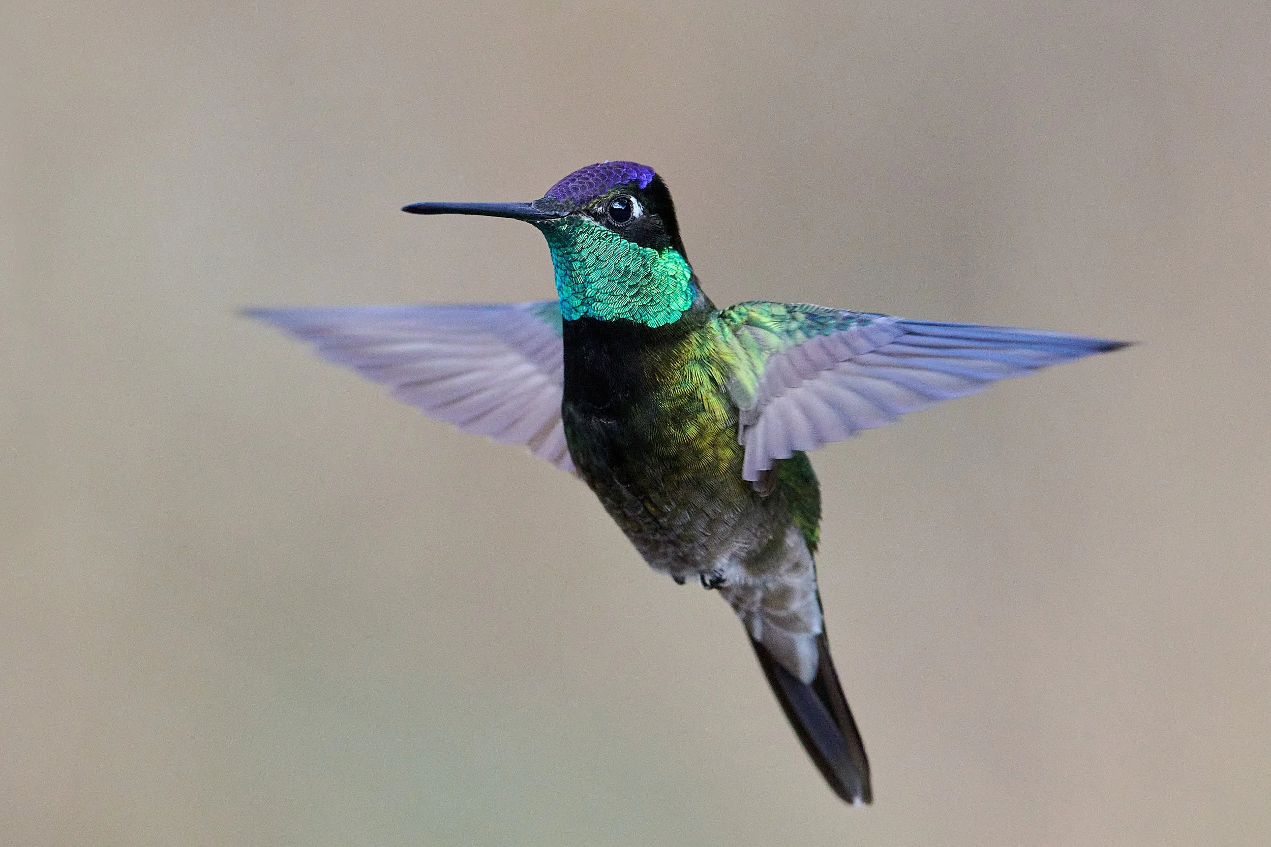
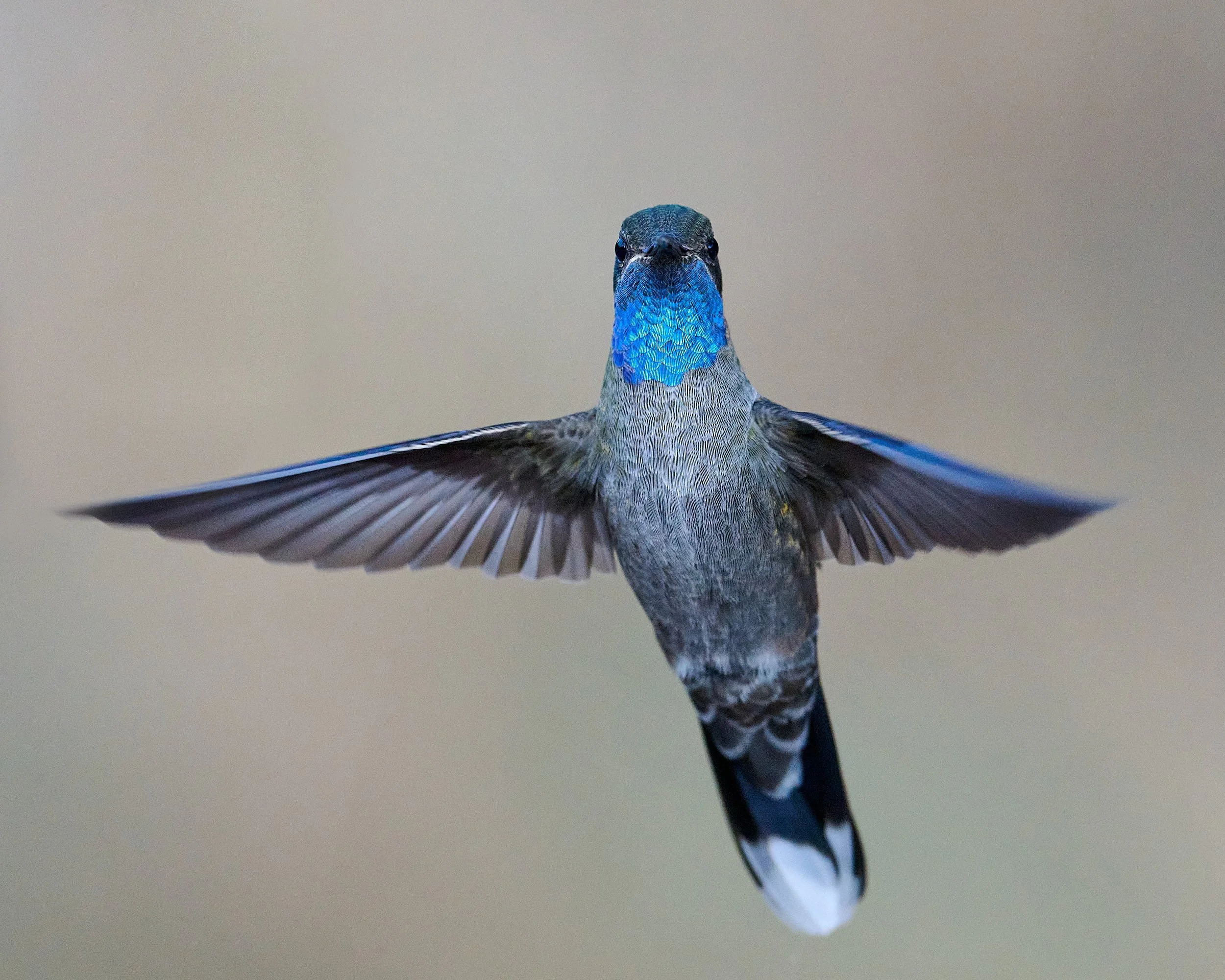
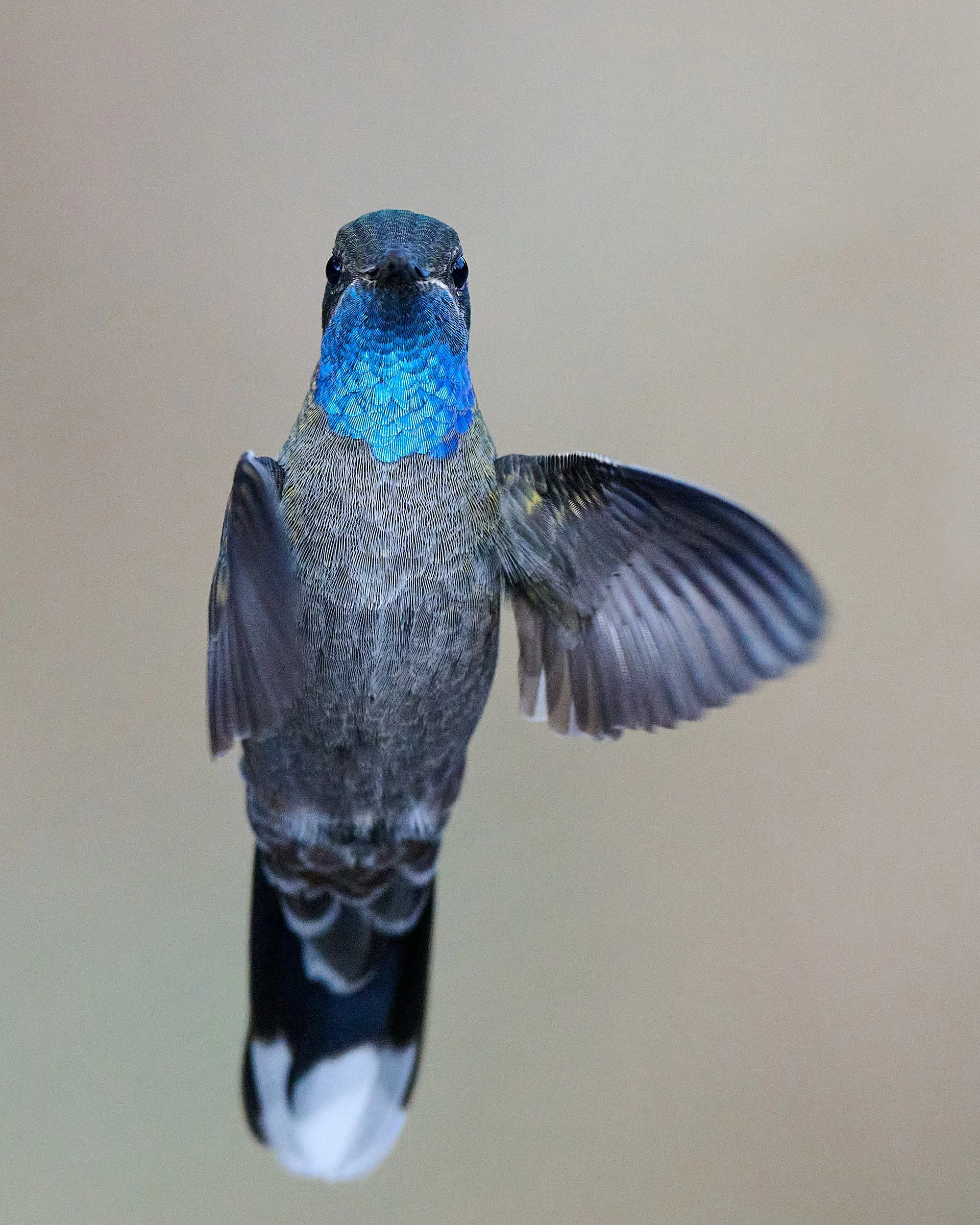
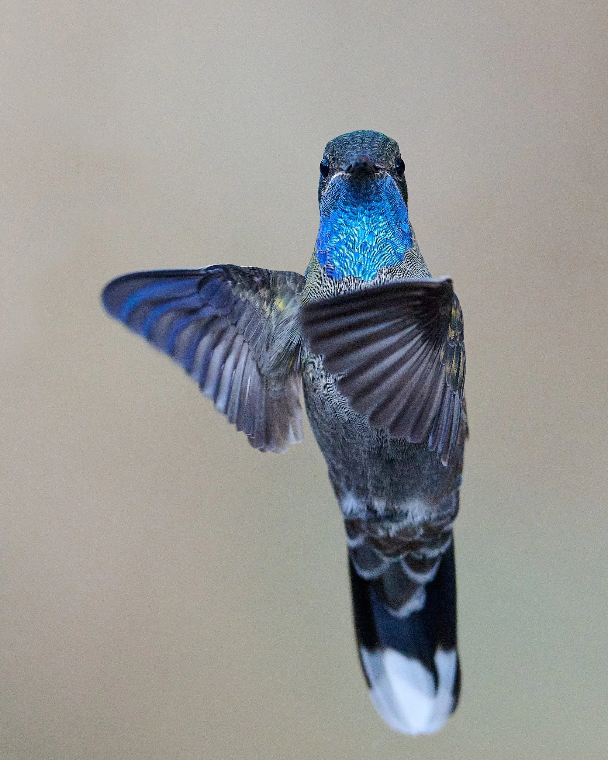
Male Rivoli’s Hummingbird
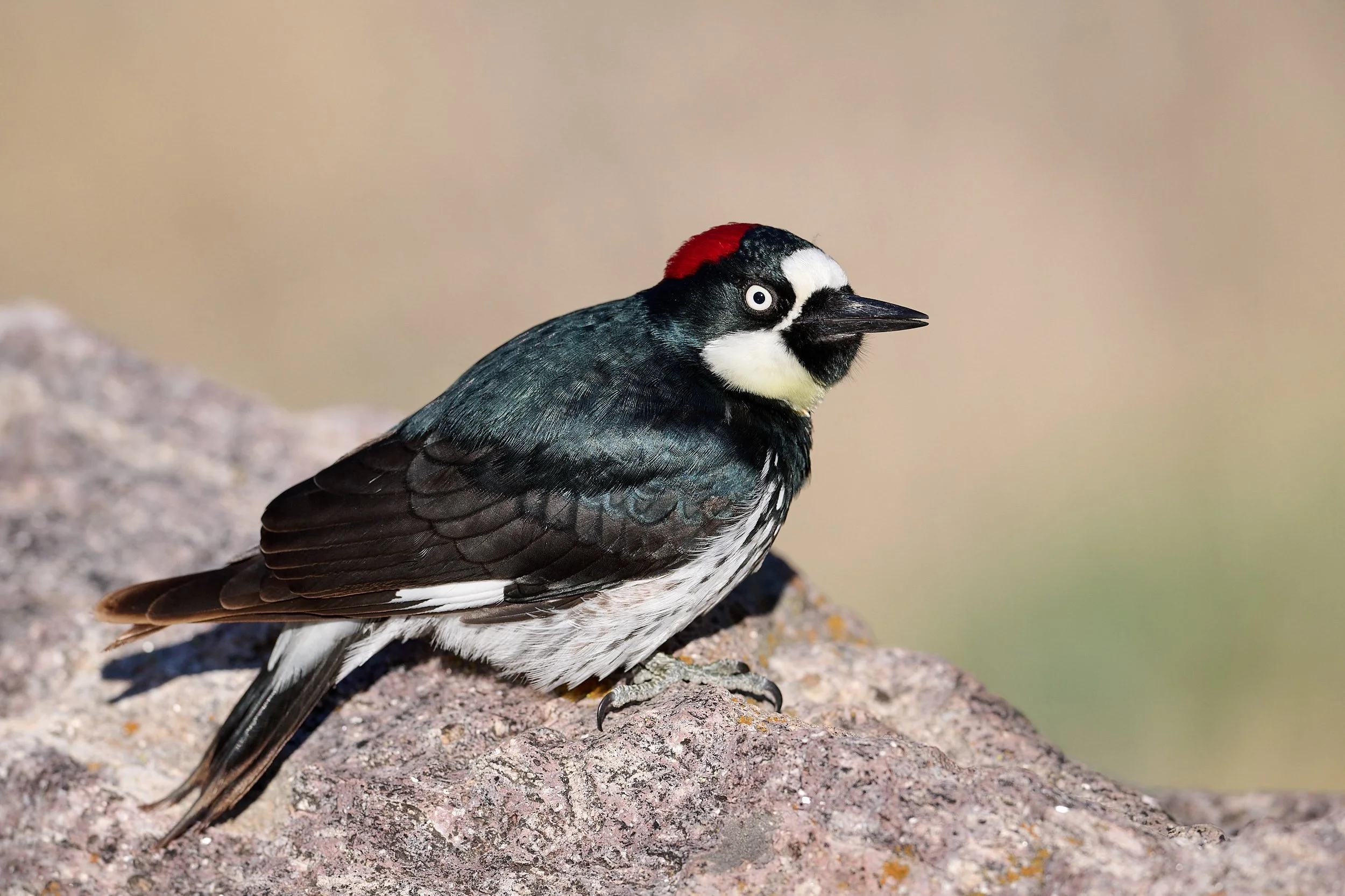
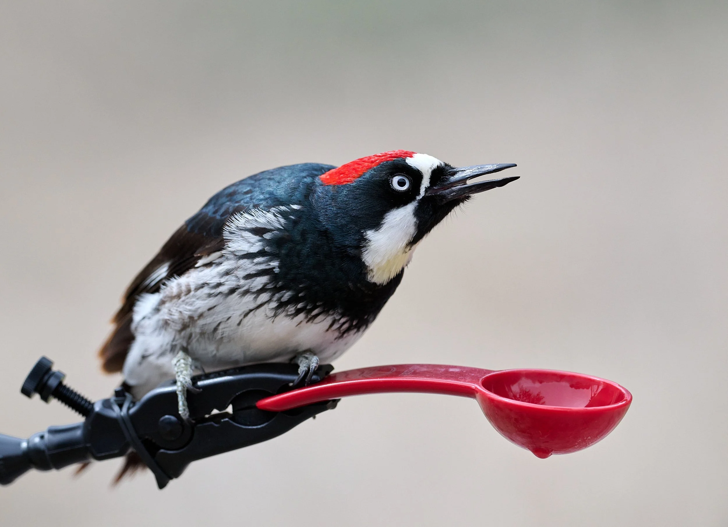
Female Acorn Woodpecker
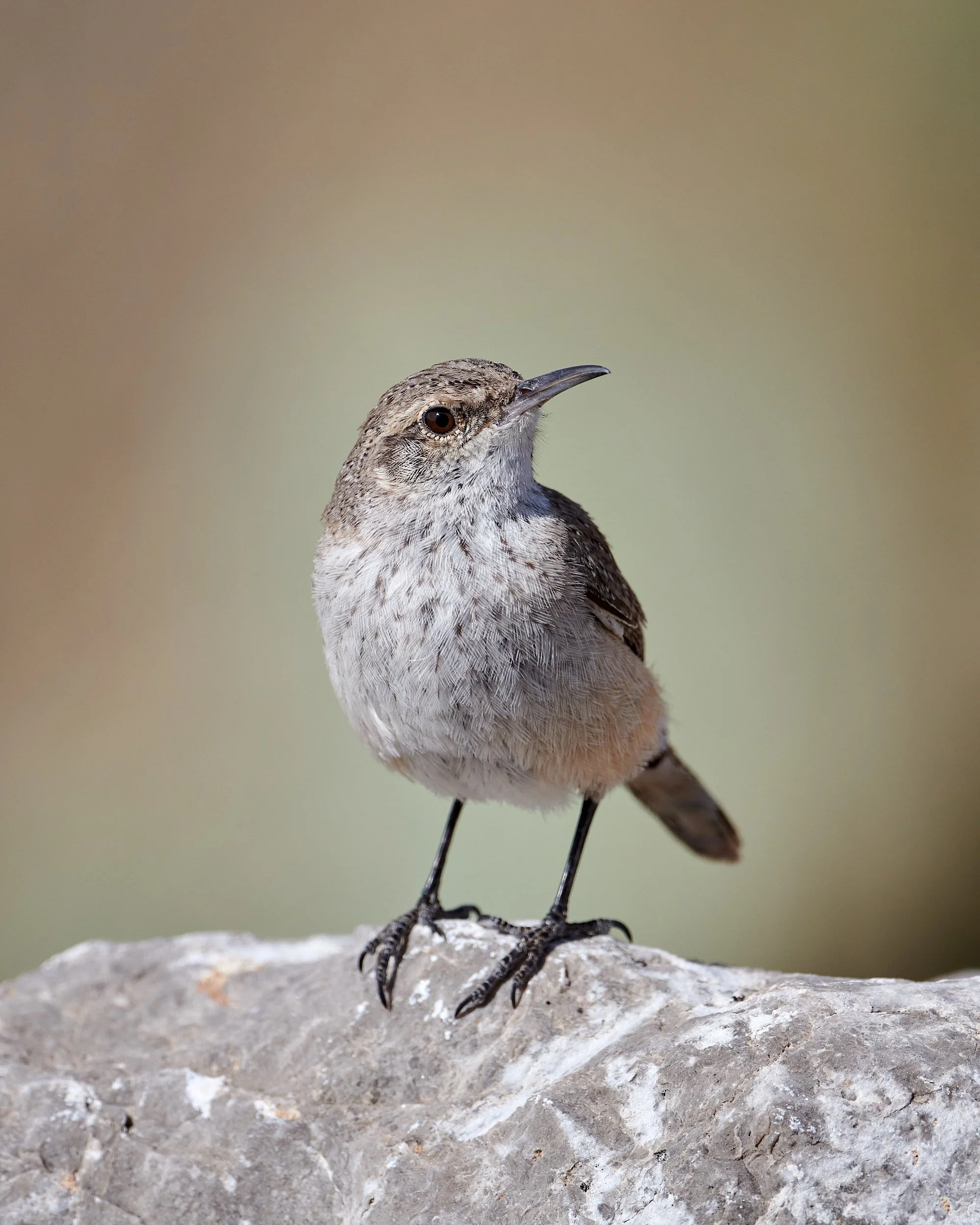
Rock Wren

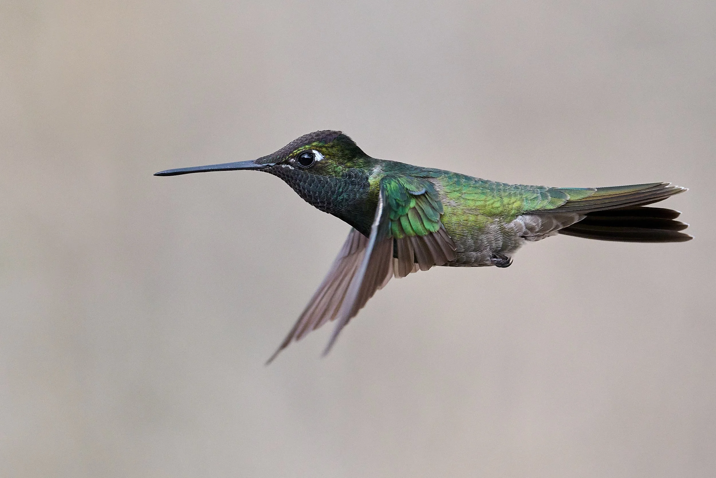
Juvenile Blue-throated Mountain Blue Gem
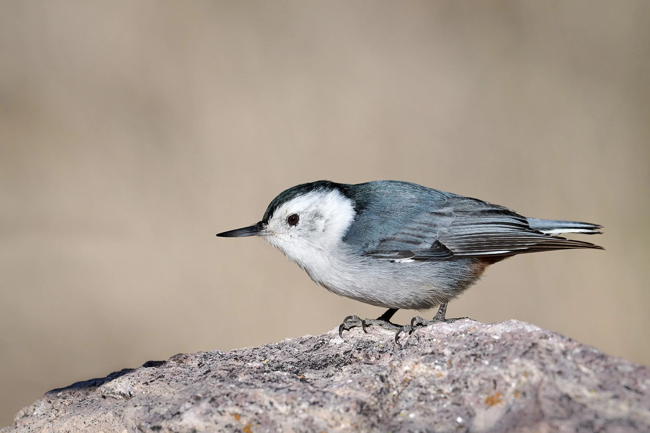
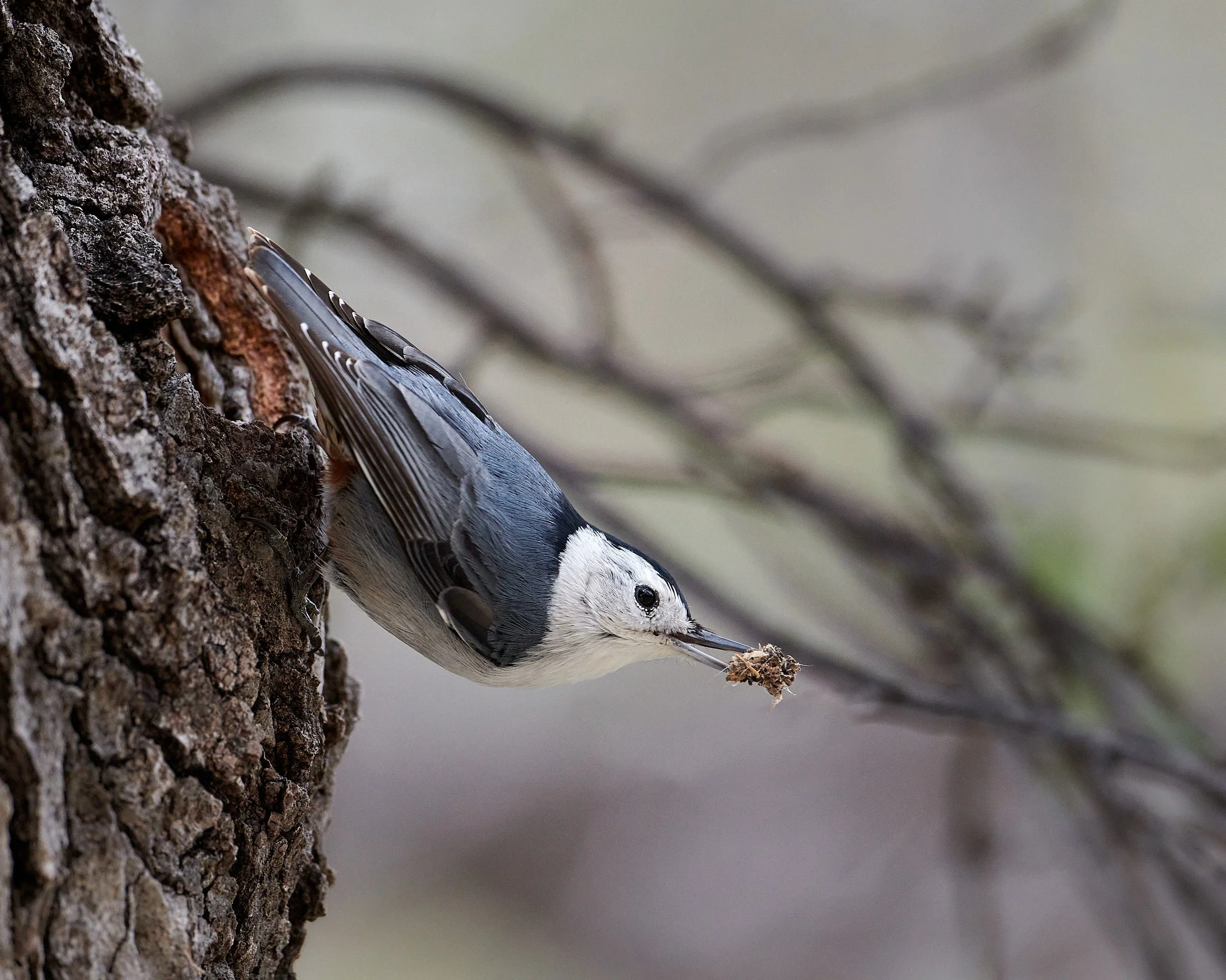
White-breasted Nuthatch
Wings to fly
Birds are very mobile and their travels include local movements associated with daily foraging, flights to and from roost sites, and other daily activities. Migration is a regular seasonal movement of individuals away from, and back to, the breeding grounds. Birds generally undertake migration to avoid times when resources are scarce and conditions are harsh, or, conversely, to exploit sites and seasons where the benefits far outweigh the costs. Dispersal is a movement to find a place to breed and generally occurs only once or a very few times in an individual bird’s life.
(From: Handbook of Bird Biology. 3rd Ed. 2016. The Cornell Laboratory of Ornithology).
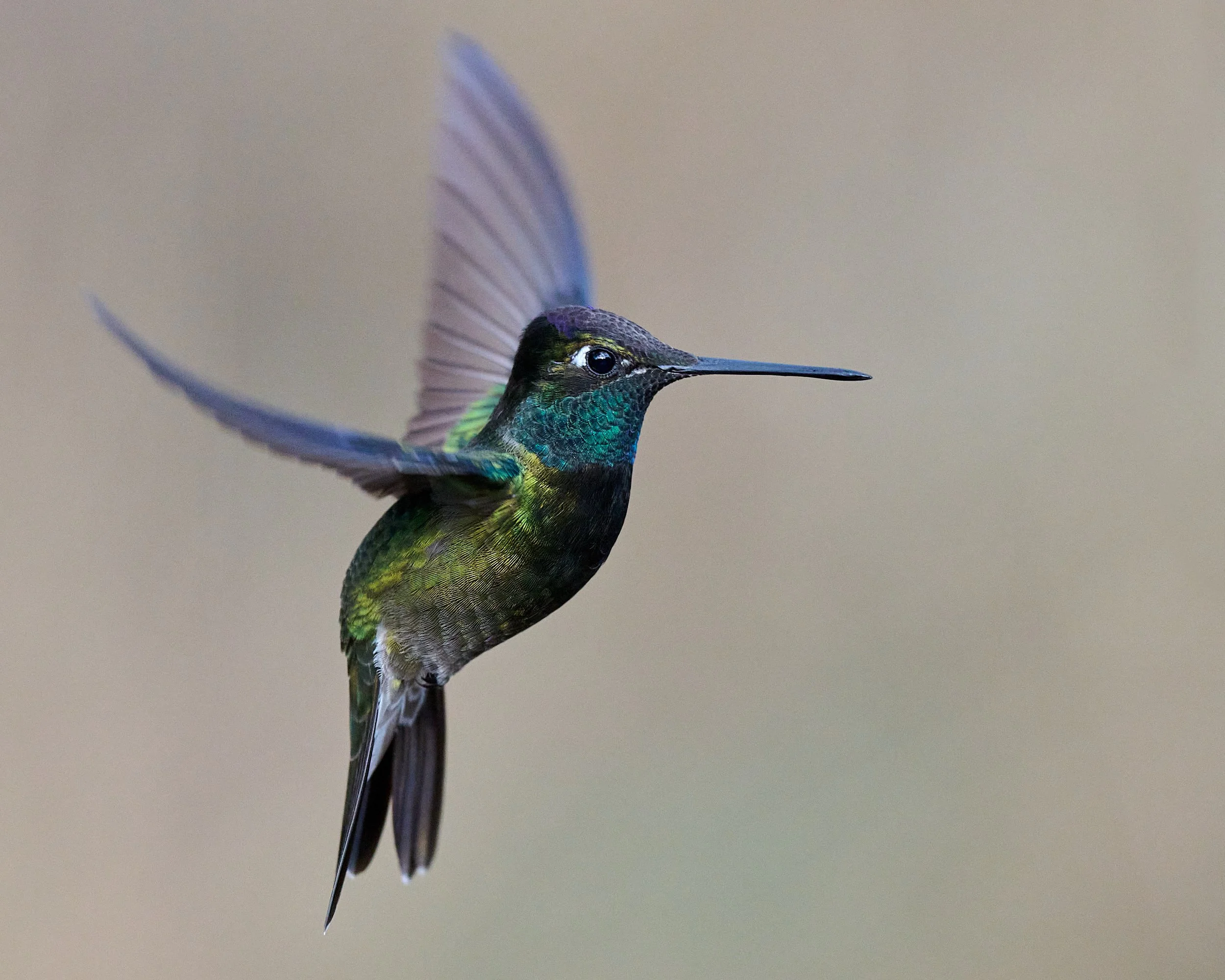
Male Rivoli’s Hummingbird
Male Rivoli’s Hummingbird
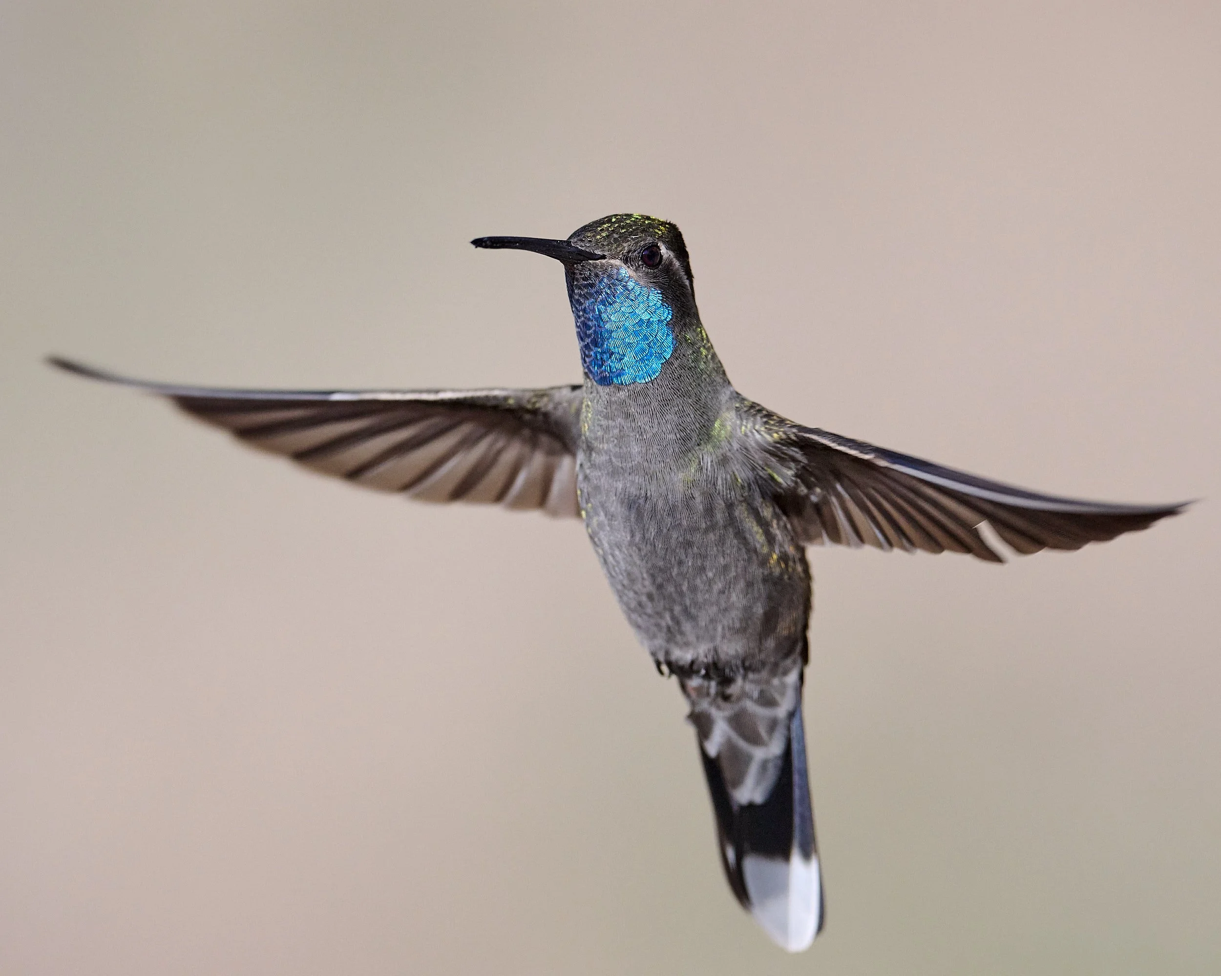
Blue-throated Mountain Gem
Homo sapiens also gets around
Humans, faithful to their evolutionary heritage and ancient history, often travel. Personally, we dispersed from Africa to USA. “Snow birds” avoid winter tribulations by migrating south. The “itch” can be described as the feeling people get when they've sat still for too long, when they know there's so much more to be seen and done.

Tribes
Not all individuals within a population of birds of the same species will migrate. Similarly, some of us are home-bodies.
Those that journey are probably genetically predisposed to embrace the experience and have traits in common with other fellow wanderers.
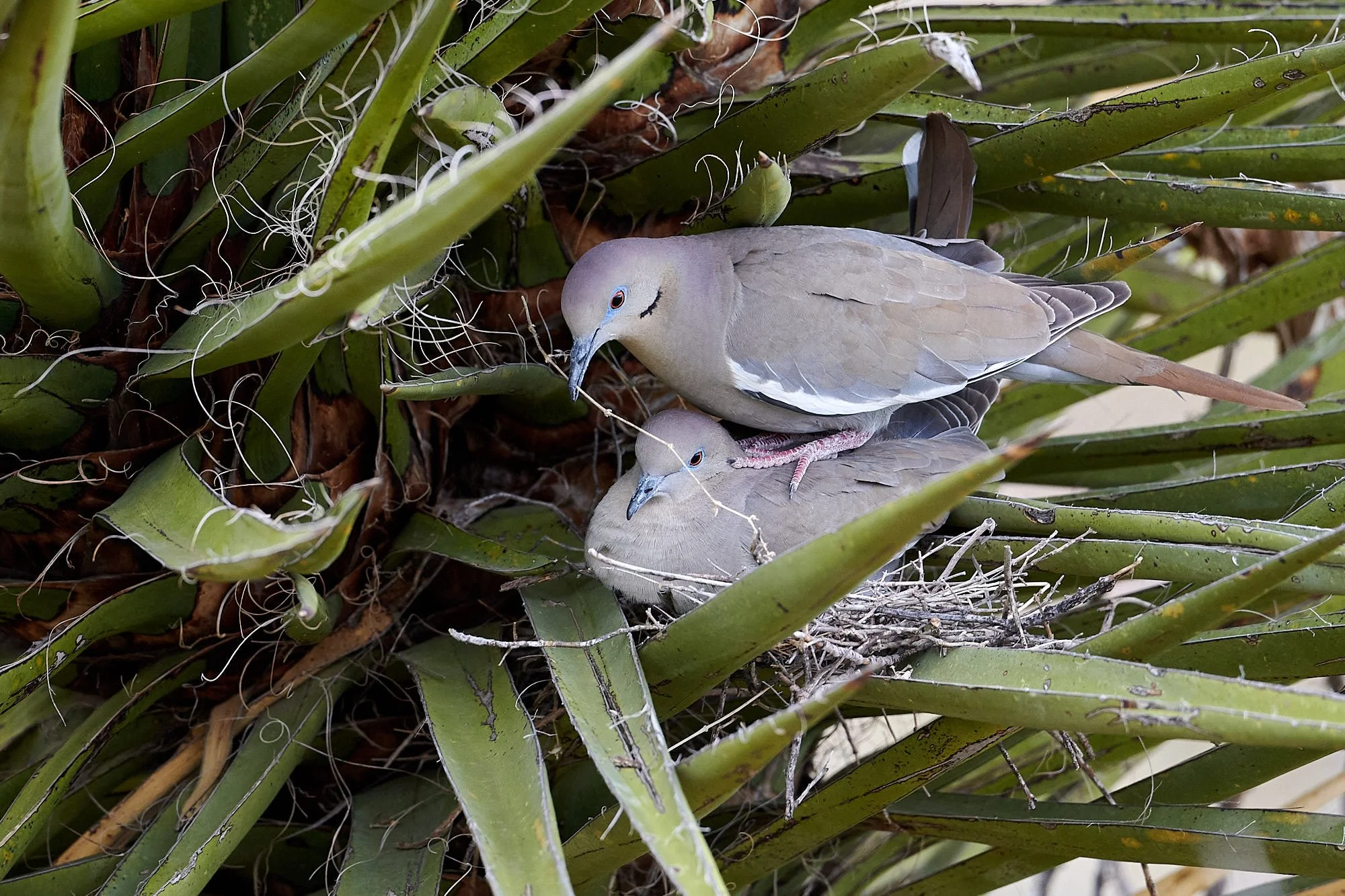
Sheltering together
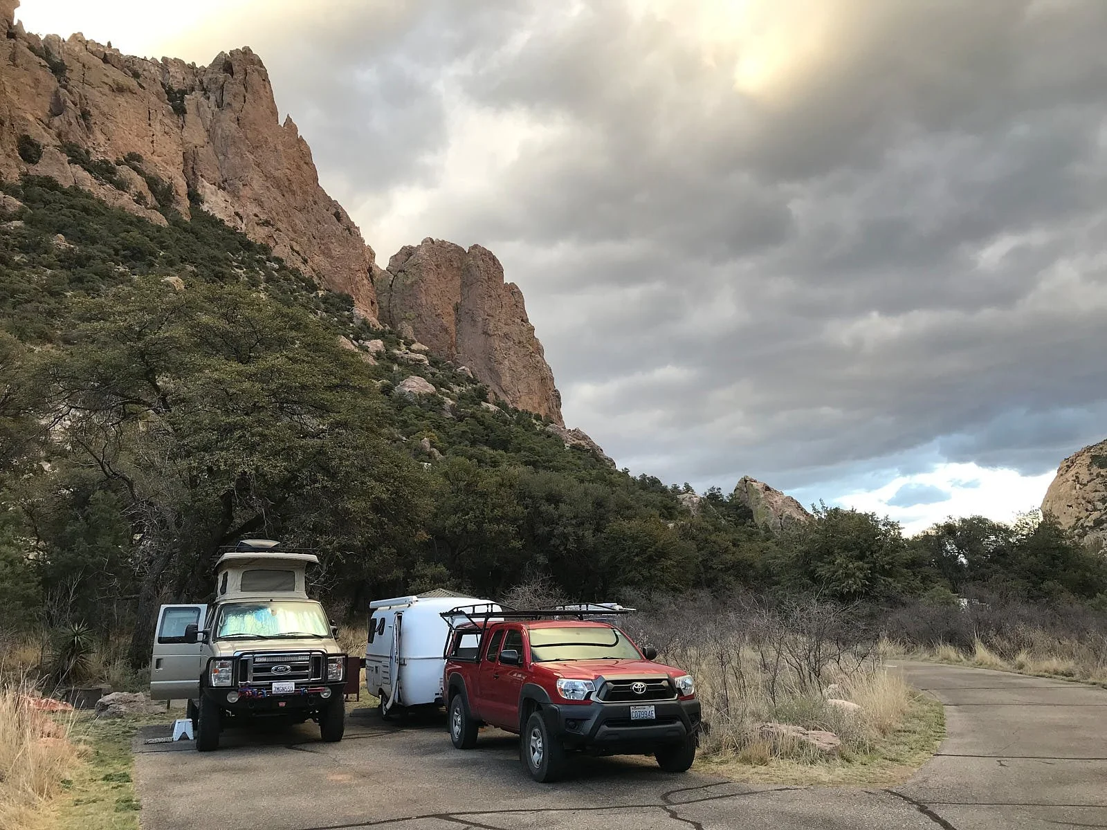
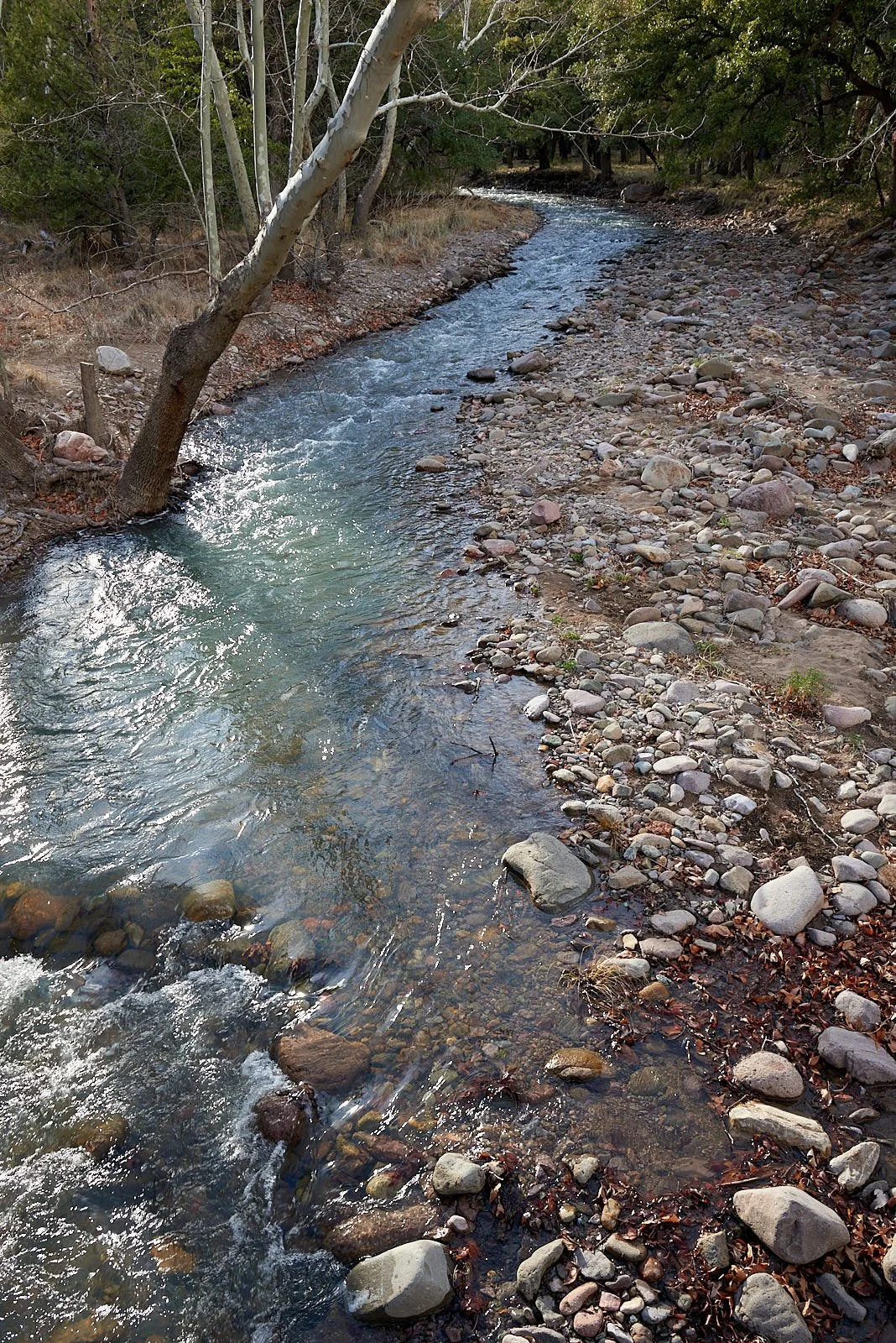
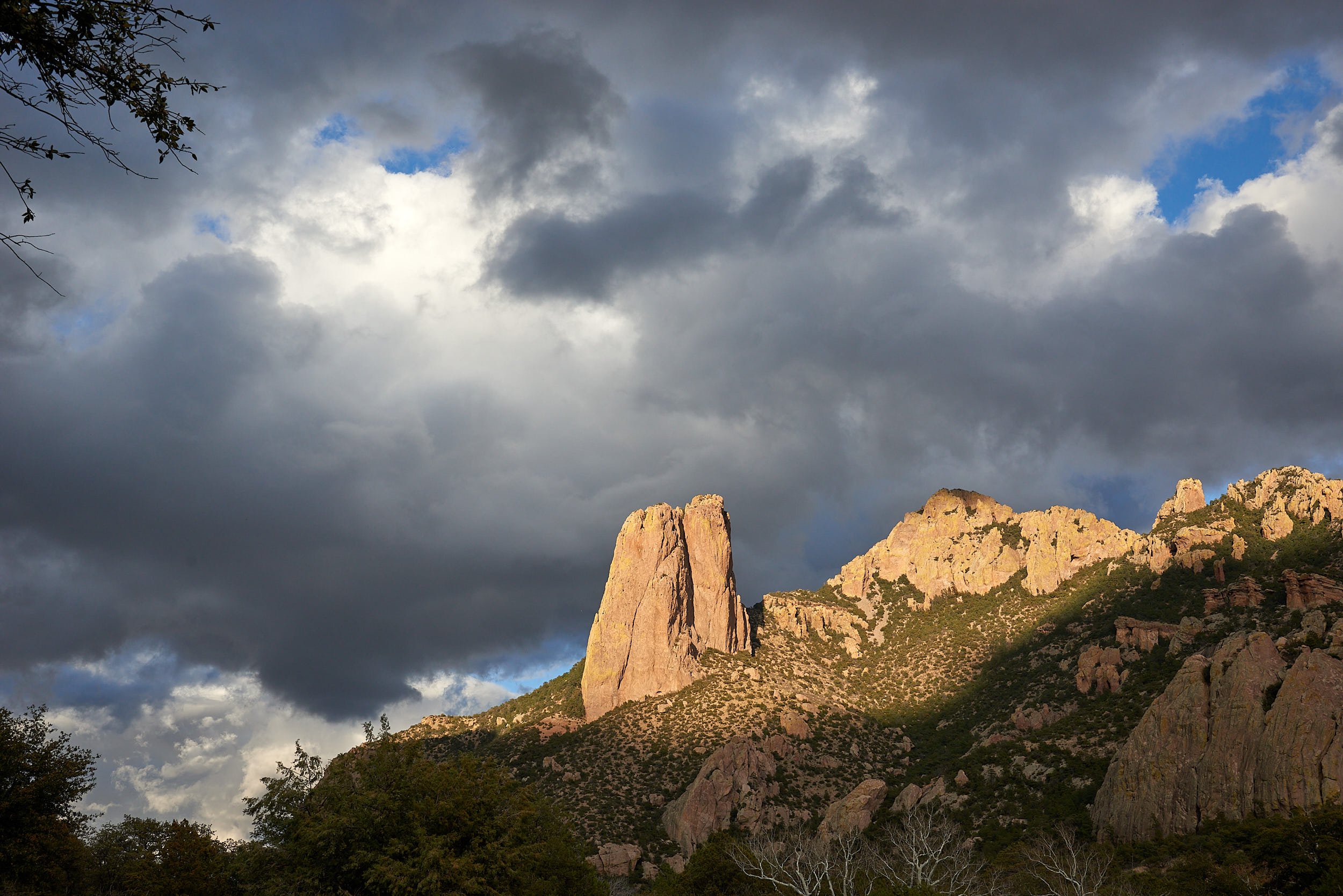
H. sapiens is a highly social creature and it is perhaps unsurprising that transients often form communities. This was brought home to us during our time at Sunny Flat campground in the Chiricahua Mountains of Coronado National Forest, Arizona
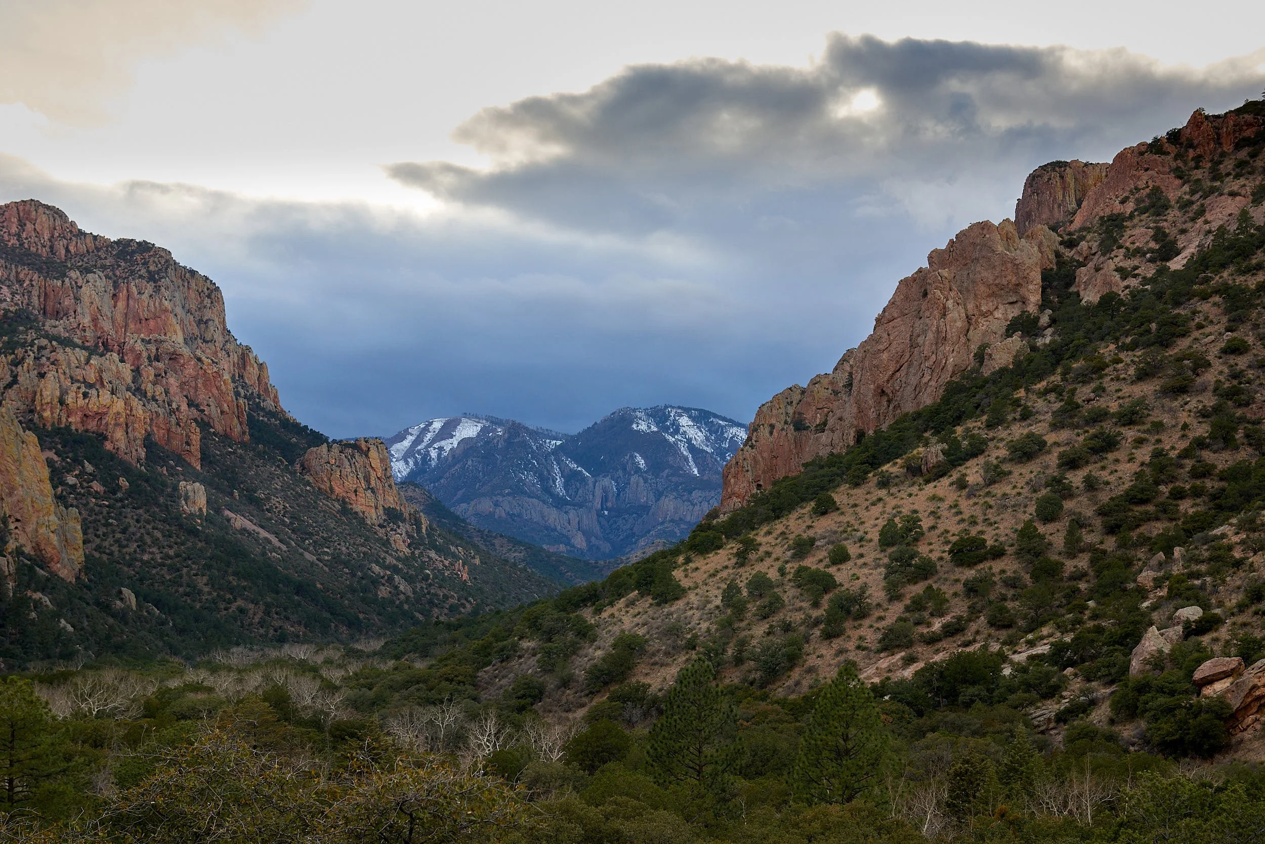
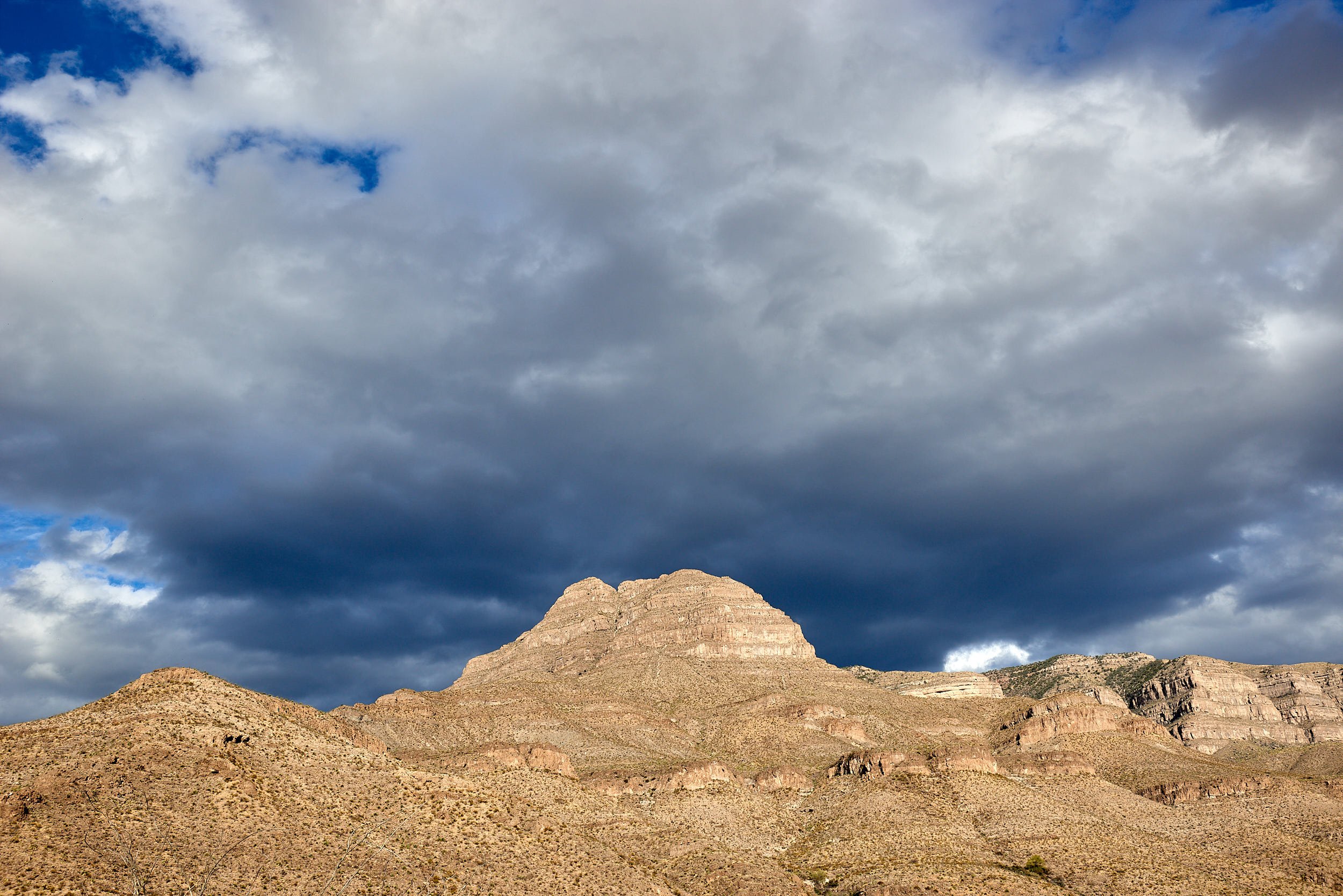
Chiricahua Mountains: Arizona
Eastern access to the Chiricahua Range is primarily via the paved road from Rodeo to Portal, the latter being a small community sheltering at the entrance of spectacular Cave Creek Canyon. There are several National Forest campgrounds within the canyon, including our destination – Sunny Flat.
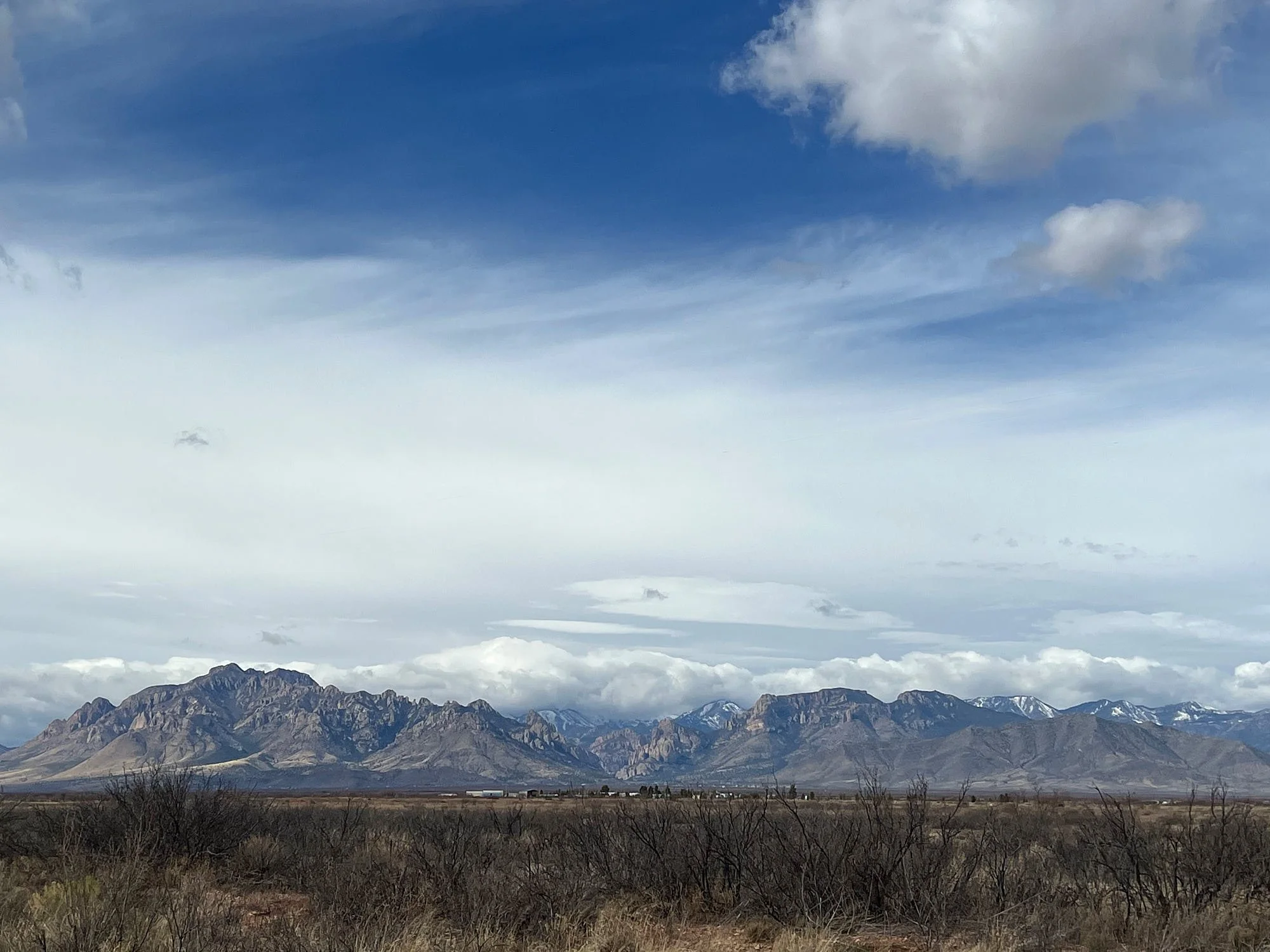
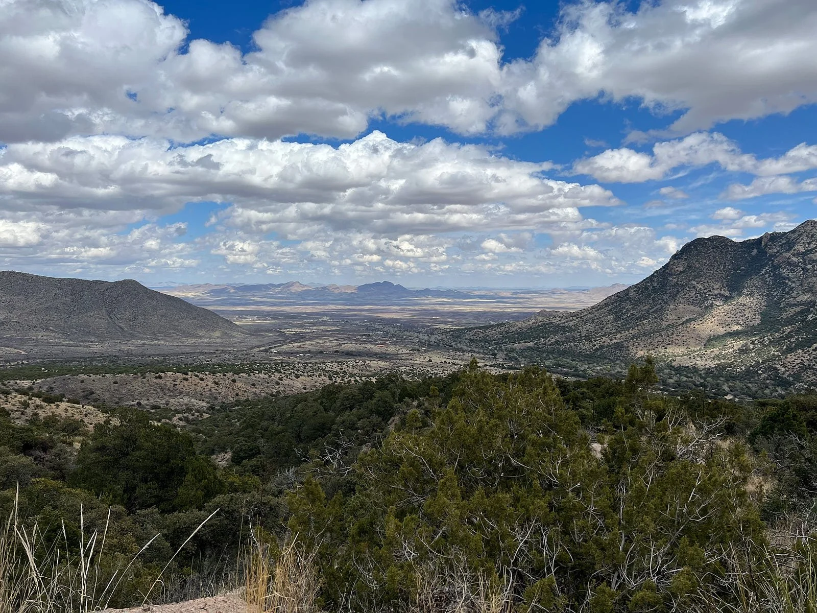
Left: Chiricahua Range viewed from the east. Right: Looking east towards Portal village, which is arranged around Cave Creek.
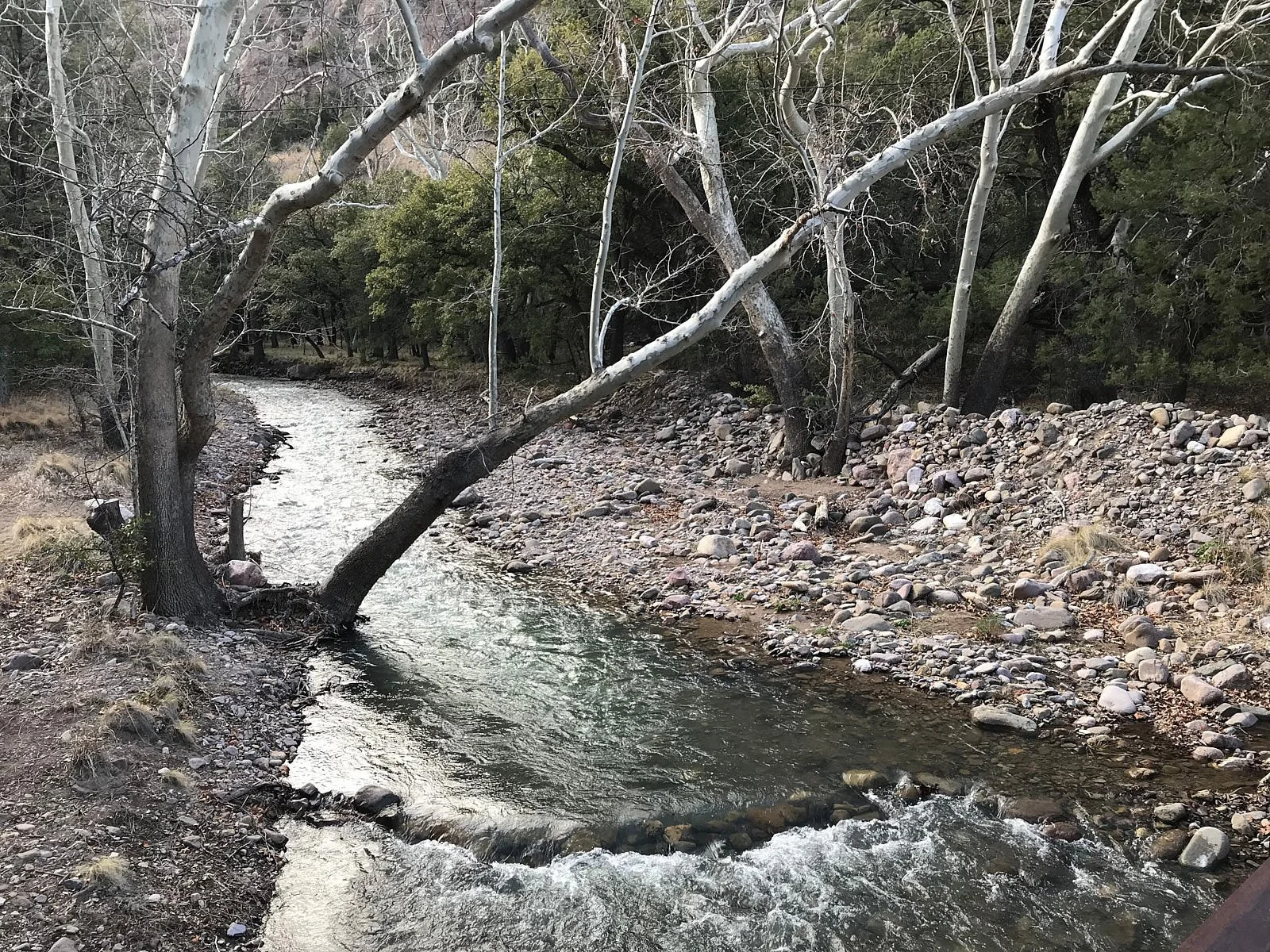
Sunny Flat is exactly that; a floodplain opening within the riverine woodland that accompanies picturesque Cave Creek. For folk that appreciate nature, securing a spot at the no-reservations campground is highly prized. Most of the sites are fairly secluded, allowing some peace and immediate entry into Cave Creek Canyon’s diverse environment.

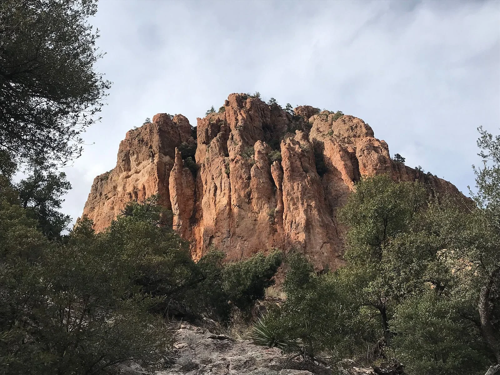
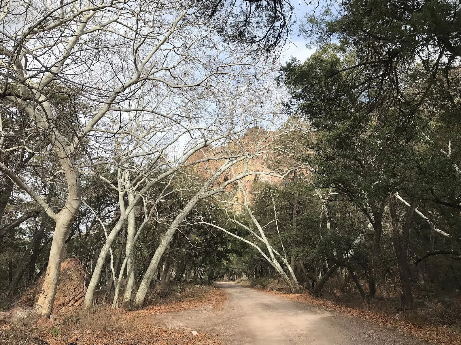
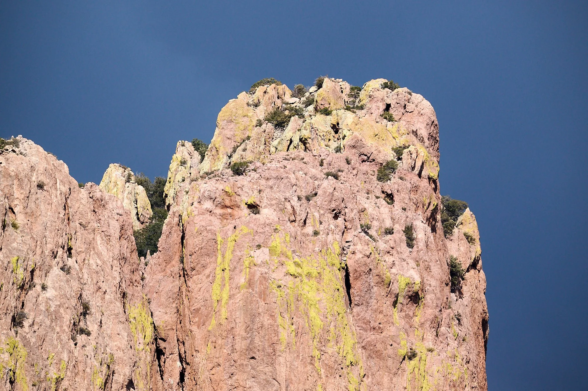


1st row: Left and Right - Erosion over geologic time has exquisitely sculpted the canyons.
2nd row: Left - Sycamore and oak woodland along the south fork of Cave Creek; Right - Cave Creek rhyolite from volcanism about 25 million years ago.
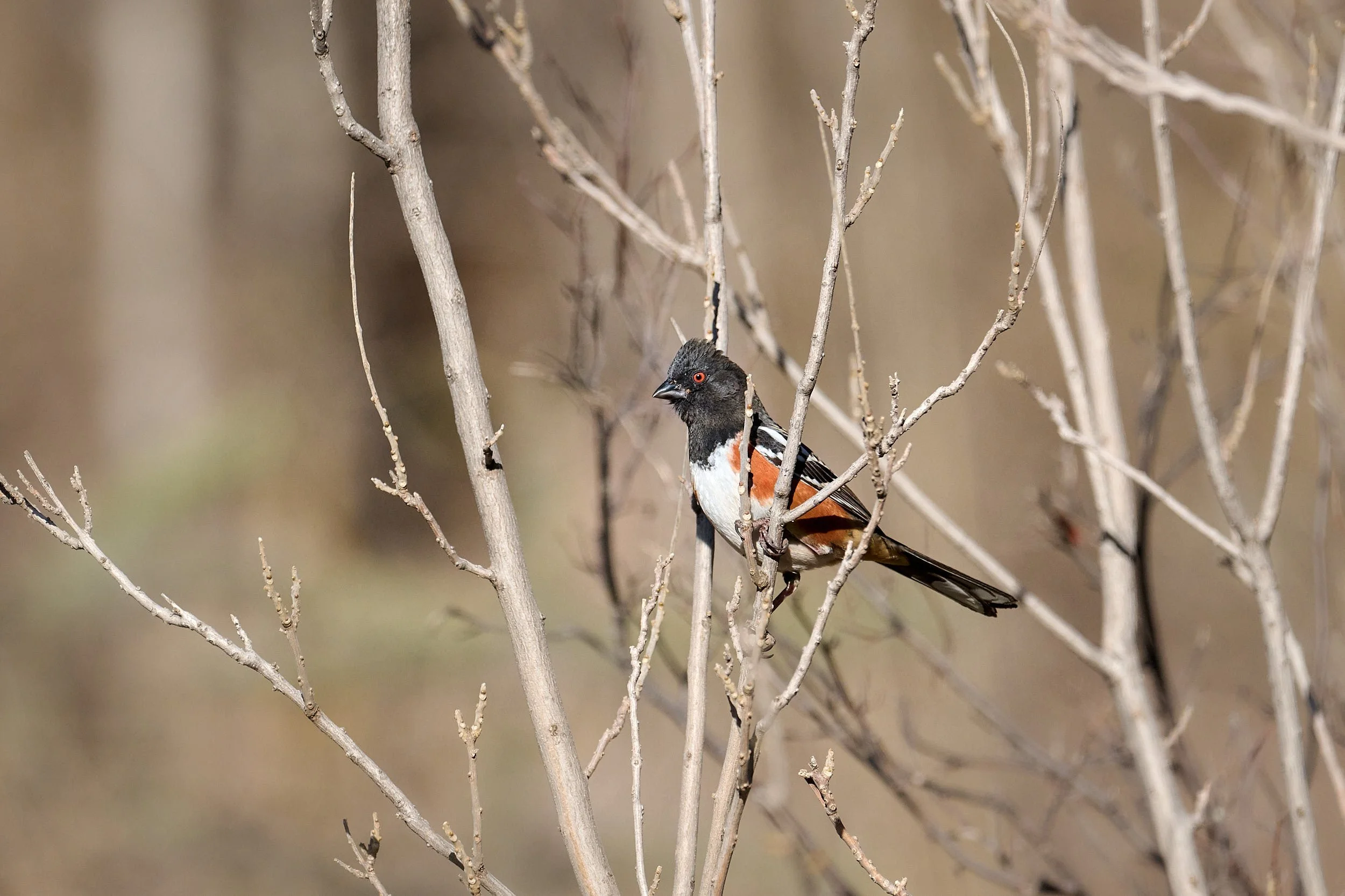
3rd row: Left - Coues deer (a diminutive subspecies of White-tailed Deer); Right - Male Spotted Towhee near our camp.
4th row: Left - Looking westwards at the junction of the south & north forks of Cave Creek; Right - Morning mist rising after rains during the night.
5th row: Left and Right - Cave Creek was flowing vigorously because of recent precipitation and substantial snow melt.
Finding friends at Sunny Flat
A circular campground road provides access and facilitates socialization. Campers amble along the pavement, exchanging pleasantries and gentle conversation with their neighbors. I set up hummingbird feeders and people regularly dropped by to view the action. It wasn’t long before we bonded with two couples from the Puget Sound area of Washington State. The common glue was coffee, humor and a love of the outdoors. We shared stories about Alaska, the Northwest and Africa, hiked the Greenhouse trail to Winn Falls and spent evenings appreciating their musical expertise on ukulele, mandolin, autoharp and voice.
It is great to learn fresh perspectives and hear how people have approached life’s opportunities and challenges. In contrast to discourse in the media, travelers generally interact within respectful, friendly, non-judgmental boundaries. It reaffirms one’s optimism for humanity’s future.
These social connections, although transient, can become long-lasting. A year ago, we met B&T at Sunny Flat. The campground has some magic!


Beauty versus Brawn
I was intrigued to see if hummingbirds would drink nectar from an open spoon. This Blue-throated Mountain Gem showed interest.
Guess who won
But then along came you know who.
Sunny Flat scenes
Anyone who enjoys the natural world will find something of interest in the Chiricahua Mountains.
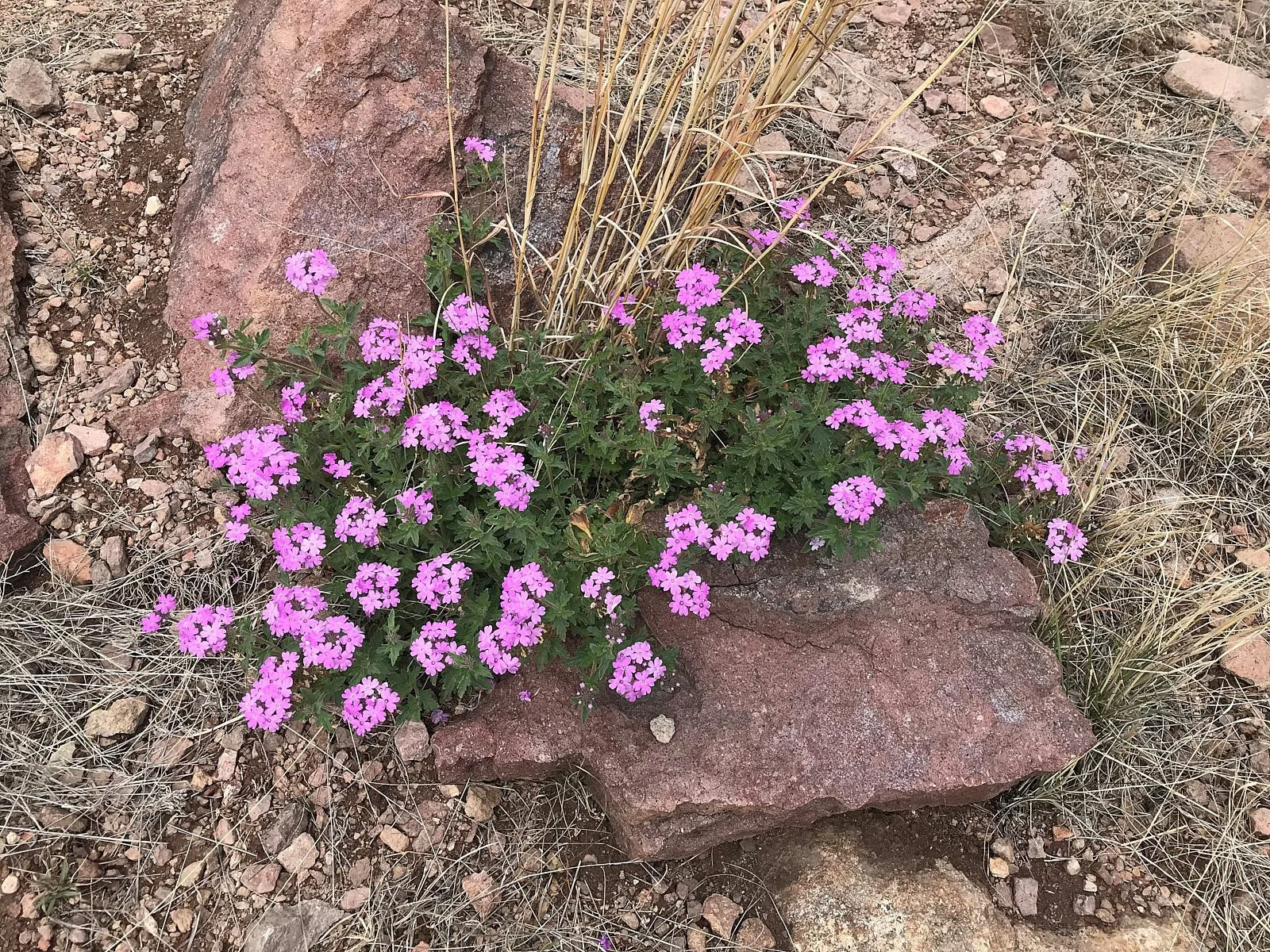


1st row: Left - Goodding’s Verbena; Right - Sotol, Alligator Juniper, Arizona Juniper, & Yucca were common on ridges above the riprarian woodland.
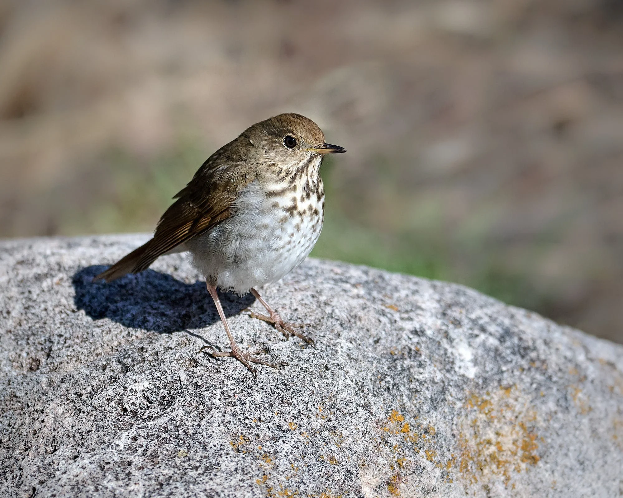
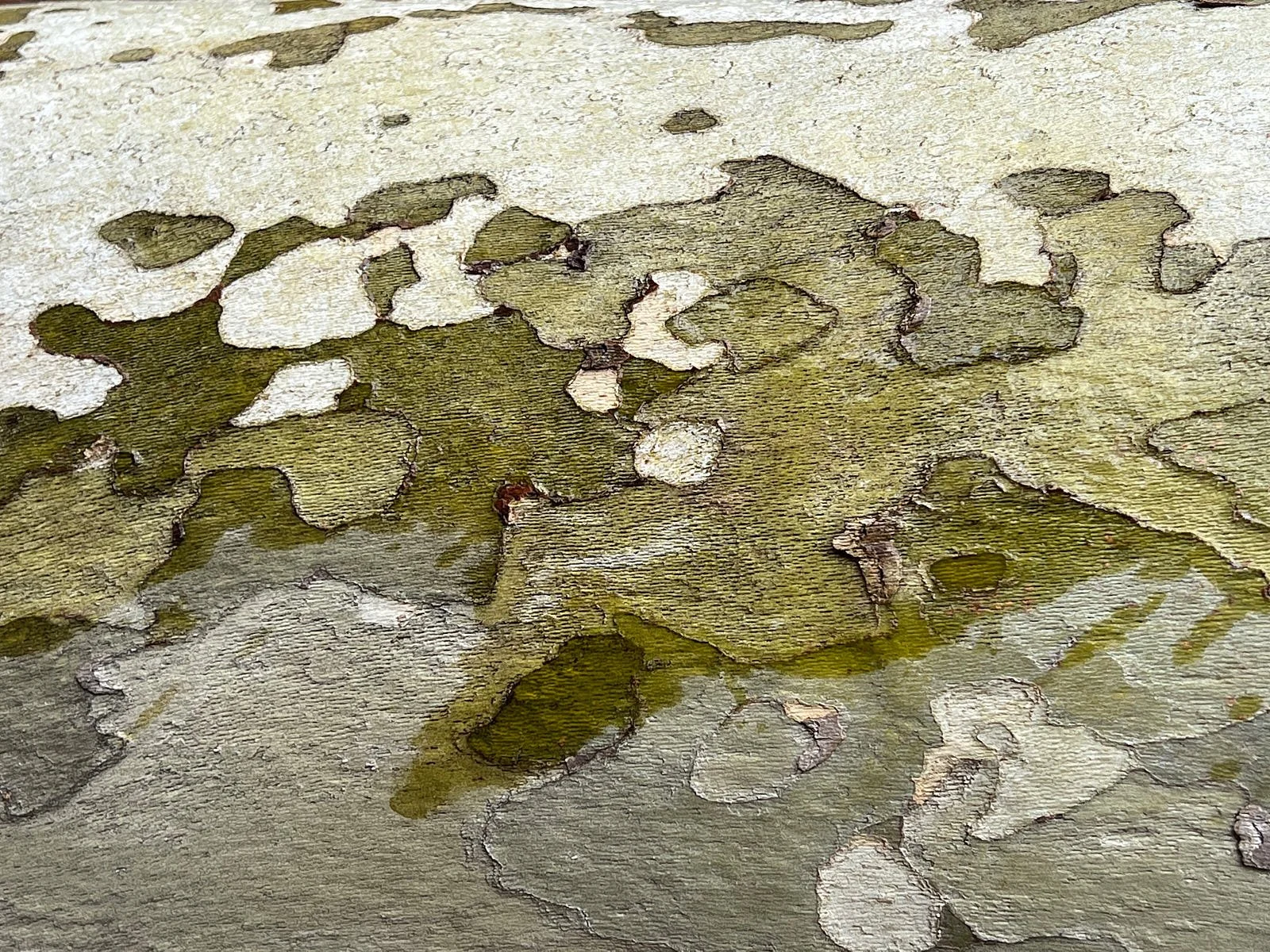
2nd row: Left - Hermit Thrush; Right - Sycamore bark.
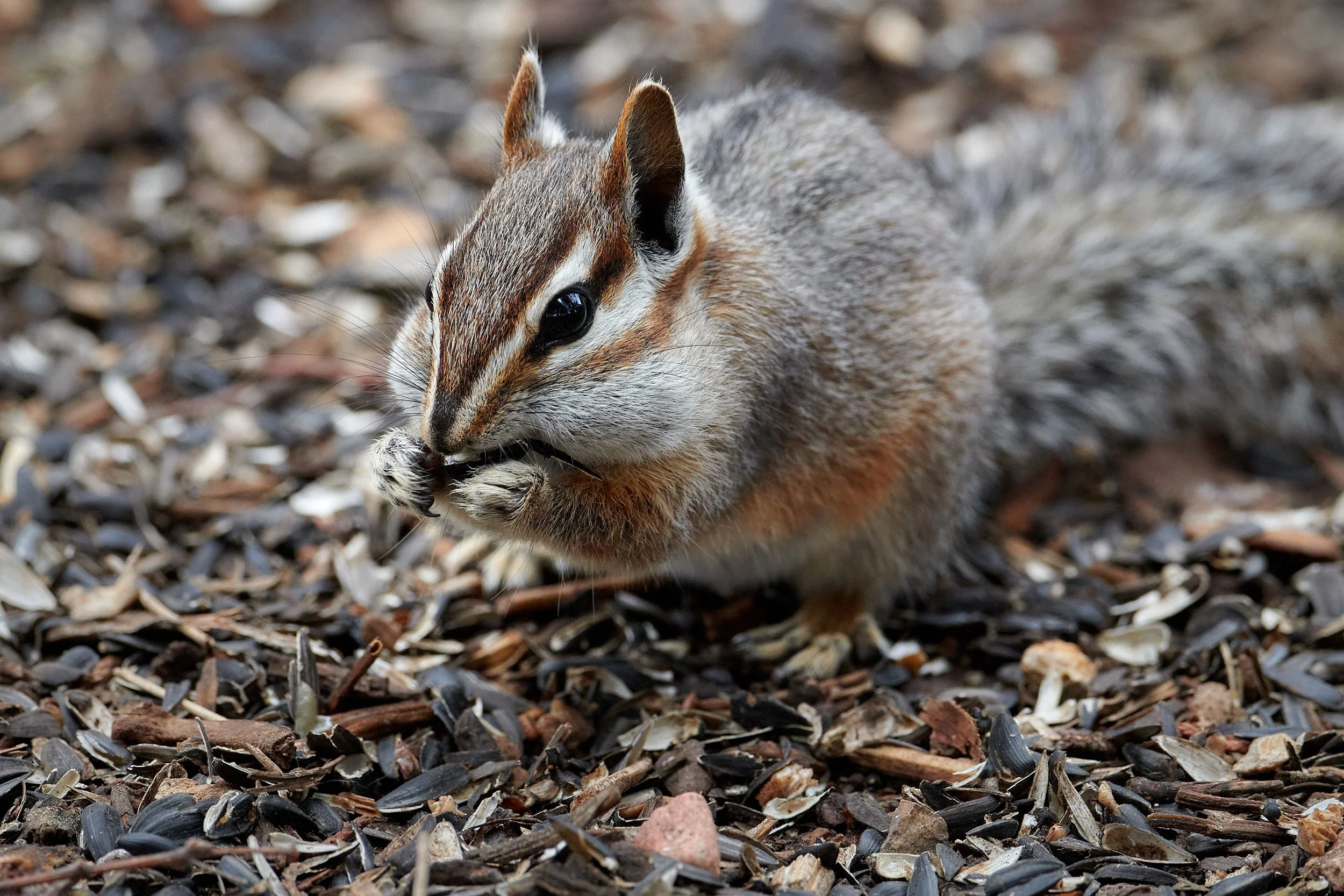
3rd row: Left - Shaded north fork of Cave Creek; Right - Chipmunk enjoying sunflower seeds at Portal feeder station.
4th row: Left - White-breasted Nuthatch removing debris from potential nesting hole; Right - Agave spp.
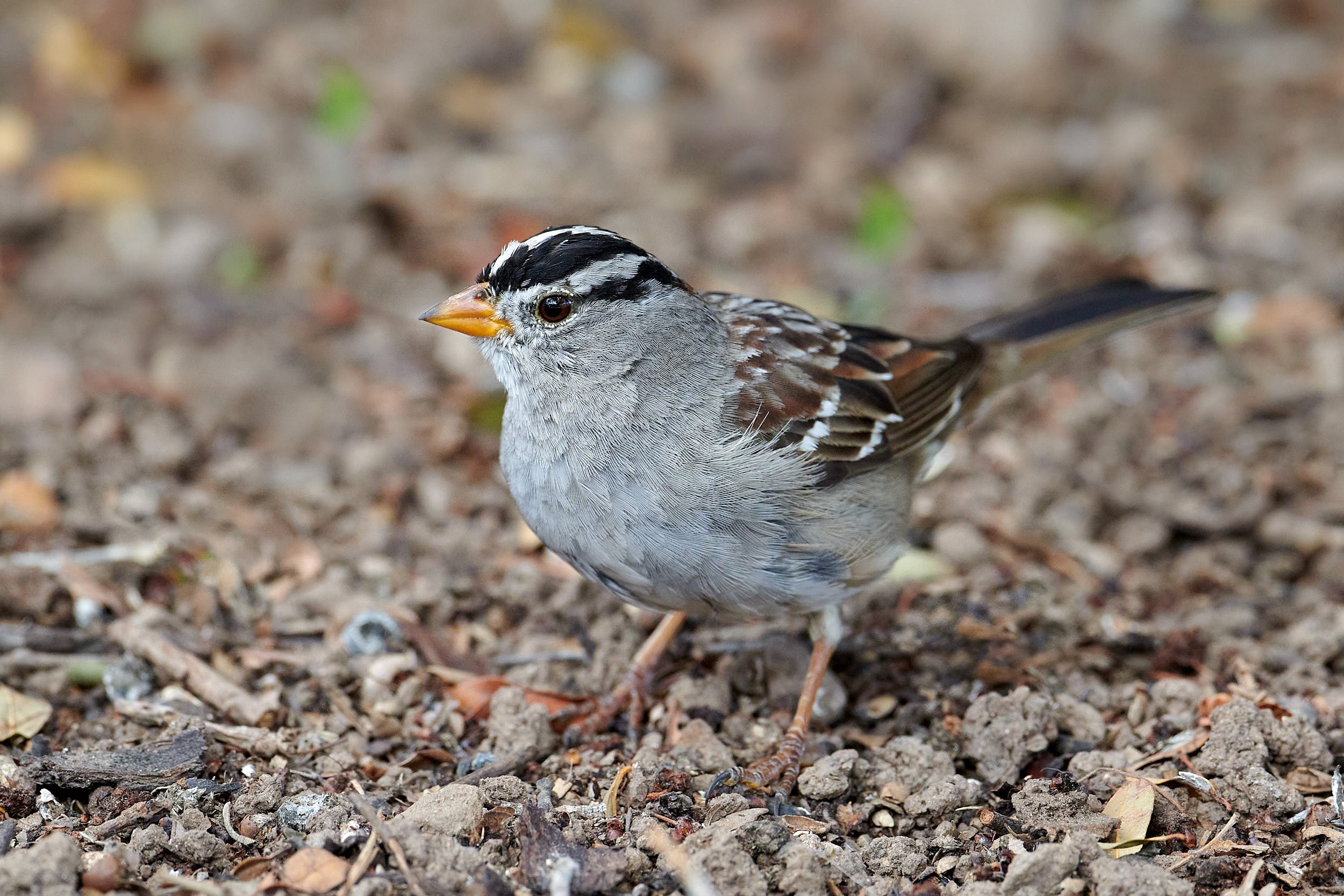
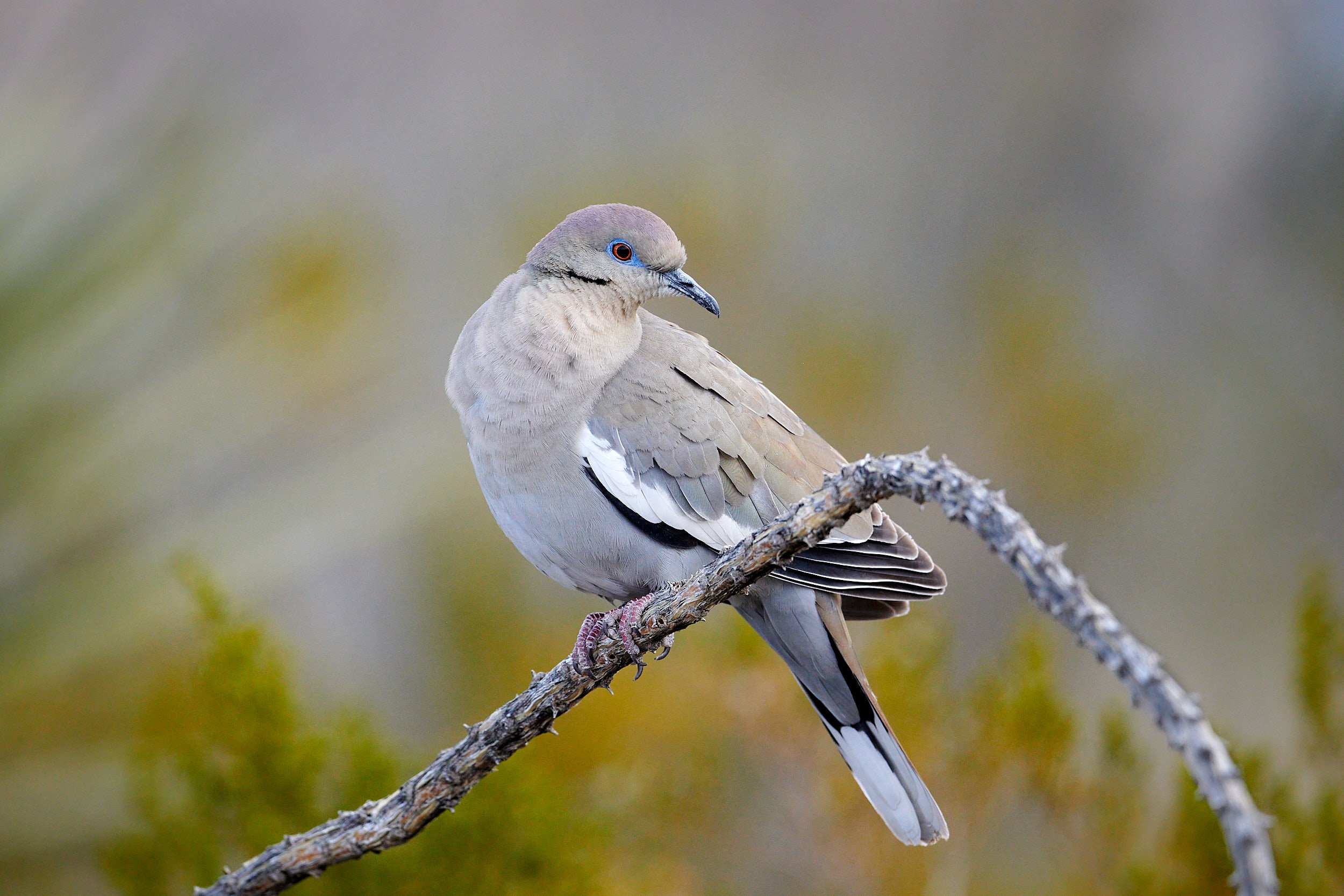
5th row: Left - Curve-billed Thrasher; Right - White-crowned Sparrow.
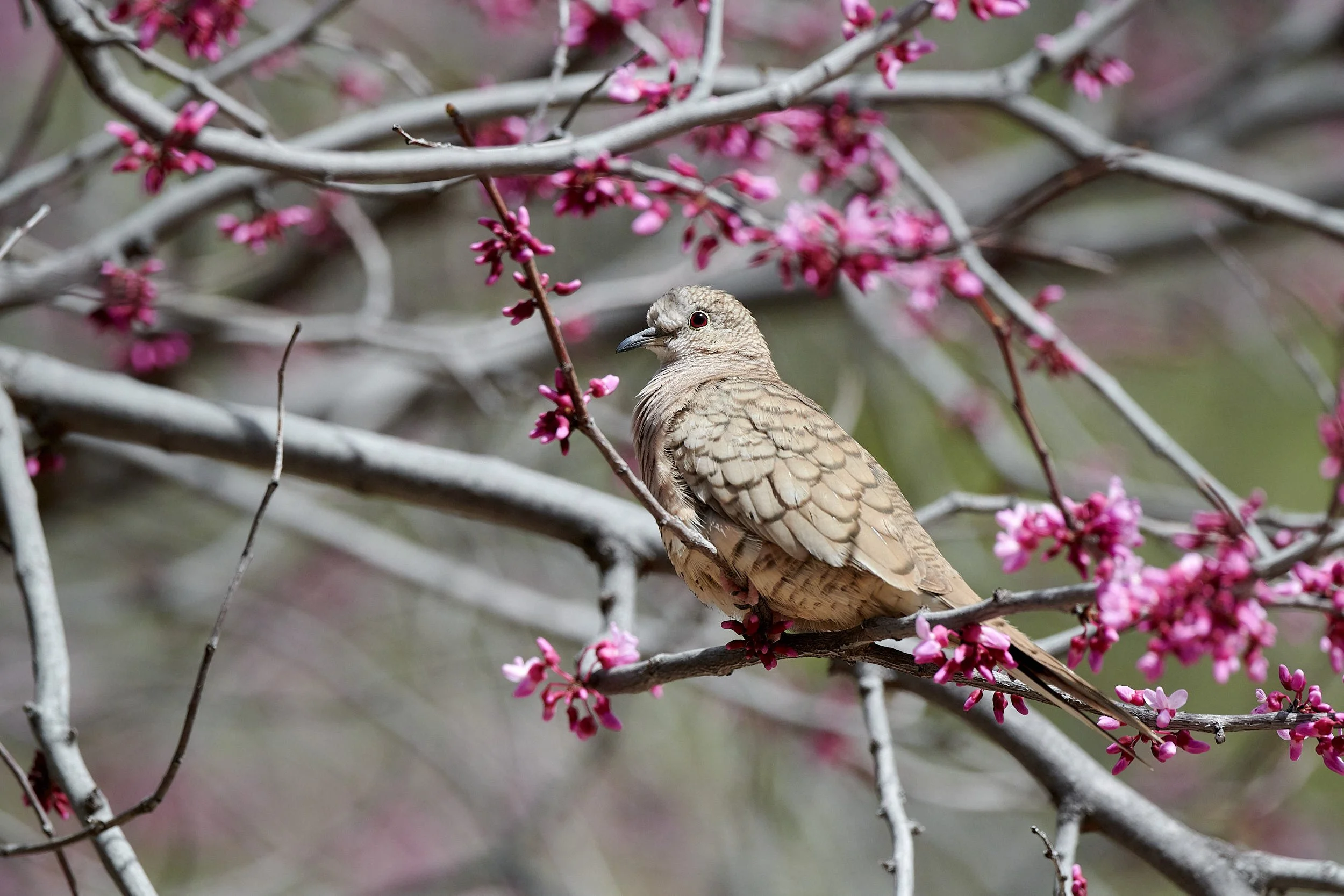
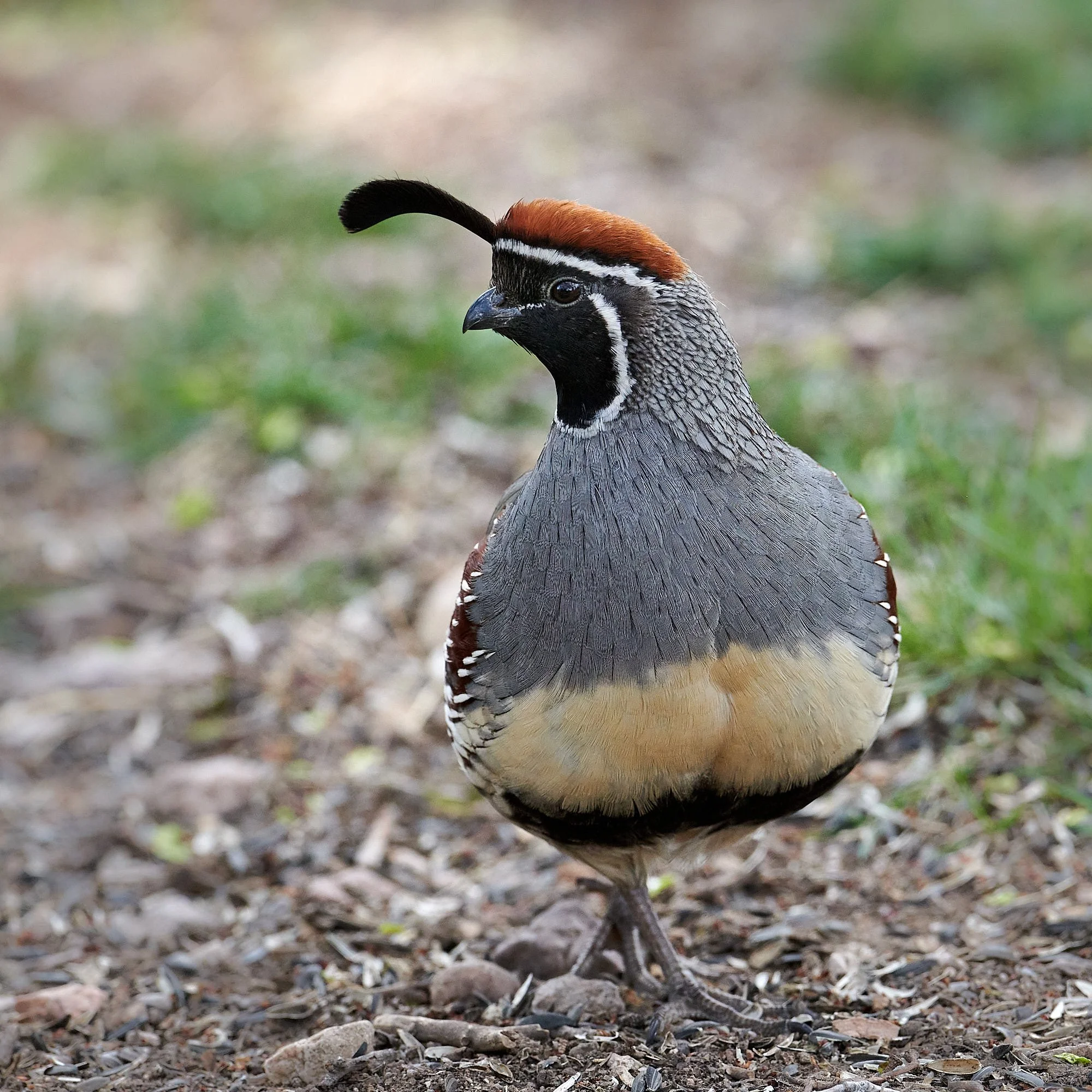
6th row: Left - Female Gambel’s Quail; Right - Inca Dove.
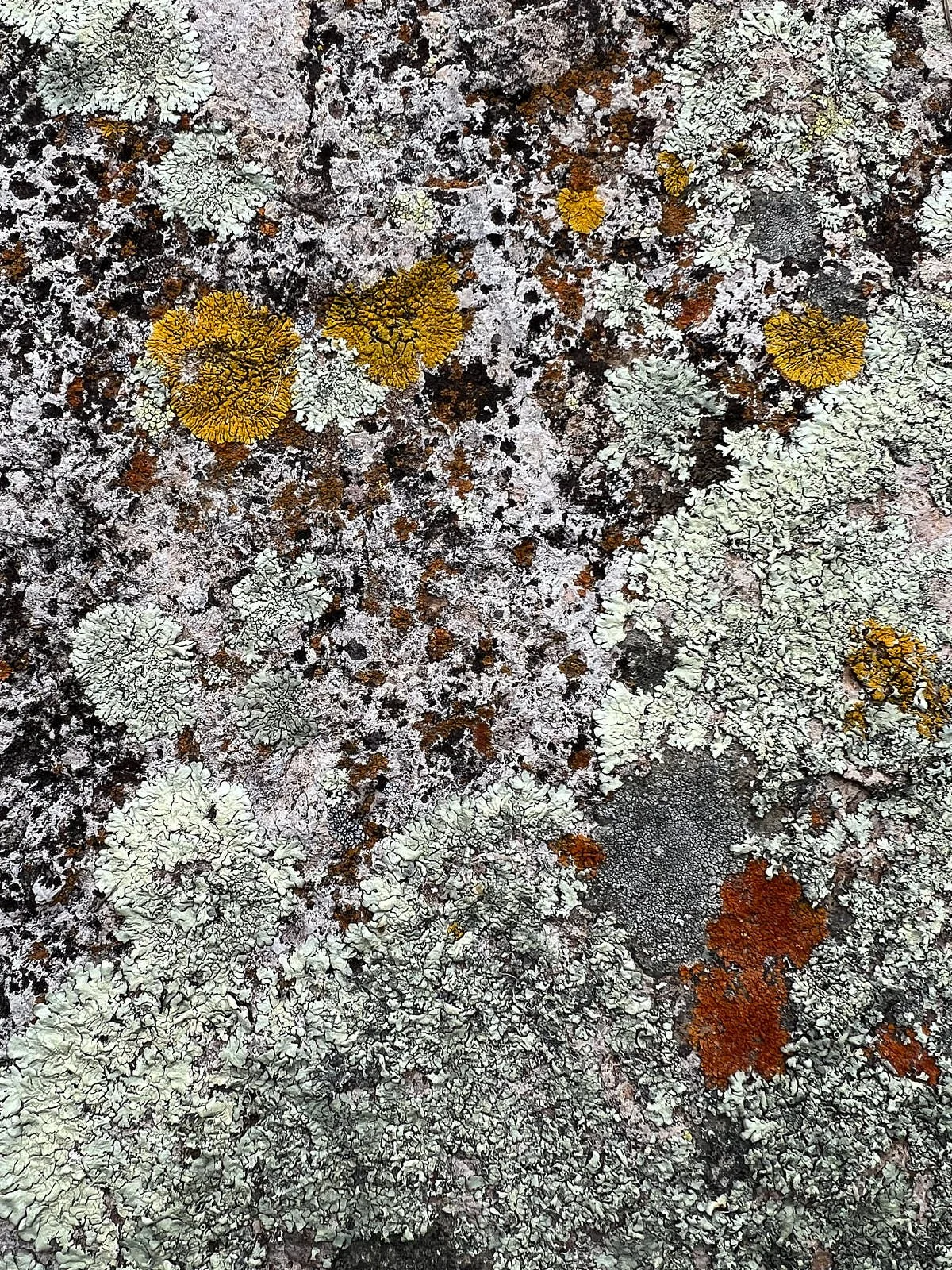
7th row: Left - Lichen on granite; Right - Male Gambel’s Quail.
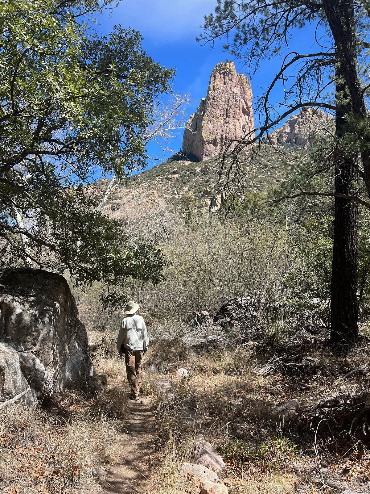
8th row: Left - Trail to Silver Peak area; Right - House Wren.
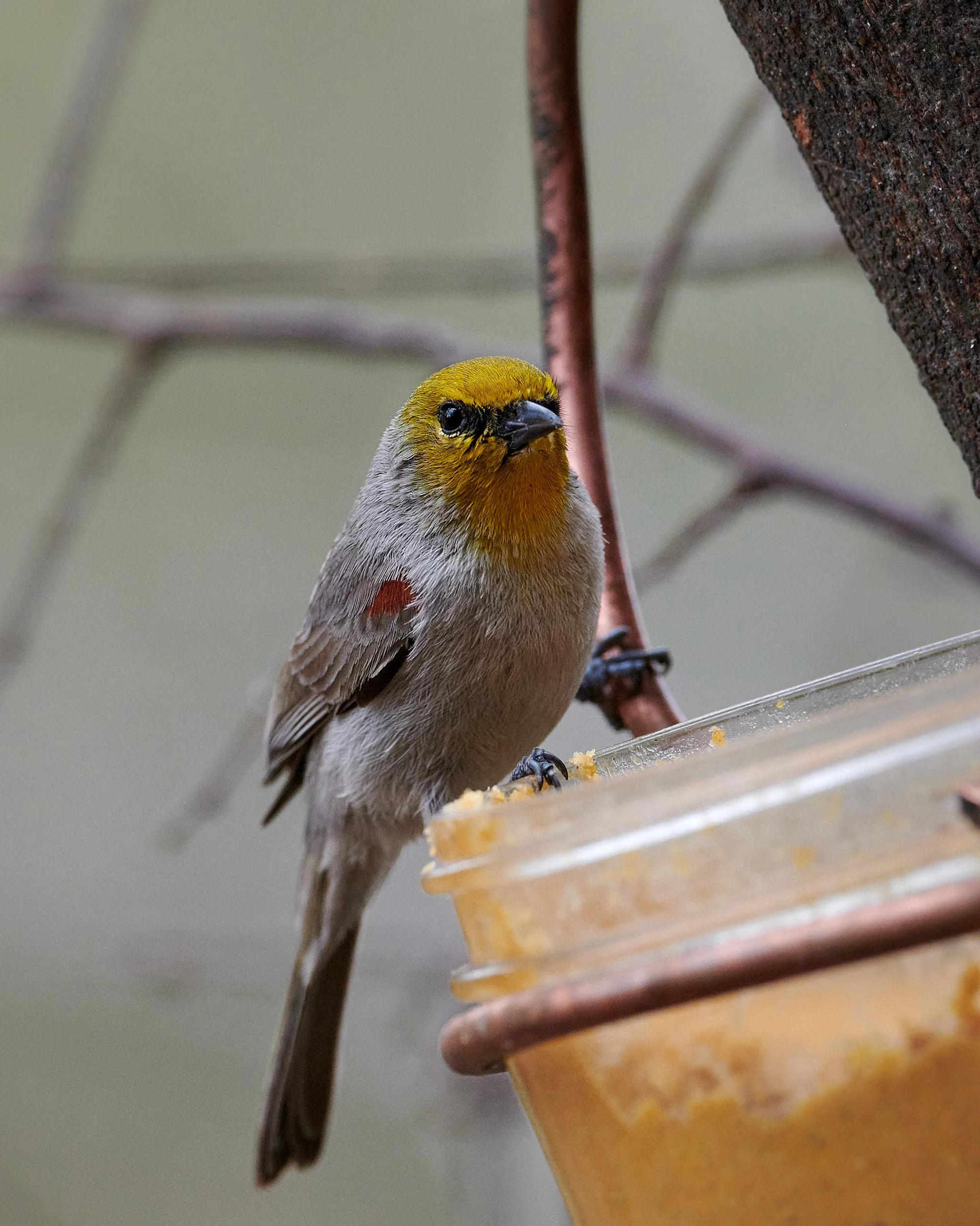
9th row: Left - Verdin showing red shoulder spot; Right - Mammillaria cactus spp.
10th row: Left - agave spp; Right - Female Evening Grosbeak.
Sunshine and Storms
The weather remained unsettled; ripple effects from California’s storms. New snow accumulated in northern Arizona and New Mexico. We consulted the weather forecasts and extended our Sunny Flat stay, visited Portal’s excellent library and bird feeder stations, and applied a southerly bias to our travel plans.
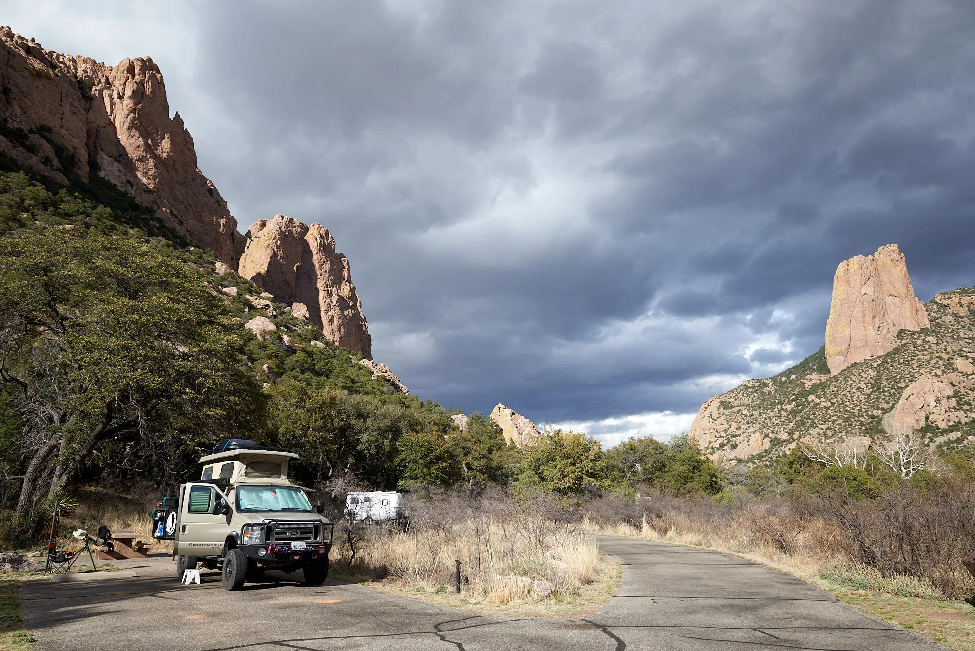
Head for shelter - storm approaching fast!
Scene from camp.
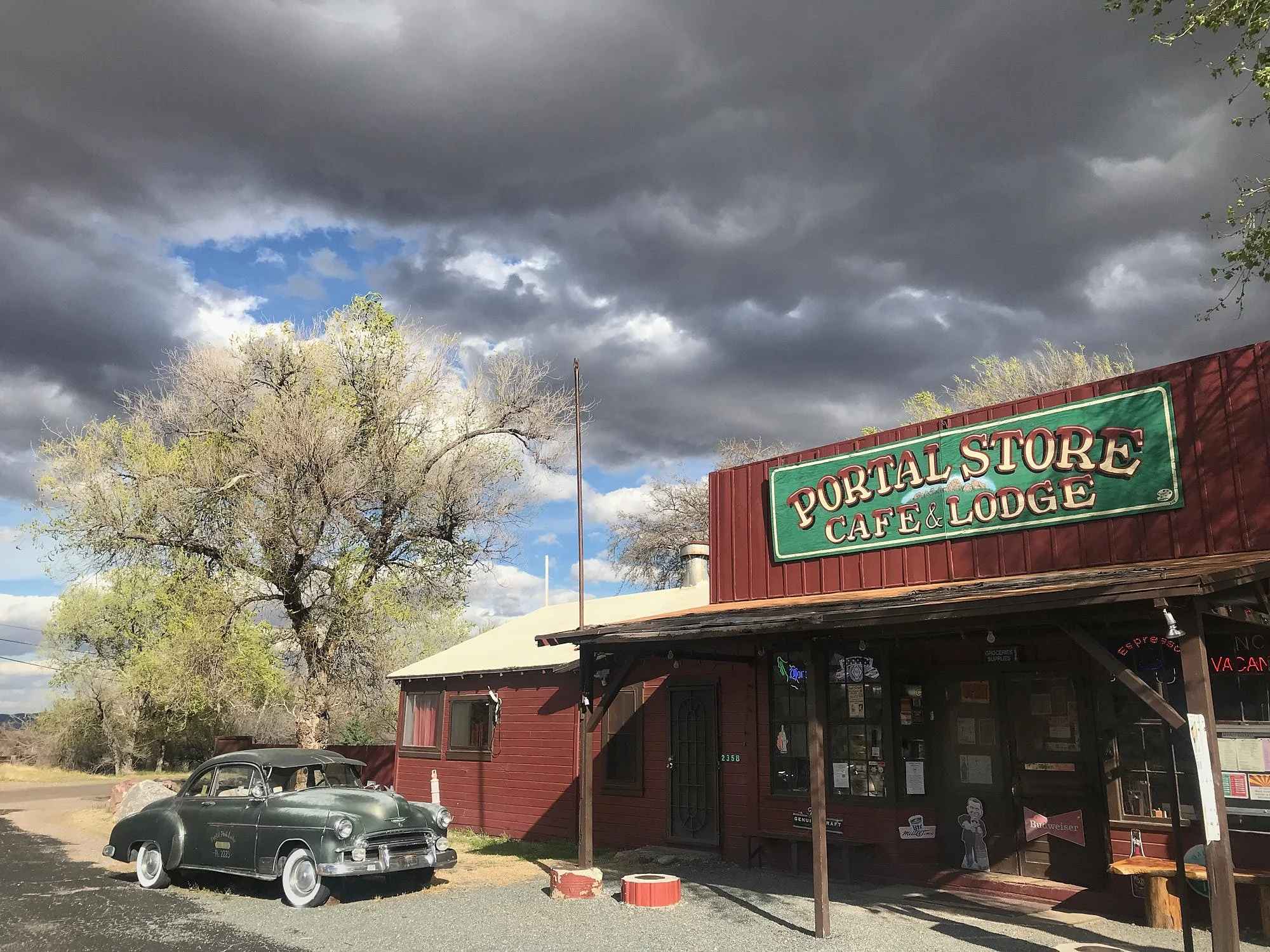
Portal store is quite well stocked with high-calorie treats. Good refuge from the weather.
The Full Picture: A Climate and Ecological Crisis
Aiming towards 1.5°C Lifestyles
In 2015, nearly every country in the world except the United States – 195 in total – committed to the Paris Agreement. The goal was to limit global warming to well below 2°C, and ideally below 1.5°C, compared to pre-industrial levels. Currently, the world is not on course to achieve that target. The carbon budget is the maximum amount of CO2 that humanity can emit while still having a chance at limiting warming to 1.5°C. According to the Intergovernmental Panel on Climate Change (IPCC)’s estimate, our remaining carbon budget for a 67% chance of limiting warming to 1.5°C at the beginning of 2020 was 400 gigatonnes. At the current rate of emissions, we will exceed this carbon budget before 2030.
To achieve the Paris Agreement goal requires a radical rebalancing of consumption between the Global North and South so that it becomes possible to meet the needs of all people within the means of the living planet. Oxfam estimates the world’s richest 10% of people need to reduce their consumption emissions to one tenth of their 2015 levels – and, in the process, make space for the poorest 50% of people in the world to realize their essential consumption needs.
Blue-throated Mountain Gem (also for 2 images below).
A Rich Life
How, then, can rich communities escape the consumerist lifestyles that have engulfed them for over a hundred years? Psychotherapist Sue Gerhardt argues that “Although we have relative material abundance, we do not in fact have emotional abundance.” It has been proposed that 5 simple acts are proven to promote well-being:
Connecting to the people around us.
Being active in our bodies.
Taking notice of the living world.
Learning new skills.
Giving to others.
Plunge In
Take the Jump is a grassroots initiative that offers six principles for moving towards a 1.5°C lifestyle.
End clutter: keep electronic products for at least 7 years.
Holiday local: take short-haul flights only once in 3 years.
Eat green: adopt a plant-based diet and leave no waste.
Dress retro: buy at most three new items of clothing a year.
Travel fresh: don’t make use of private cars, if possible.
Change the system: act to nudge and shift the wider system.
(From: Kate Raworth. In The Climate Book. Ed. Greta Thunberg)
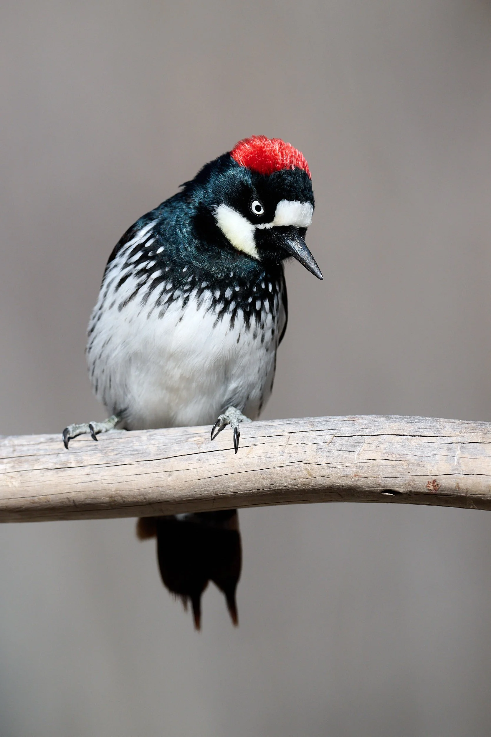
Female Acorn Woodpecker

When does the journey end?
How does the RV nomadic lifestyle measure up against Take the Jump’s maxims?
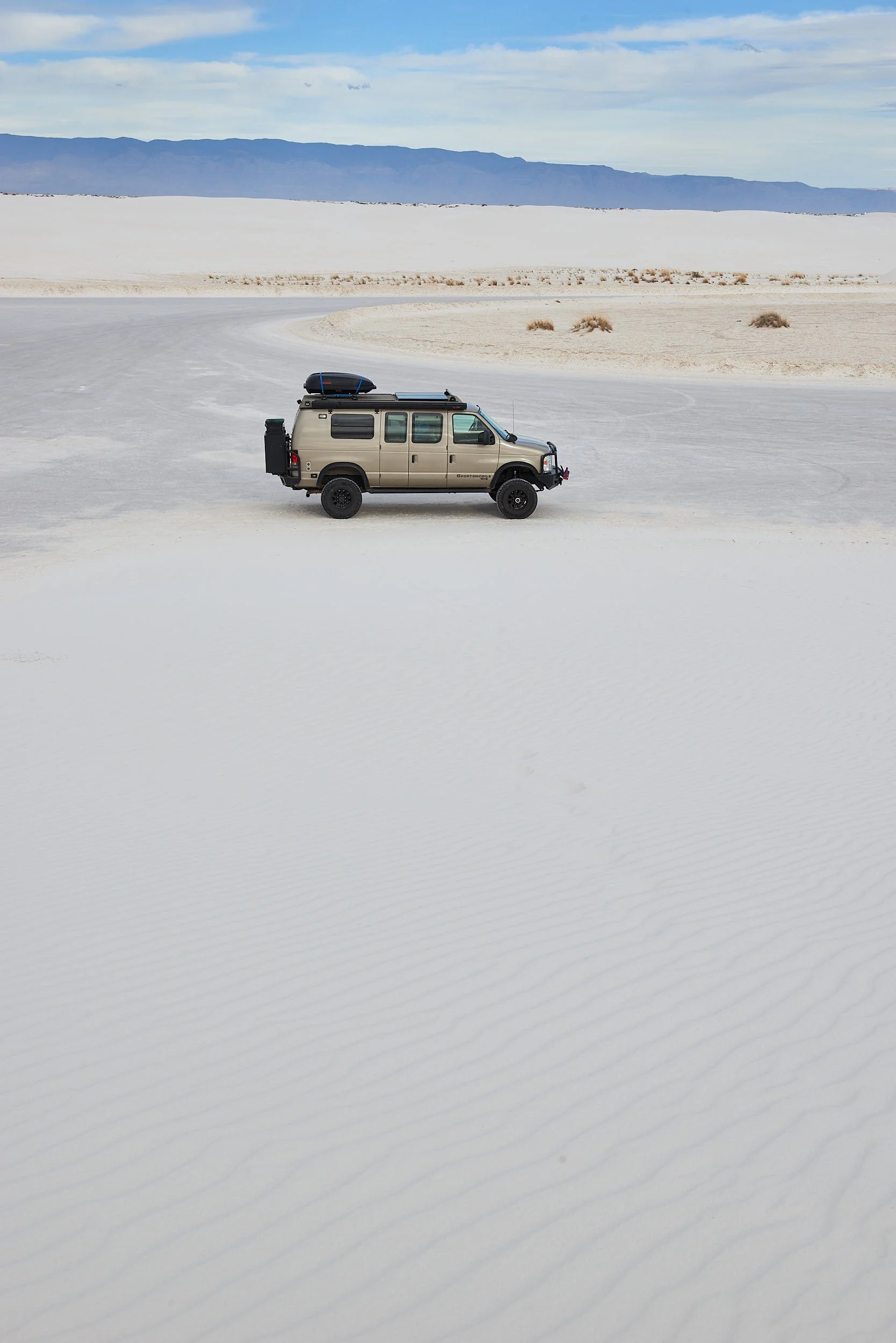
Our journeys are beyond local. The Sportsmobile averages 10 miles per gallon of fossil fuel – that’s horrible – but at least we are not riding aeroplanes. Electric RVs are being launched but their range is tied to the charging network. We have propane for heating but use very little. The solar panels provide adequate electricity. Our diet is vegetarian, we minimize our use of plastic, don’t have campfires, pack everything out & recycle. Bush living and fast fashion hardly mix. Accumulation of stuff is severely limited by the van’s small size. Climate change and non-violent activism are widely recognized in our circle of travel friends.
I don’t know the right answer, or maybe I’m simply reluctant to relinquish a treasured enjoyment during my precious few years of good health and retirement.
To quote Caesar, “The die is cast”. The Sportsmobile will continue to be used, whether by us or, if we sold it, by its new owner.
Oliver Lee State Park, New Mexico
We bid our Sunny Flat friends farewell and ventured eastward into southern New Mexico. Oliver Lee State Park lies at the base of the Sacramento Range and has close proximity to White Dunes National Park. A notable number of bird species were active around camp and we had our first close-up exploration of Chihuahuan Desert habitat.
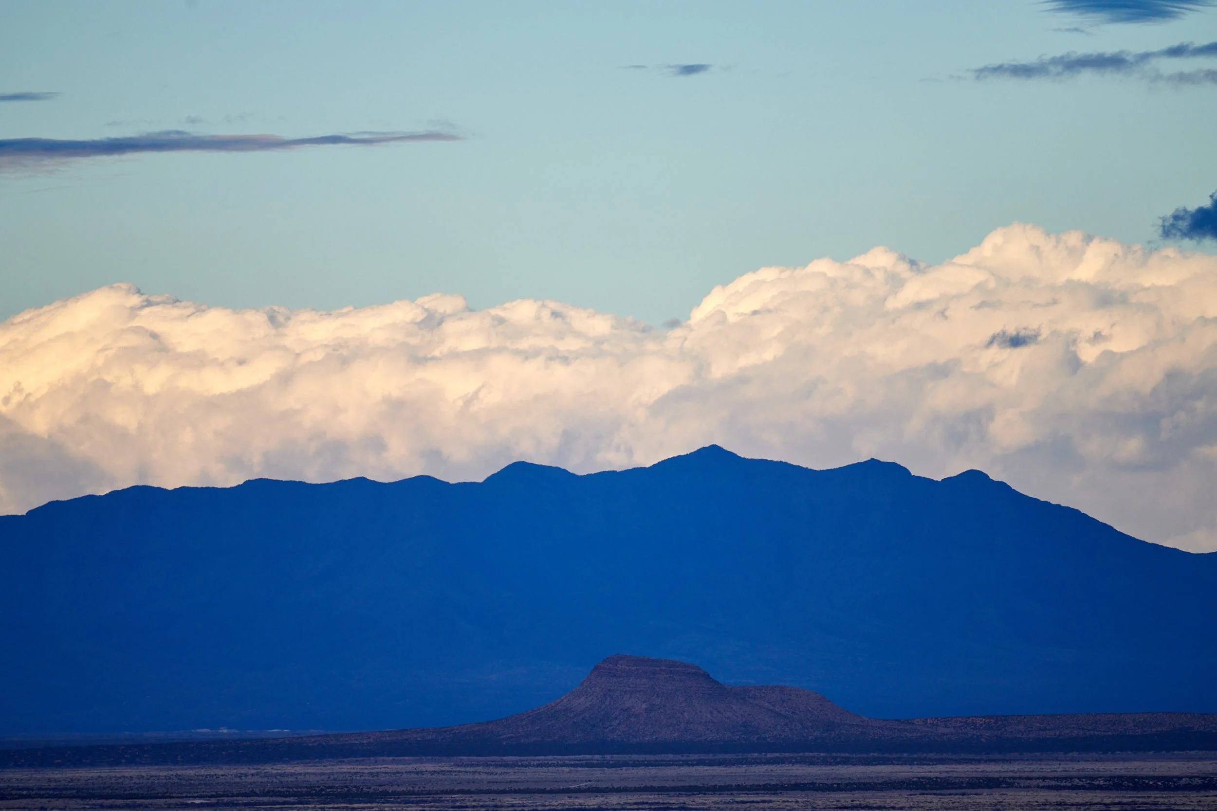
Sacramento Range geology
335 million years ago (mya) the area was under an ocean. Shell, sand and mud deposition on the sea bottom eventually solidified into a mile-thick layer of sedementary limestone rock. The sea receded and about 25 mya, during Basin and Range faulting, the Sacramento mountains were pushed up as a block, exposing the extensive limestone.


Looking west towards San Andres Mountains
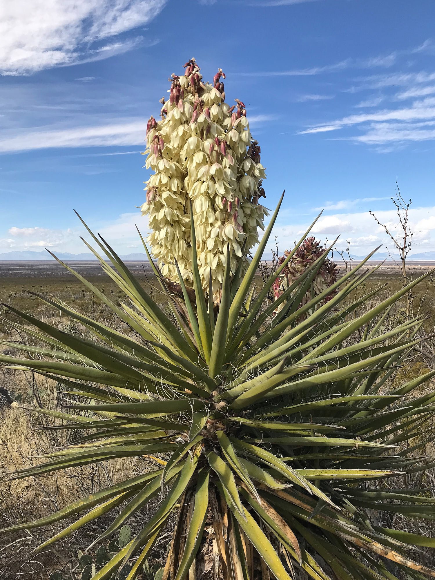


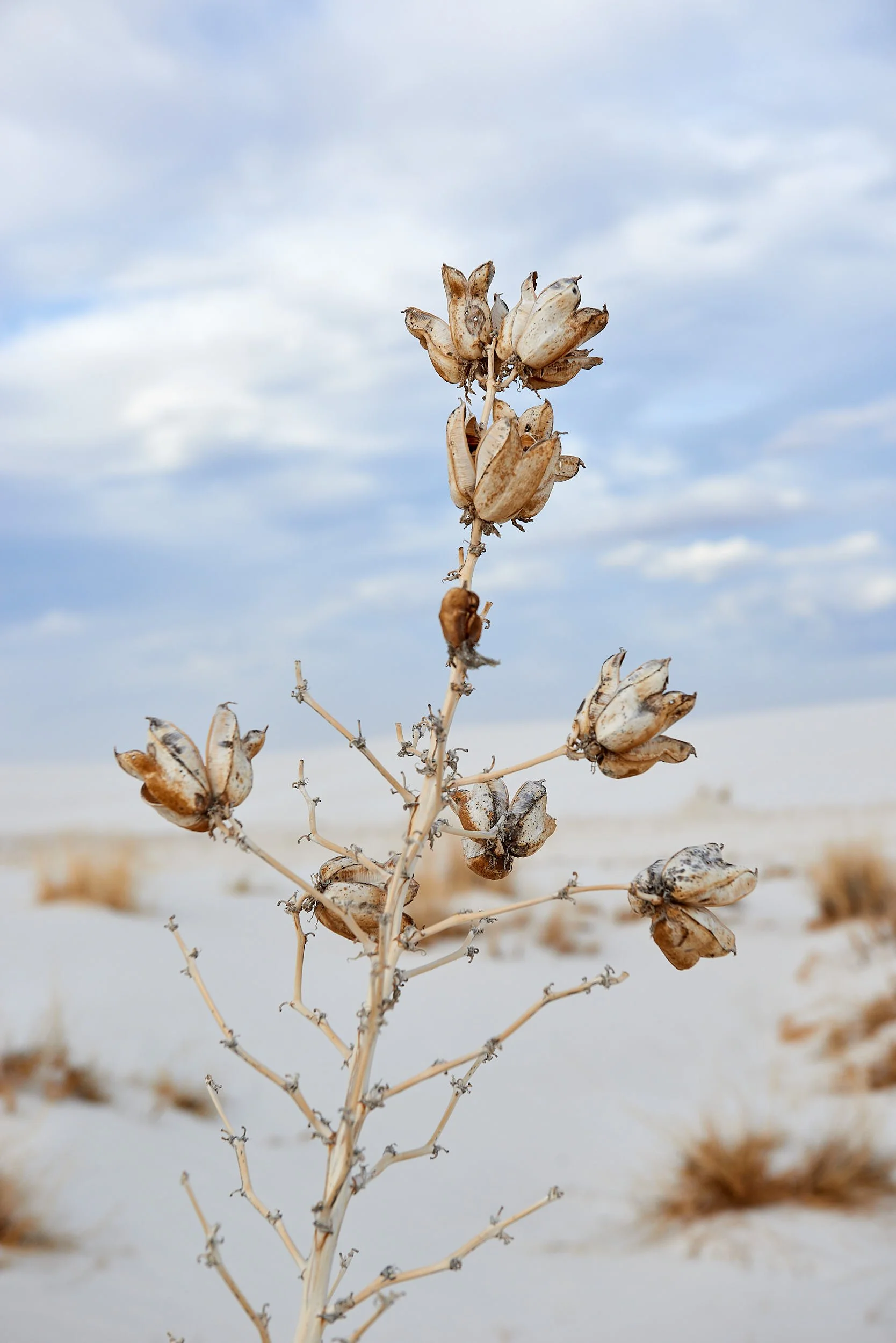
1st row: Left & Right - Banana Yucca, pollenated by moths. A valued plant; southwestern indigenous peoples make use of the stalks, leaves, flowers, fruits and roots.
2nd row: Left - Claret cup cactus; Right - Yucca sunset, quiet and serene.
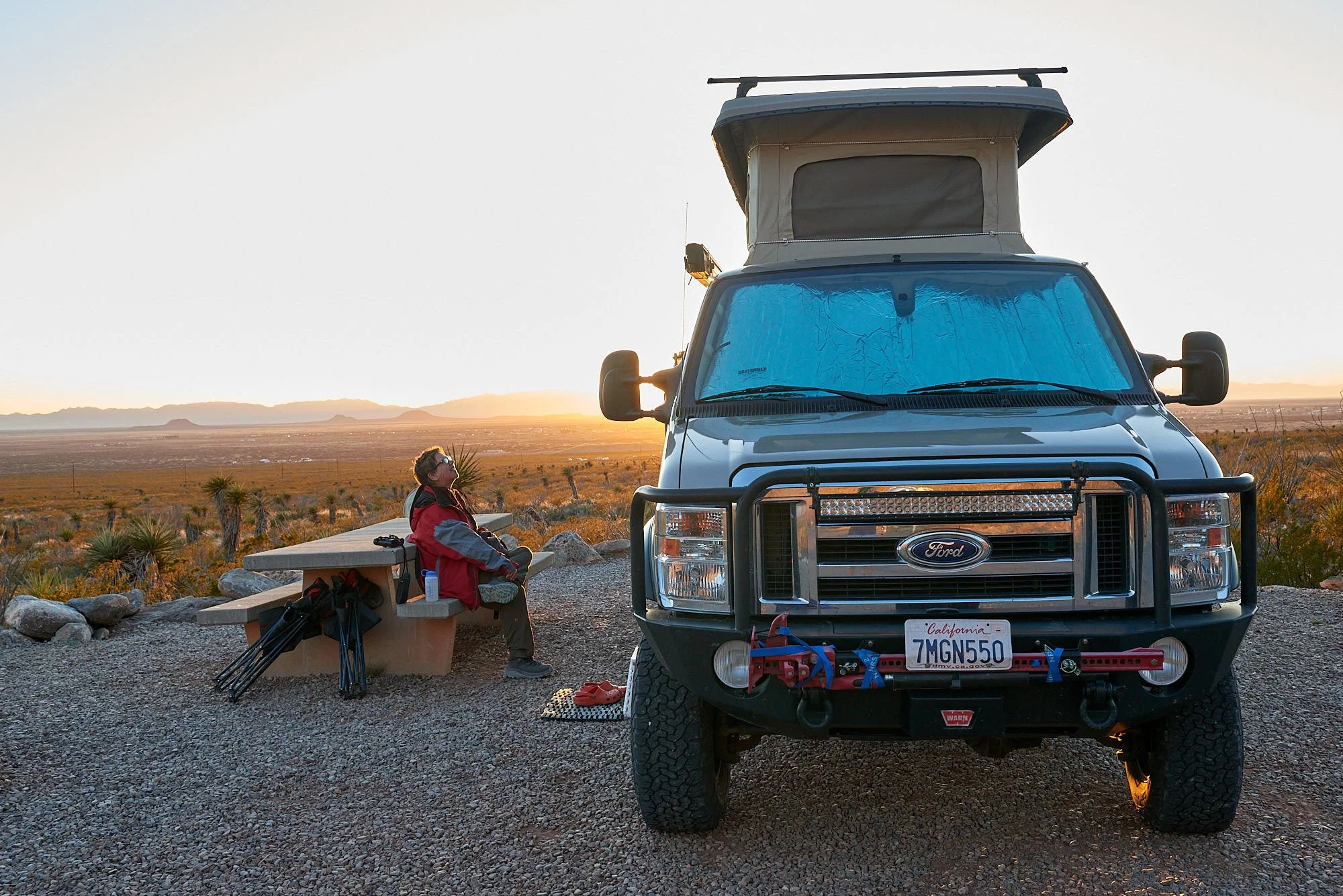
3rd row: Left - Our camp had a uncluttered view of the Tularosa basin; Right - Typical Chihuahuan Desert vegetation on foothills of Sacramento Range.
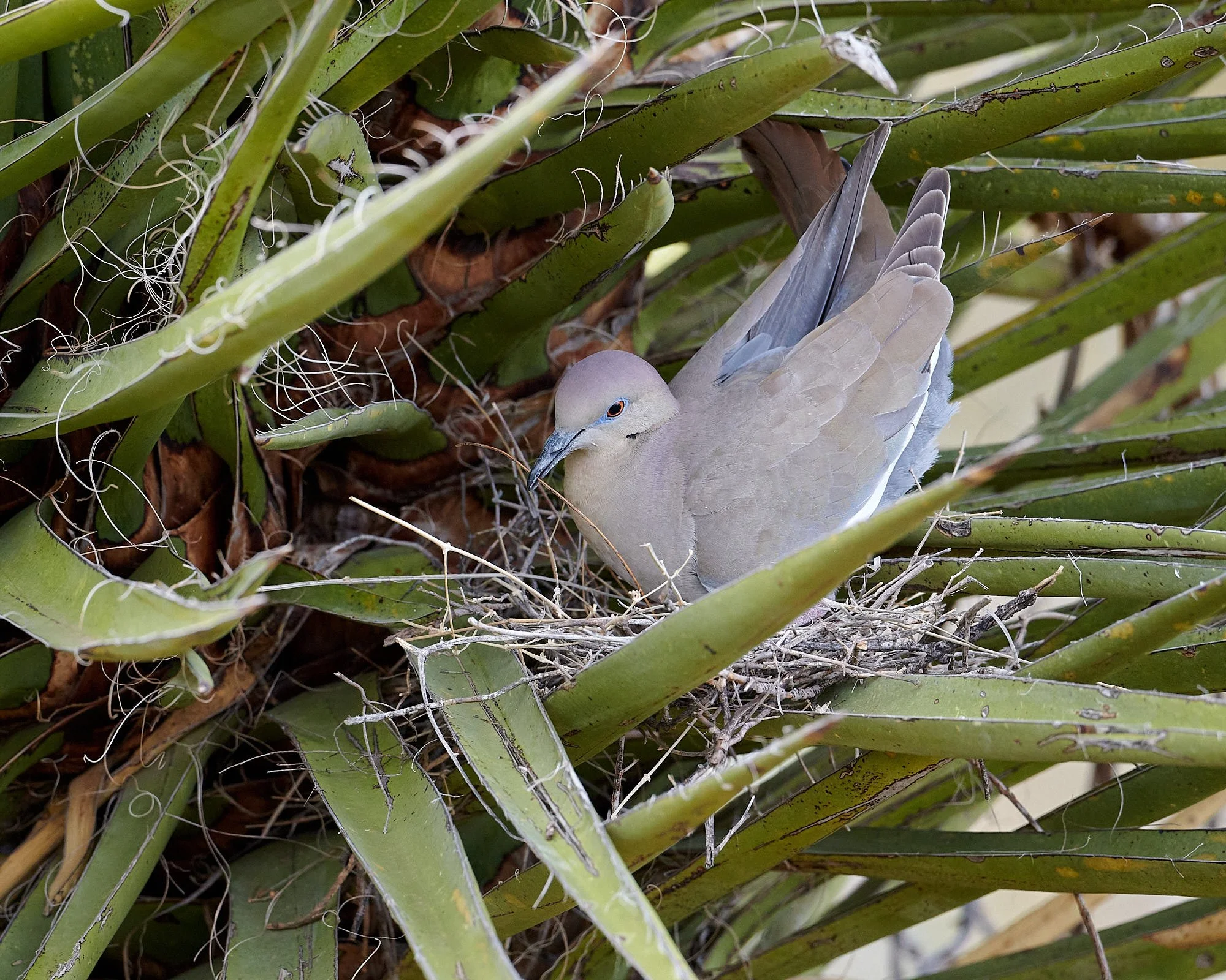
Nesting White-winged Doves
A pair were building their nest in a yucca very close to our campsite. Activity was greatest in the early morning. Occasionally, they rested close by, but there were long periods during the hotter times of the day when the doves were absent from the area.


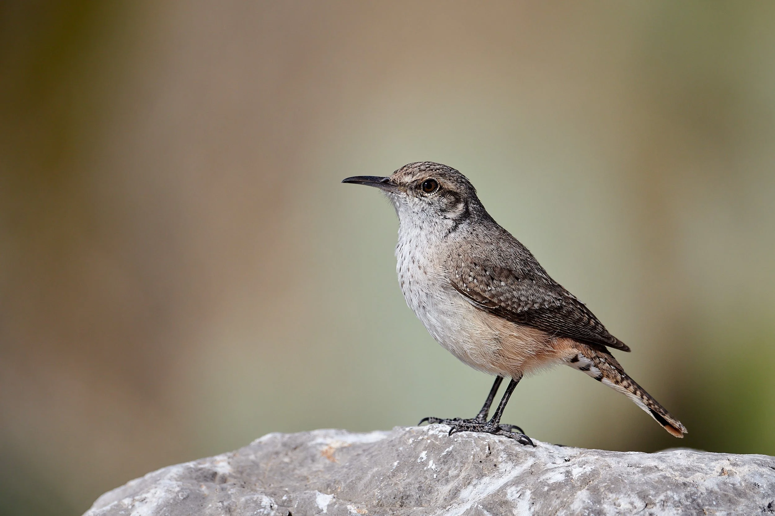
Rock wren
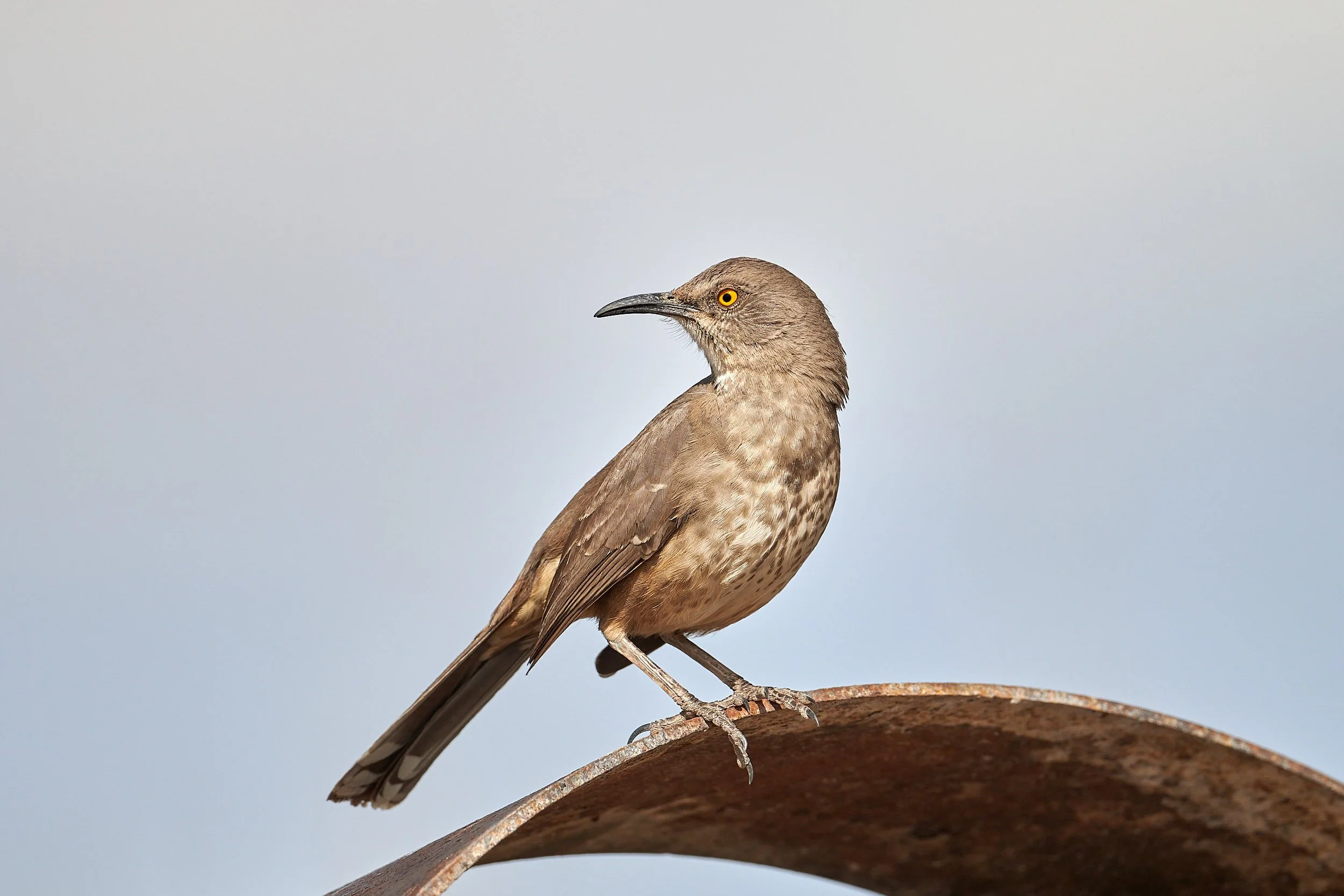
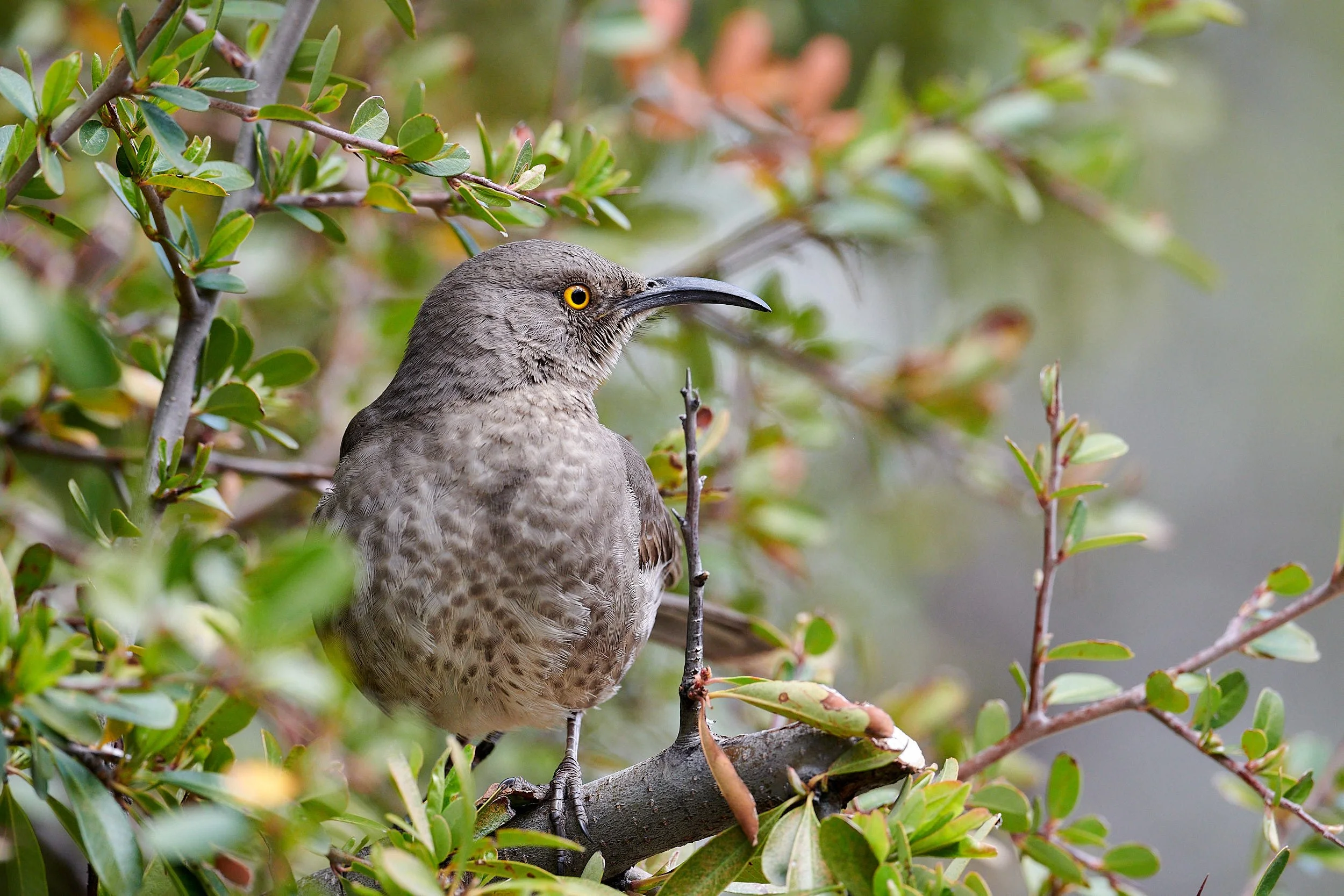
Curve-billed Thrasher


1st row: Left - Lincoln Sparrow; Right - Juvenile White-crowned Sparrow.
2nd row: Left - Black-chinned Sparrow; Right - Lesser Goldfinch.
Hard days, hard men
Frenchy
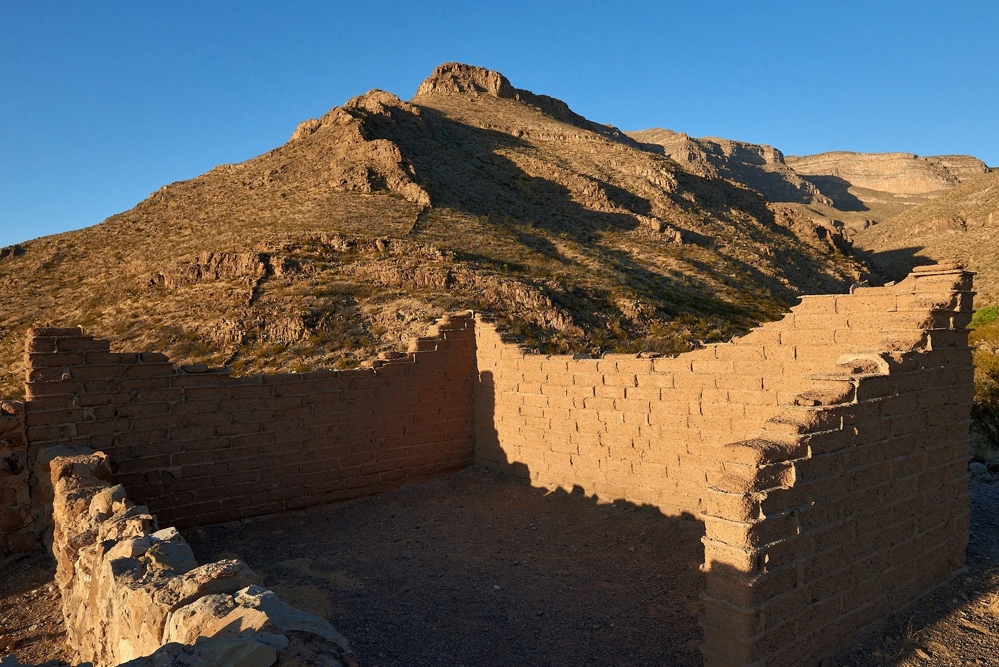
Francois-Jean Rochas (Frenchy) was born in France in 1843 and emigrated to New Mexico in the 1880s, settling in Dog Canyon. Frenchy lived alone, raised cattle and tended an orchard and vineyard.
After excavation by archeologists in 1978, Frenchy’s cabin was partially reconstructed. The rock-walled room was the original cabin, and the adobe section added later.
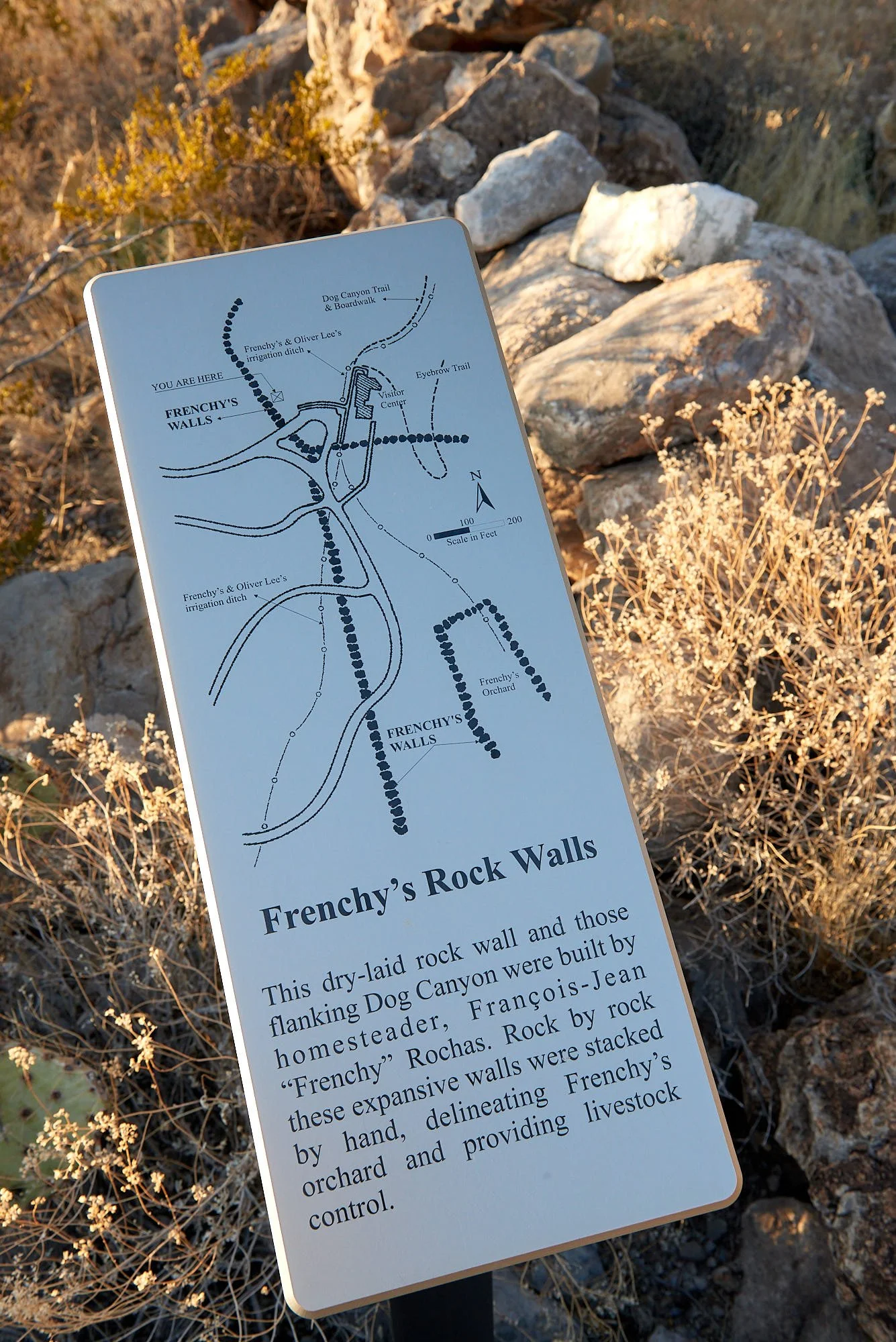
Along with his closest neighbor, Oliver Lee, Frenchy developed a system of irrigation ditches that brought water from Dog Canyon to their ranches.
In July 1886 Frenchy accused Morrison, a young employee, of stealing. Morrison was arrested but escaped and returned to Dog Canyon for revenge. When Frenchy emerged from his cabin in the morning, Morrison shot him twice with a Winchester rifle. Frenchy staggered back into the cabin and all went quiet. About 10 o’clock that night Morrison broke open the cabin door and discovered Frenchy was armed, ready and waiting. Morrison was wounded and retreated. Frenchy, in poor condition, made it to the nearest ranch where he told his story. Soon a posse set out to find Morrison and placed him in the Las Cruces jail.
Frenchy’s wounds healed and he continued at his farm, building up a herd of about 500 cattle. However, increasing competition for open range, land, and water lead to range wars and Frenchy, at 51 years of age, was found dead in his cabin. The coroner deemed it suicide but many suspected murder.
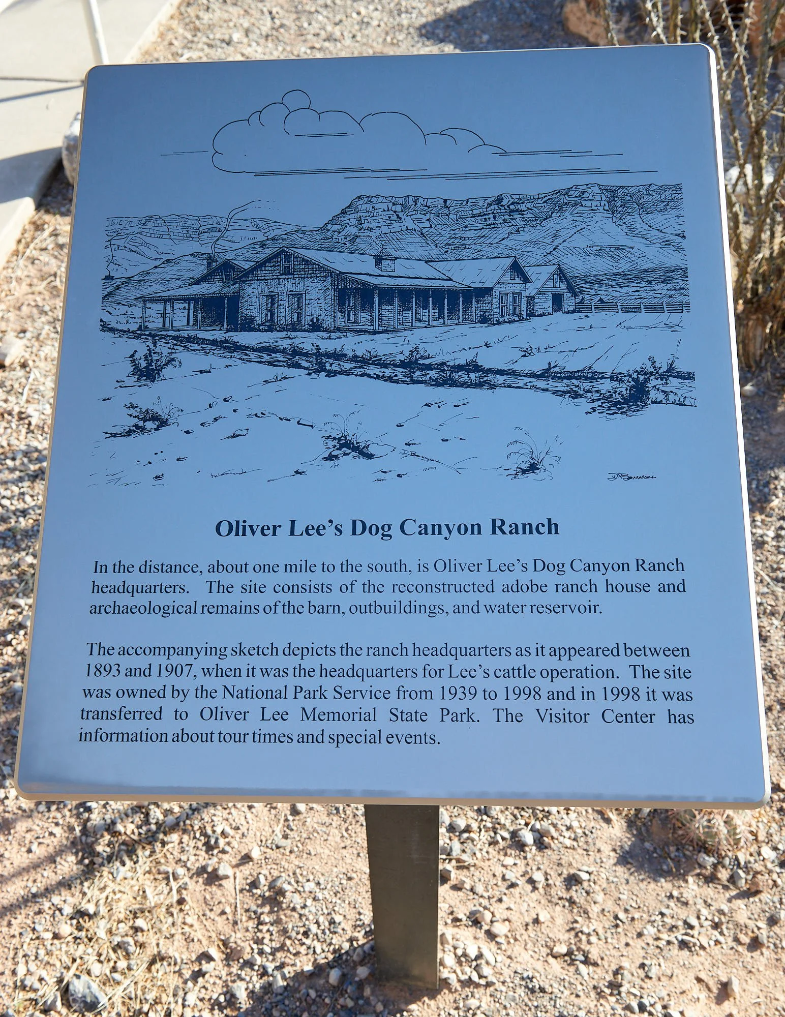
Oliver Milton Lee
Oliver Lee, (8 November 1865 – 15 December 1941) was a gunfighter and successful rancher. He was born in Buffalo Gap, Texas and died in Alamogordo, New Mexico, where the Oliver Lee Memorial State Park is named for him.
At the age of 18 years, Lee moved to New Mexico with his older half-brother, Perry Altman. After a stint as a deputy US marshal, he turned to ranching at Dog Canyon and later became involved in the range wars of 1895-6. He was accused of murdering Colonel Fountain and his young son Henry and survived a shootout against Sheriff Pat Garrett’s posse. Lee was acquitted at trial and later held office in the New Mexico Senate.
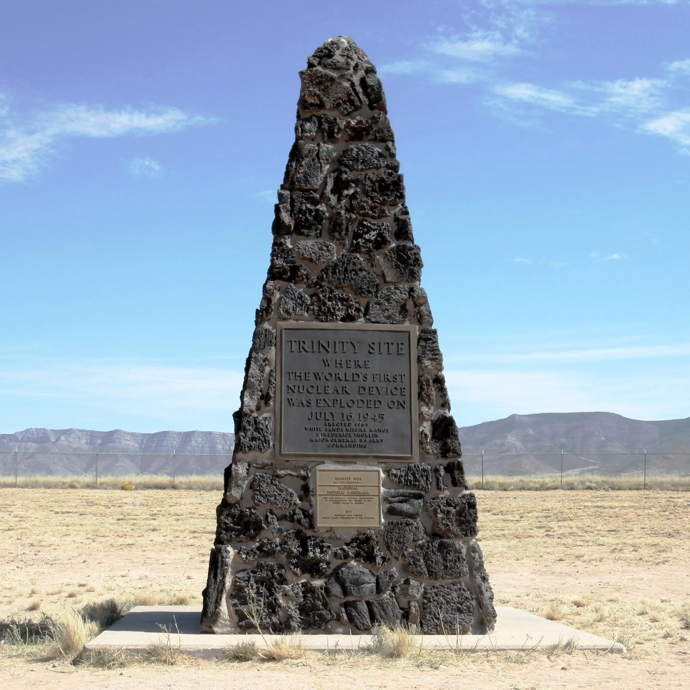
Blast in the sand
Oliver Lee State Park abuts on the White Sands Missile Range which contains a National Historic Landmark – the site of the first nuclear bomb detonation. It occurred on July 16, 1945, when a plutonium implosion device was tested on the barren Alamogordo plains. Inspired by the poetry of John Donne, J. Robert Oppenheimer code-named the test "Trinity." Hoisted atop a 100-foot tower, the plutonium device, or "Gadget," detonated at precisely 5:30 a.m. over the New Mexico desert, releasing 18.6 kilotons of power, instantly vaporizing the tower and turning the surrounding asphalt and sand into green glass.
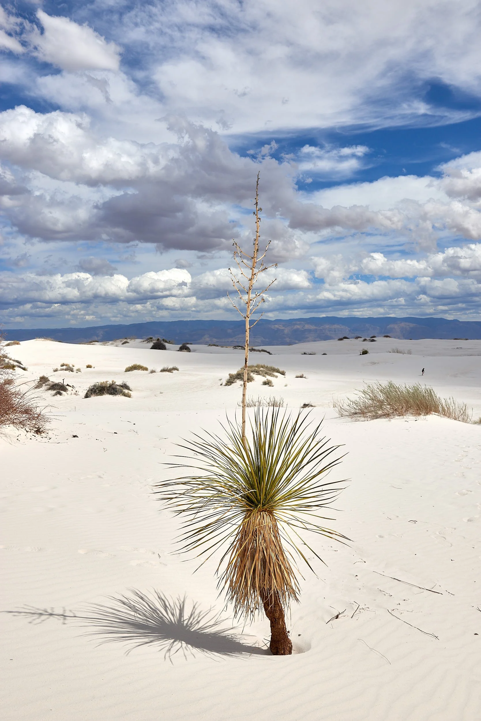
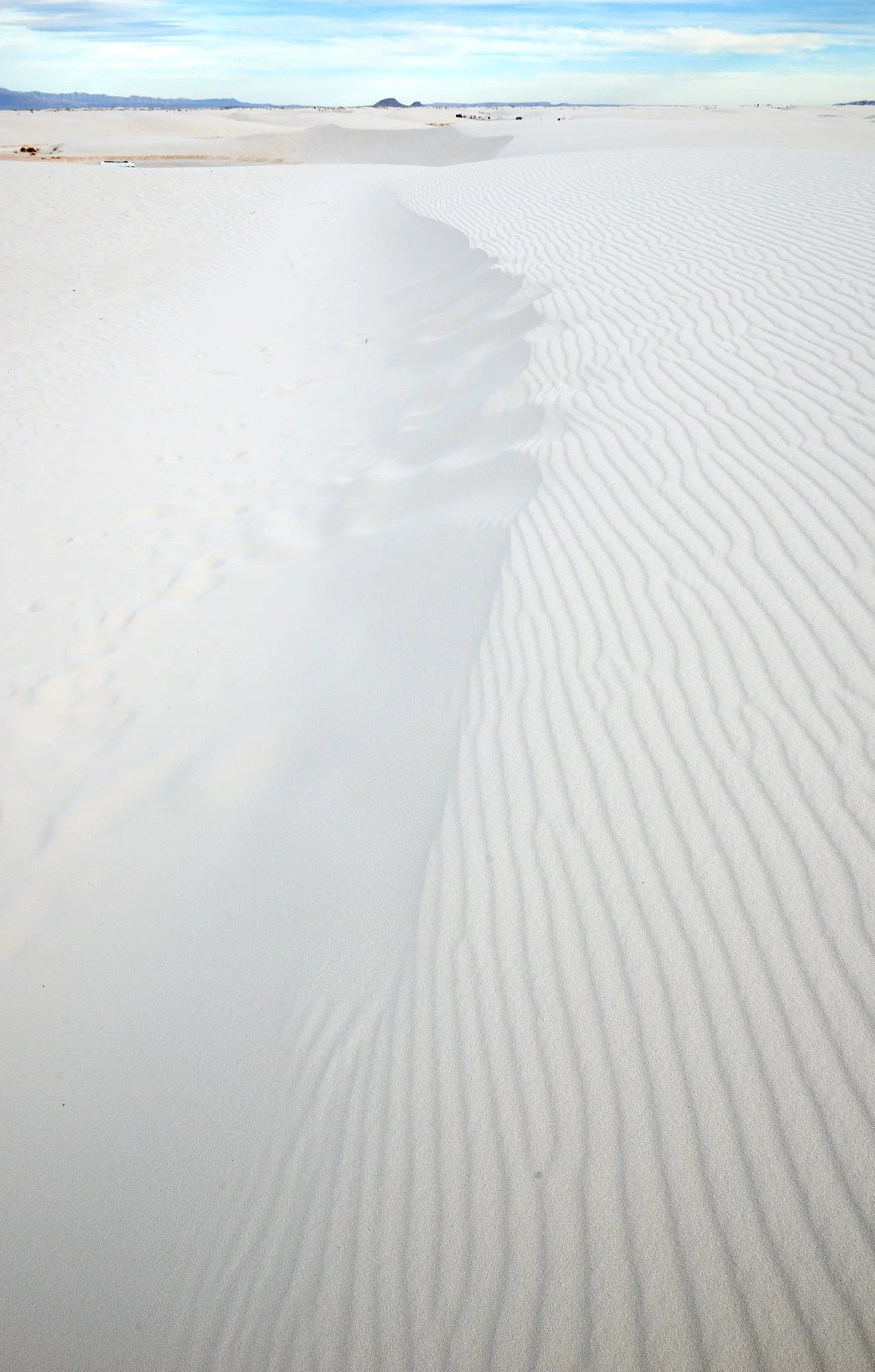
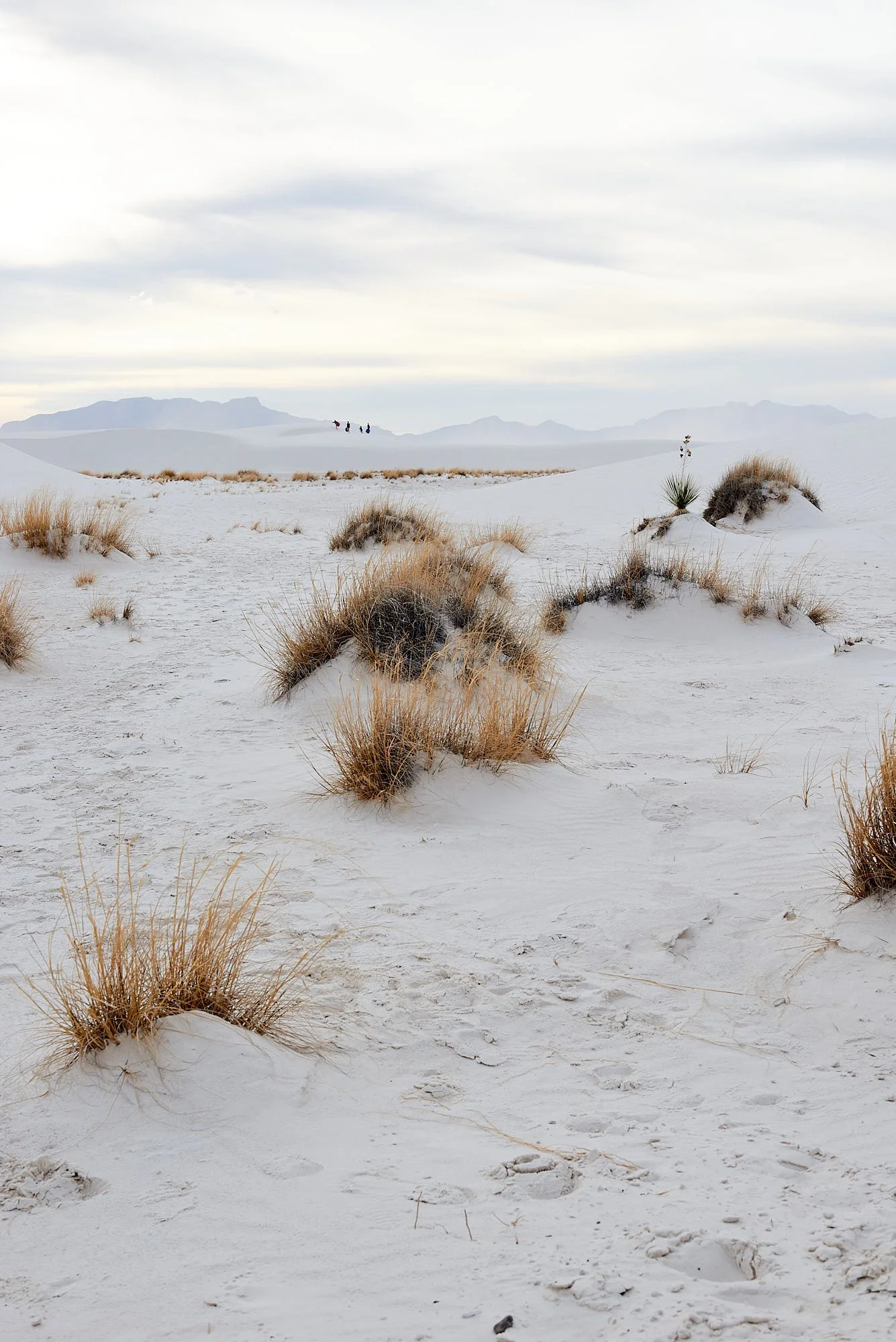
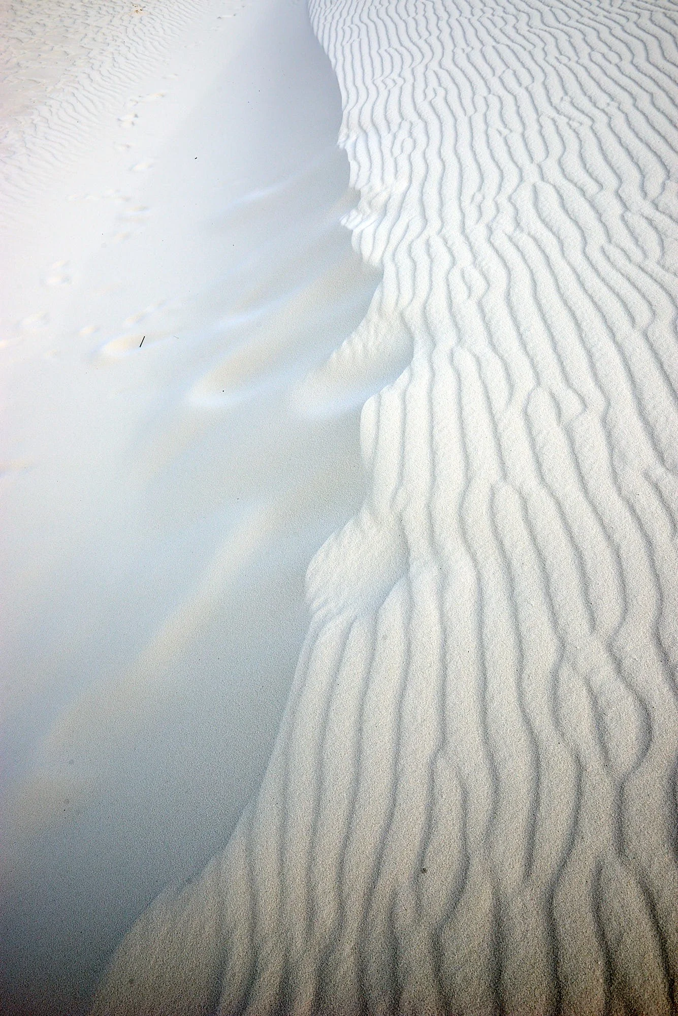
White Dunes National Park, New Mexico
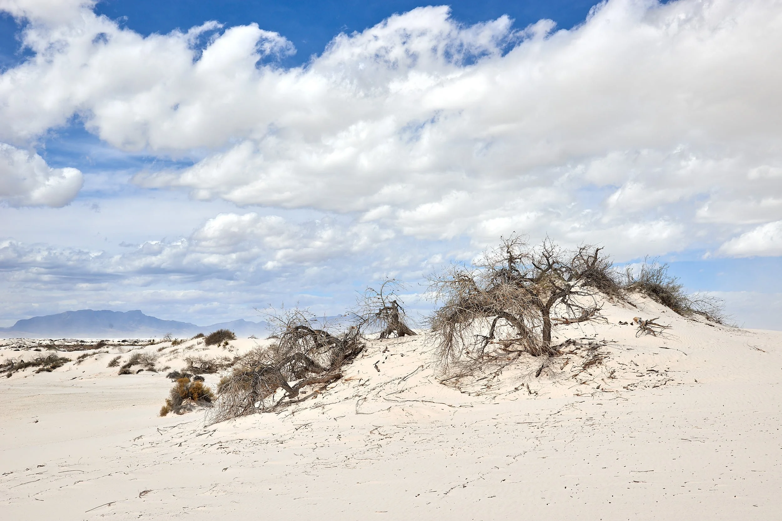
Dunes of gypsum sand
White Sands National Park geology
280 to 250 million years ago
During this era, there was one massive mega-continent, known as Pangaea. Current southern New Mexico, was covered by a shallow sea, known as the Permian Sea. Over millions of years, thick layers of mineral gypsum (a calcium sulfate dihydrate) were deposited on the seafloor.
(Soap tree Yucca)
70 million years ago
As the earth’s tectonic plates started to shift and collide, the pressure from these movements pushed up land, eventually creating the mountains that surround the Park.
30 million years ago
Eventually, the tectonic plates began to pull apart in opposite directions, resulting in Basin and Range morphology. The mountains in this area split into two distinct ranges; the San Andres Mountains to the west, the Sacramento Mountains to the east, and the Tularosa basin between them.
2 to 3 million years ago
The Rio Grande River flowed along the southern edge of the Tularosa basin. This river brought sediments and minerals downstream into the Tularosa Basin, and eventually blocked the basin’s outlet to the sea. Water trapped by the blockage started to collect at the lowest point in the basin and eventually formed Lake Otero, an ancient 1,600-square mile lake that covered much of the basin.
24,000-12,000 years ago
During the last Ice Age 40,000 to 12,000 years ago, the climate was much colder and wetter. As the climate started to warm around 11,000 years ago rain and snowmelt carried dissolved gypsum from the surrounding mountain ranges into the basin. The gypsum runoff settled in Lake Otero. With the ending of the last Ice Age, about 12,000 years ago, Lake Otero began to evaporate, becoming a playa, or dry lake bed.
10,000 years ago to present – formation of dunefield
As the climate became warmer and drier, most of Lake Otero dried up. The dry portions of the lakebed became what we know today as Alkali Flat, while the smaller seasonal playa that remained formed modern Lake Lucero. As Lake Otero’s water disappeared gypsum crystals formed on Alkali Flat. The crystals (called selenite) are brittle and fragile. Strong northeast winds carried the smaller pieces, further breaking down the crystals into small grains and polishing them into a brilliant white color. The sand accumulated into today’s white dune fields.
Gypsum
Gypsum is a common mineral that is used in a variety of products - from drywall to toothpaste. When gypsum (CaSO42H20) is heated and the water within the mineral is evaporated out, gypsum turns into a chalk known as plaster of Paris. When water is re-added to this chalky gypsum powder, it rehydrates and becomes gypsum again, forming a hard substance.

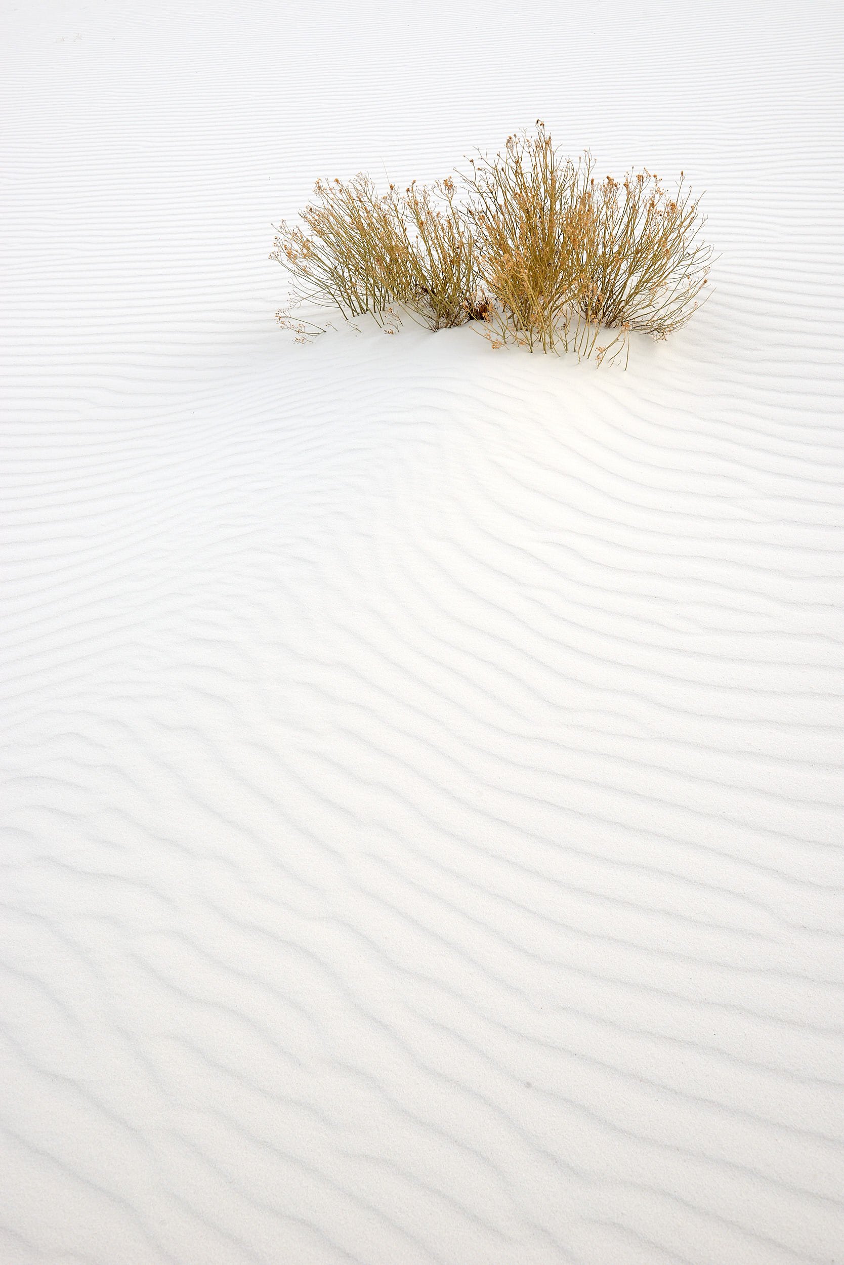
Rubber Rabbitbrush