Desert Adventures with Friends: March 2021
Van Life - is it fun or fantasy?
Our good friends Frauke and Mac called in late March. They were travelling from eastern Washington to southern California to visit family. Any chance of linking up with us for a Death Valley exploration?
Also, they were thinking about procuring an RV and wanted to see what van travel was about.
Jumbo plotted out a 3-week itinerary that included a mix of botany, 4x4 driving, birding, Pacific Crest Trail, geology and sharing with friends.
Frauke and Mac would join us for the latter half of the trip.
Carrizo Plains National Monument
We camped in the Padrones Canyon area, a picturesque site that we have previously visited in 2020. Carrizo Plains information HERE.
As expected, the wildflower display was below average but the birding was great. Had good views of Black-chinned and Sage Sparrows and Laurence’s Goldfinch - species we don’t see at home.

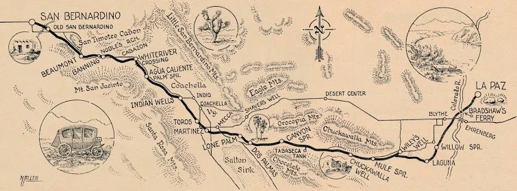
Bradshaw Trail
Powell Weaver, a scout and trapper, found gold at La Paz on January 12, 1862. William Bradshaw, a veteran of the California gold rush, knew that Weaver's strike lay on the Arizona side of the Colorado River and anticipated that gold prospectors based in California would appreciate a direct trail east from the Los Angeles area across the desert to reach Weaver's strike.
Accompanied by 8 recruits, he scouted out the most feasible route and was guided by a map that illustrated an ancient Halchidoma trade route through the Colorado Desert. (The Halchidoma tribe were documented in 1604 as inhabiting the lower Colorado River region.) The 180-mile trail was created in 1862, and was rapidly adopted by prospectors, entrepreneurs and travelers who utilized his trail and expensive Colorado River ferry service to access the new gold fields.
Below are maps (from web) depicting the original Bradshaw Trail and the current trail which traverses the Chocolate and Chuckwalla ranges.

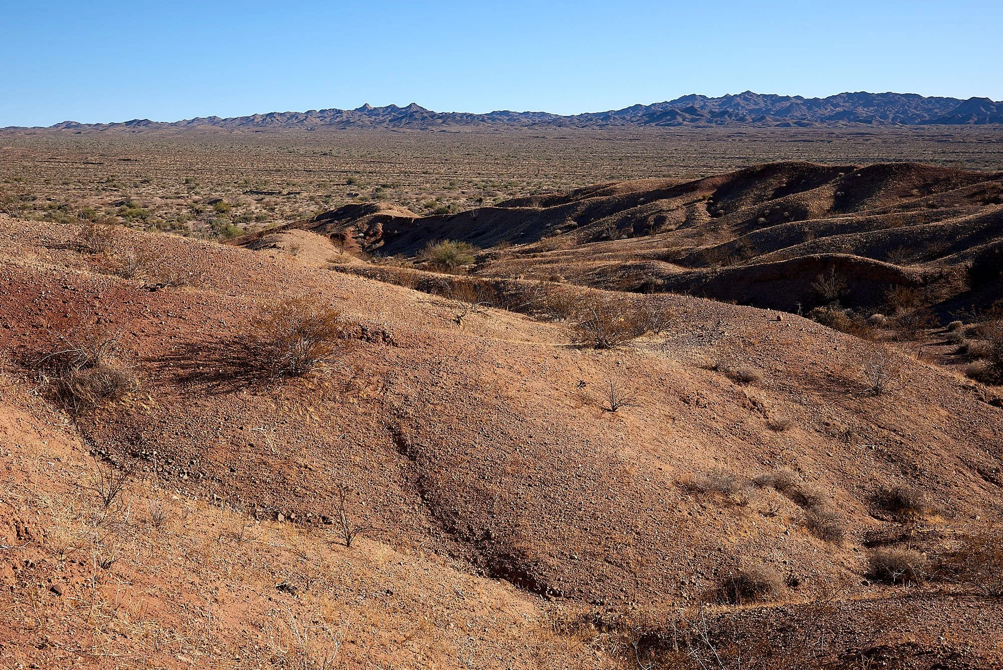
We disperse camped near Wiley’s Well and entered the Bradshaw Trail the next morning. Our travel time for the day probably averaged around 15 mph. Some areas were benevolent hard soil and could be comfortably cruised at >20mph. Other areas were deeply corrugated sand or rough gravel and required 5mph.
We camped on a flat sandy terrace overlooking Salt Creek Wash which sustains groves of Smoke & Mesquite trees. Phainopepla (an elegant, glossy black bird) flitted among the mistletoe - the berries are its favorite food.

Fish Creek Camp, Anza Borrego Desert State Park
The final push to the Salton Sea was a grind. We had to retrace our way after a navigational error lead us into the prohibited Chocolate Mountain Aerial Gunnery Range.
Spent the night by the Salton Sea, visited the Sony Bono Wildlife Refuge (spotted a Sora & a hunting Peregrine Falcon) and finally reached Fish Creek Wash primitive camp.
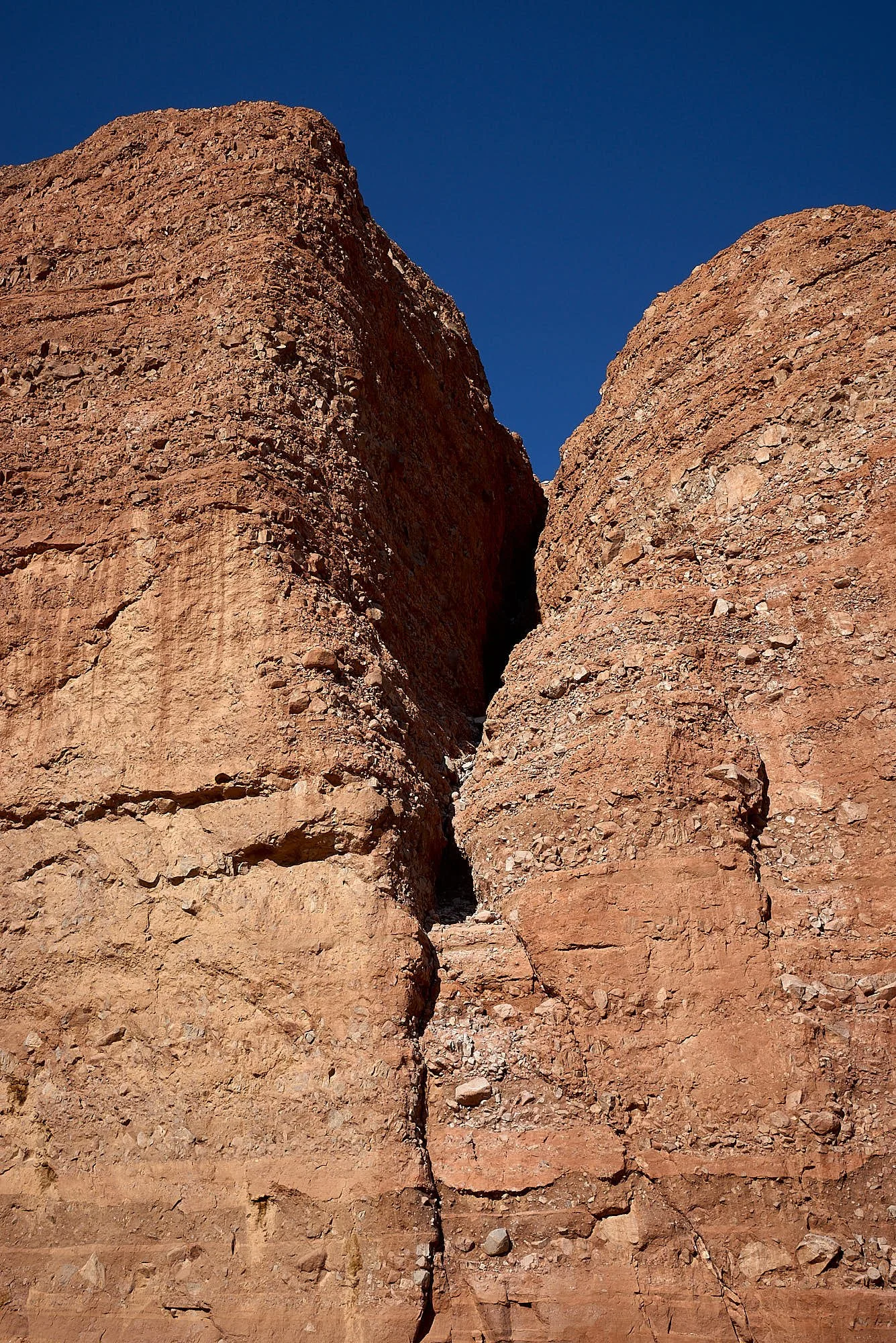
Fish Creek canyon is popular with the 4x4 crowd but we were happy to stretch our legs and hike the wash as it twists between precipitous sandstone cliffs.
We also walked the nearby Elephant tree (Bursera microphylla) trail. Anza Borrego is the Californian northern limit of this desert species. The swollen trunk acts as water storage and has papery, exfoliating bark. The tree has a red sap and small, star-shaped white or cream flowers.
Anza Borrego Desert State Park map HERE.
Fish Creek Canyon


Nolima Wash, Anza Borrego Desert State Park
We drove eastward and left pavement to camp by a mesquite thicket along Nolima Wash.
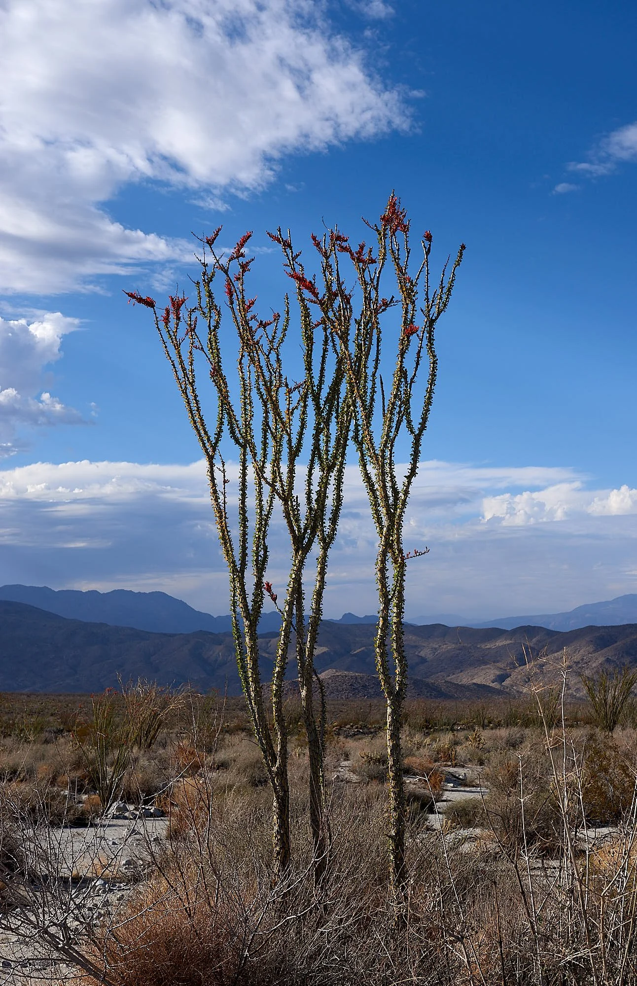
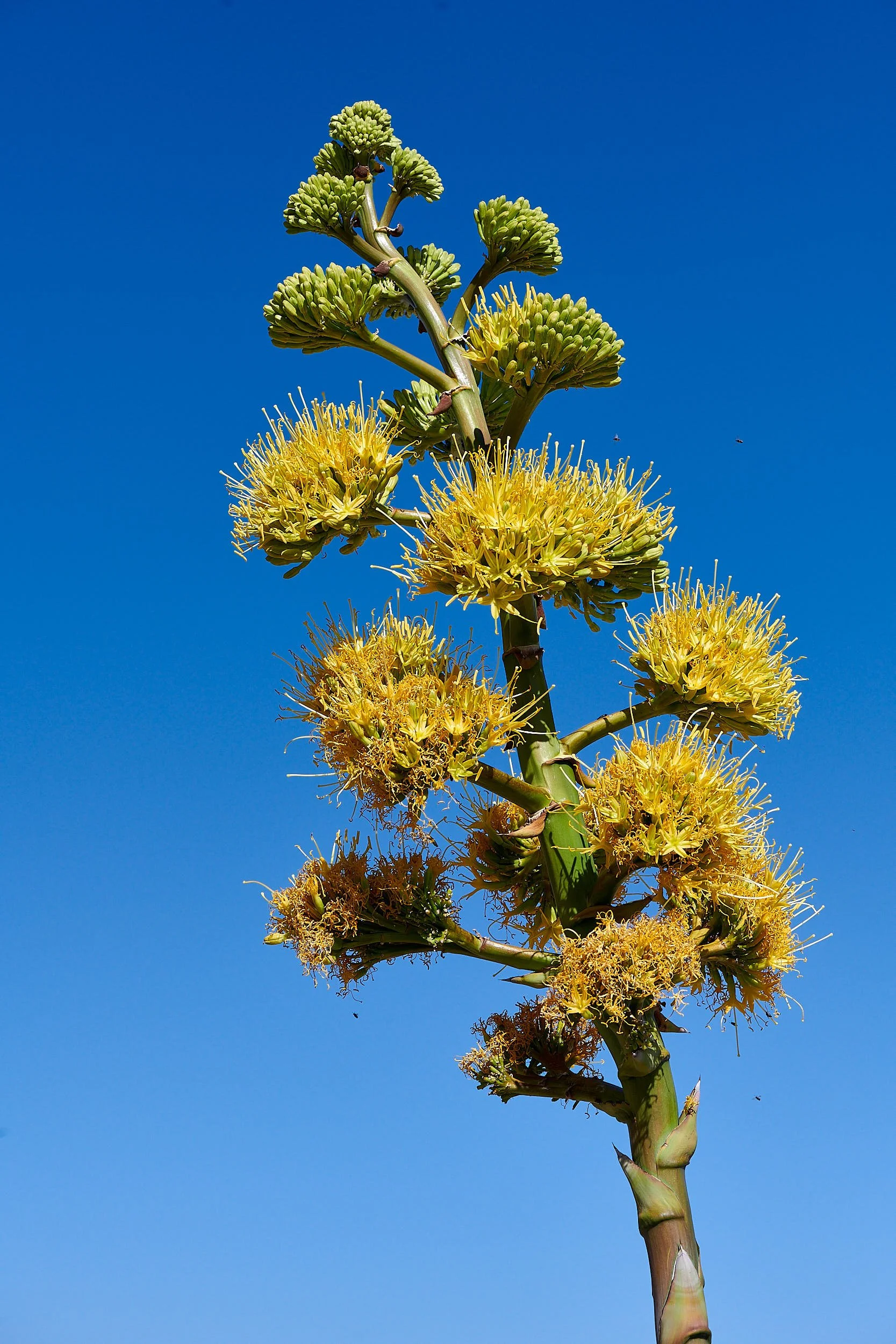
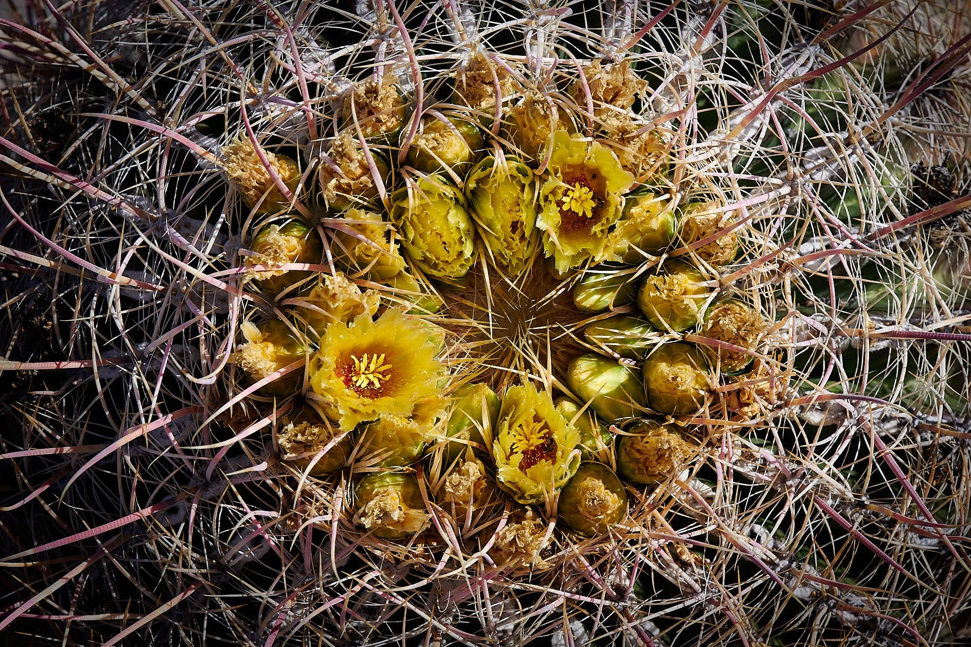
The area was a panoramic delight with hillsides adorned with flowering Ocotillo & Chuparosa (both red), Desert lavender (white) and Desert agave (yellow). Yucca, cacti (Barrel, Beavertail, Hedgehog, Fish Hook) and cholla (Teddybear, Gander’s, Silver) were common. Monkeyflowers, primroses and asters sparkled on the sandy floor.
Diminitive Verdin foraged around camp and Costa’s Hummingbird drank at our nectar feeder.

Whitewater Preserve,
The Wildlands Conservancy
Whitewater Preserve is adjacent to the San Gorgonio Wilderness (BLM) and provides a year-round water source and rich riparian habitat. More information HERE.
Mac and Frauke drove from the southern California coast to meet us there at noon. Great friends! Together, we hiked up towards Red Dome via the Pacific Crest Trail.
Oak Spring, Mojave National Monument
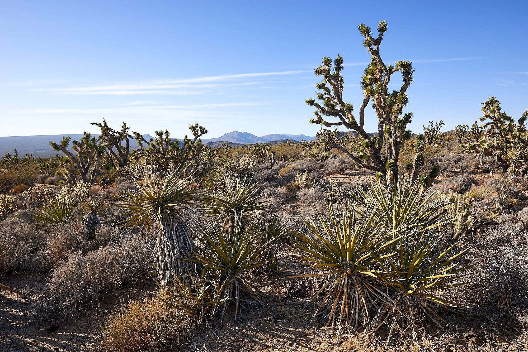
We traveled, via Amboy Crater on Route 66, to Oak Spring in Mojave National Monument and camped at 4370 feet, perfect altitude for Joshua trees and great vistas. Cima Dome was visible in the distance; it lost much of its Joshua tree woodland to a recent wildfire. Mojave National Monument map HERE.
The group hiked to the source of Oak Spring, nestled among Interior Live Oaks and Pinyon Pines. Bats at twilight and the glow of Las Vegas brightening the night horizon.

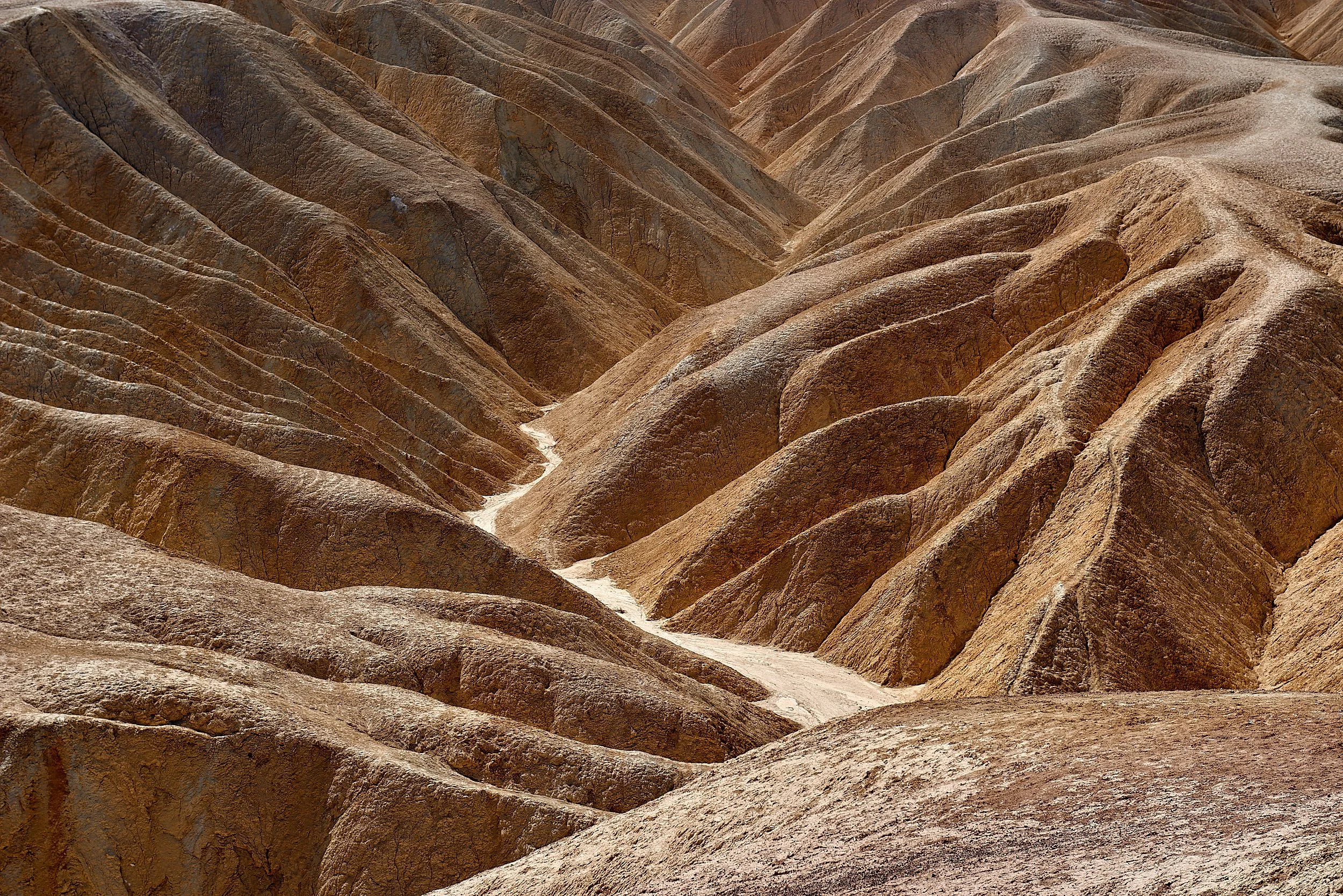
Echo Canyon, Death Valley National Park
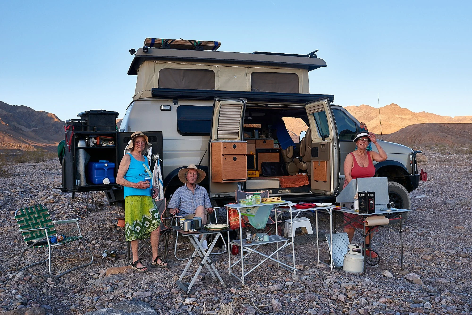
Camp was established in Echo Canyon wash. Our altitude was 980 feet, so daytime temperatures are more moderate than those at Badwater (about 260 feet below sea-level). It was a pleasant morning hike into Echo Canyon. Relaxed around camp in the afternoon, beverages at sundown. Death Valley maps HERE.
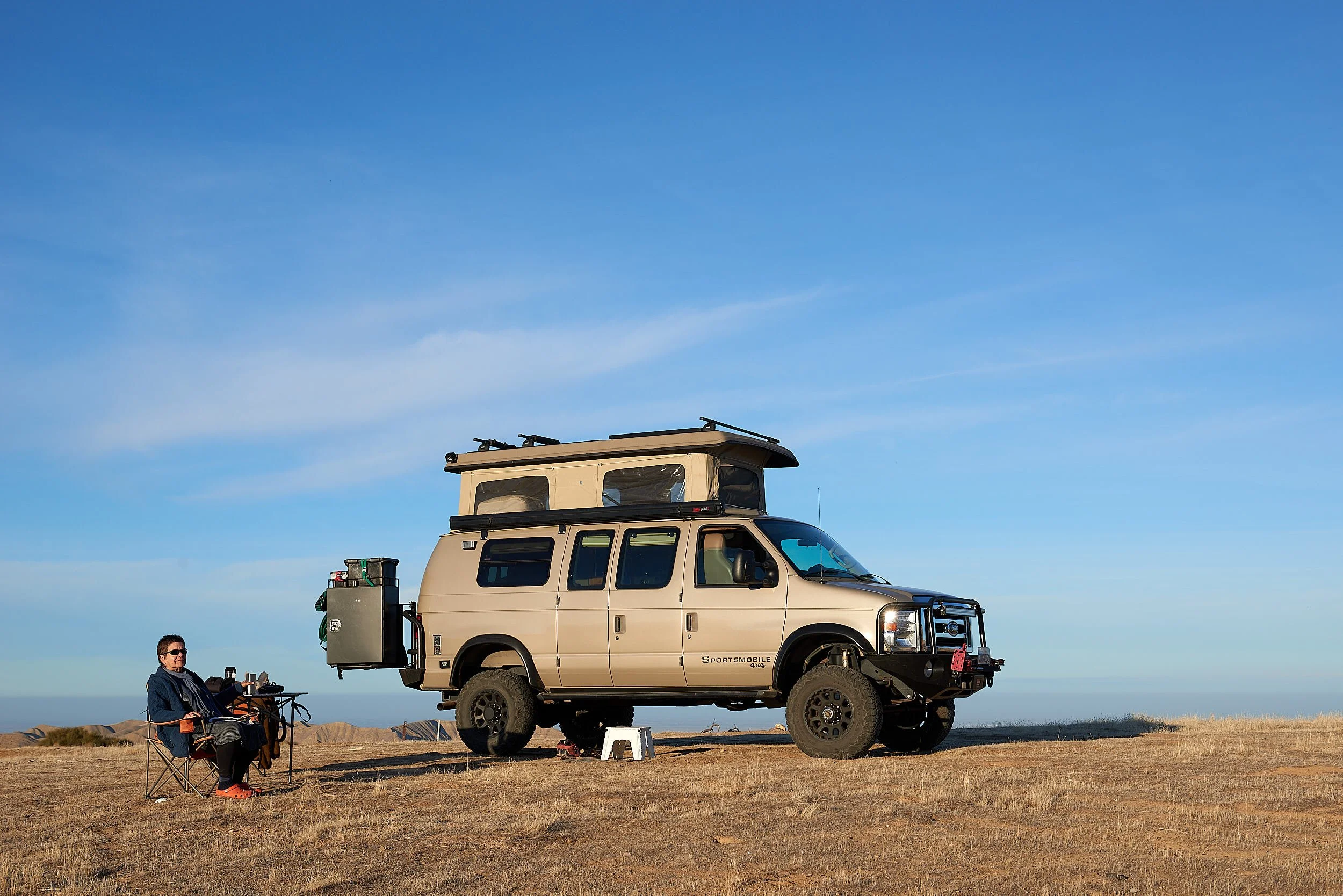
Frauke and Mac were rapidly adapting to van life.
Tourist Activities
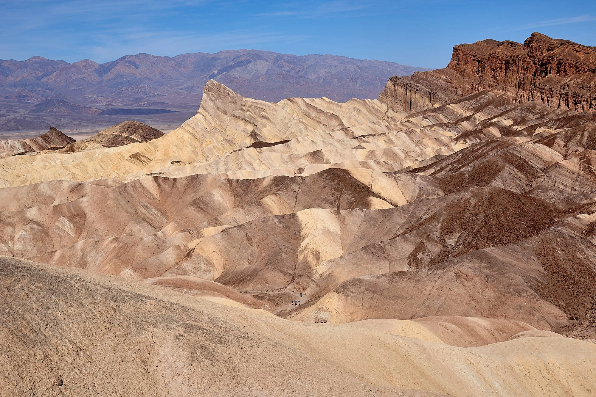
Mac’s vehicle battery was flat in the morning so we embarked on a lengthy drive to the popular tourist sites - Dante’s View, 20-Mule road, Zabriskie Point, Badwater, Artist’s Palate, Furnace Creek - to recharge it. First visit to Death Valley for our guests - they enjoyed the tour.
Treated ourselves to ice cream at Furnace Creek.

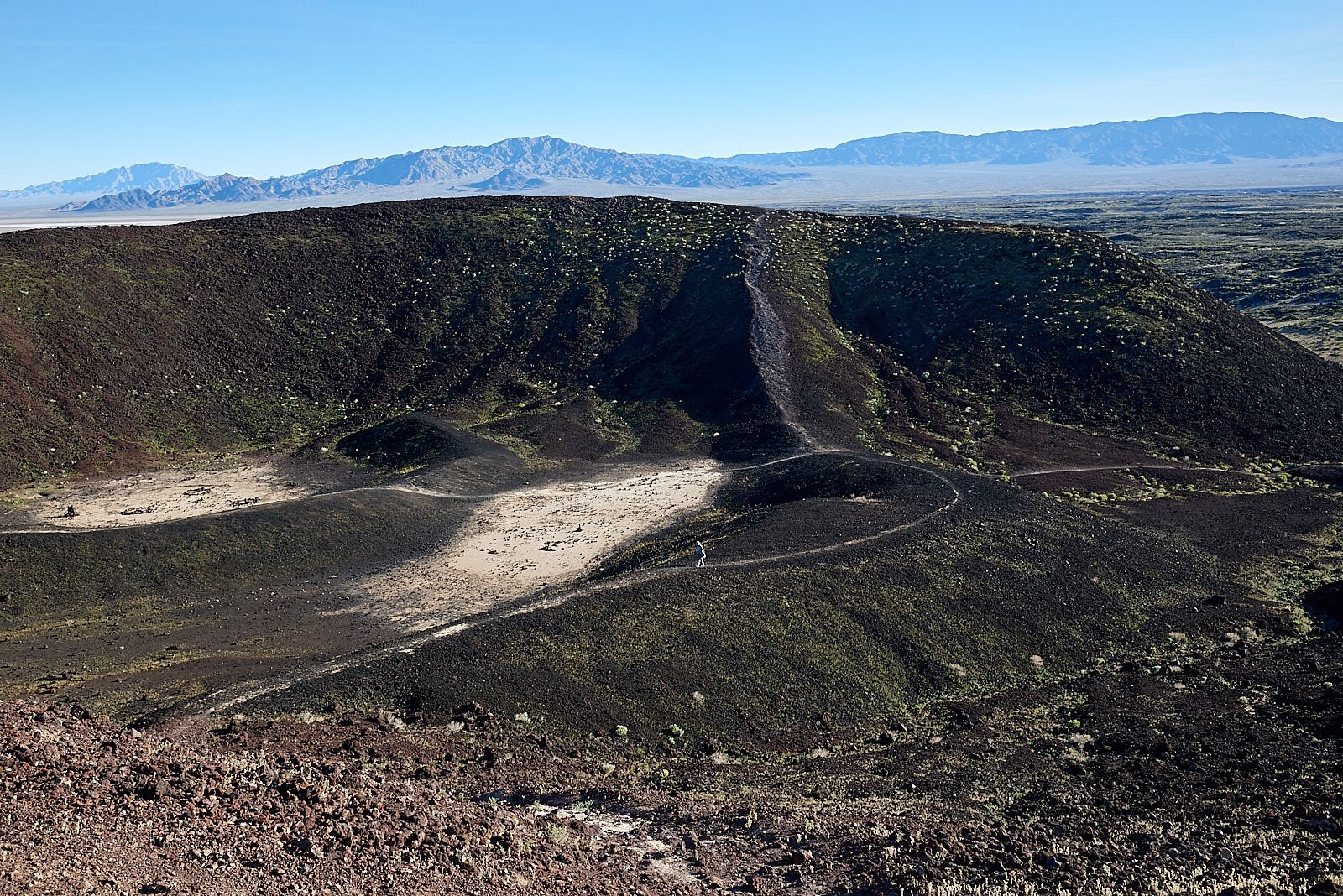
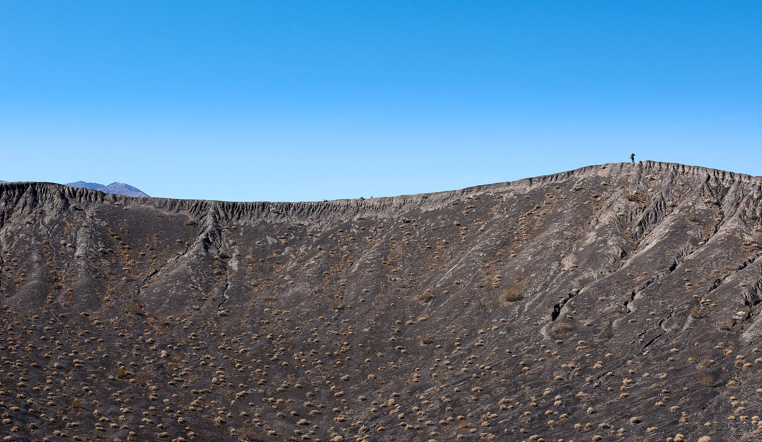
Ubehebe Crater, Death Valley National Park
The team relocated to Mesquite Springs Campground and used it as a base to explore the surrounding areas. Ubehebe and its associated craters were formed when rising volcanic magma came in contact with ground water. Steam formed instantly under great pressure and was released as massive explosions.
Energetic Mac could not resist a midday 600 feet descent into Ubehebe’s bowl (see tiny figure on path).


Free Range Ruby
Time was short. Mac & Frauke departed north on Highway 395, bound for Washington State.
During the trip, Mac interviewed many RV owners and inspected their rigs. Now our friends are the proud owners of a Winnebago Revel called Free Range Ruby.
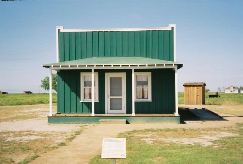
Colonel Allensworth State Historic Park
We went south and overnighted in the Central Valley at a very pleasant park. In August 1908, Colonel Allen Allensworth and four other settlers established a town founded, financed and governed by African Americans.
Their dream of developing an abundant and thriving community stemmed directly from a strong belief in programs that allowed blacks to help themselves create better lives. Part of the old town has been restored by CA State Parks.
(web photo)