Exploring Costa Rica: January, 2025
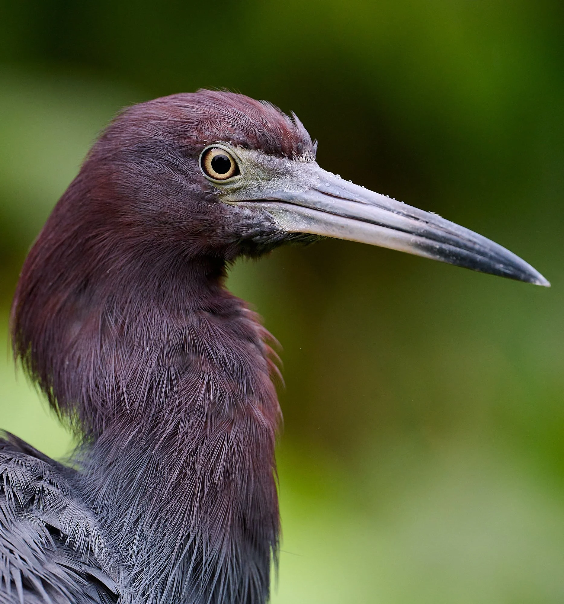
Little Blue Heron
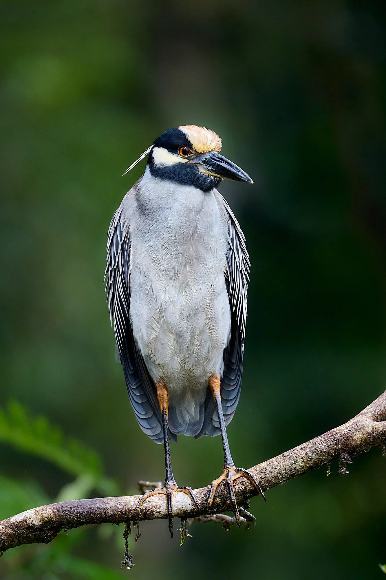
Yellow-crowned Night Heron
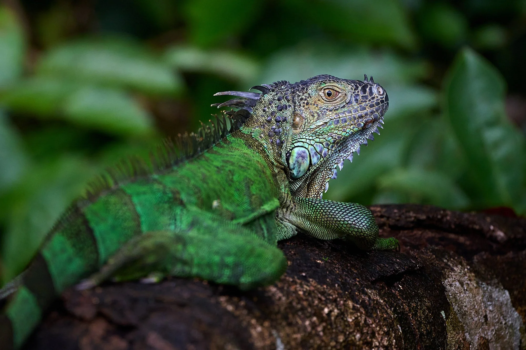
Green basilisk
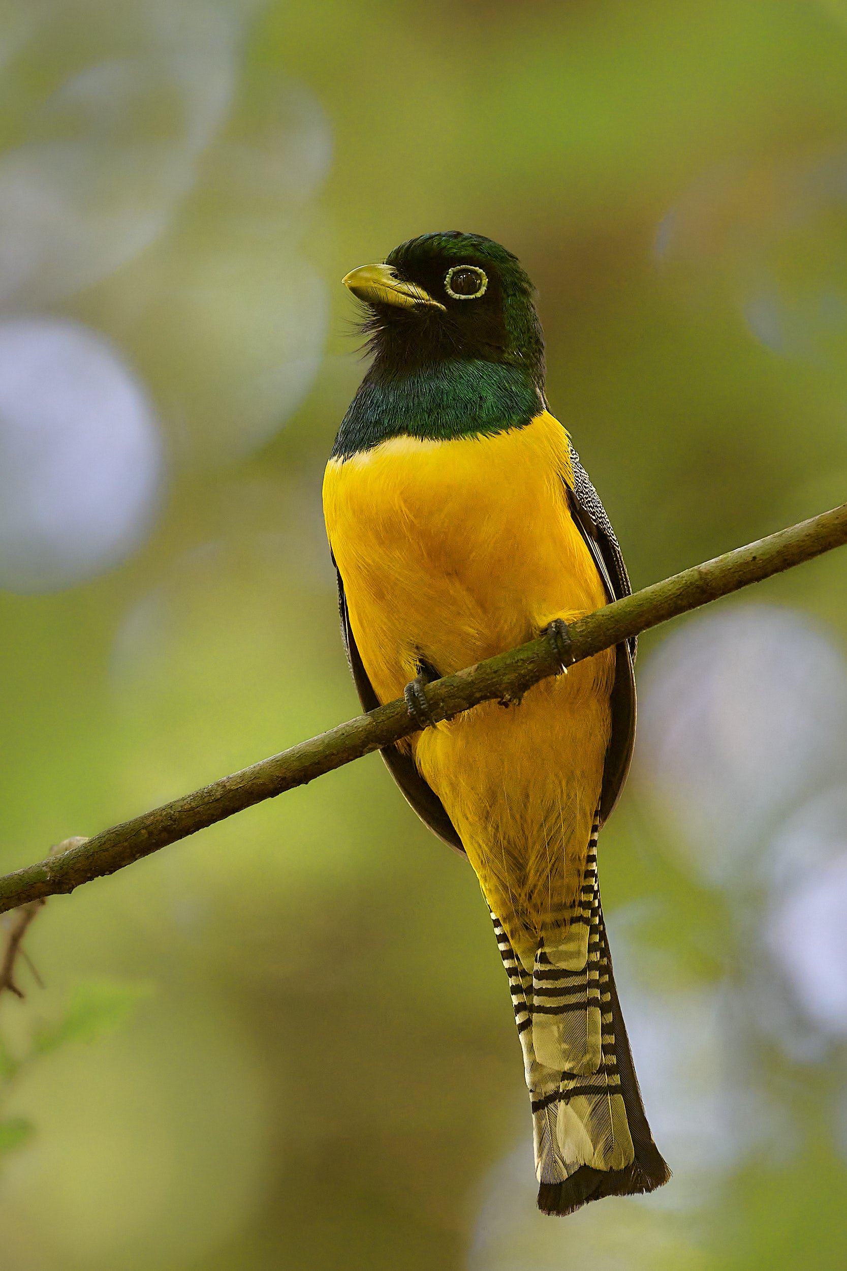
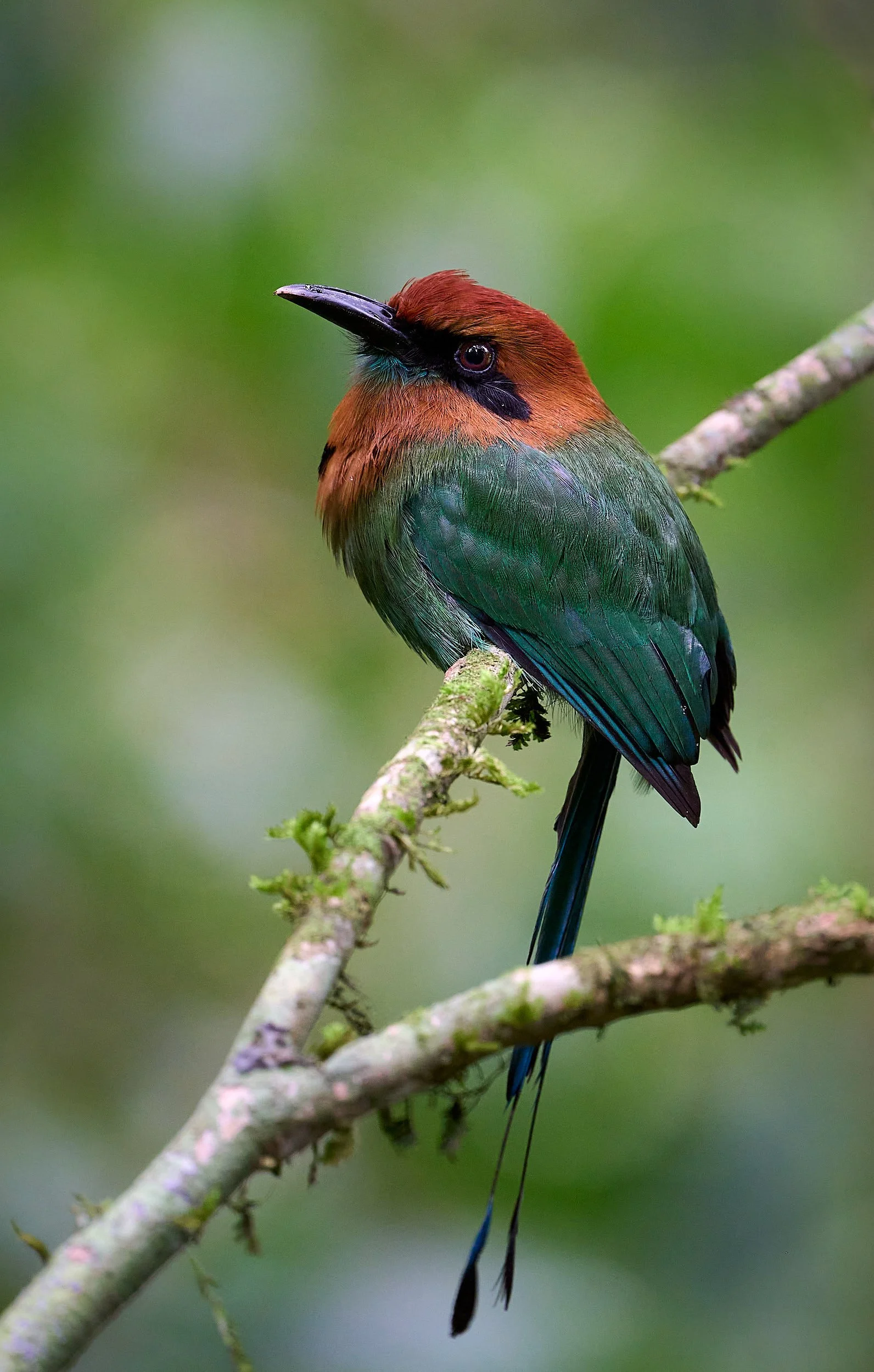
Northern Black-throated Trogon
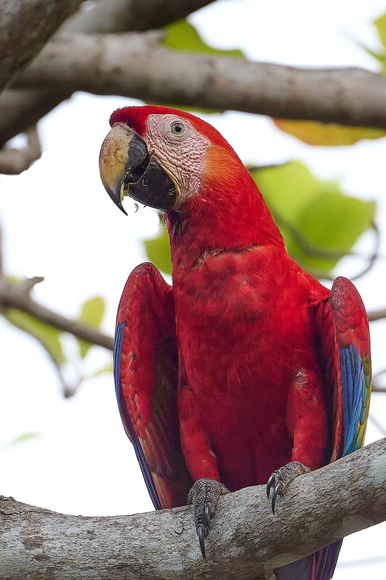
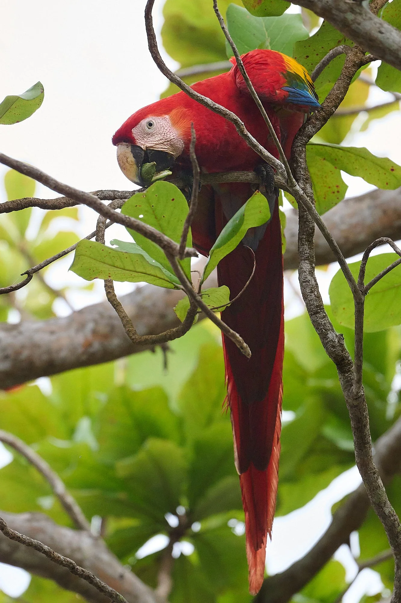
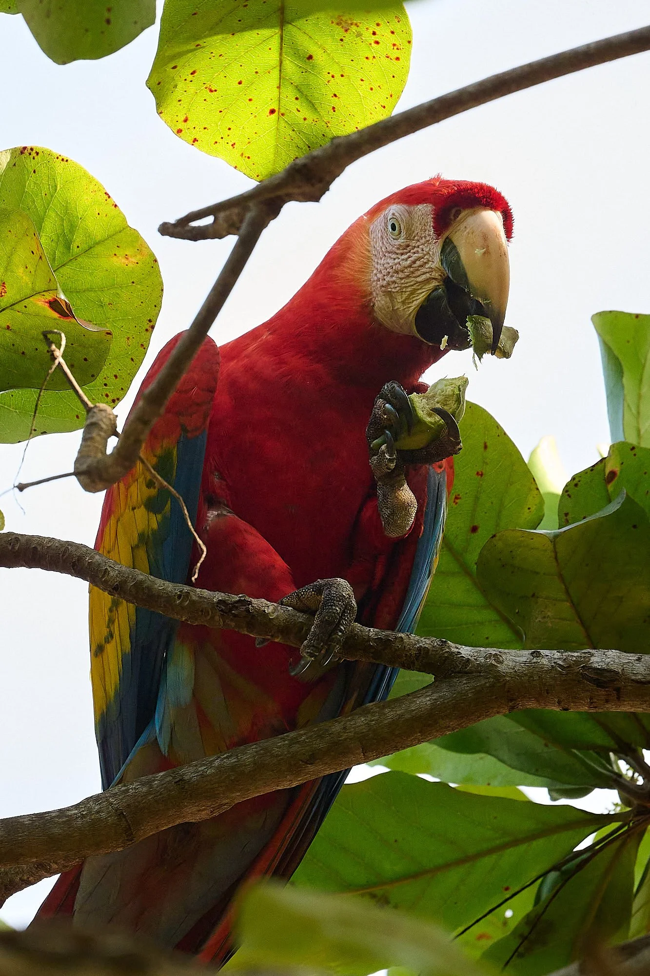
Scarlet Macaw
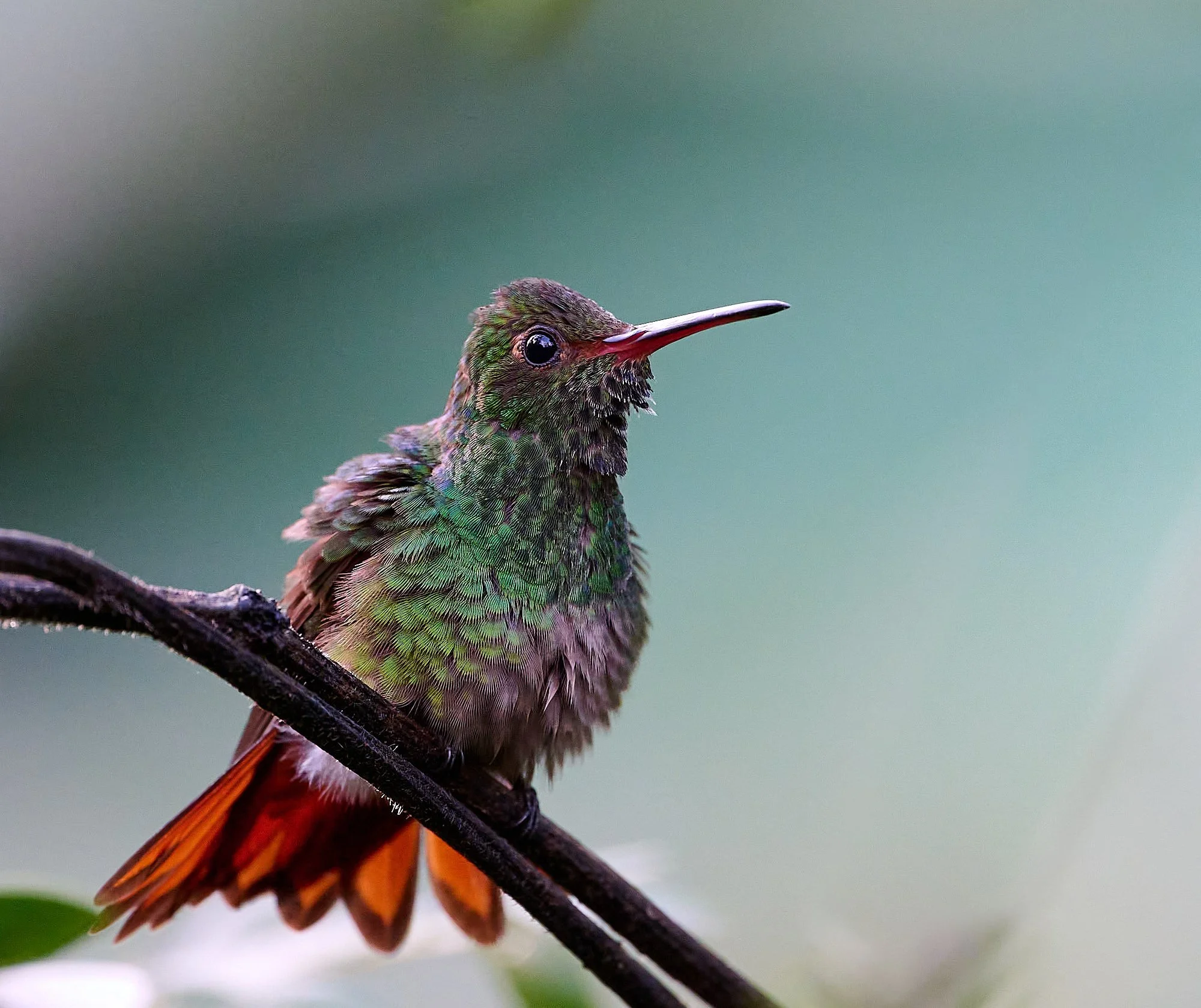
Rufous-tailed Hummingbird
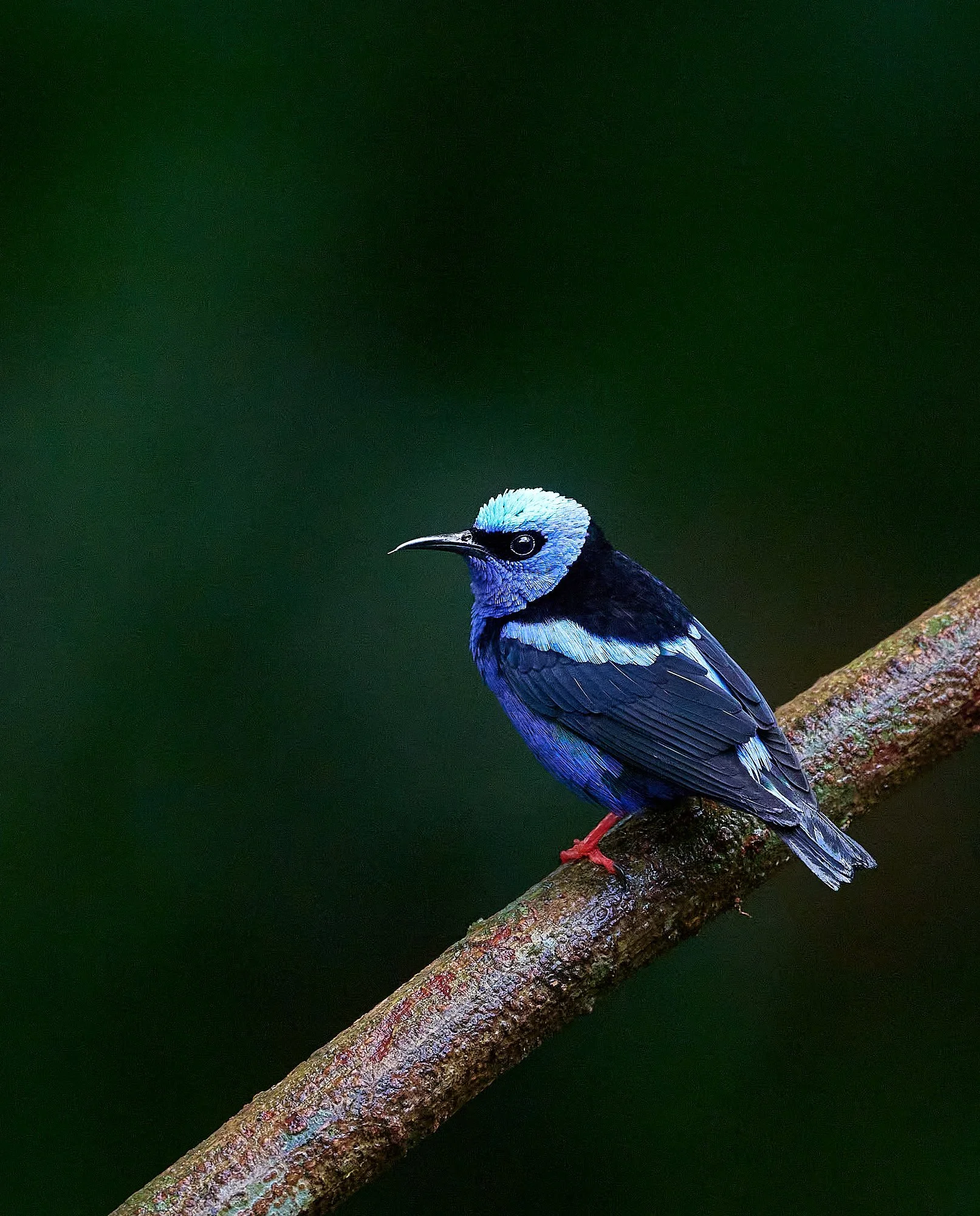
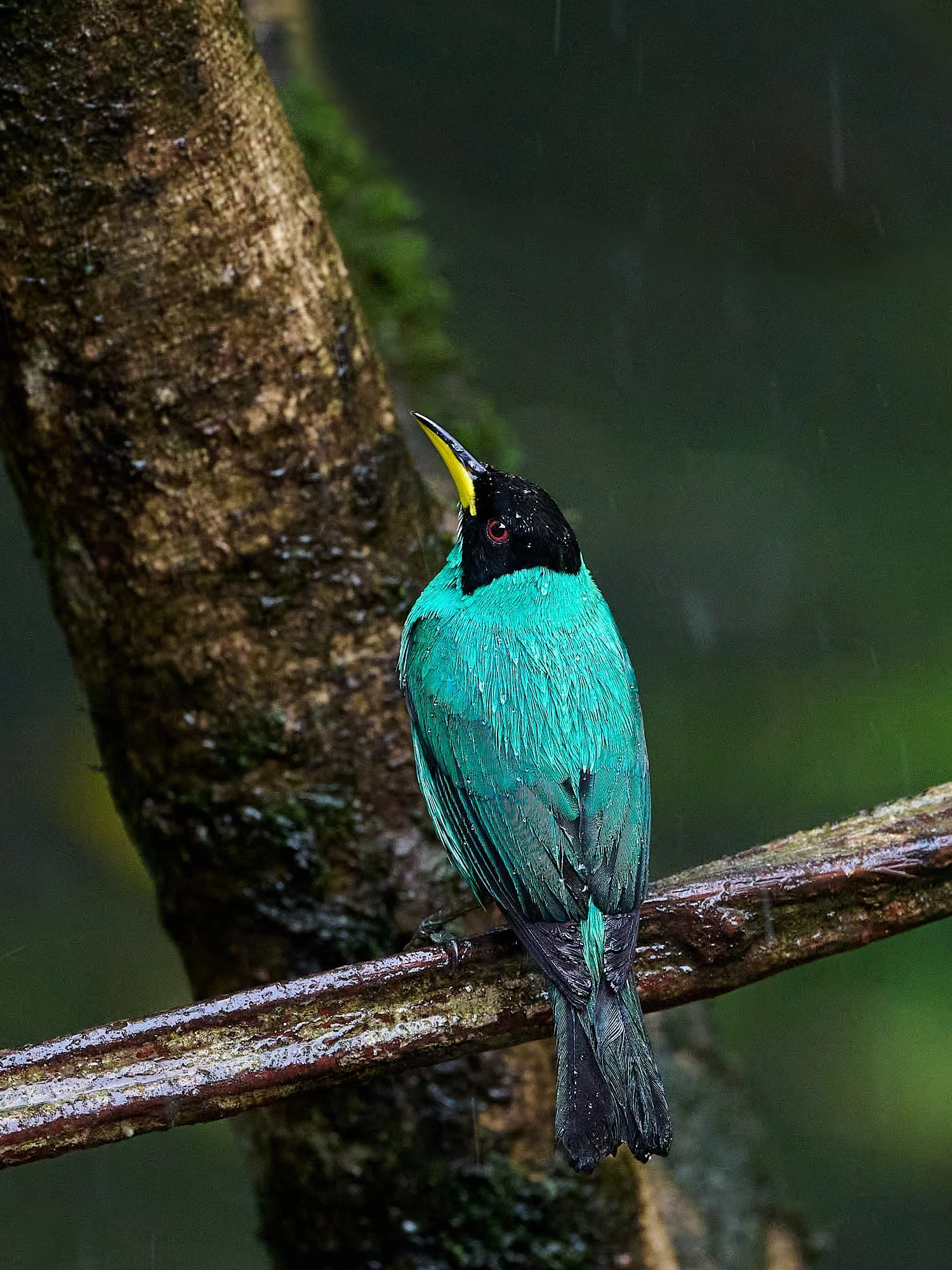
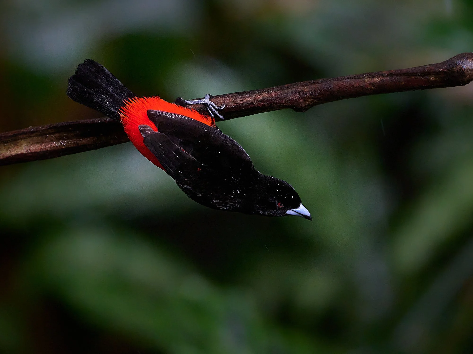
Red-legged Honeycreeper
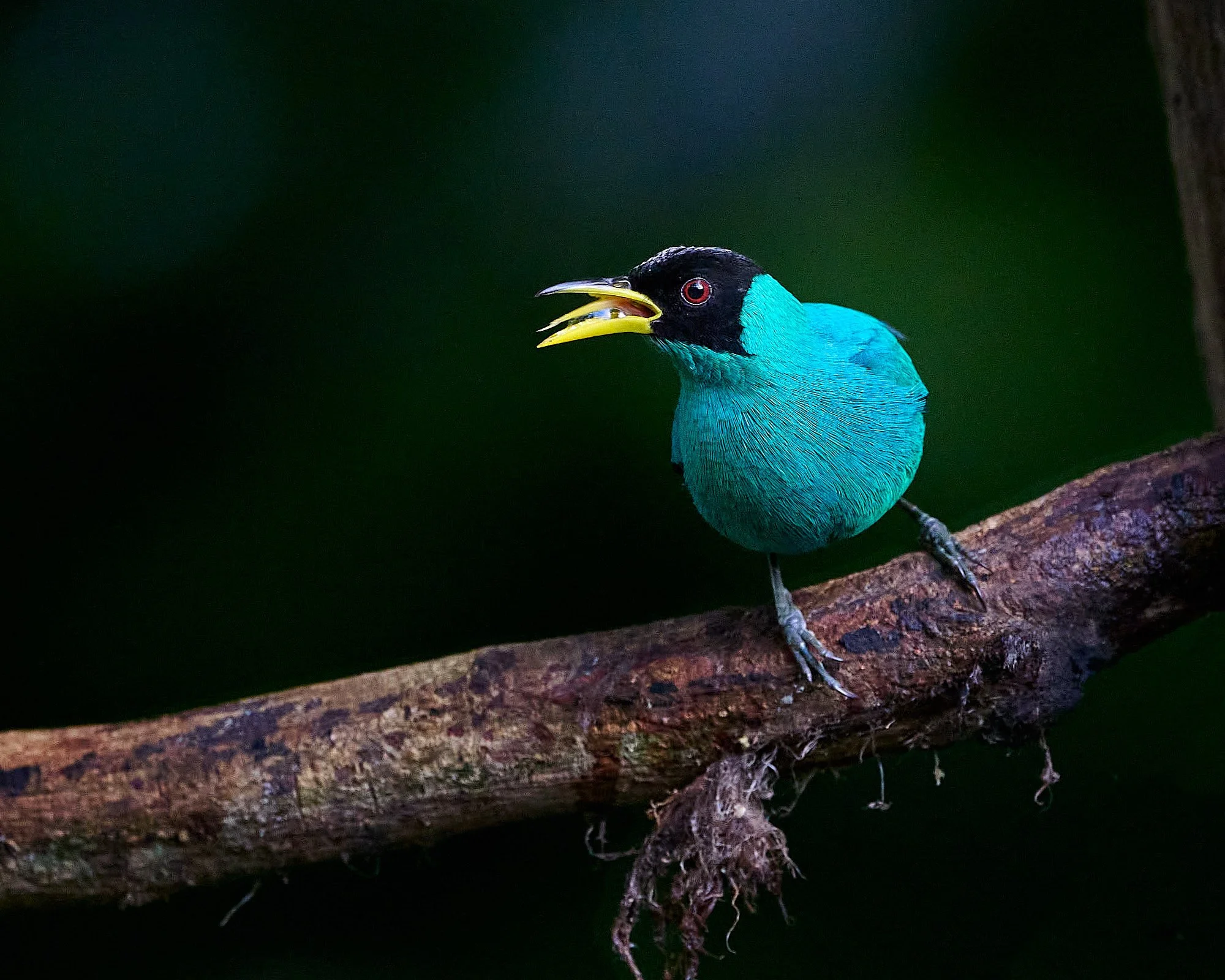
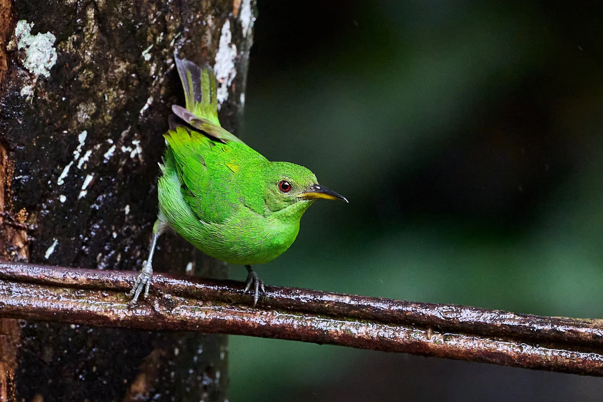
Green Honeycreeper
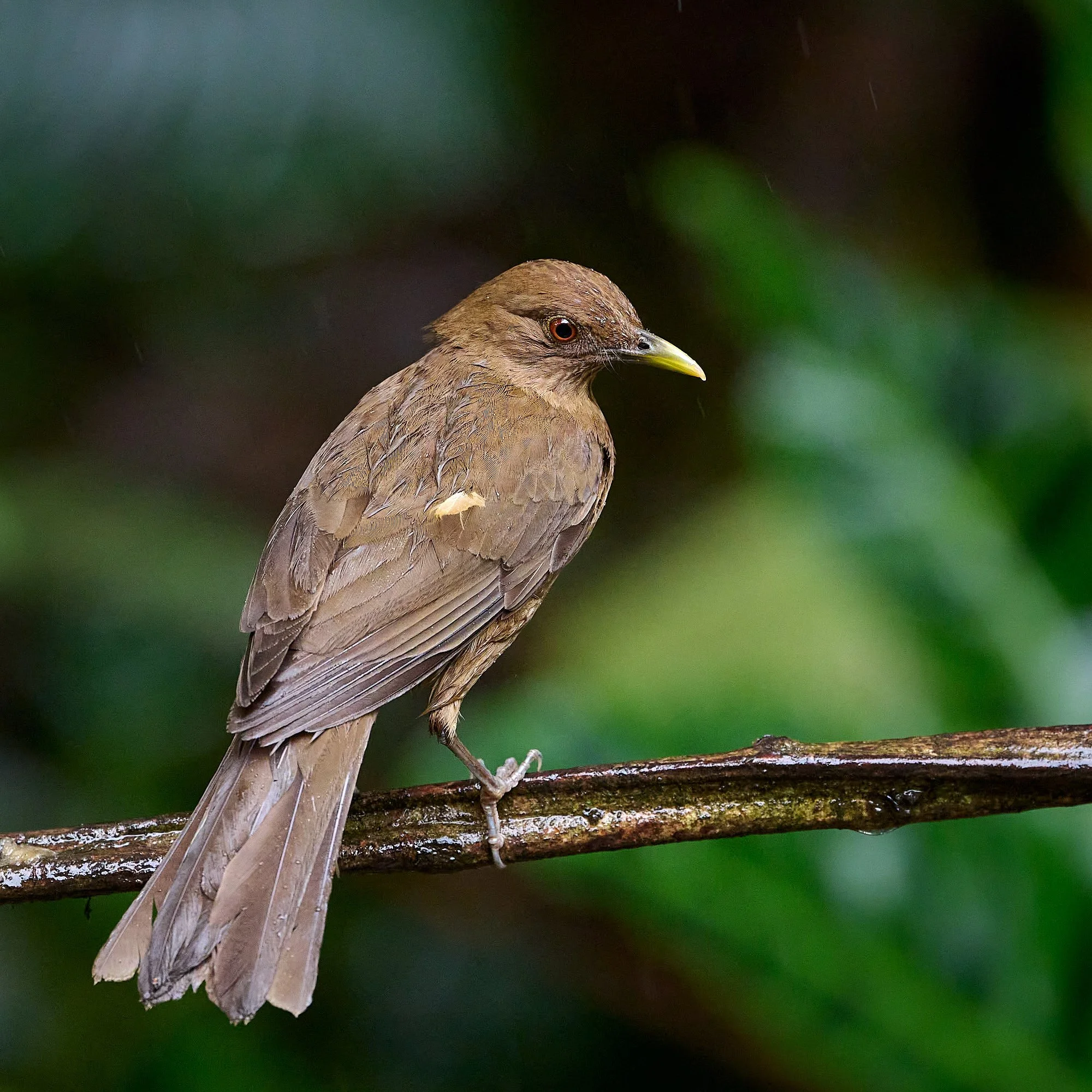
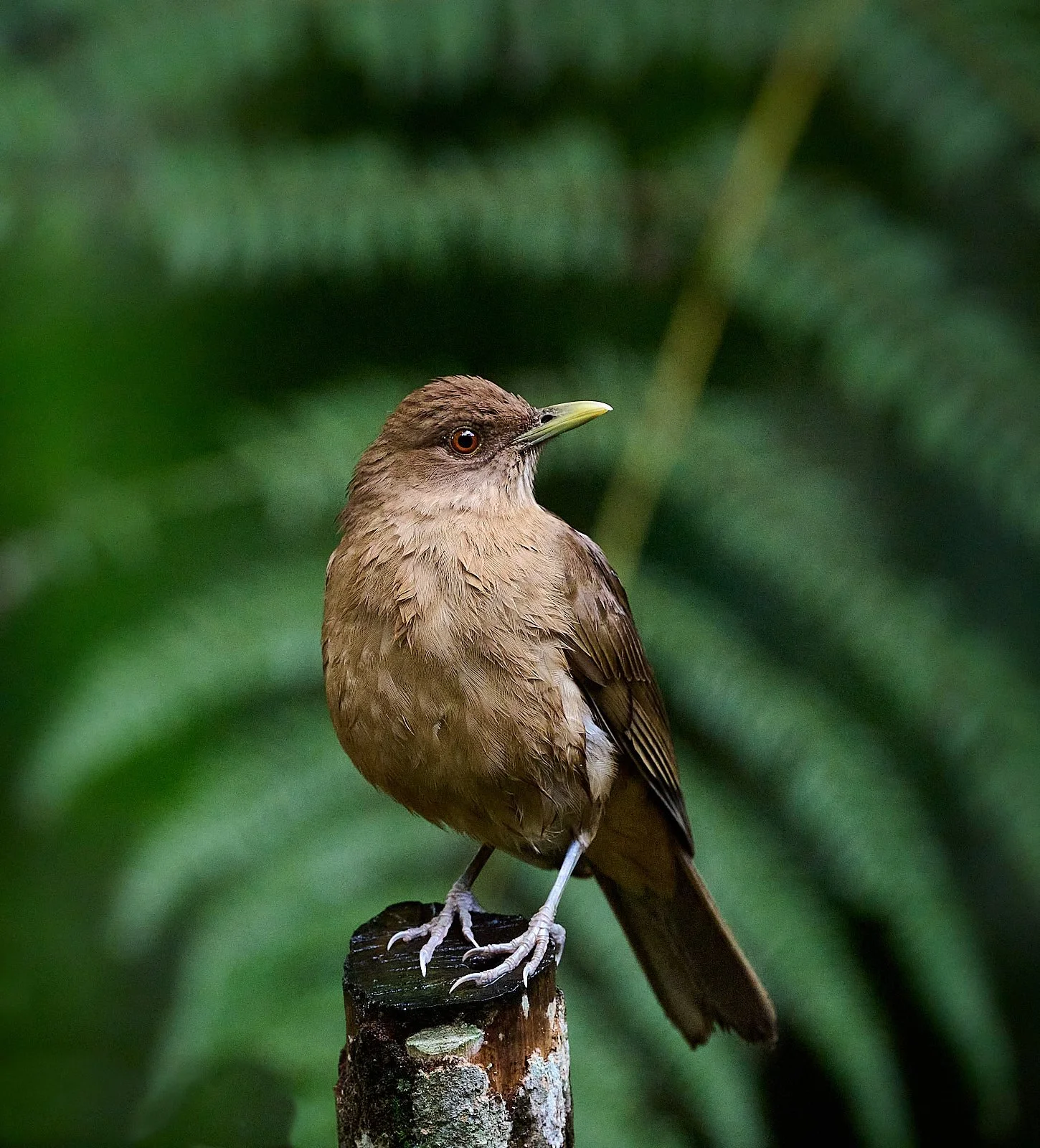
Clay-colored Thrush: the National Bird of Costa Rica
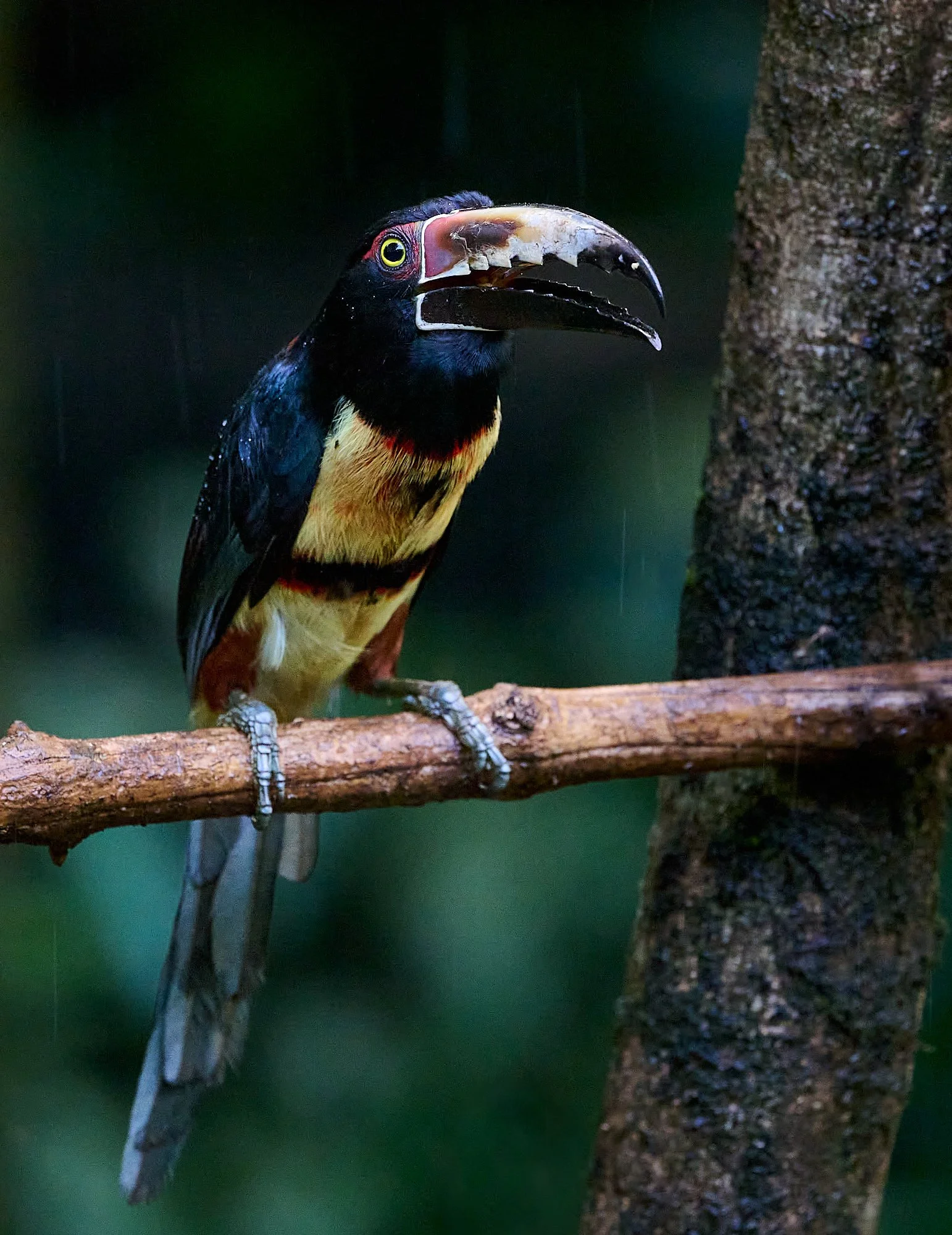
Collared Aracari
Plugging the Gap: The Panama Isthmus
The Isthmus - a land bridge - connects North and South America. It is situated in Panama, with Costa Rica on the northern section and Columbia at the southern edge.
Scientists regard the formation of the Isthmus of Panama as one of the most important geologic events to have occurred on Earth in the last 60 million years. Even though it is only a tiny sliver of land, relative to the sizes of continents, the Isthmus of Panama had an enormous impact on Earth’s climate and its environment.
Some Background from Eons ago
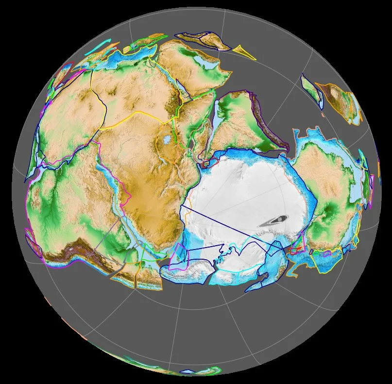
Gondwana
Gondwana was a massive landmass that formed about 600 million years ago (Ma) from the accretion of several blocks (cratons) of the Earth’s crust. South America, Africa, Antarctica, Australia, Zealandia, Arabia, and the Indian subcontinent all originated from Gondwana.
Pangaea
Around 335 Ma, Gondwana fused with Euramerica to create the supercontinent Pangaea. Evidence of Pangaea includes complementary geography (close fit of the Americas coastlines with those of Europe and Africa), matching geology, identical fossils, and similar orientation of magnetic minerals in rocks.
Gondwana 420 million years ago, as viewed from the South Pole.
Life on Pangaea
A scorpion fossil found in South Africa demonstrated that invertebrate land animals lived in Gondwana some 360 million years ago.
Dinosaurs appeared about 230 Ma during the Triassic period, and the earliest mammal fossil dates back 225 Ma . Birds probably evolved around 160 million years ago from theropod dinosaurs, a group first recorded in the fossil record at about 225 Ma (from: Cornell Lab of Ornithology).
By the time Pangaea broke up, in the Middle Jurassic (circa 170 Ma), the seas swarmed with mollusks, ichthyosaurs, sharks, rays, and early bony fishes; while life on land was dominated by forests of cycads and conifers in which dinosaurs flourished, and true mammals were present.
A Big Break Up
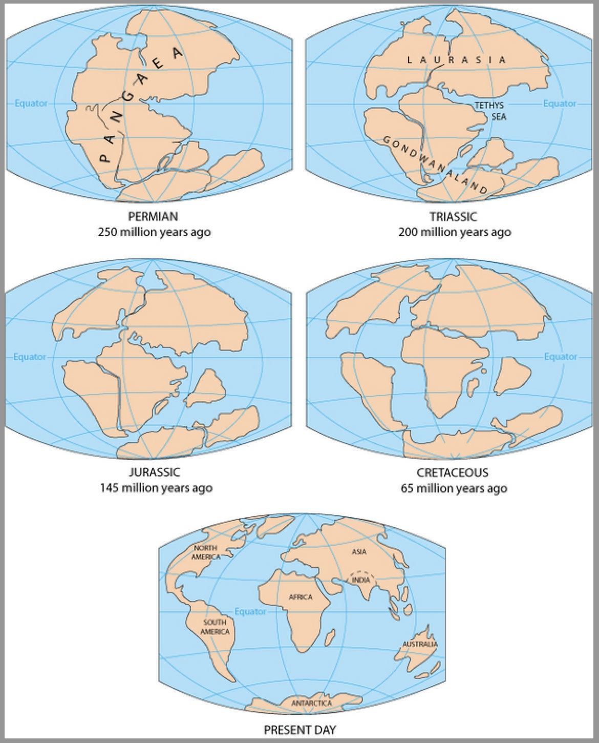
Pangaea Rifting
Pangaea started to break up around 230 Ma due to rifting.
The first phase involved separation of Laurasia (which became Europe/Asia and North America) from Gondwana and the opening of the central Atlantic.
Next, in the early Cretaceous (150-140 Ma), Gondwana started to separate into Africa, South America, India, Antarctica, and Australia. Expansion of the south Atlantic occurred from south-to-north rifting.
During the third phase (starting 60-55 Ma), Australia split from Antarctica and India collided into Asia.


Top left: Earth 120 Ma during the early Cretaceous. Top right: Earth 85 Ma during the late Cretaceous.
Bottom left: Earth 60 Ma during the early Cenozoic . Bottom right: Earth 30 Ma during the mid-Cenozoic.
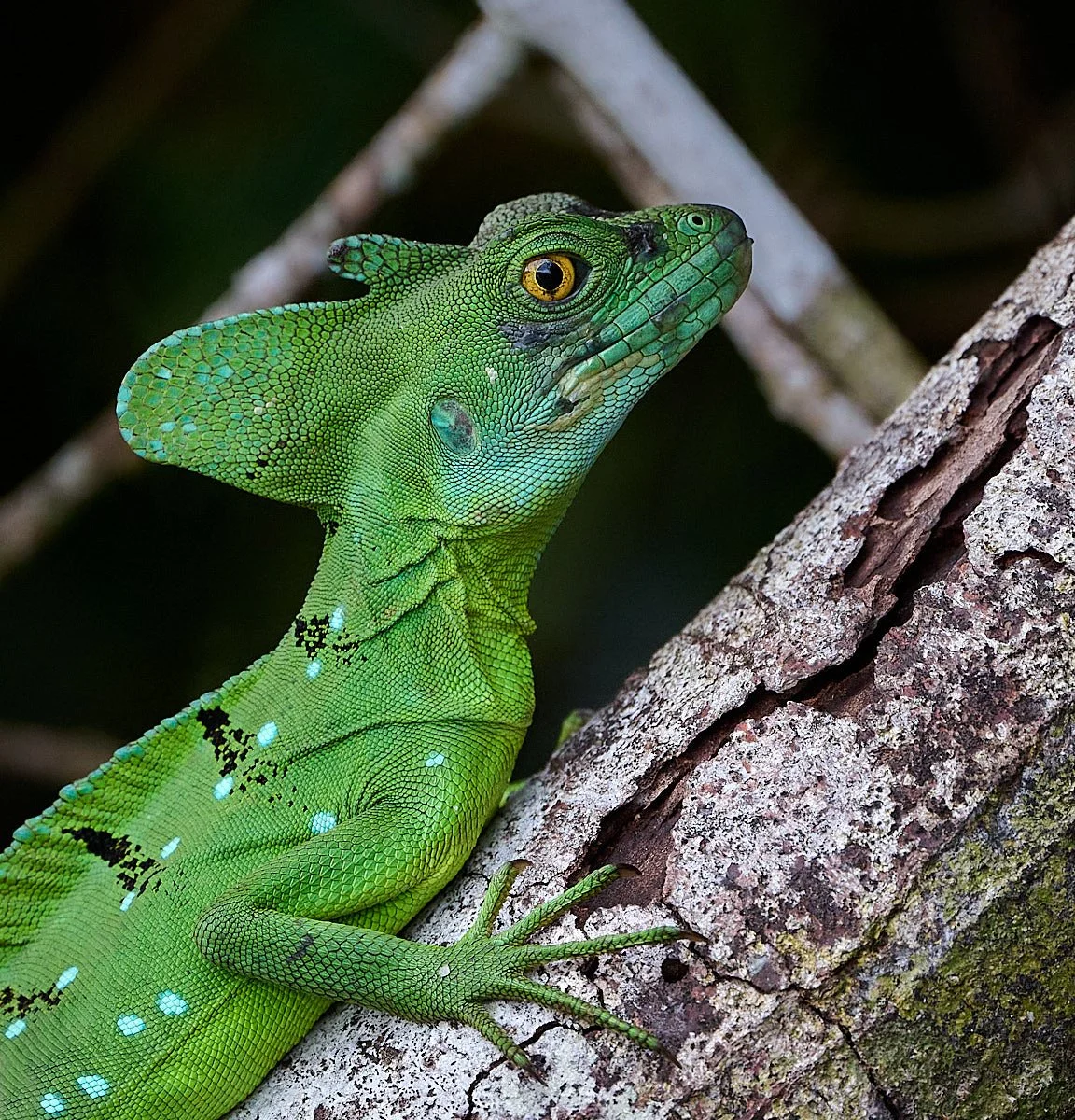
Locally called the “Jesus lizard” because it has large webbed feet that allow it to scamper along the water’s surface for a short distance.
South America’s links to other landmasses during the Cenozoic Era (66 Ma to present)
66 Ma: South America was joined to both North America and Antarctica. Soon after this point, it lost its connection to North America.
65 Ma: Asteroid slams into Mexico’s Yucatán Peninsula, dinosaurs become extinct.
66-50 Ma: South America was connected to Antarctica which, in turn, was attached to Australia.
50-34 Ma: South America was connected to Antarctica, which was no longer attached to Australia and not yet covered by ice.
34 Ma: The connection between South America and Antarctica was severed and Antarctica became glaciated.
34-9 Ma: South America had no land connections to any other continent.
9-3 Ma: Islands formed between South and North America.
3 Ma: to present: Complete land connection between South and North America.
South America’s mammals
South America was an island continent for much of the past 66 million years (the Cenozoic Era - the “Age of Mammals”).
Consequently, its mammals evolved uniquely, and can be categorized into 3 groups:
Ancient Inhabitants
These included many marsupial species. (Marsupials probably originated in South America and migrated via Antarctica to Australia).
Other mammal groups included xenarthrans (sloths, armadillos, anteaters); ungulates (all extinct), monotremes, and rodent-like animals called Gondwanatheres.
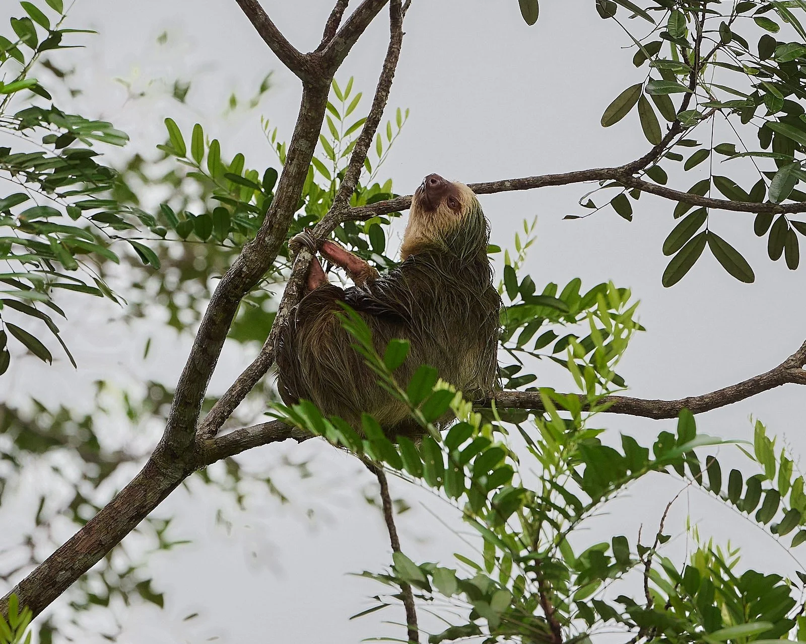
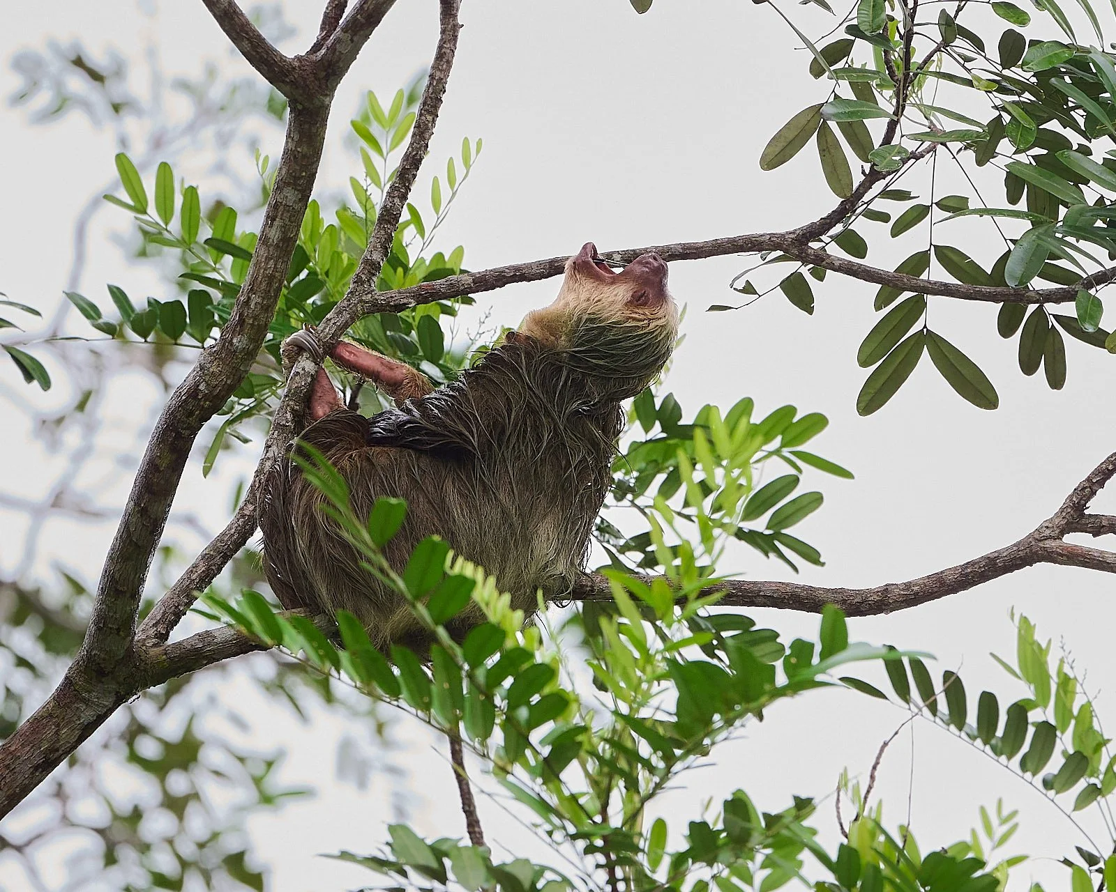
Three-toed sloth
Lucky Arrivals
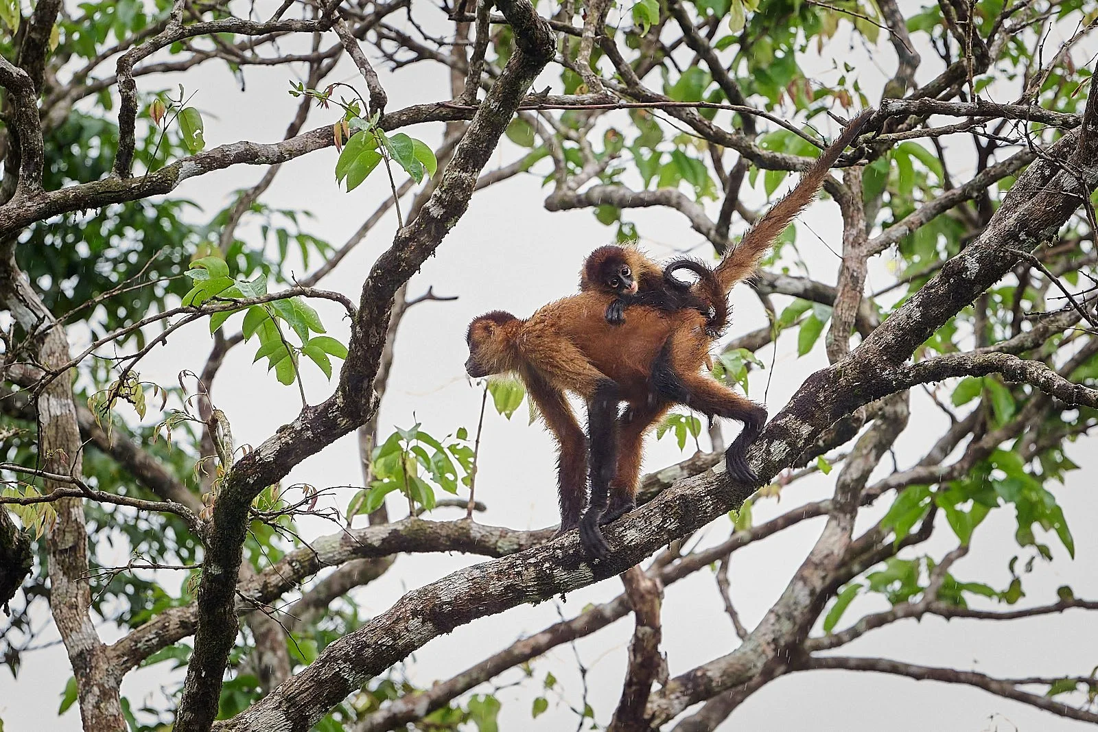
Rodents (e.g.: capybara) and primates (e.g.: monkeys) arrived from Africa in the mid-Cenozoic, having survived an astounding crossing of the Atlantic.
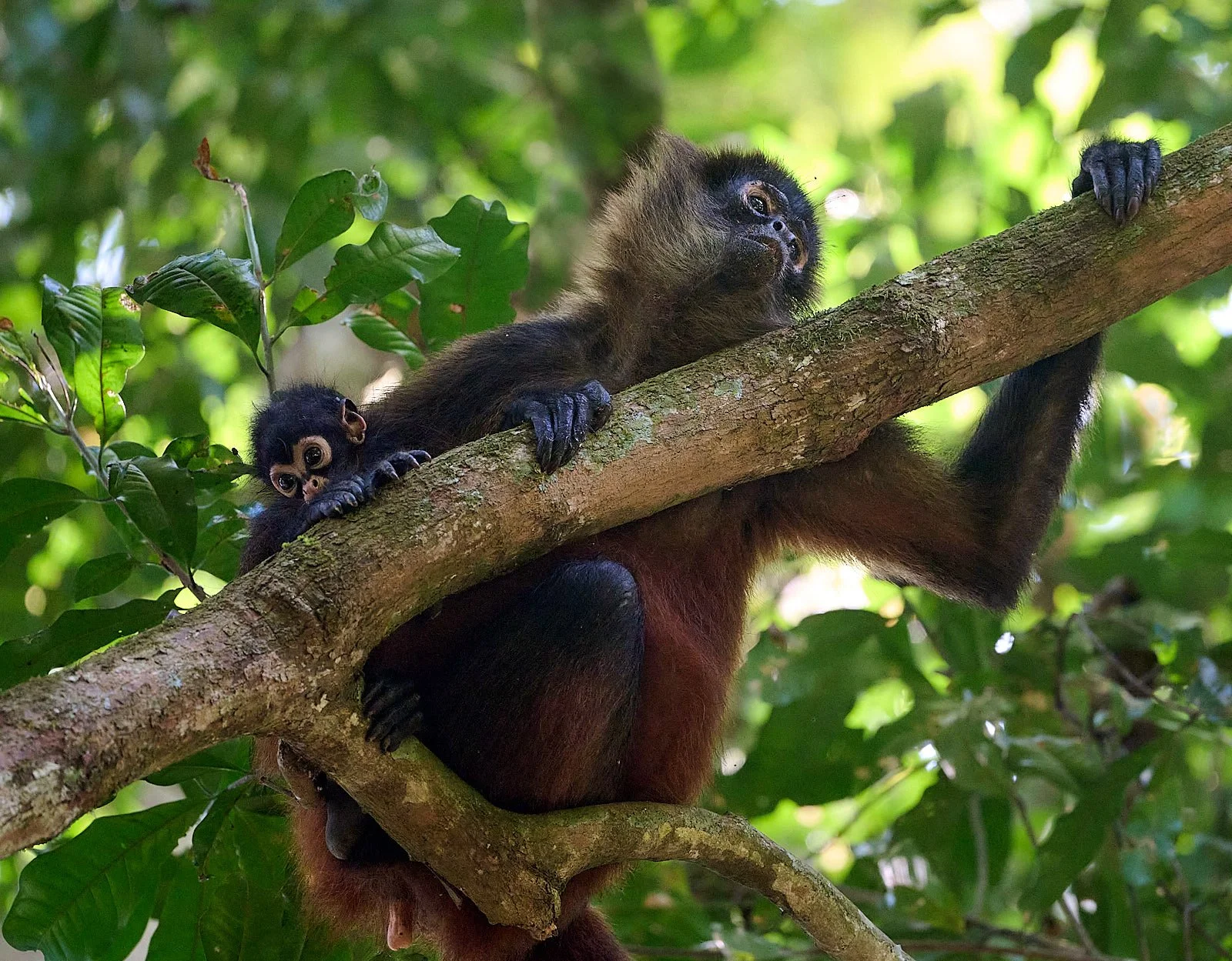
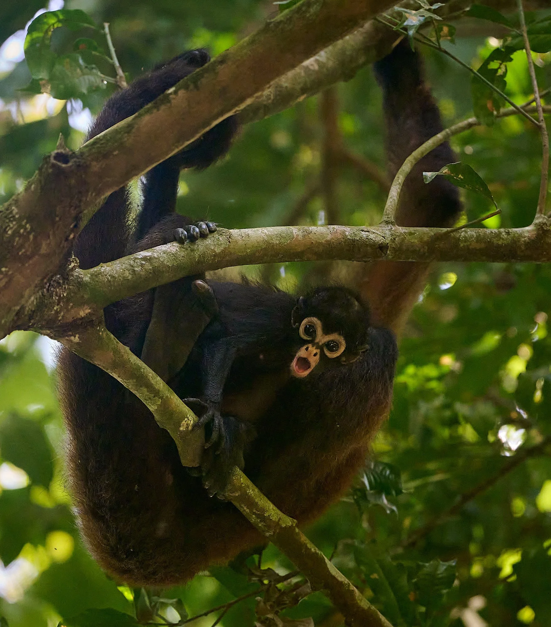
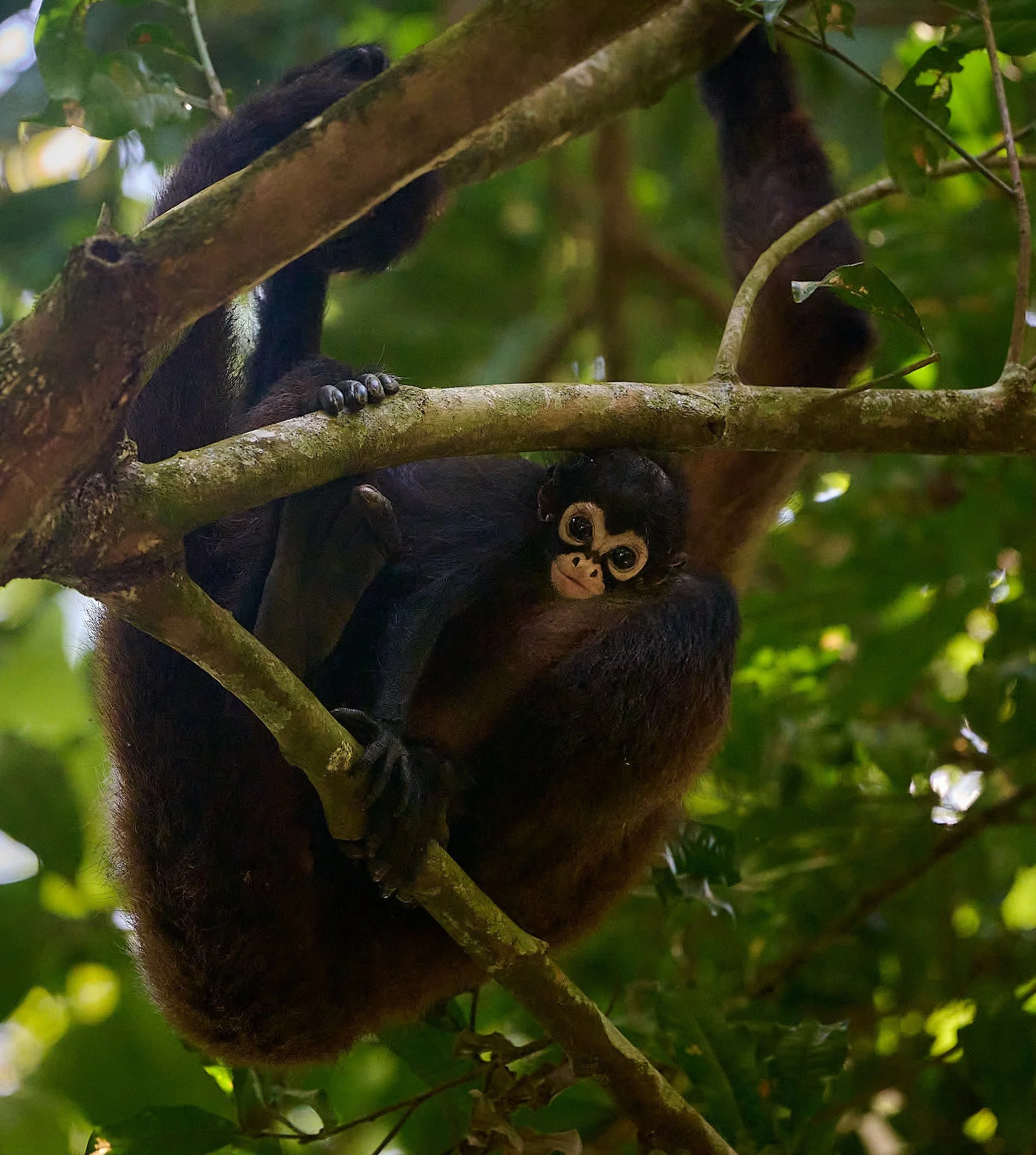
Spider monkey with baby.
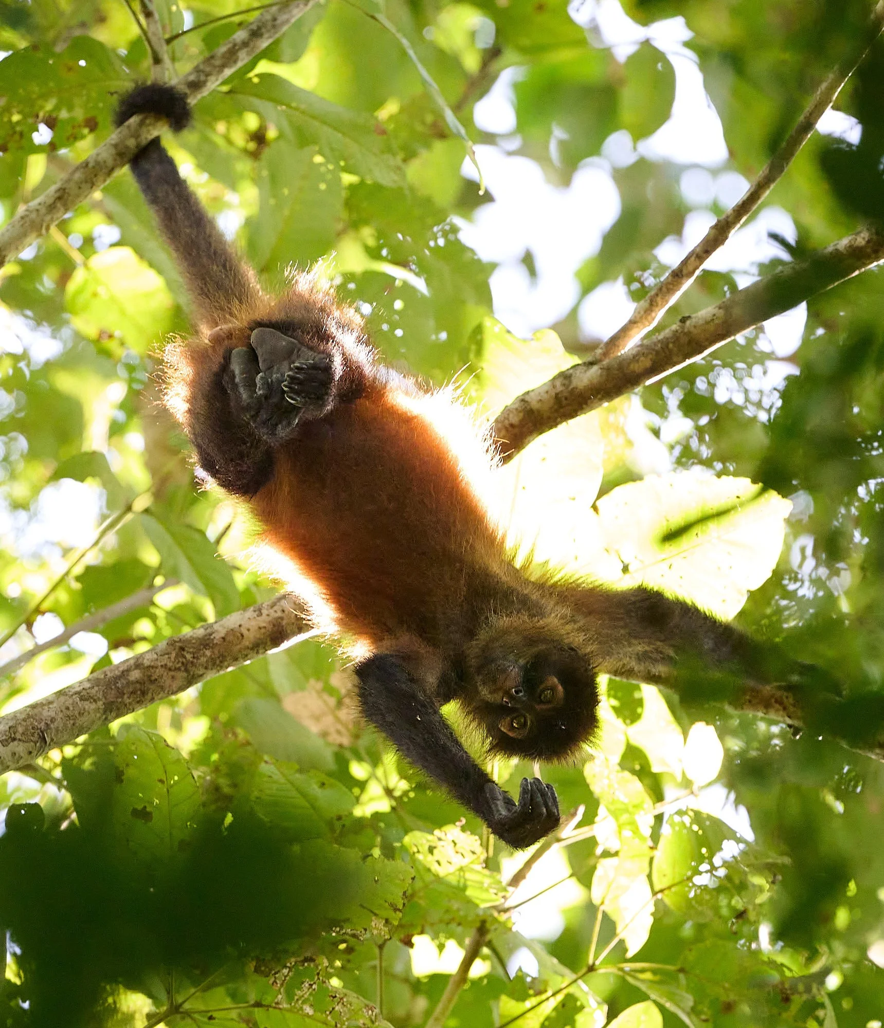
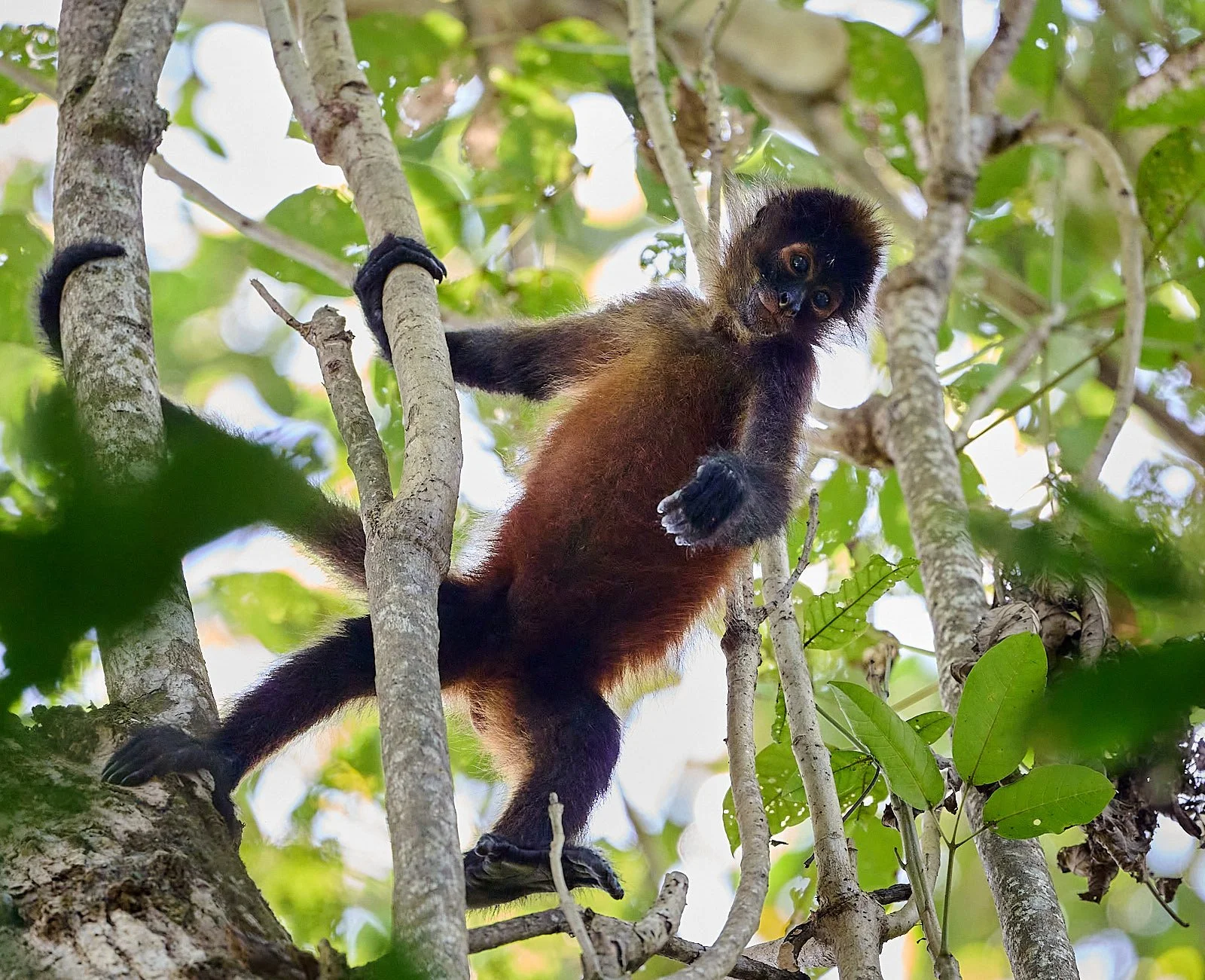
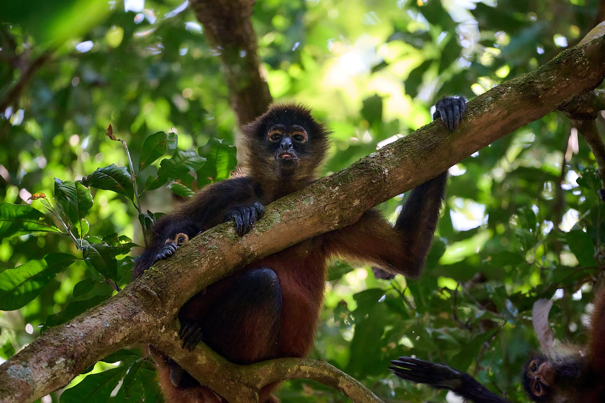
A spider monkey troop passed above us, foraging among the canopy.
Northern Immigrants
Near the end of the Cenozoic, a few groups of North American mammals began to appear in South America. They probably arrived by “island hopping”. The number of mammal groups to cross between the two continents increased as the amount of exposed land increased, and the two continents probably were fully connected by at least 3 million years ago. The gap was closed.
Pronounced glacial (cooler) and interglacial (warmer) intervals during the Pliocene (5.3 - 2.6 Ma) and Pleistocene (2.6 Ma - 11,700 years ago) probably affected the types of vegetation covering Central America at different times and thereby the types of mammals that were able to make the crossing. The migration of species accelerated after 2.7 Ma. In total, 19 families of North American mammals became established in South America during what is now termed the Great American Biotic Interchange.
These included:
Artiodactyla (even-toed ungulates) - guanaco, vicuña, llama, alpaca, deer, peccary
Carnivora (meat-eating mammals) - dogs, foxes, cats, skunks, otters, weasel-like mammals, raccoons, spectacled bear
Lagomorpha - rabbits
Perissodactyla (odd-toed ungulates) - horses, tapirs
Primates - humans
Proboscidea - extinct relatives of elephants
Rodentia - rats, mice, pocket gopher, pocket mice, squirrels
Soricomorpha - shrews
South American Emigrants
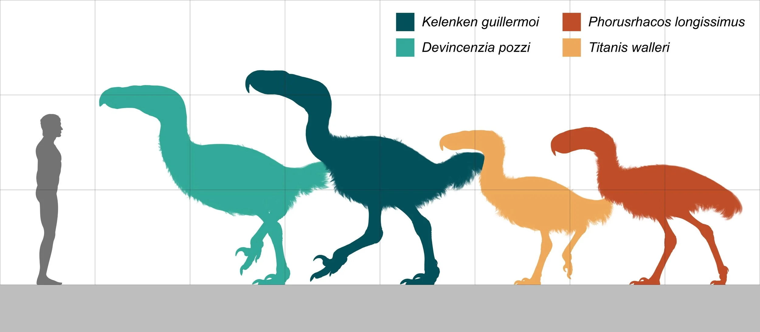
Porcupines, ground sloths, armadillos, glyptodonts and terror birds migrated into North America.
Terror birds are an extinct family of huge, carnivorous, mostly flightless birds that were among the largest apex predators in South America during the Cenozoic era. Their closest modern-day relatives are believed to be the seriemas found in South America.
Three-toed sloth
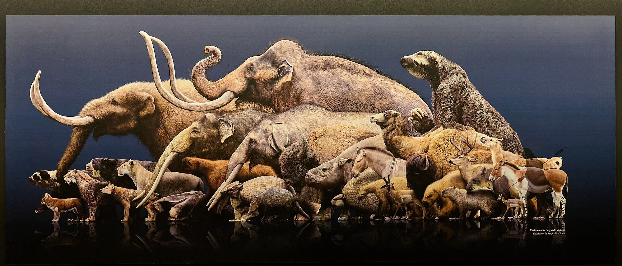
Animals that migrated during the Great American Biotic Interchange. Note the size of a giant sloth! (Graphic in the Pre-Columbian Gold Museum.)
How did the Land Bridge form between North and South America?
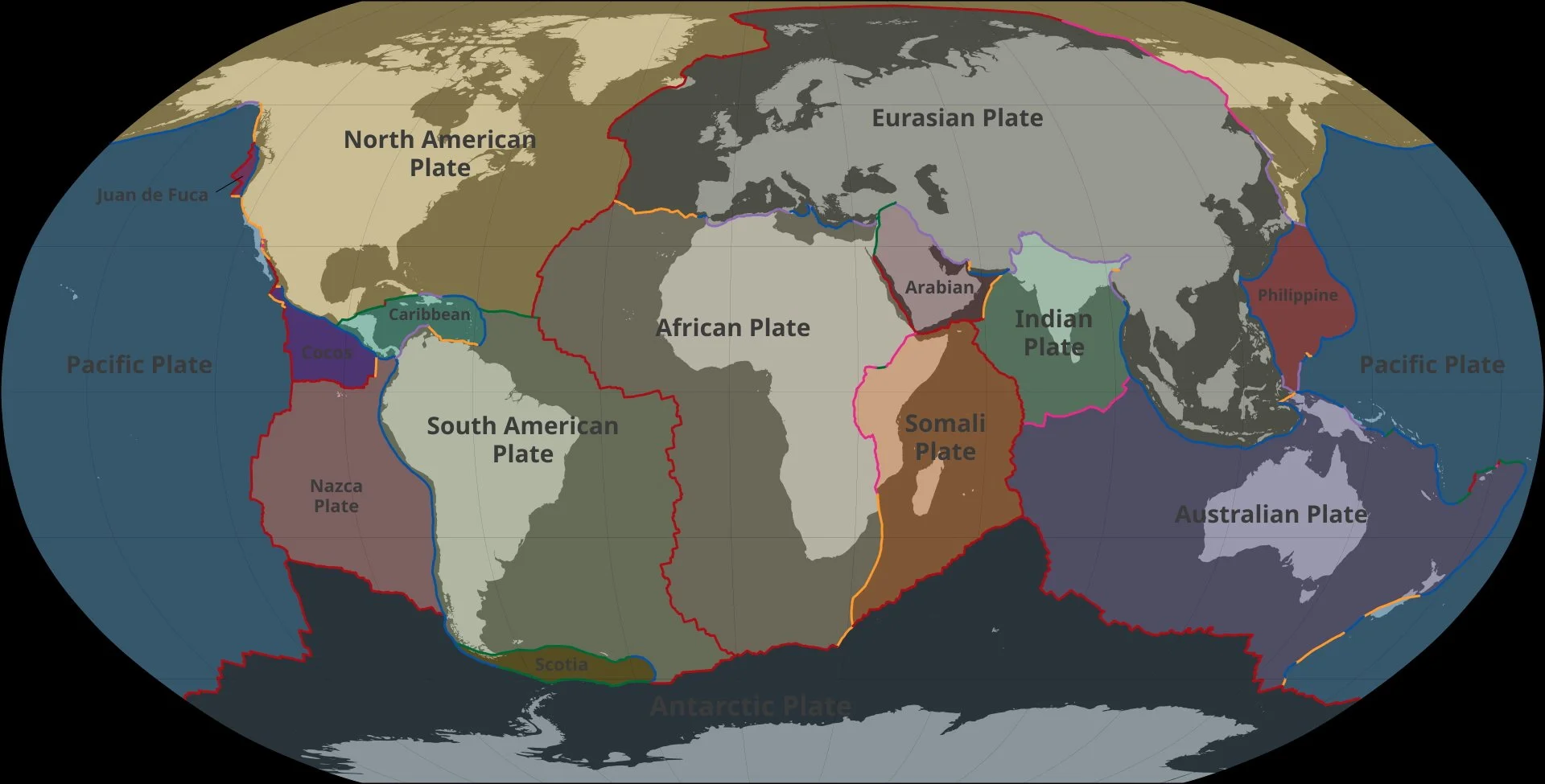
It is all about Plate Tectonics. The above figure depicts the Earth’s 16 major tectonic plates.
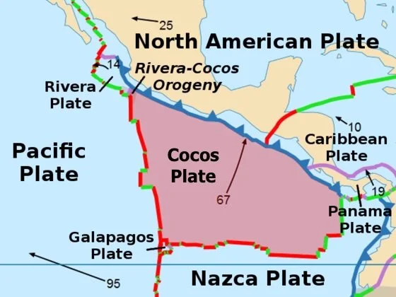
The Land Bridge
5 of the tectonic plates – South American, Nasca, Cocos, North American, Caribbean – surround the Isthmus of Panama.
It is hardly a stable environment.
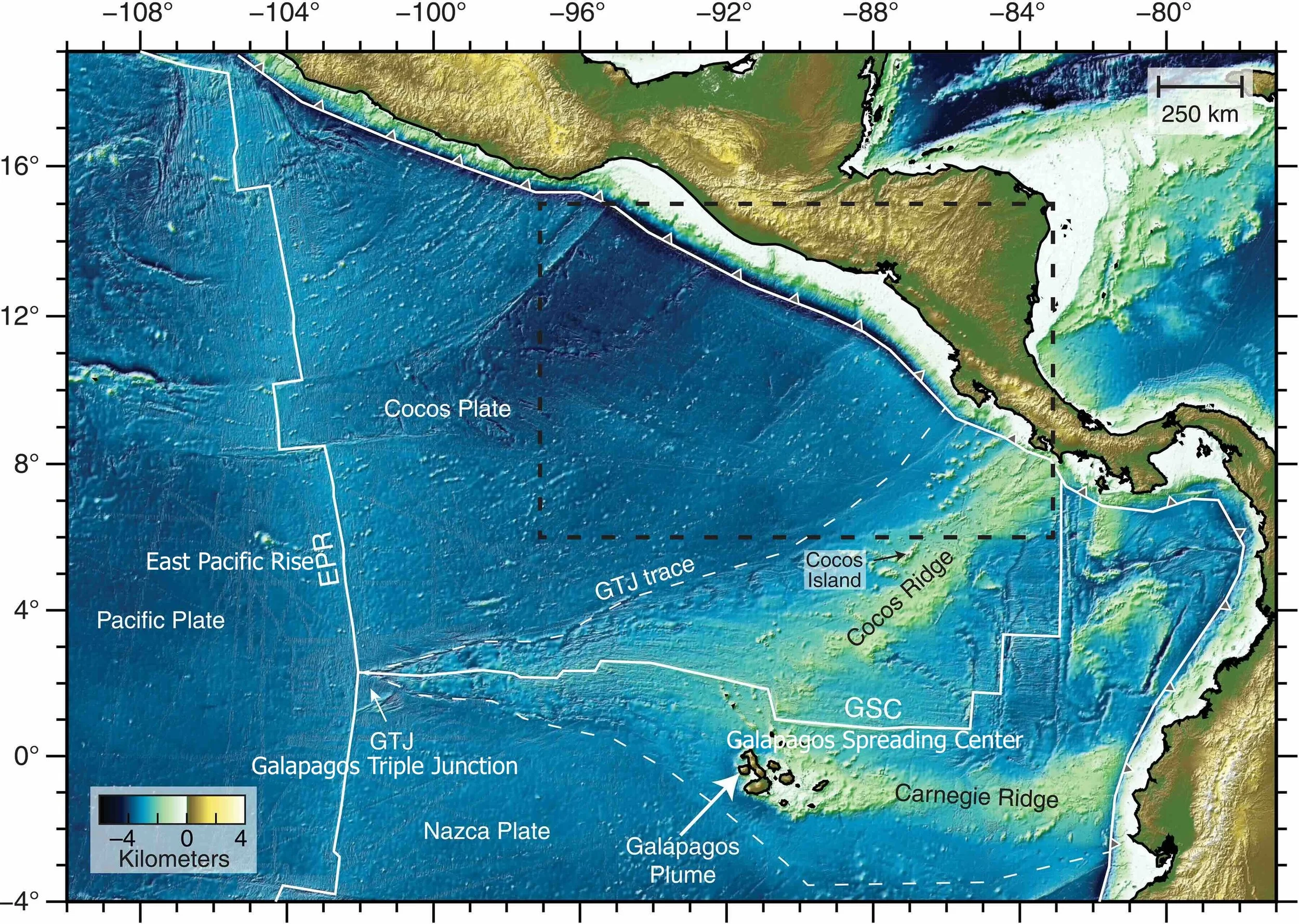
Cocos Plate
The Cocos plate was created by sea floor spreading along the East Pacific Rise. A hot spot beneath the Galapagos Archipelago provides magmatic material that forms the Cocos Ridge, a zone of elevated sea floor within the Cocos Plate.
The Cocos Plate is subducting beneath the less dense Caribbean plate at approximately 11 mm per year.
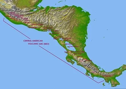
Volcanoes
The subducted leading edge heats up and adds its water to the mantle above it. In the mantle layer called the asthenosphere, mantle rock melts to make magma, trapping superheated water under great pressure.
As a result, to the northeast of the subducting edge lies a continuous arc of volcanos – known as the Central America Volcanic Arc – stretching 680 miles from Costa Rica to Guatemala, and a belt of earthquakes that extends farther north, into Mexico.
The devastating 1985 Mexico City and 2017 Chiapas earthquakes resulted from the subduction of the Cocos plate beneath the North American plate. Subduction of the Cocos plate beneath the Caribbean plate caused the El Salvador earthquakes in 2001.
Rising from the Depths
Underwater volcanoes grew tall enough to break the surface of the ocean and form islands as early as 15 million years ago. Volcanos built mountains on the adjacent mainland.
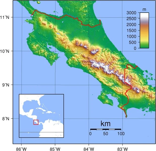
The subduction of the Cocos plate also resulted in buckling and uplifting of the sea floor, resulting in Costa Rica’s impressive Talamanca mountain range.
Topographic map of Costa Rica
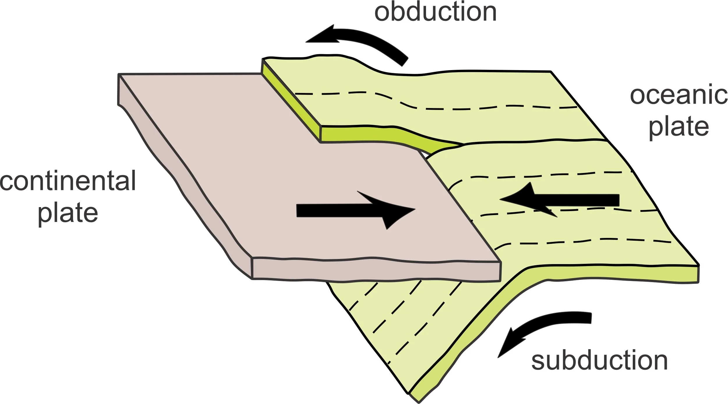
Subduction and Obduction
Additionally, Costa Rica’s Osa Peninsula was created by obduction - a geological process whereby denser oceanic crust is scraped off a descending ocean plate at a convergent plate boundary and thrust on top of an adjacent plate.
Finally, over time, ocean currents deposited massive amounts of North and South American sediments around the newly forming islands until the gaps in the Isthmus were completely filled about 3 million years ago.
Consequences of closure
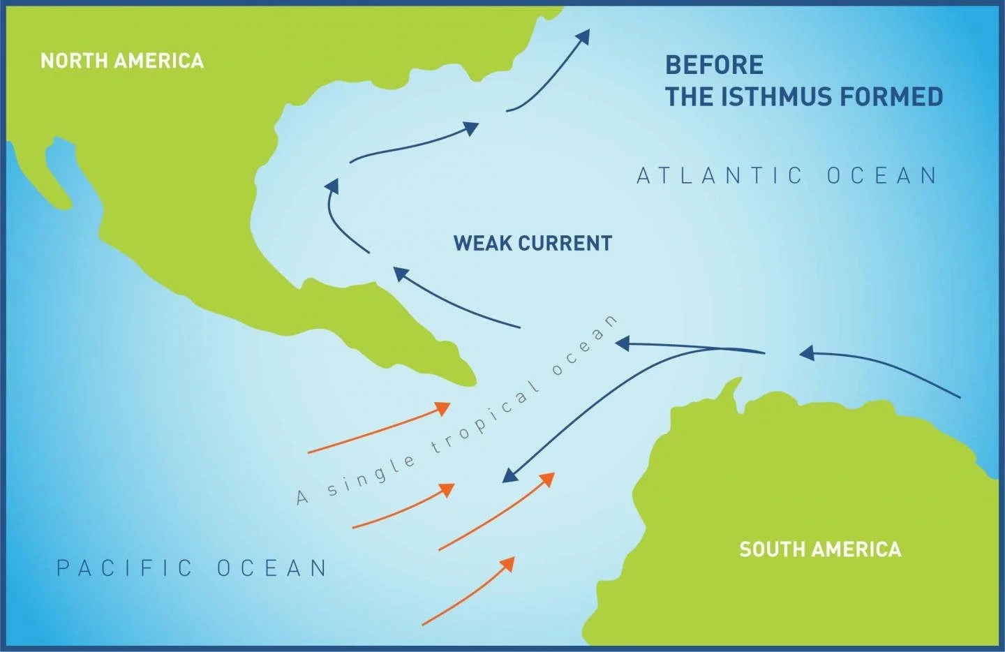
The Central American Seaway formed during the breakup of Pangaea and allowed interchange between the Pacific and Atlantic Oceans.
Closure of the Central American Seaway had tremendous effects on oceanic circulation and the biogeography of the adjacent seas, isolating many species and triggering speciation and diversification of marine fauna.
The inflow of nutrient-rich water of deep Pacific origin into the Caribbean was blocked and so local species had to adapt to an environment of lower productivity. The Pacific coast of South America cooled as the input of warm water from the Caribbean was cut off, leading, for example, to the extinction of the region’s marine sloths.
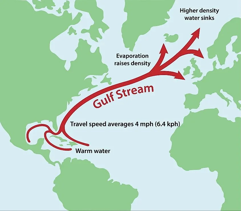
Gulf Stream
The land bridge re-routed currents in both the Atlantic and Pacific Oceans. Atlantic currents were forced northward, forming a new current pattern - the Gulf Stream.
The modifications influenced ocean and atmospheric circulation patterns, which regulated patterns of rainfall, which in turn sculpted landscapes.
With warm Caribbean waters flowing toward the northeast Atlantic, the climate of northwestern Europe grew warmer. The Atlantic, no longer mingling with the Pacific, also grew saltier.
These changes increased the moisture supply to Arctic latitudes, which contributed to both Arctic continental glaciation and sea ice formation, eventually contributing to the Quaternary ice age.
Where did we go?
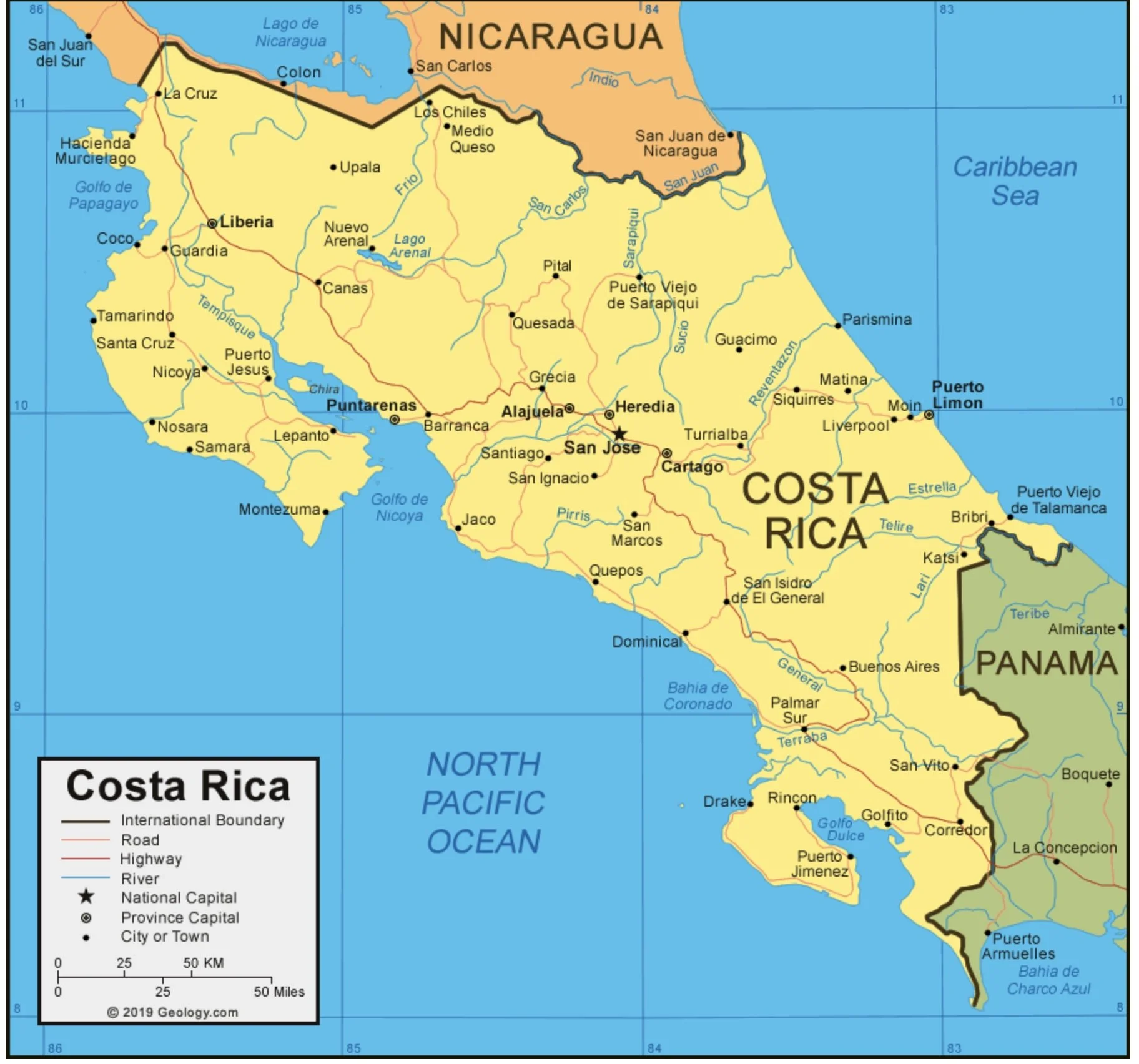
We travelled with our close friends K and B, and opted for an educational tour that emphasized natural history and local culture. It seemed the best way to obtain an overview of the country and avoided many of the logistical hassles associated with independent travel.
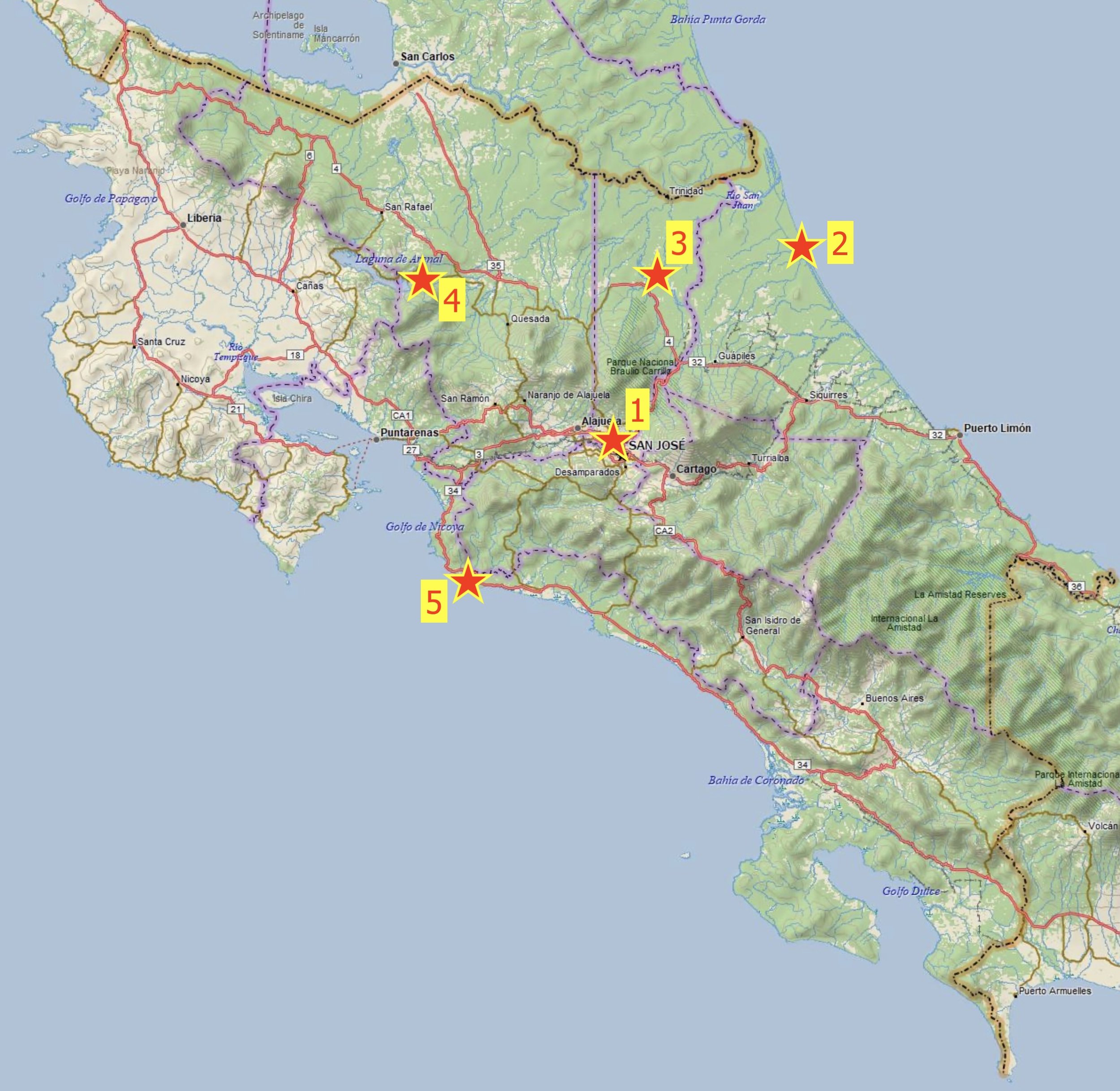
Stars indicate the places we visited, numbers show the sequence. We flew home from San José.
Our co-participants were all wonderfully respectful, pleasant, and a fun group. It seemed we were all imbued with a hint of Costa Rican “Pura Vida”.
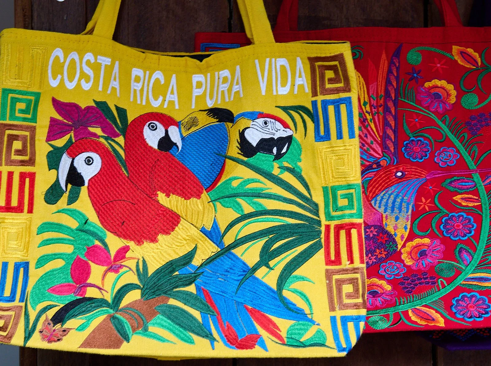
Pura Vida
Literally translated, pura vida means ‘simple life’. It's a greeting and a way of life in Costa Rica that conveys a positive outlook, gratitude, and a relaxed attitude.
For Costa Ricans, pura vida means enjoying life no matter what your circumstances; it’s a simple appreciation of life and the realization that life is what you make of it.
The philosophy has benefits. Costa Rica is consistently ranked as one of the happiest populations on the planet (#12 in 2024) and its people live longer than folk in the United States.
The Nicoya Peninsula is a designated “Blue Zone”. These zones are geographical areas with a high concentration of long-lived populations, who frequently reach ninety or one hundred years of age. There are 5 Blue Zones around the world.
Pura vida!
Scarlet Macaw
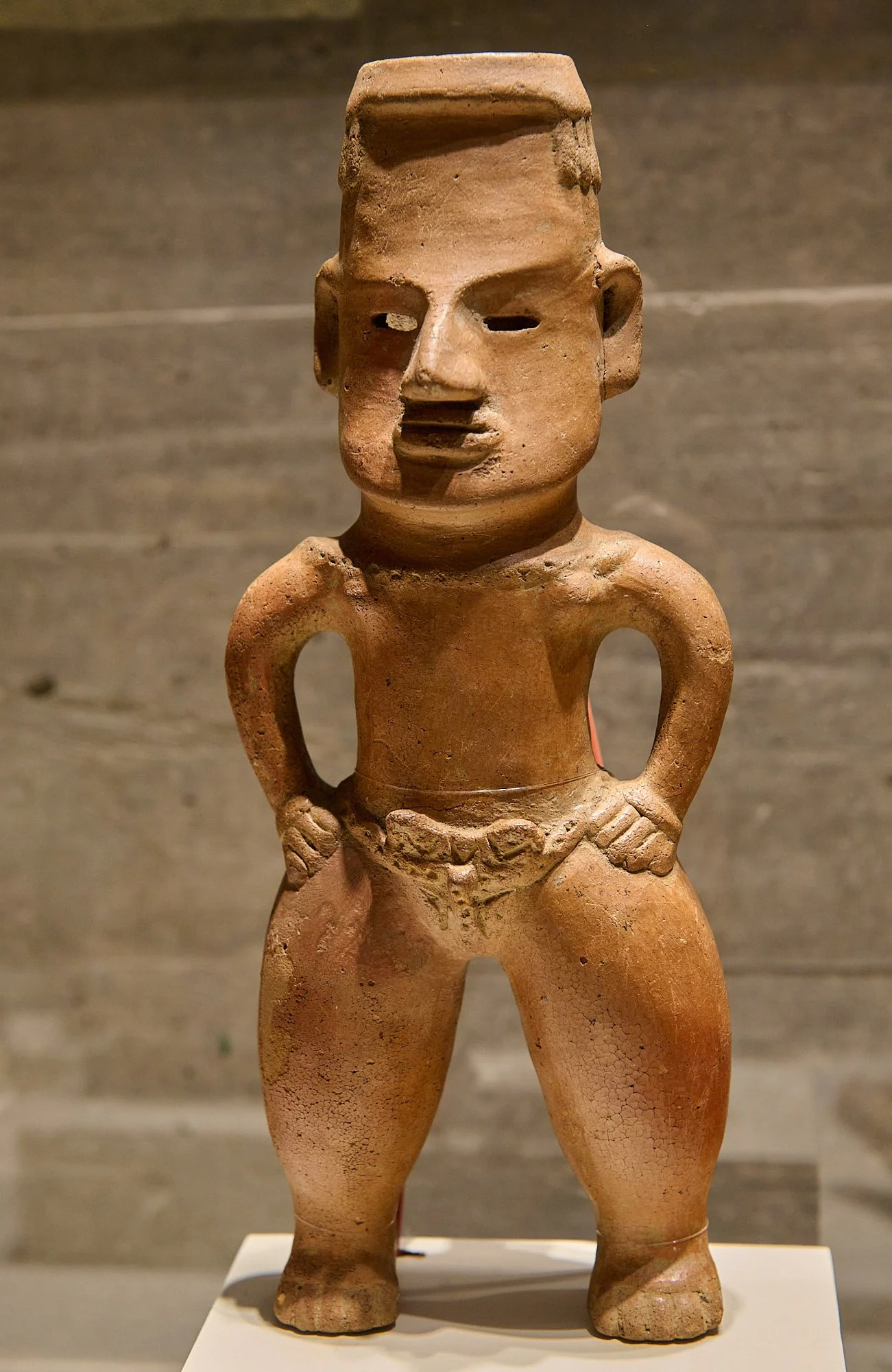
Pre-Columbian Gold Museum
This museum, at the start of our trip, was a great introduction into Pre-Columbian life in Costa Rica.
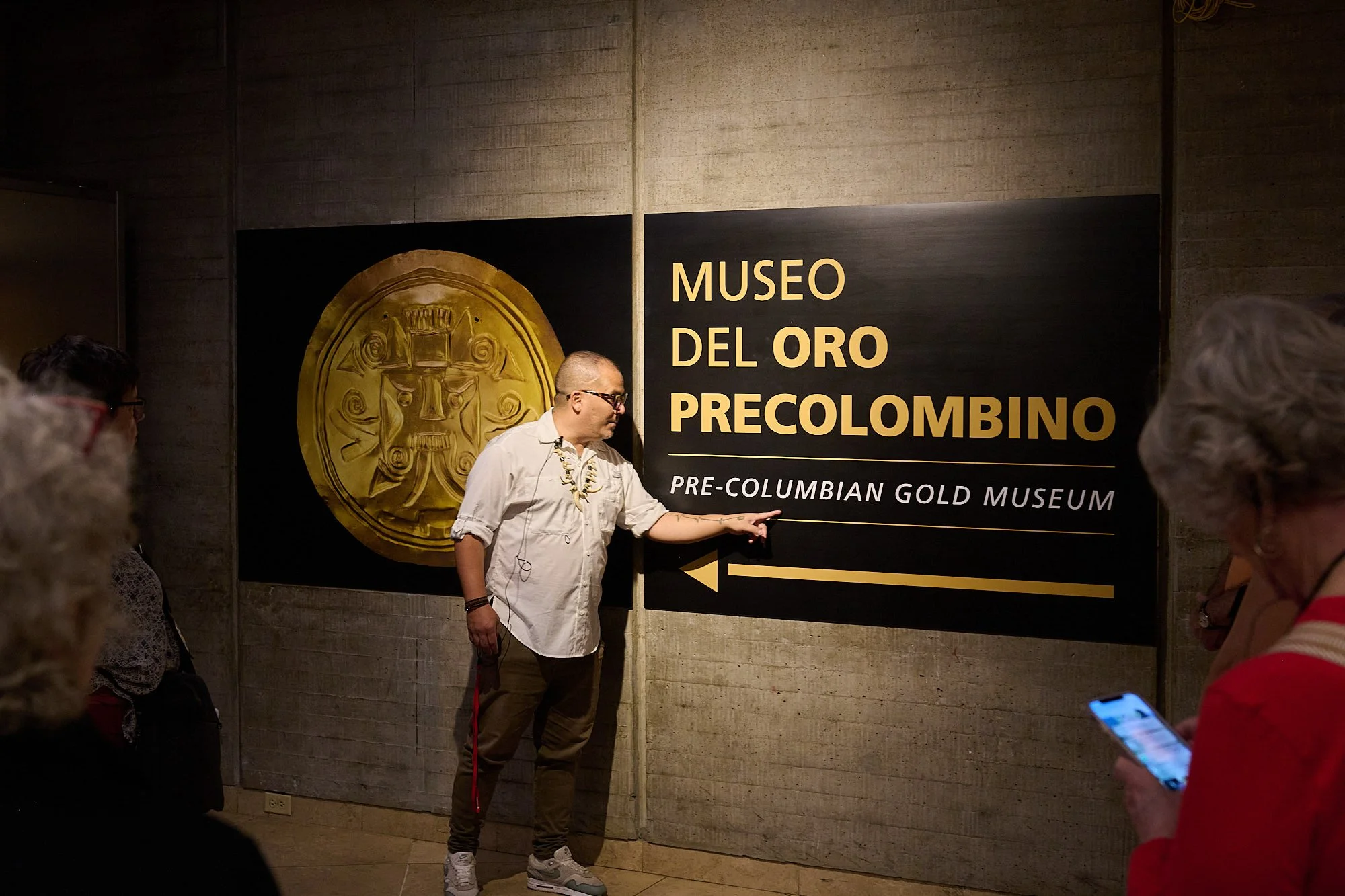
The archaeological collection contains nearly 4,000 artifacts, including over 1,500 gold pieces that date from as early as 300 BC.
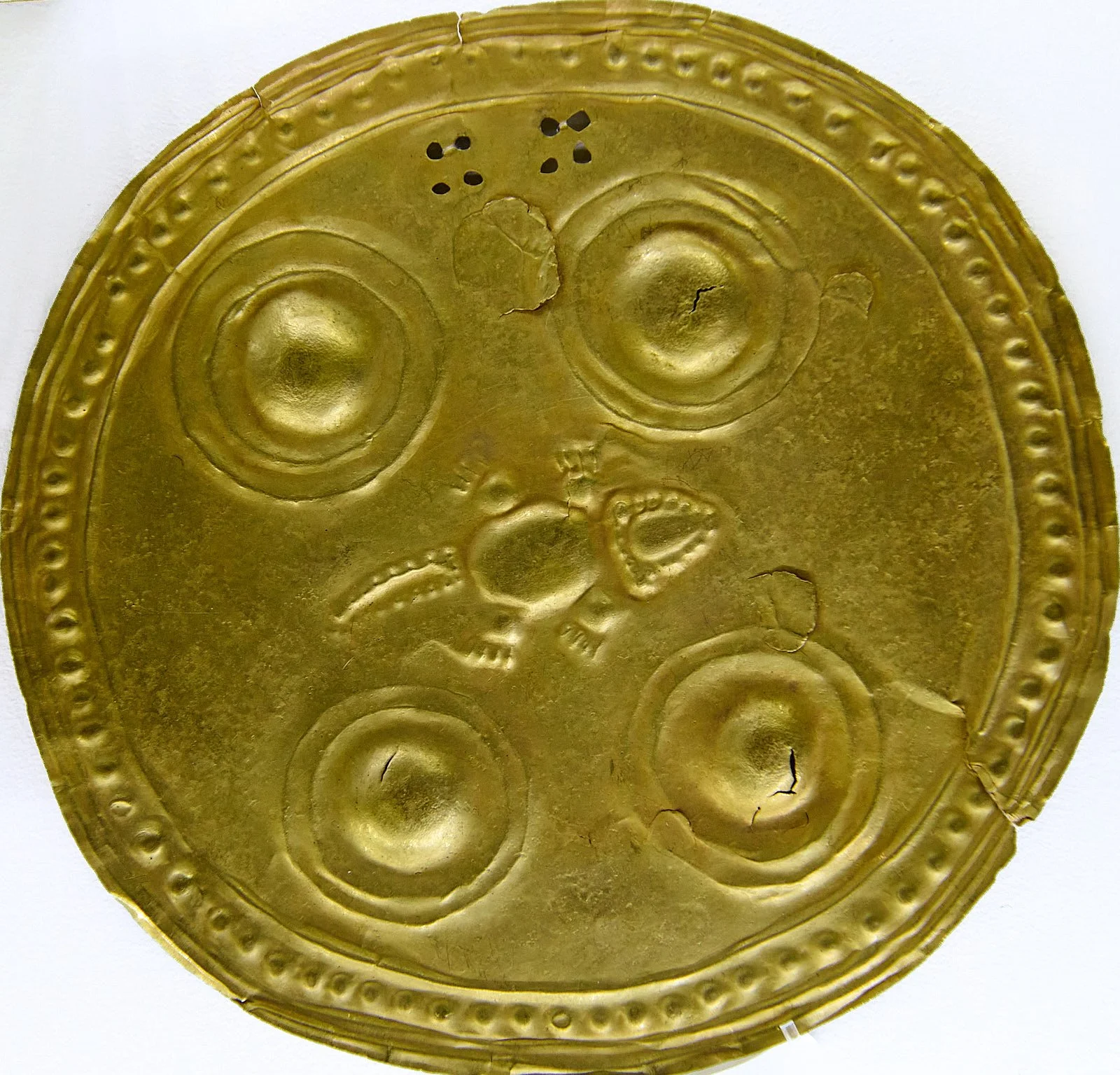
The metallurgy and goldsmithing of these indigenous peoples are extraordinary.
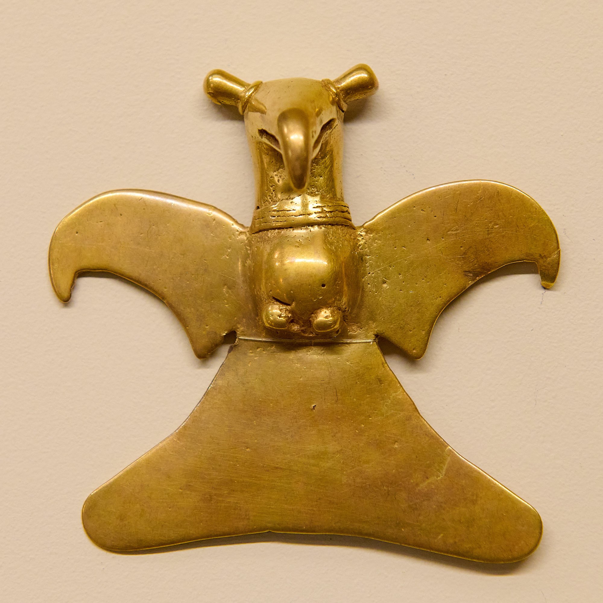
Their elaborate designs worked as carriers of their beliefs and traditions which, in turn, held magical-religious meaning.
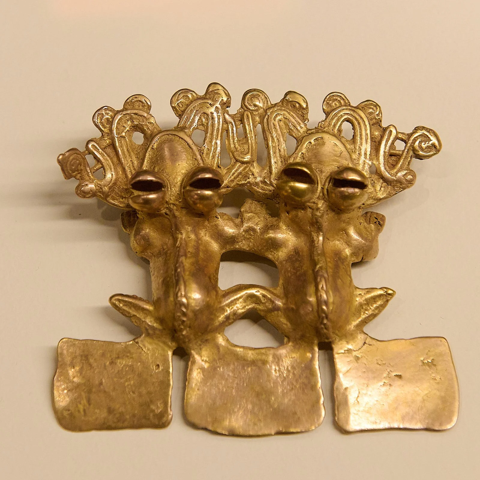
Frogs, symbols of fertility
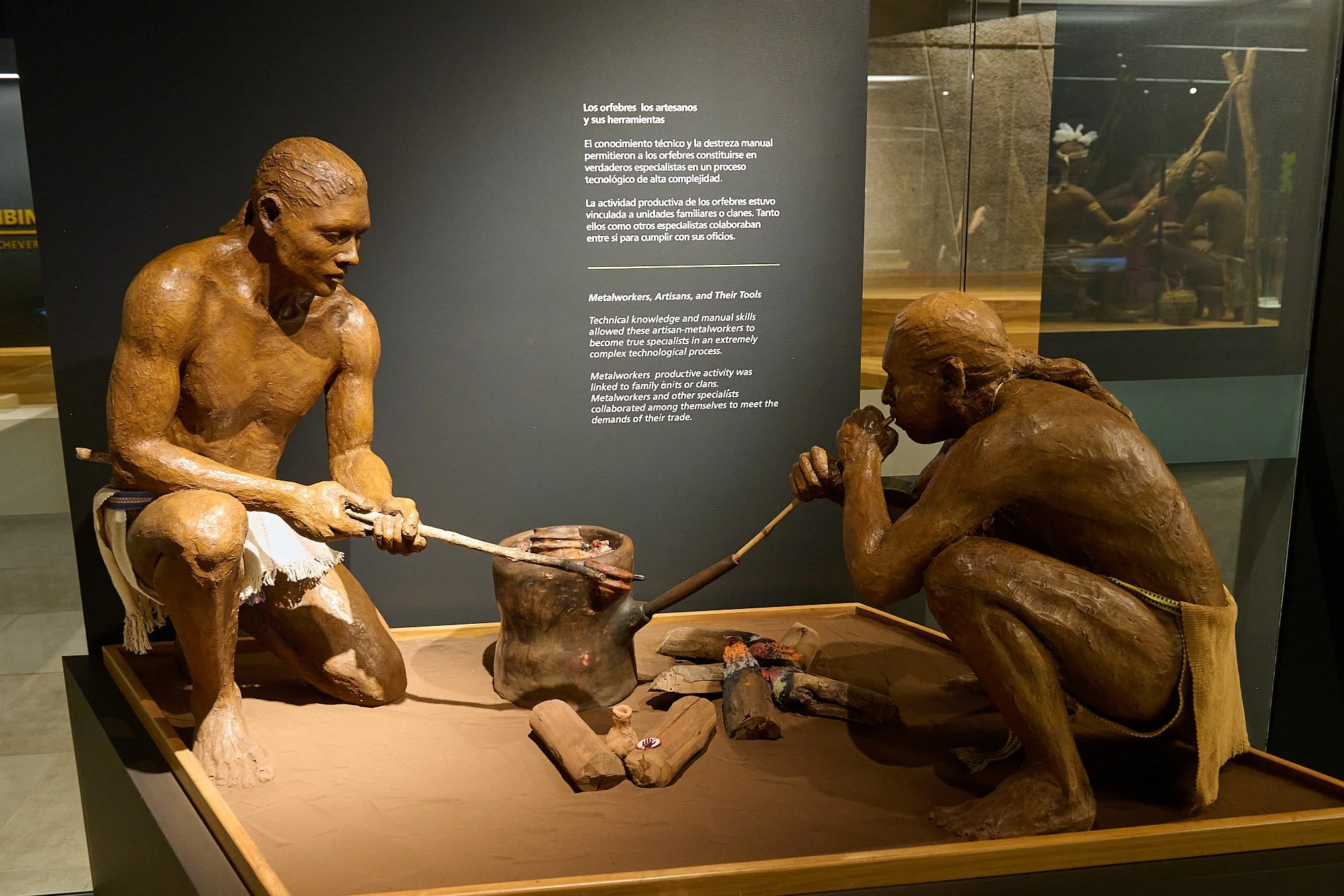
Using resources from their environment, the metalworkers were able to melt gold and create intricately designed products.
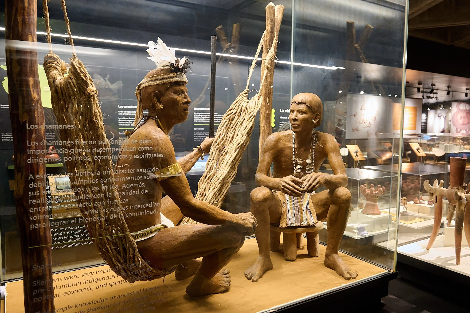
Inscription: Shamans were very important figures in pre-columbian indigenous life, acting as political, economic and spiritual leaders.
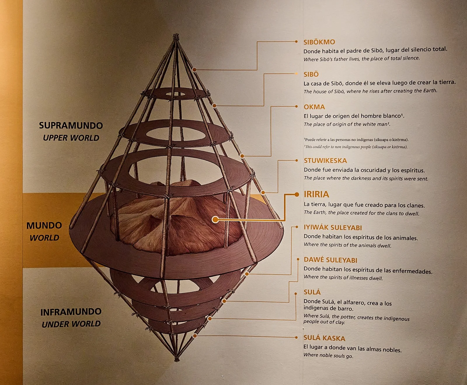
Their mythology and spiritual beliefs reflected the architecture of their dwellings.
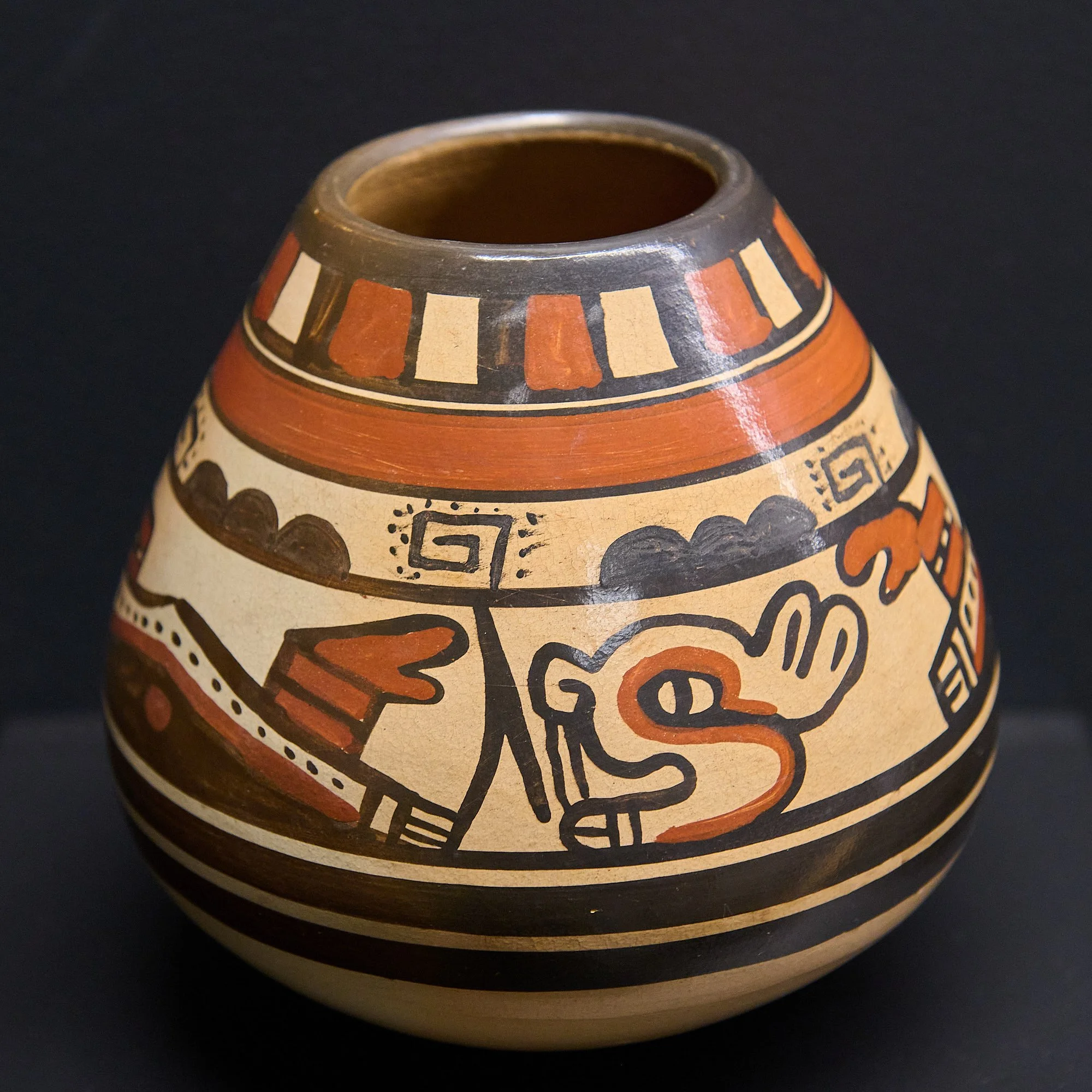
Pottery designs often identified the potter’s home area.
Indigenous peoples of the region became knowledgeable about farming as they recognized the annual weather cycles and ways to domesticate plants. Around 5000 BC, agriculture became standard practice and supplemented their hunting and gathering skills.
As these practices evolved, so did egalitarian societies between 2000 BC and 300 BC. As agricultural practices continued improving, the cultures realized they could feed many people, not just themselves. As a result, indigenous tribes began creating settlements instead of living a more nomadic lifestyle.
Around 500 AD, structured class systems began to appear, including political and religious offices. Cultural exchange was possible with other regional people in South and Central America. Once the Columbian era started in the mid-1500s, only a few chiefs remained in power.
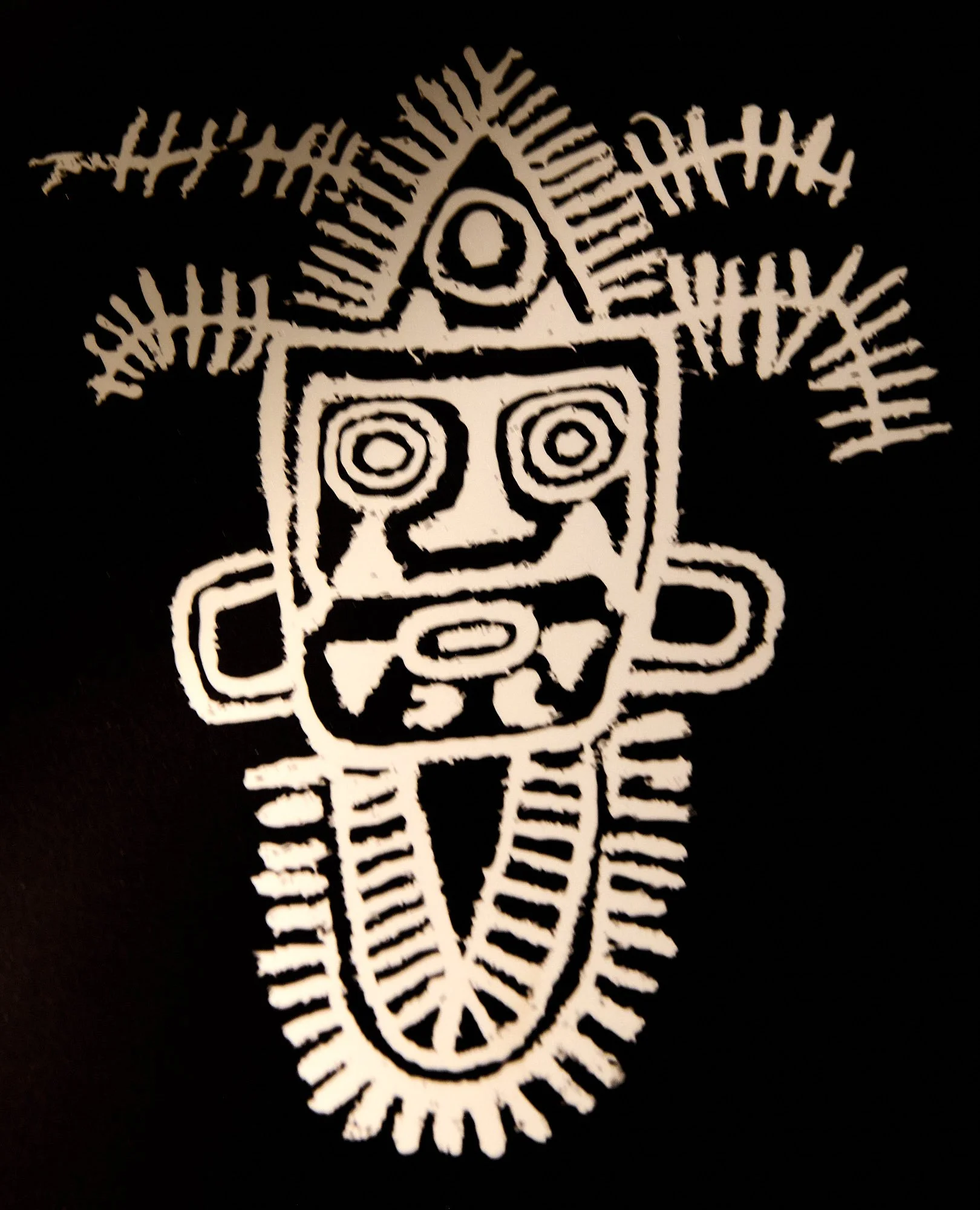
A replica of an image found chiseled into volcanic stone at an archeological site.
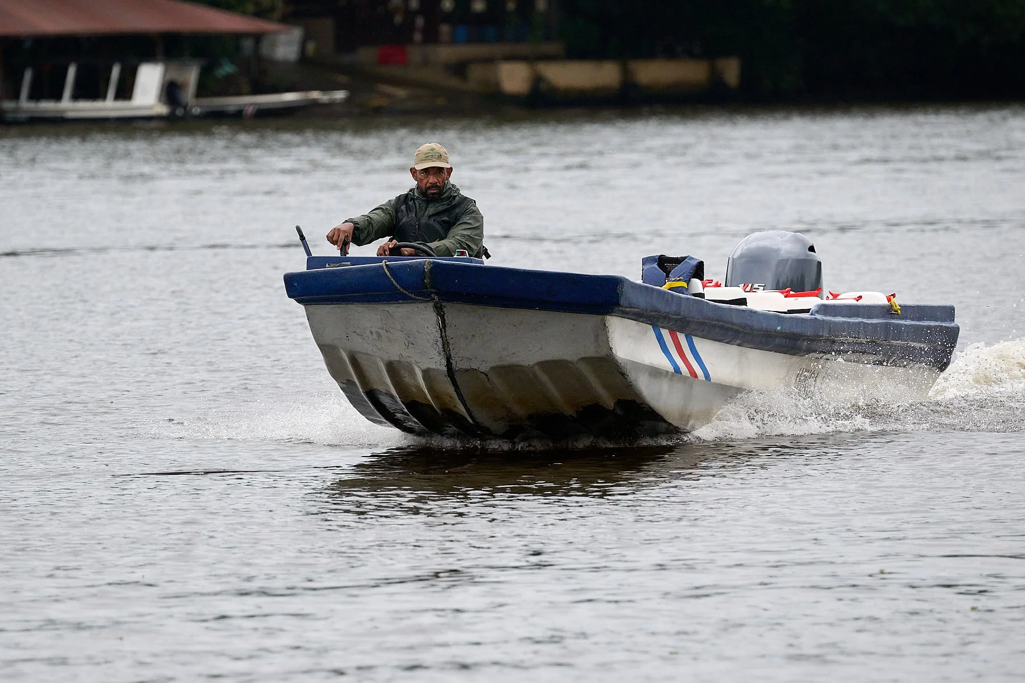
Tortuguero
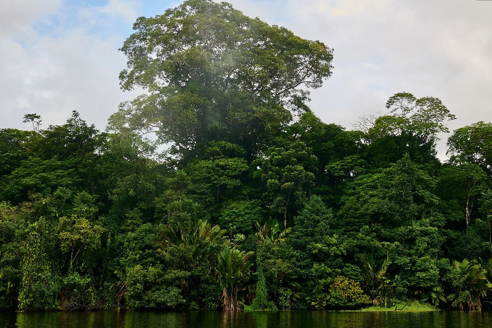
After a few days in San José, we relocated to Tortuguero, a small village of about 1,500 people that is located on a sand-spit sandwiched between the Tortuguero River and Caribbean Sea. In the past, logging and turtle exploitation were important economic activities, but now the settlement is sustained almost entirely by eco-tourism. Access is only by boat or small airplane.
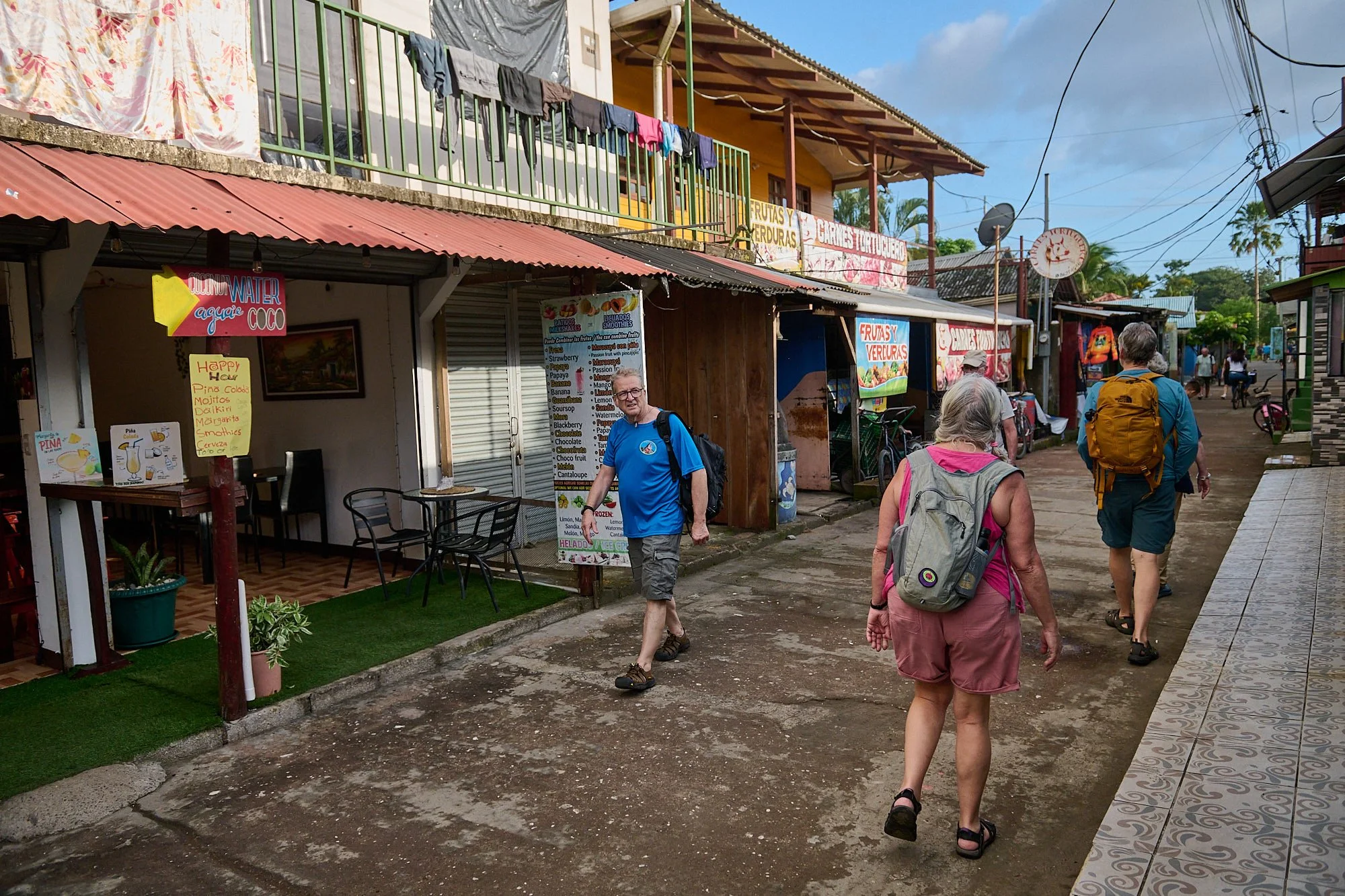
We took a stroll to the village market, enjoying the relaxed Caribbean ambience.
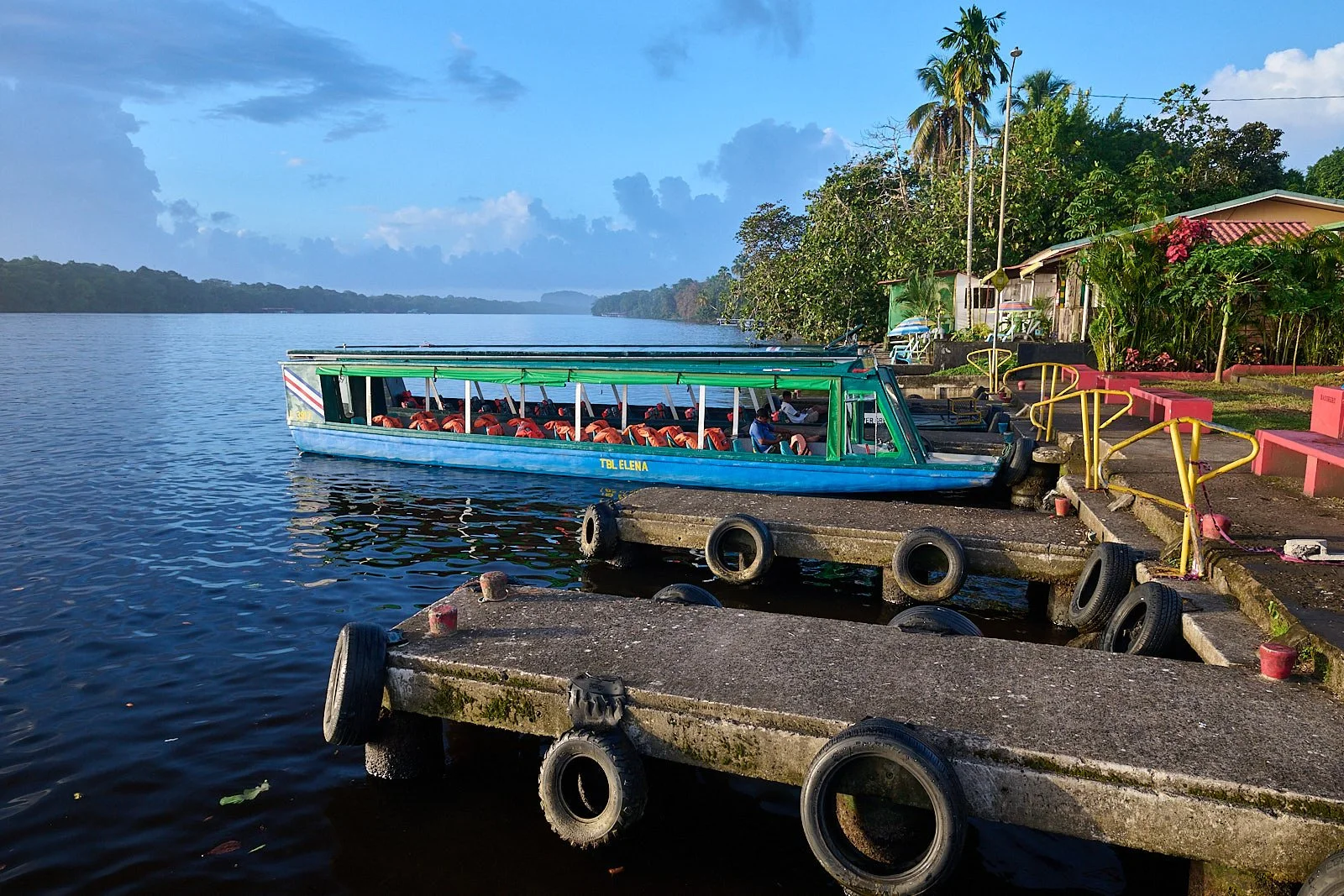
Tortuguero River
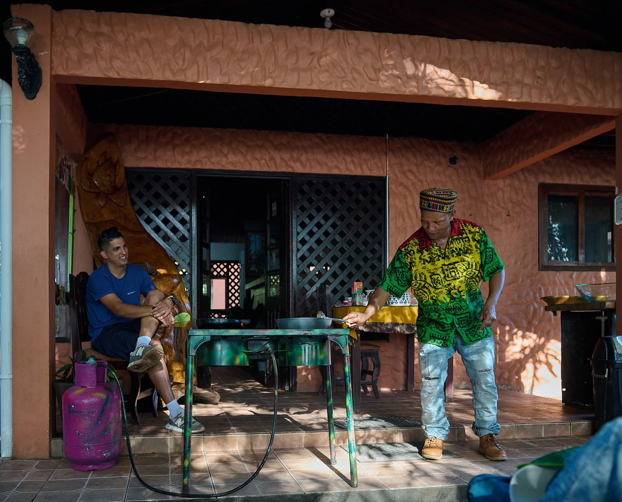
Cloyd gave our group an entertaining demonstration about coconut cuisine. That night, a jaguar took one of his dogs.
Tortuguero can be translated as Land of Turtles. The adjacent Tortuguero National Park protects the breeding sites of four turtle species and a large swath of wet lowland rainforest.
“Tortuguero receives over 200 inches of rain annually and these birds know it.
Naturalist guides provide tours into the rainforest
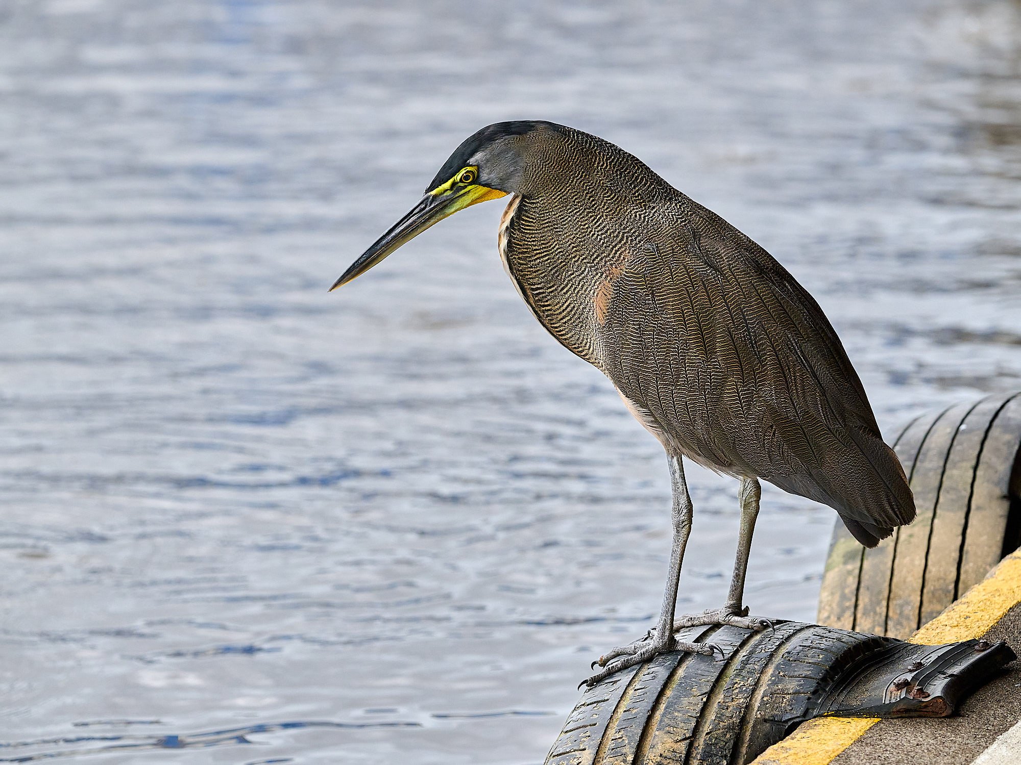
Bare-throated Tiger Heron at our boat dock
We quickly learnt that it is sensible to carry a rainproof poncho.
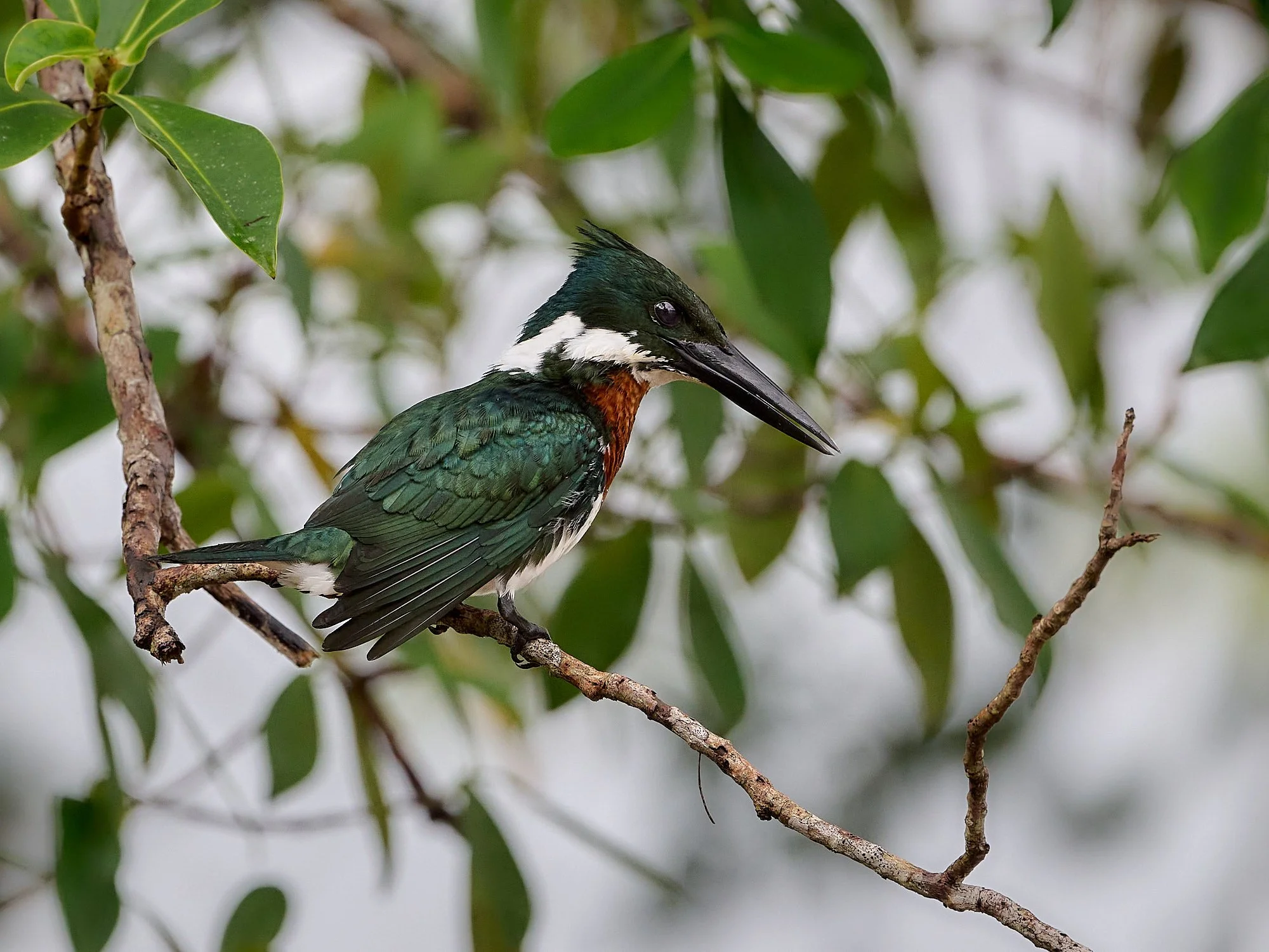
Amazon Kingfisher
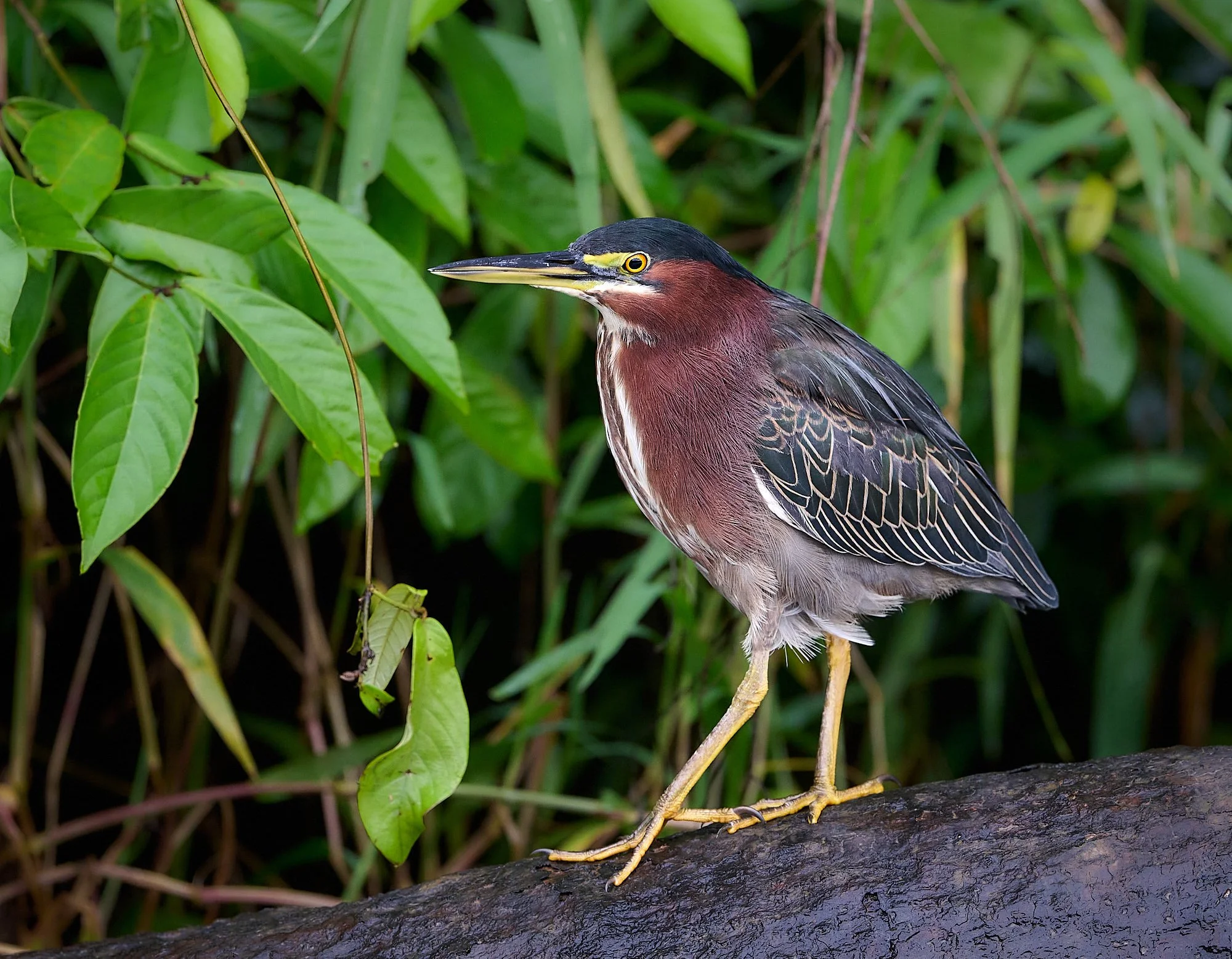
Green Heron
My only chance to photograph a Keel-billed Toucan
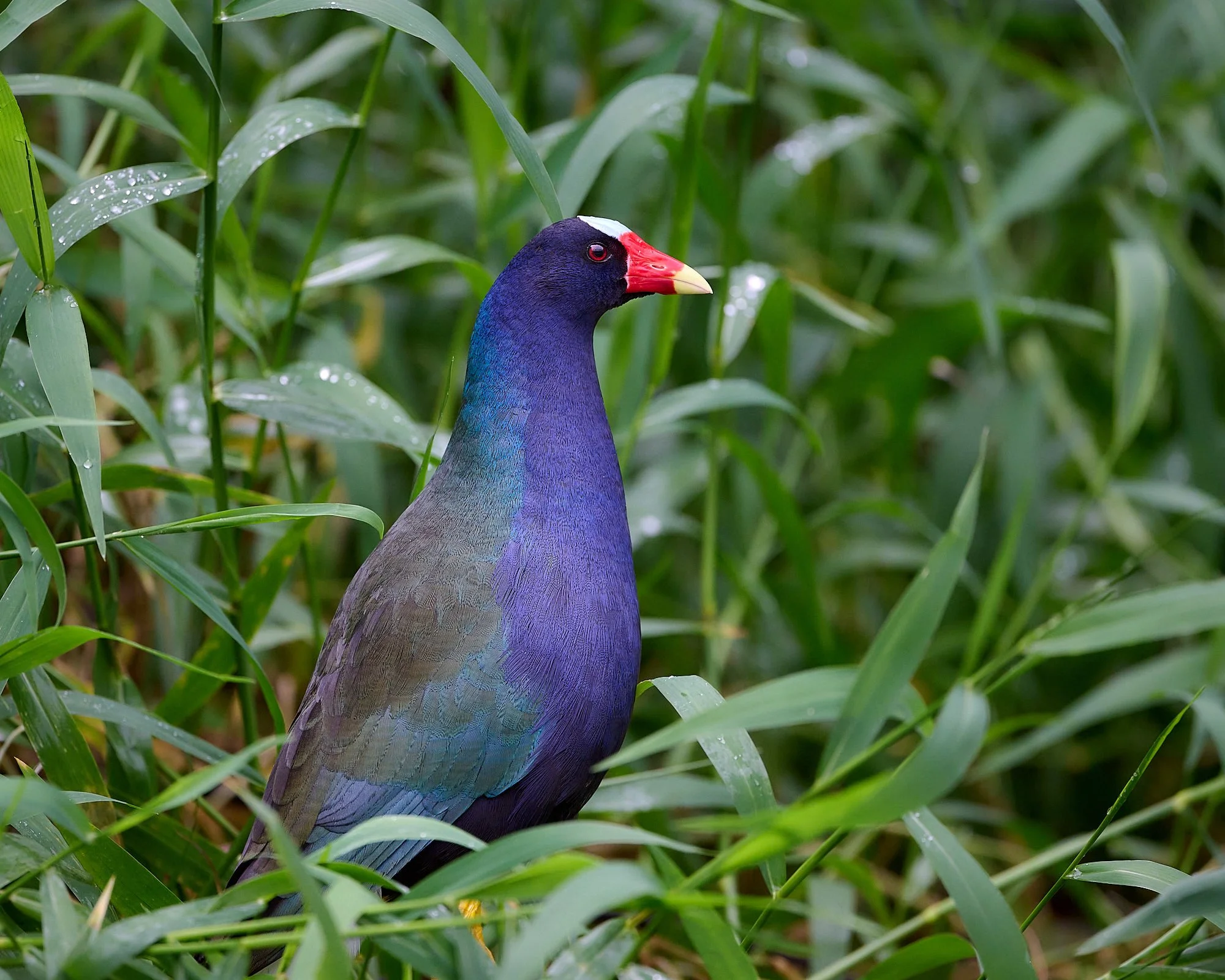
Purple Gallinule
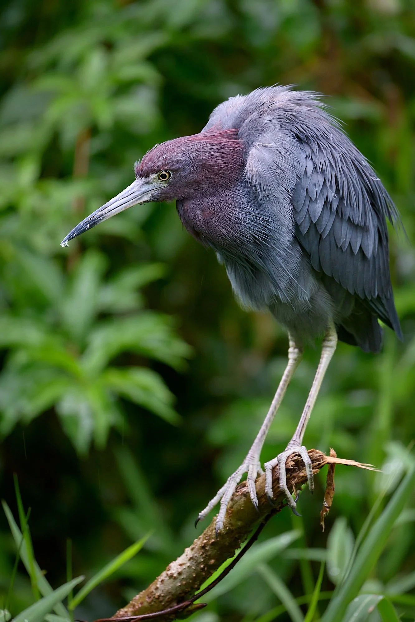
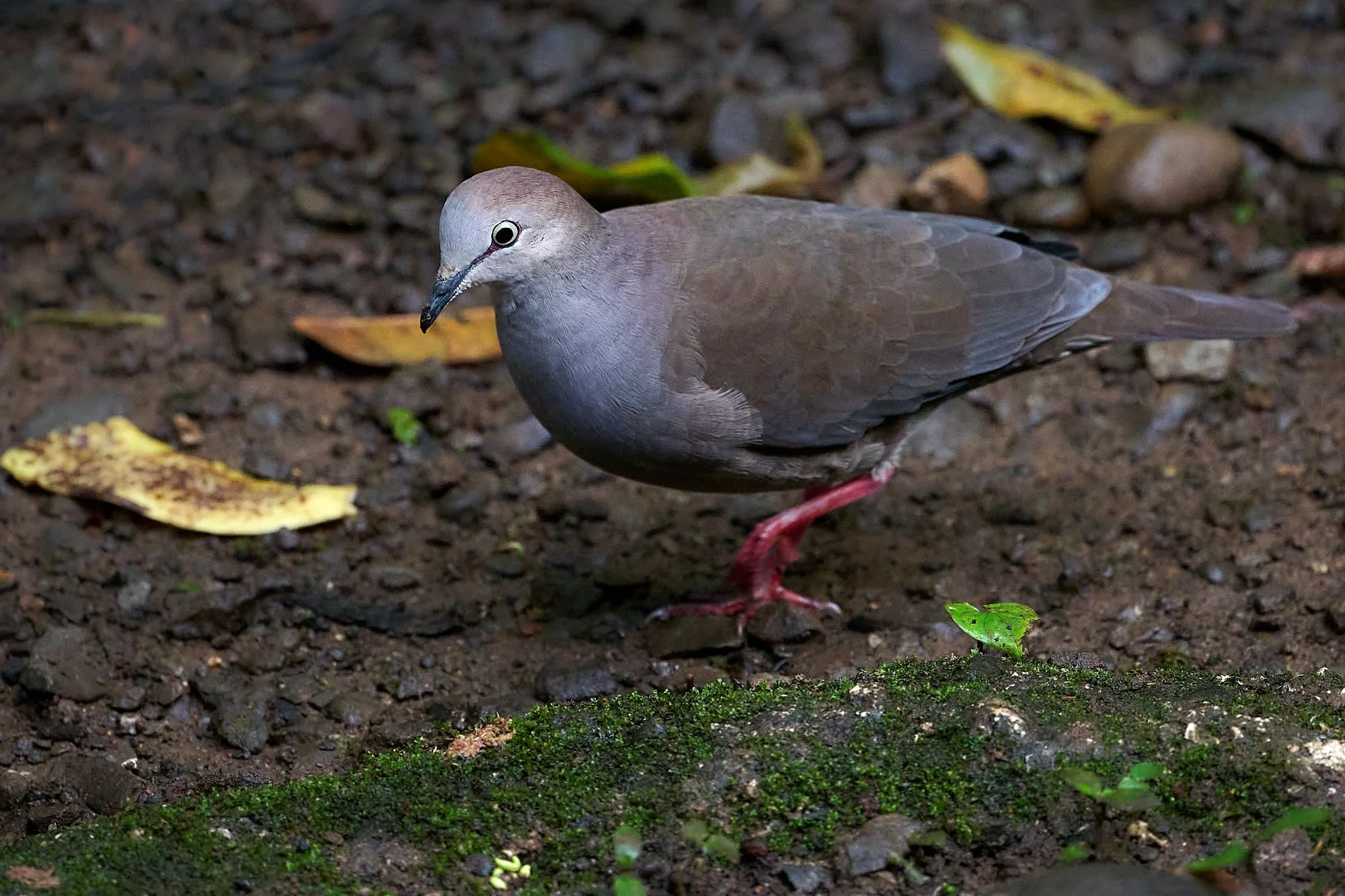
Little Blue Heron
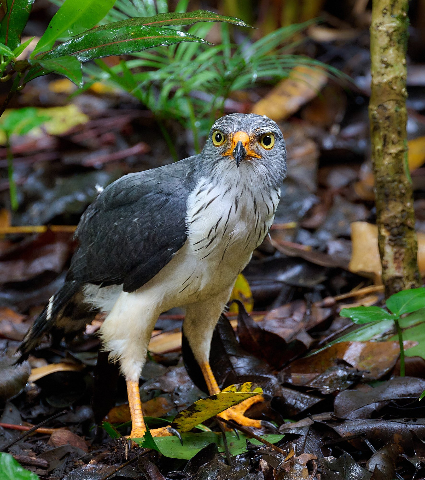
Semiplumbeous Hawk
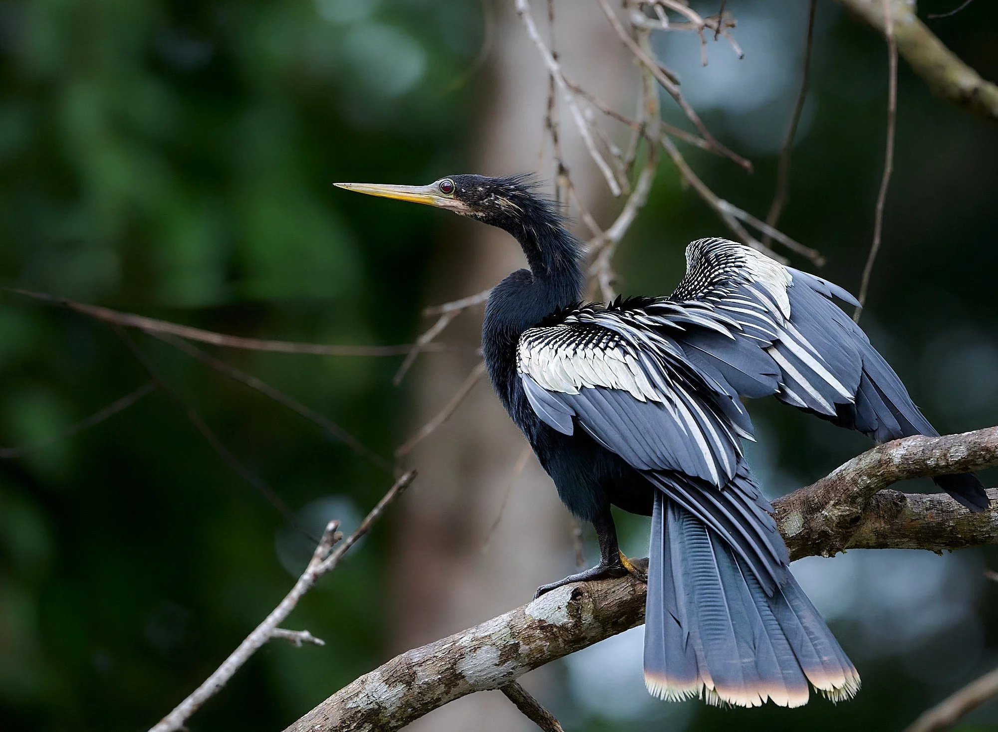
Anhinga
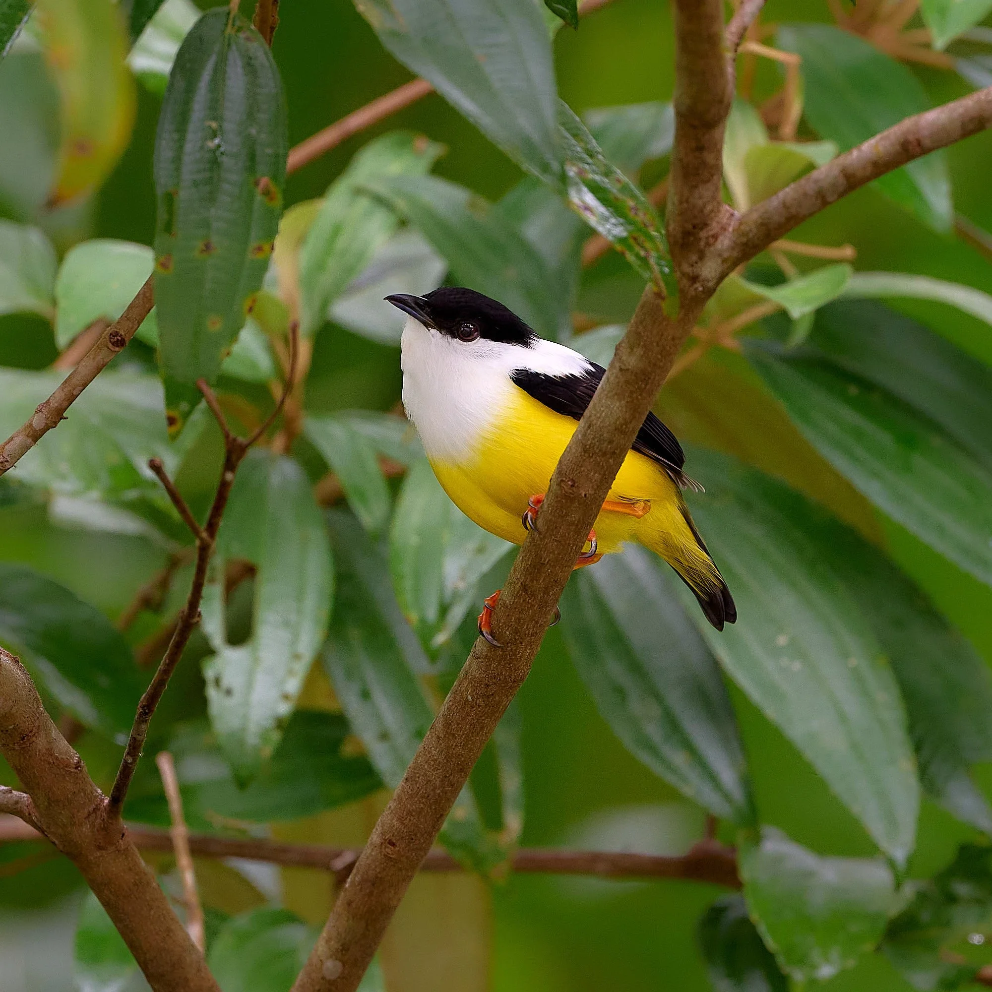
White-collared Manakin
Selva Verde
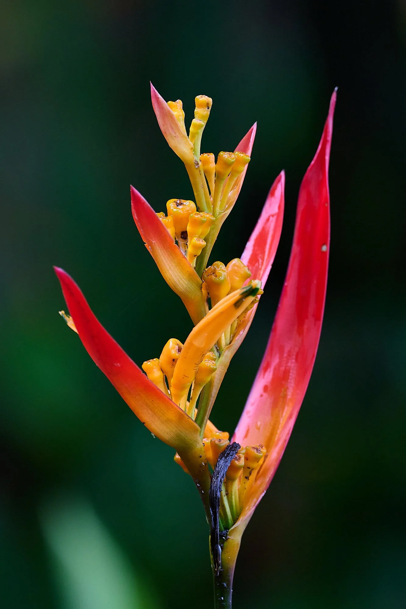
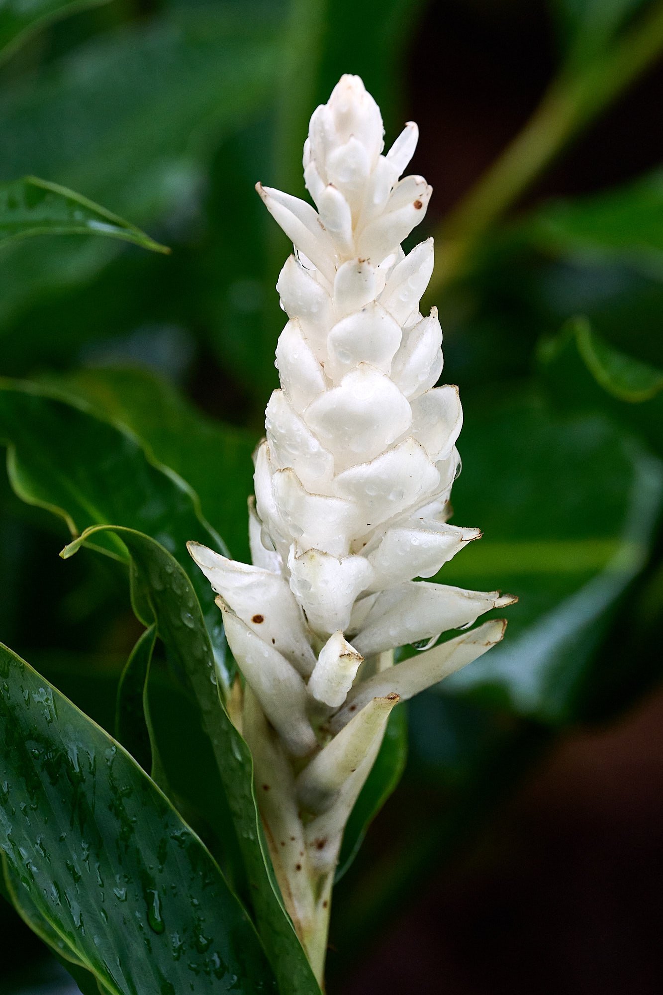
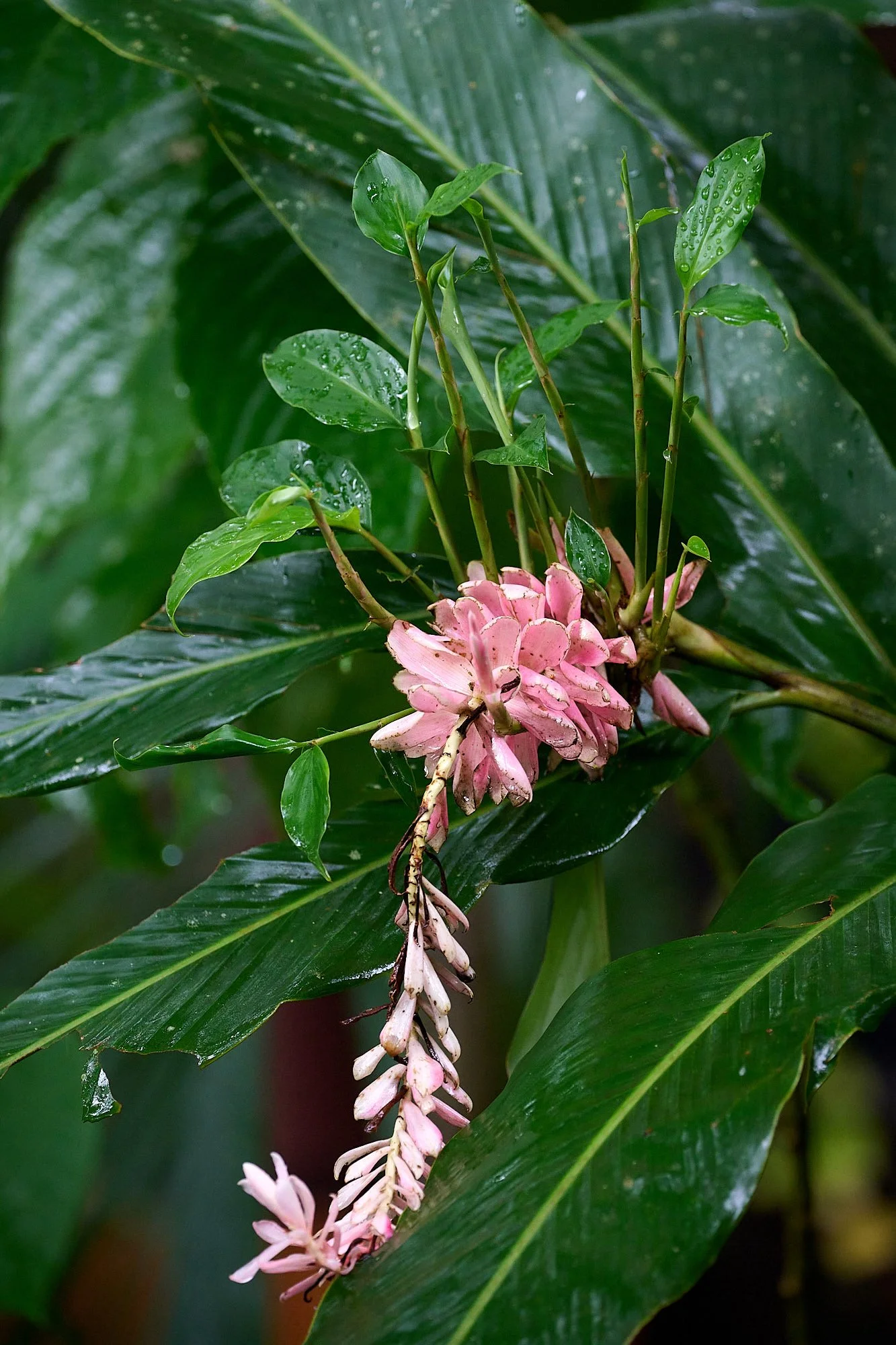
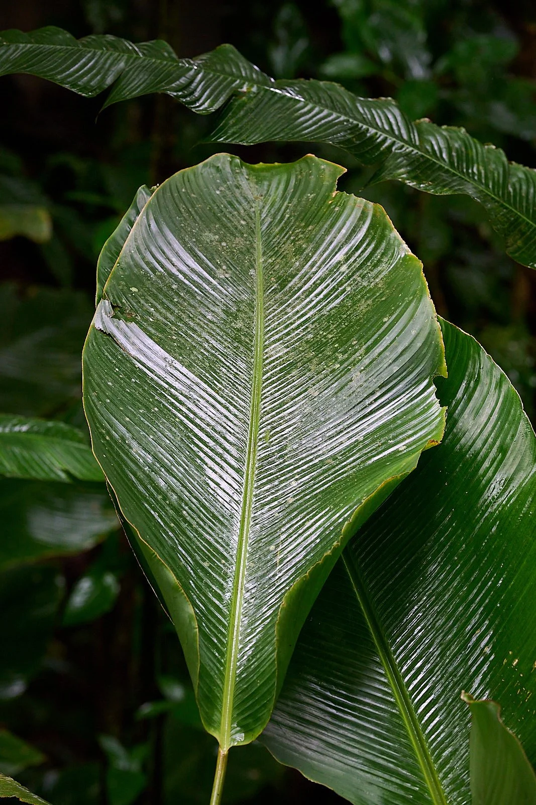
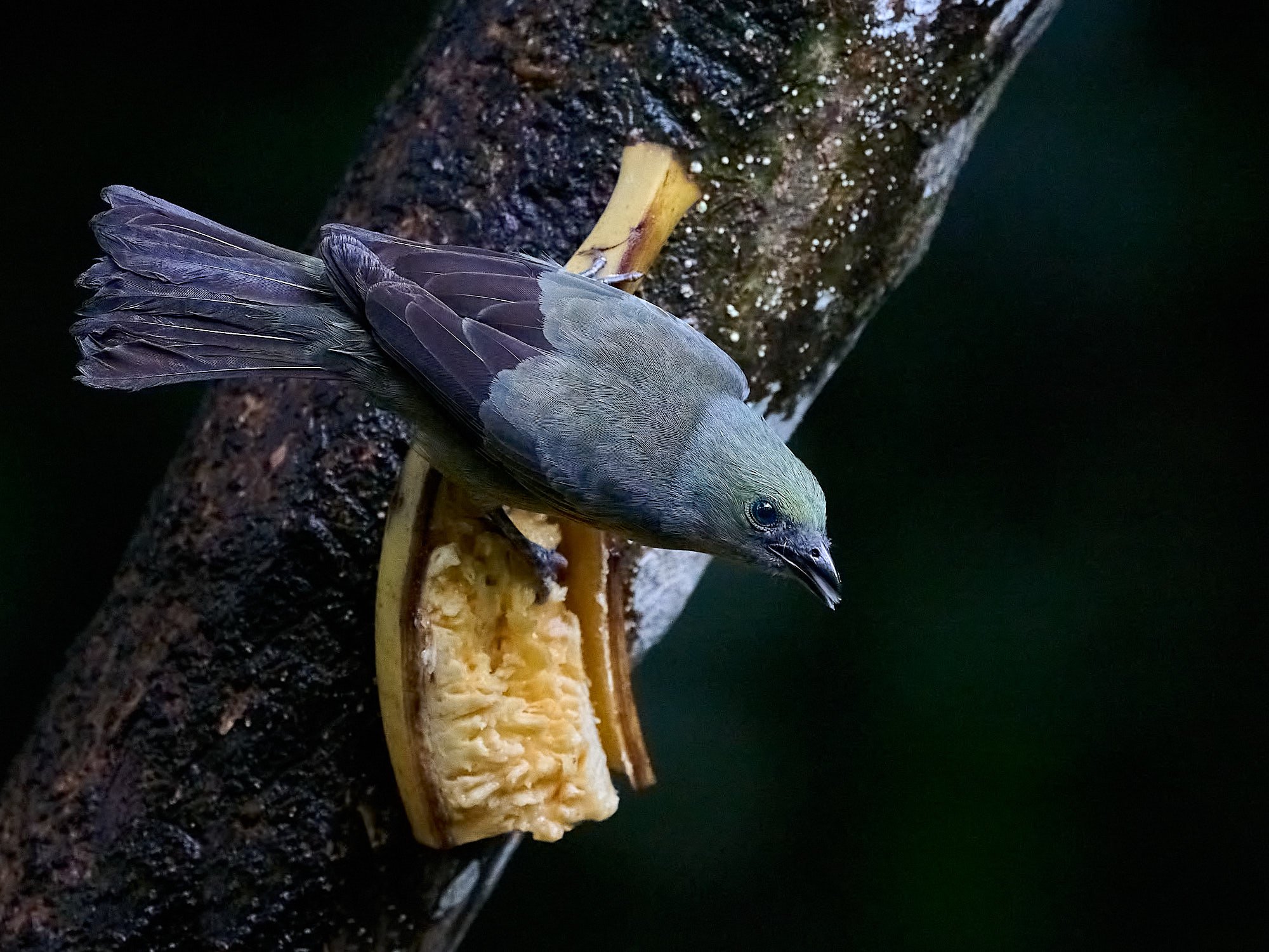
After Tortuguero, we visited Selva Verde, a town situated by the Sarapiqui river and within the lowlands rainforest zone. The rain followed us. Our lodge had a fruit feeding station that was well patronized by spectacular bird species and was, of course, popular with bird watchers.
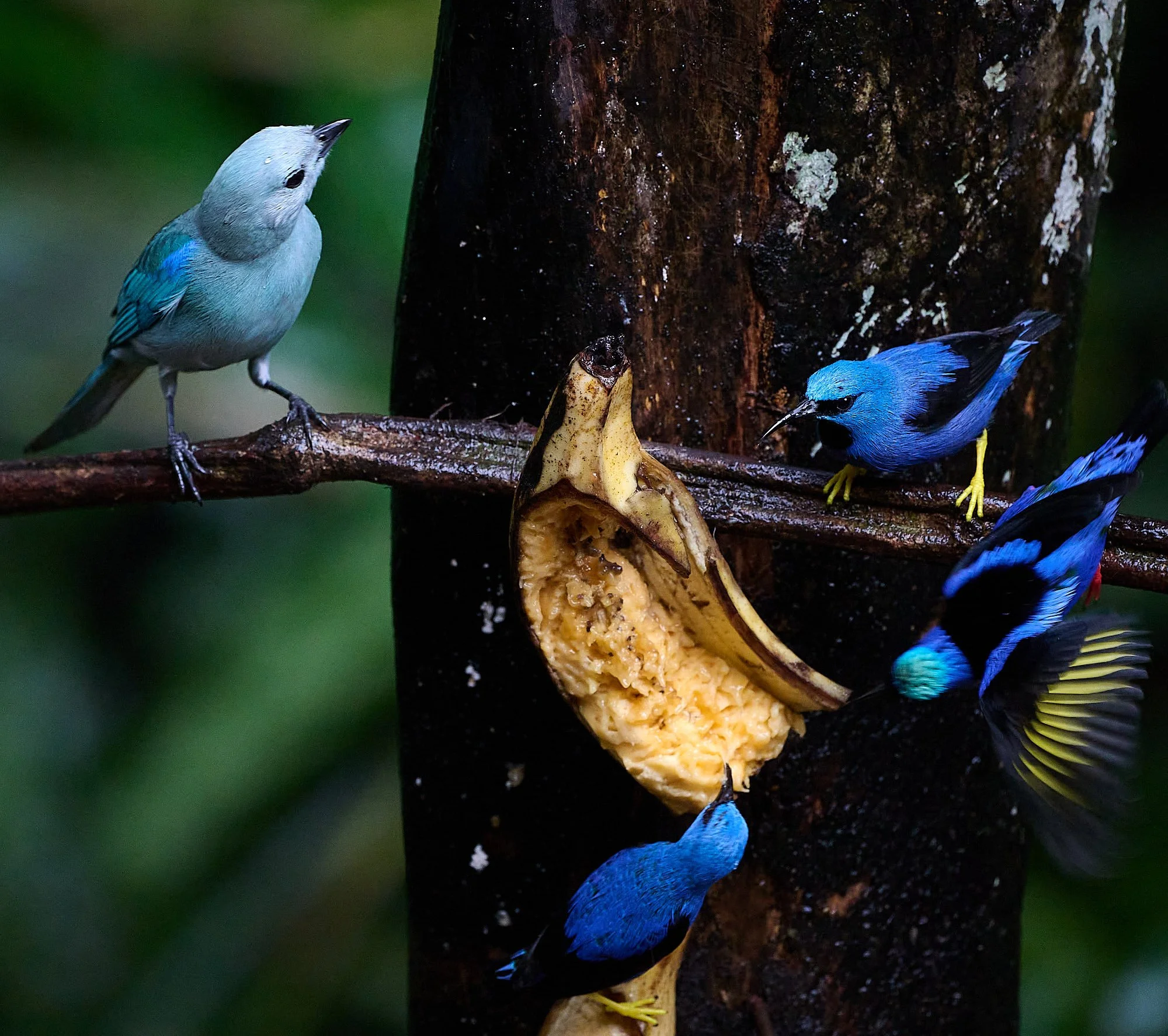
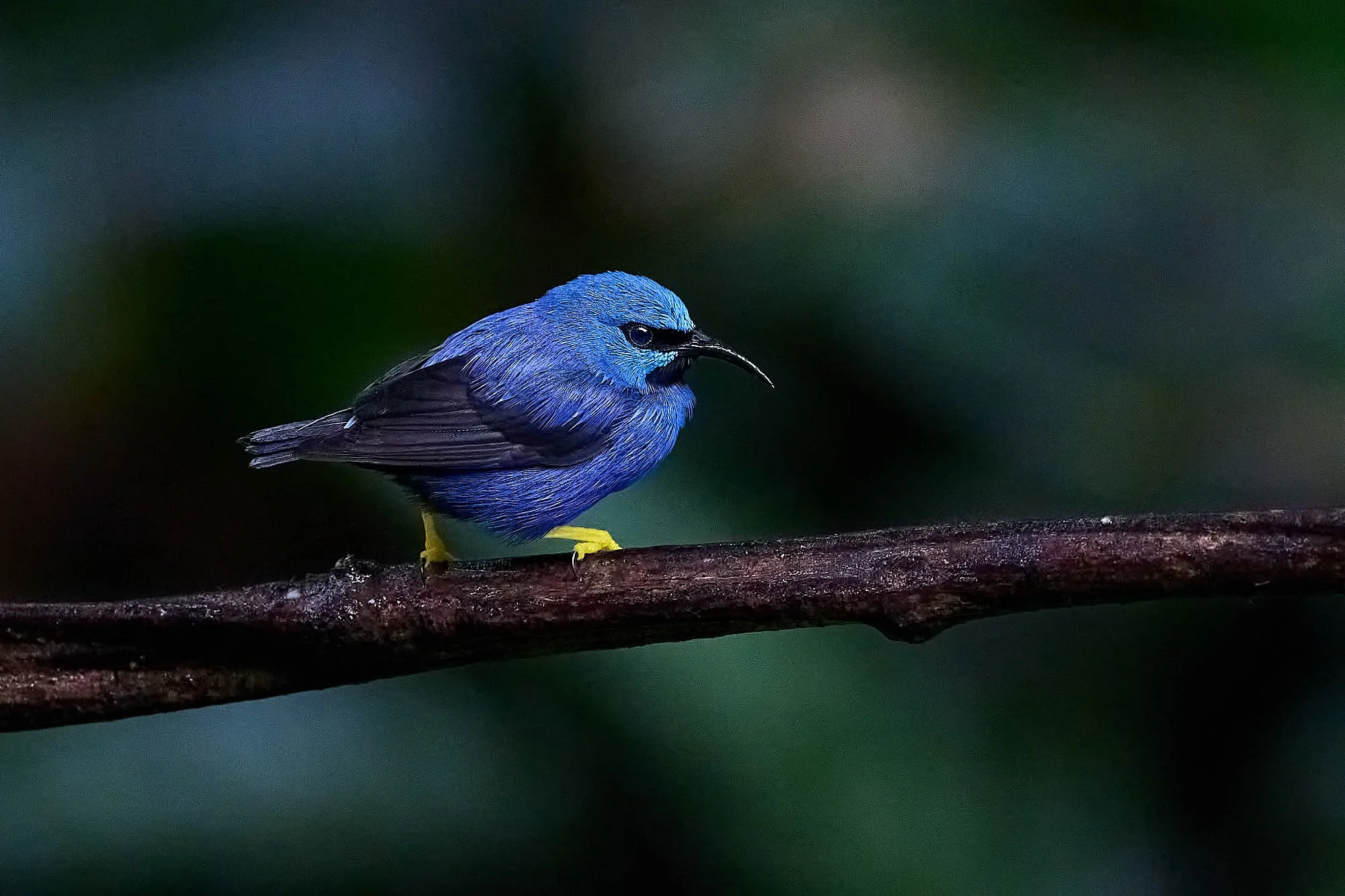
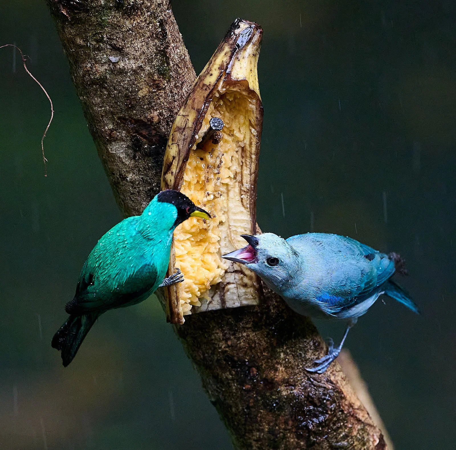
Blue-gray Tanager, Shining Honeycreeper, and Red-legged Honeycreeper
Palm Tanager
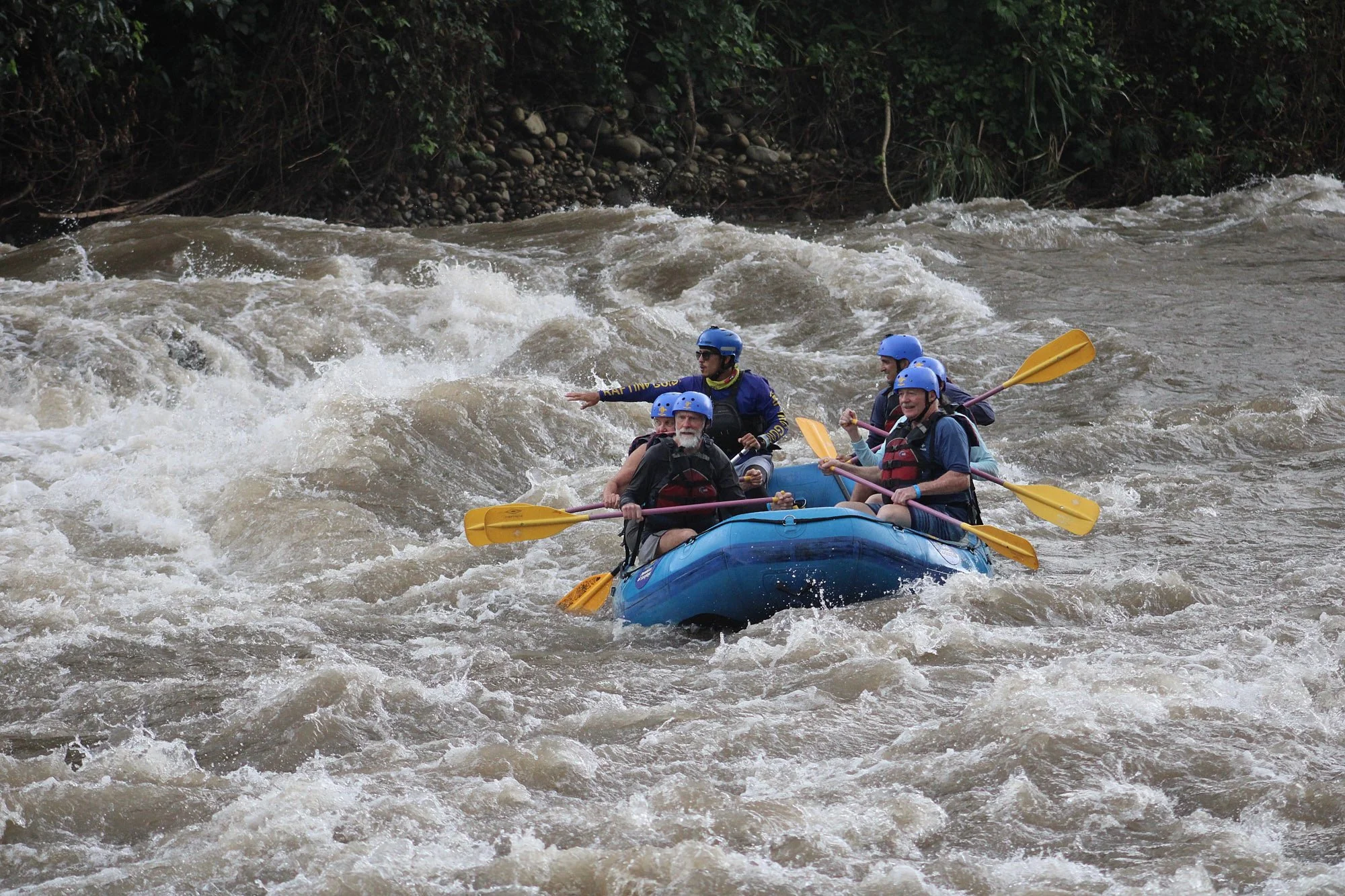
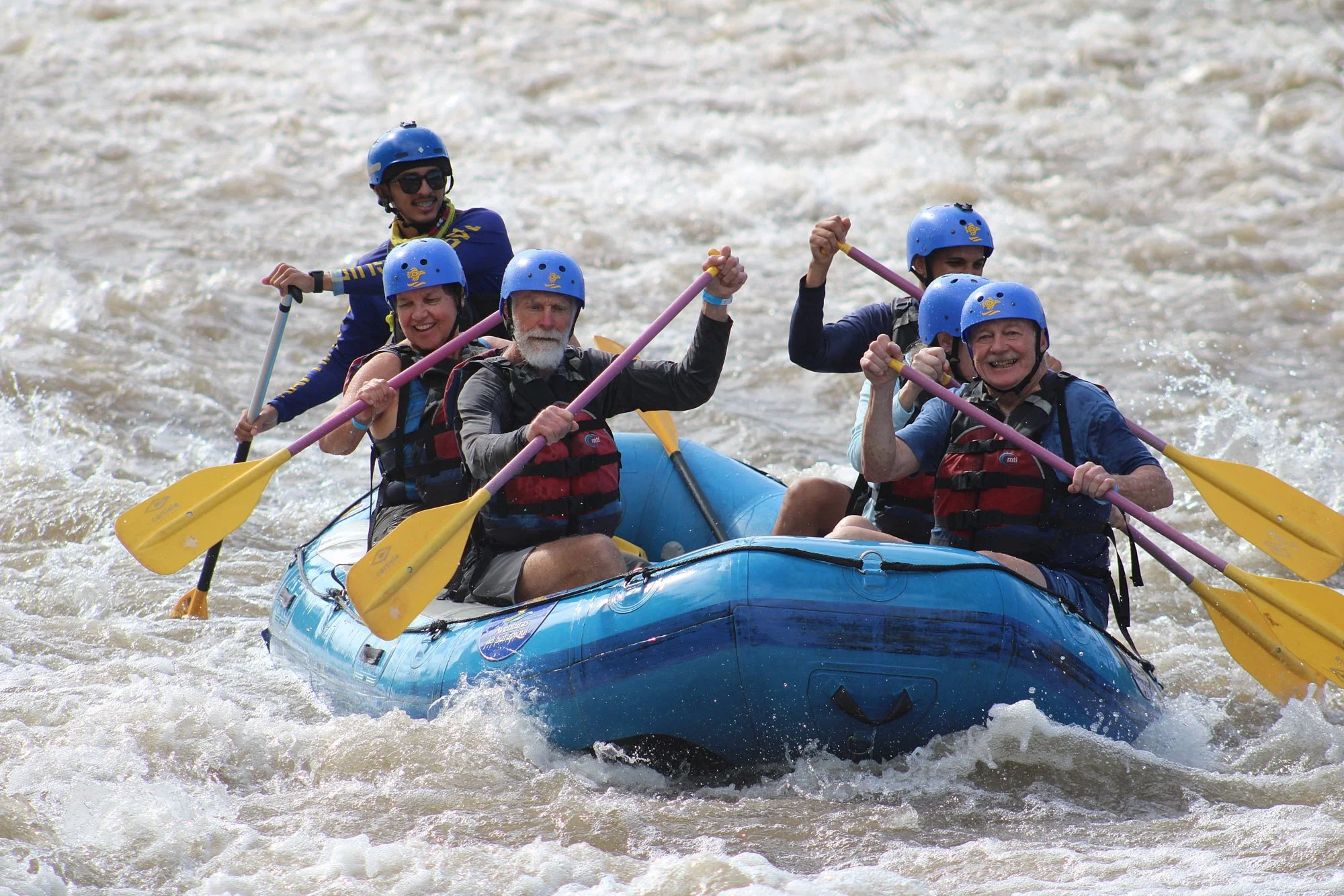
Our group visited a cacao plantation and sampled an array of delicious chocolates. One afternoon, in rare bright sunlight, we rafted a section of the Sarapiqui.
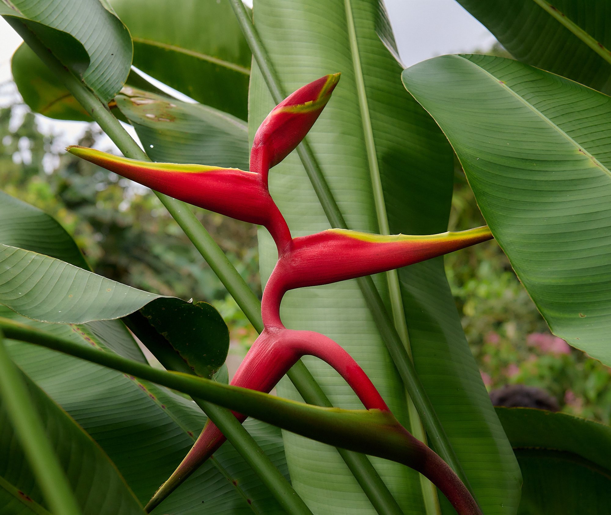
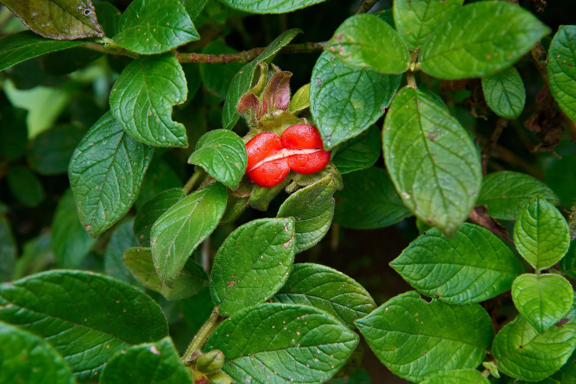
Biodiversity
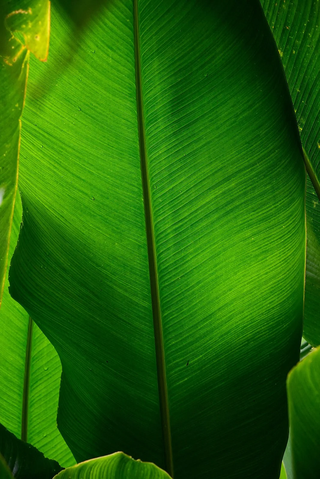
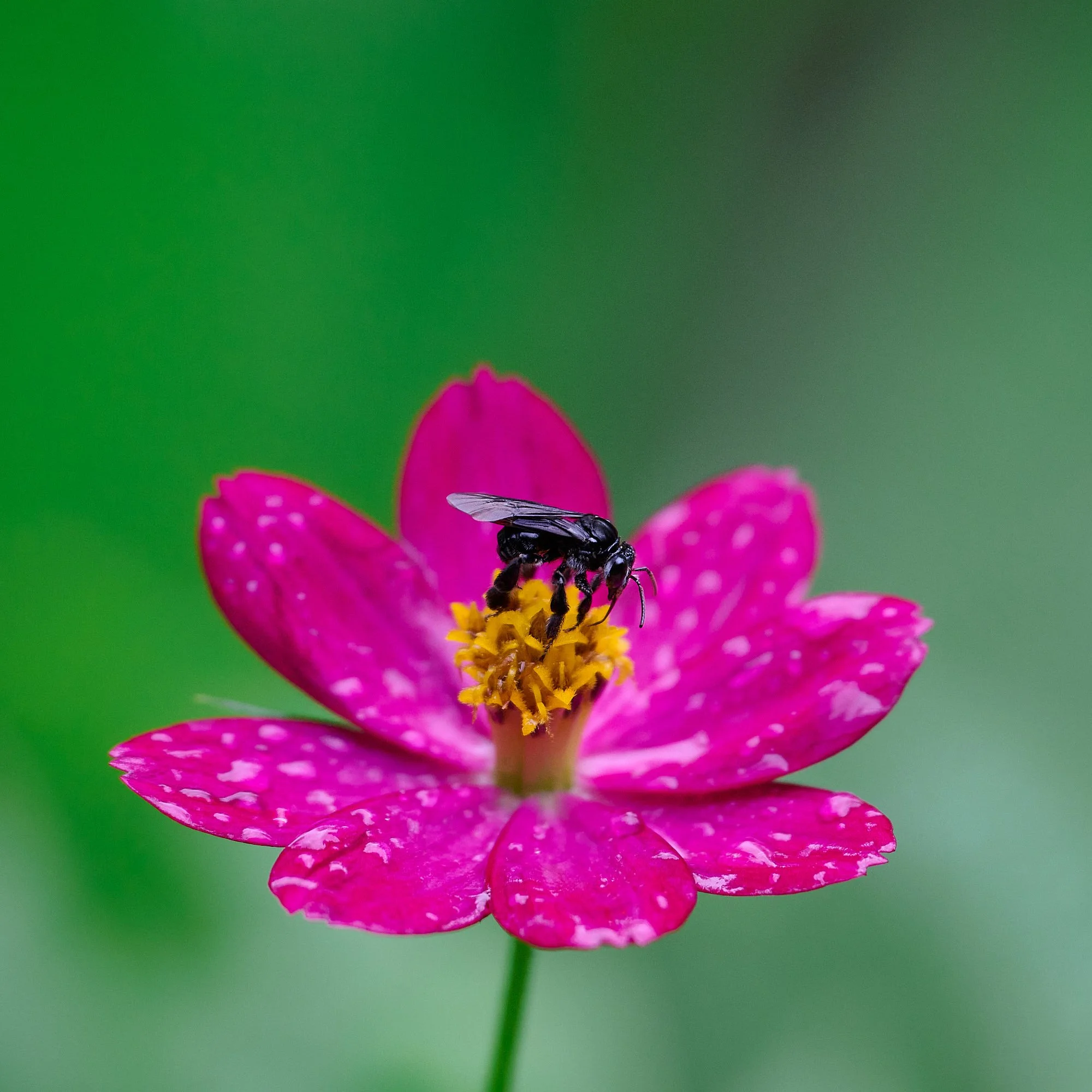
Costa Rica is one of the most biodiverse places on the planet. It is home to perhaps 500,000 species (about 5% of Earth’s total species), yet Costa Rica only makes up 0.03% of the world's landmass.
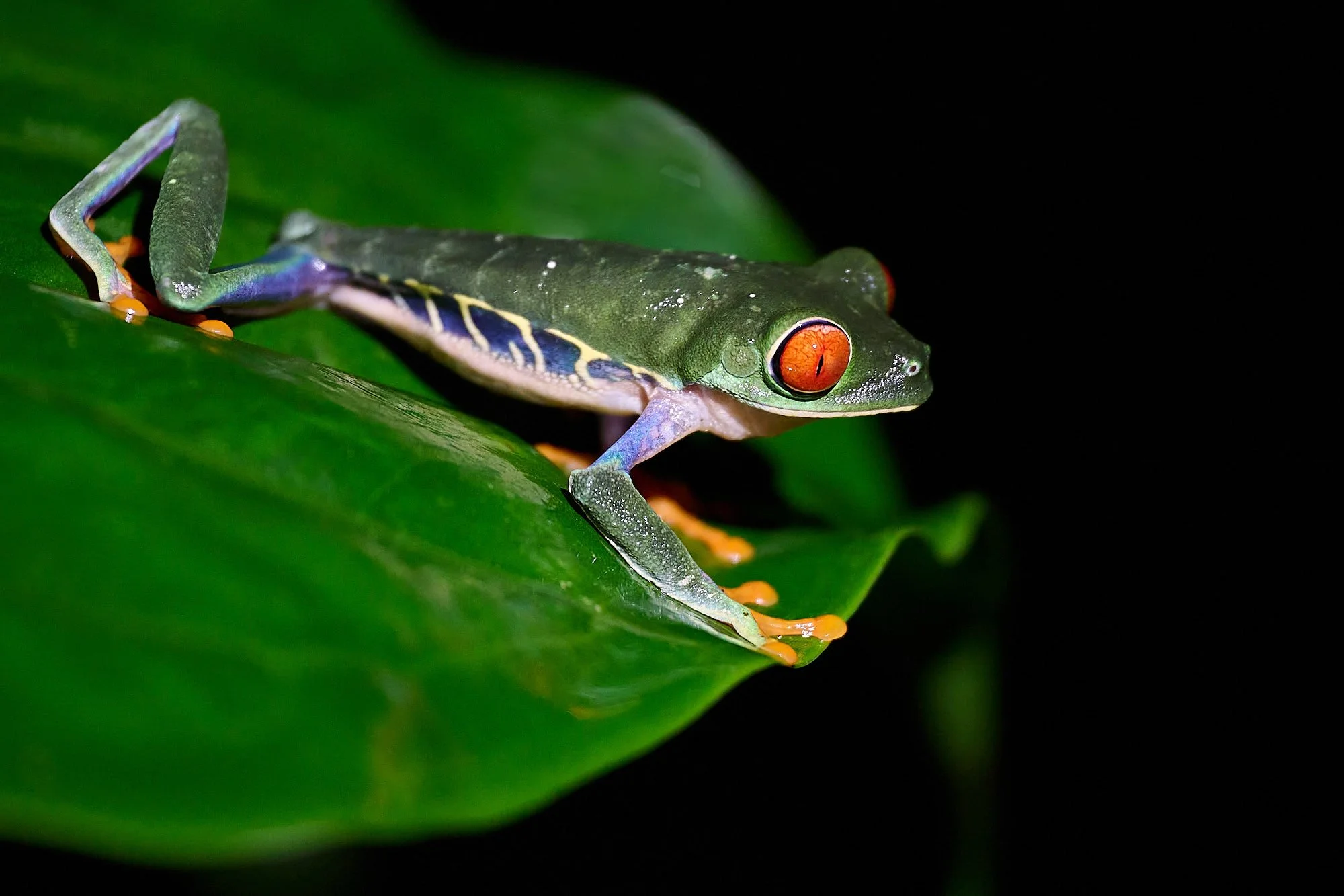
Red-eyed leaf frog
Blue-gray Tanager

Squirrel spp
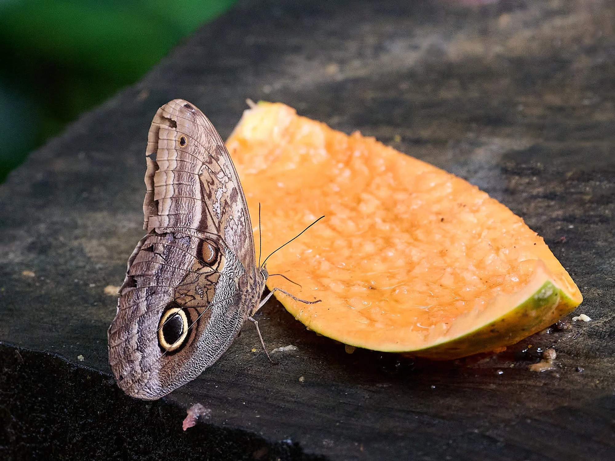
The owl butterfly is one of the biggest butterflies in the New World. Its caterpillars feed on the leaves of heliconias.
Why such Diversity?
Great American Interchange
North and South American species evolved in isolation for millennia. The Panama Isthmus allowed them to intermingle for the first time in over 60 million years. Many of those species continue their lineages in today’s Costa Rica.
Palm Tanager
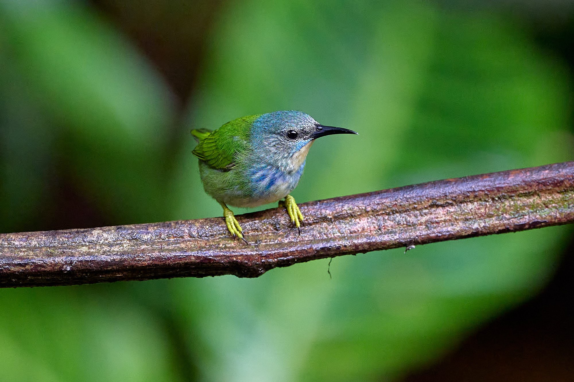
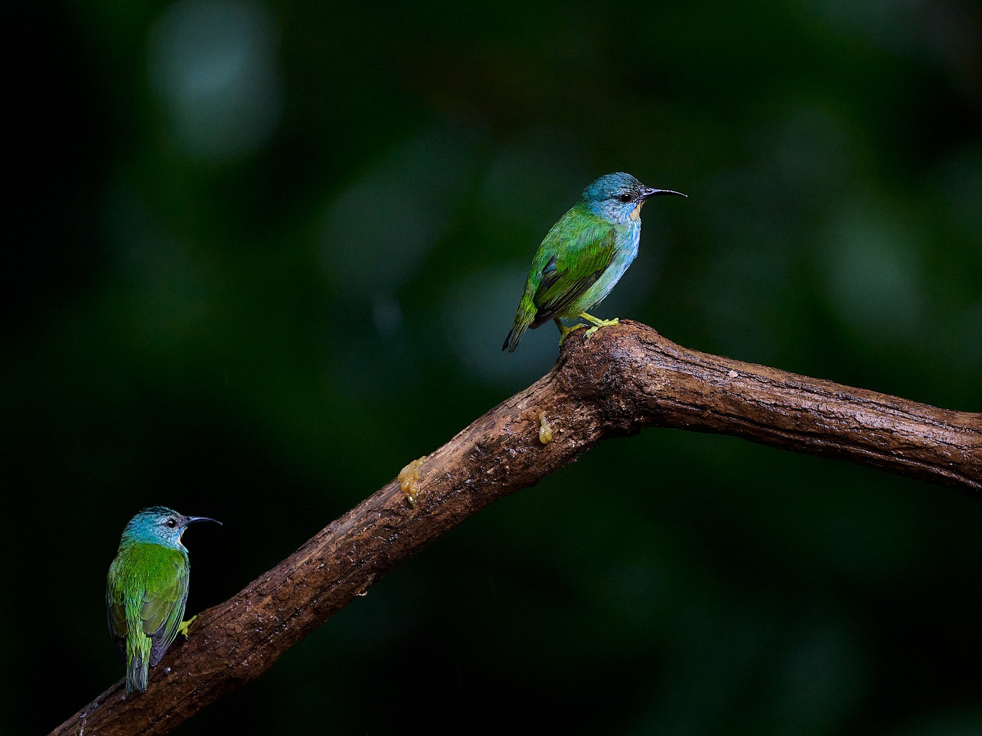
Shining Honeycreeper, female
Shining Honeycreeper, male
Why such Diversity?
Tectonics
Subduction zones cause volcanism, fire, and earthquakes, which may disturb the local environment and influence human activities.
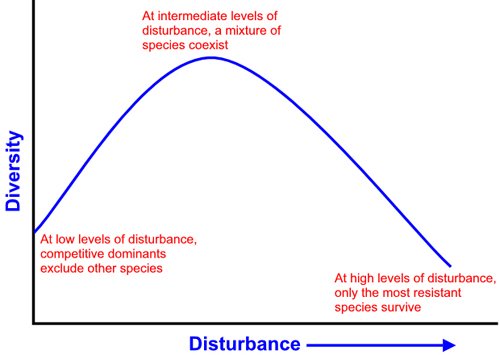
The intermediate disturbance hypothesis argues that local species diversity is maximized when ecological disturbance is neither too rare nor too frequent. At low levels of disturbance, more competitive organisms will dominate the ecosystem and push subordinate species to extinction. At high levels of disturbance, most of the species are at risk of going extinct.
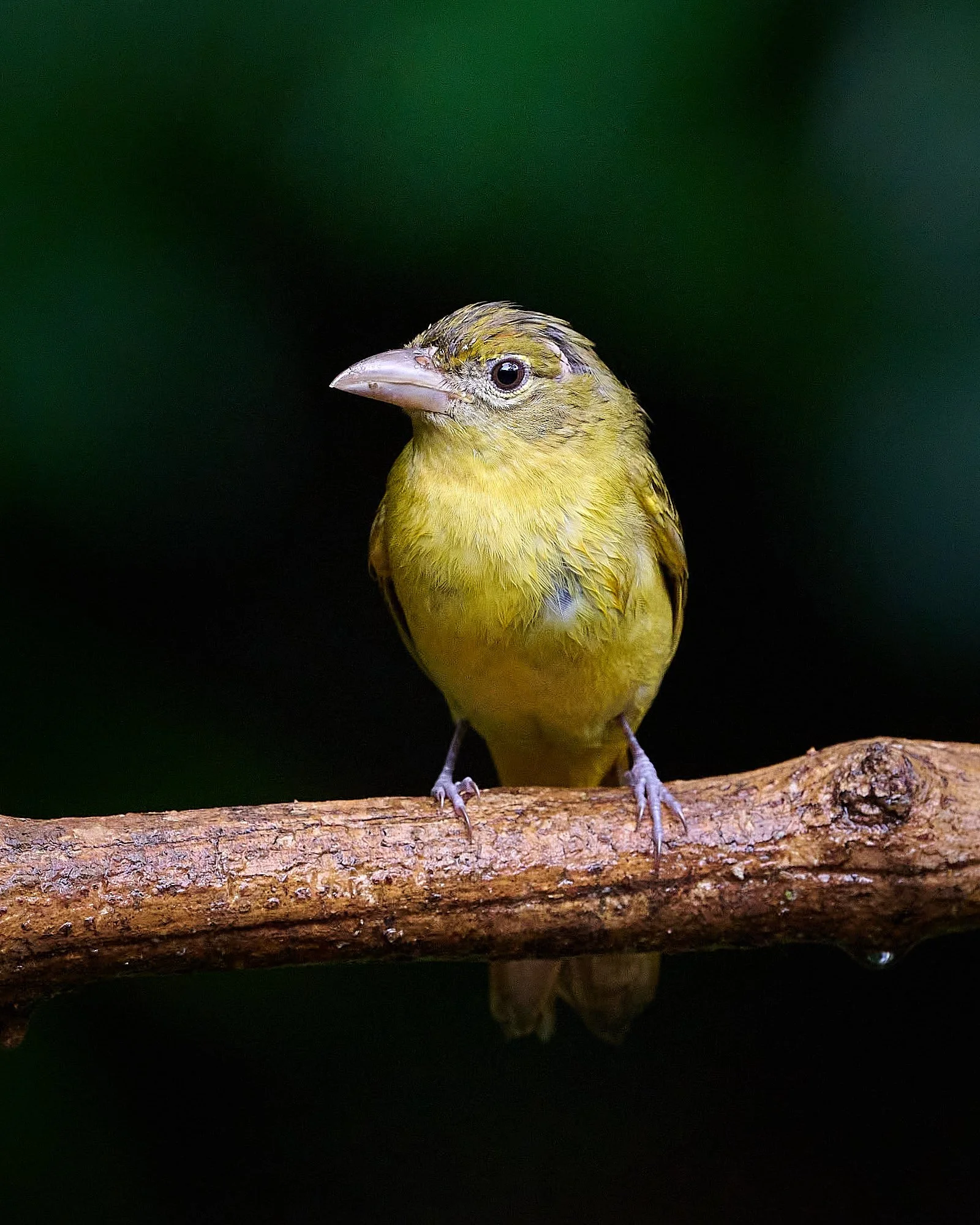
Yellow-throated Euphonia
Green Honeycreeper, Blue-gray Tanager
Summer Tanager
Clay-colored Thrush
Why such Diversity?
Location
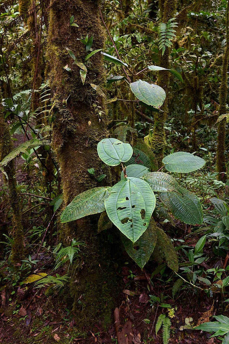
Costa Rica lies within the tropics (10°N). It is bordered by two very different oceans. The climate is amply wet, warm, sunlit, and has minimal annual fluctuation. These are conditions that support an exuberant proliferation of vegetation – providing diverse, niche habitats for animals.
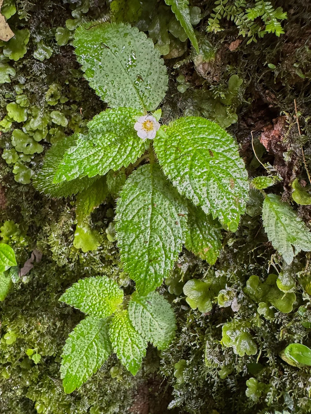
For example, epiphytes (such as orchids and bromeliads) constitute up to 40% of a rainforest’s total plant biomass. Most of these epiphytes have escaped dependency on soil for their water supply and have colonized all the way up to the forest’s canopy. Their foliage holds small pools of water. In fact, many rainforest frog species live and breed in trees, not at ground-based ponds.
Food diversity is a key to tropical bird diversity. Tropical rainforests offer food resources not found in temperate forests. A slew of antbirds, ovenbirds, and woodcreepers specialize on insects that abandon cover to flee raiding army-ants. One researcher found that 84 species of rainforest birds included significant amounts of nectar and fruit in their diet, compared to only 7 species in a temperate prime hardwood forest.
Green honeycreeper, female
Green Honeycreeper, male
Gray-chested Dove
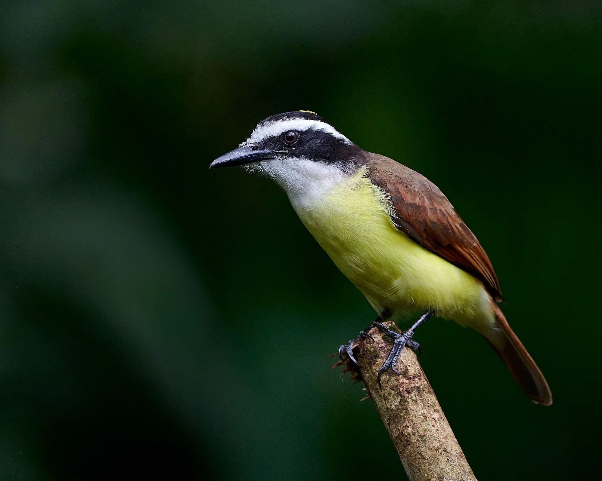
Great Kiskadee
Why such Diversity?
Geography
Four mountain ranges stretch down the middle of Costa Rica, three are volcanos. Their soils are rich in plant nutrients.
Mount Chirripó is Costa Rica’s highest peak (12,536 ft). The mountains capture Caribbean moisture borne by the northeast trade winds and the rugged terrain provides many microclimates and 12 different ecosystems between the coasts and mountain tops. These range from wet and dry tropical forests, cloud forests, to mangroves, wetlands and coral reefs.
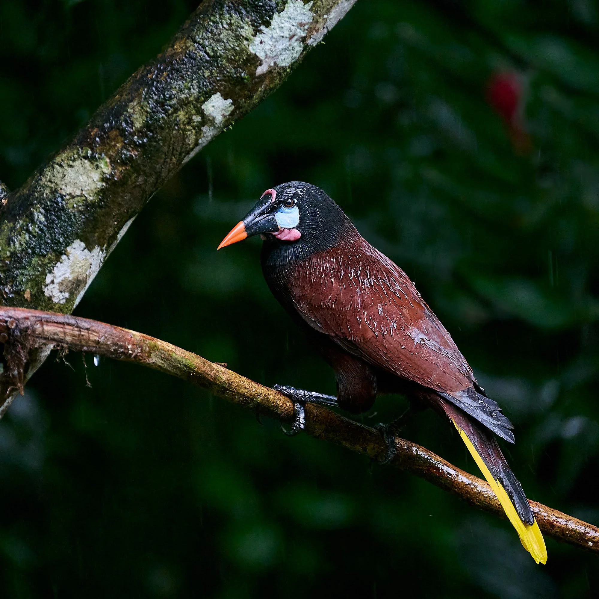
Montezuma Oropendola
Shining Honeycreeper, females
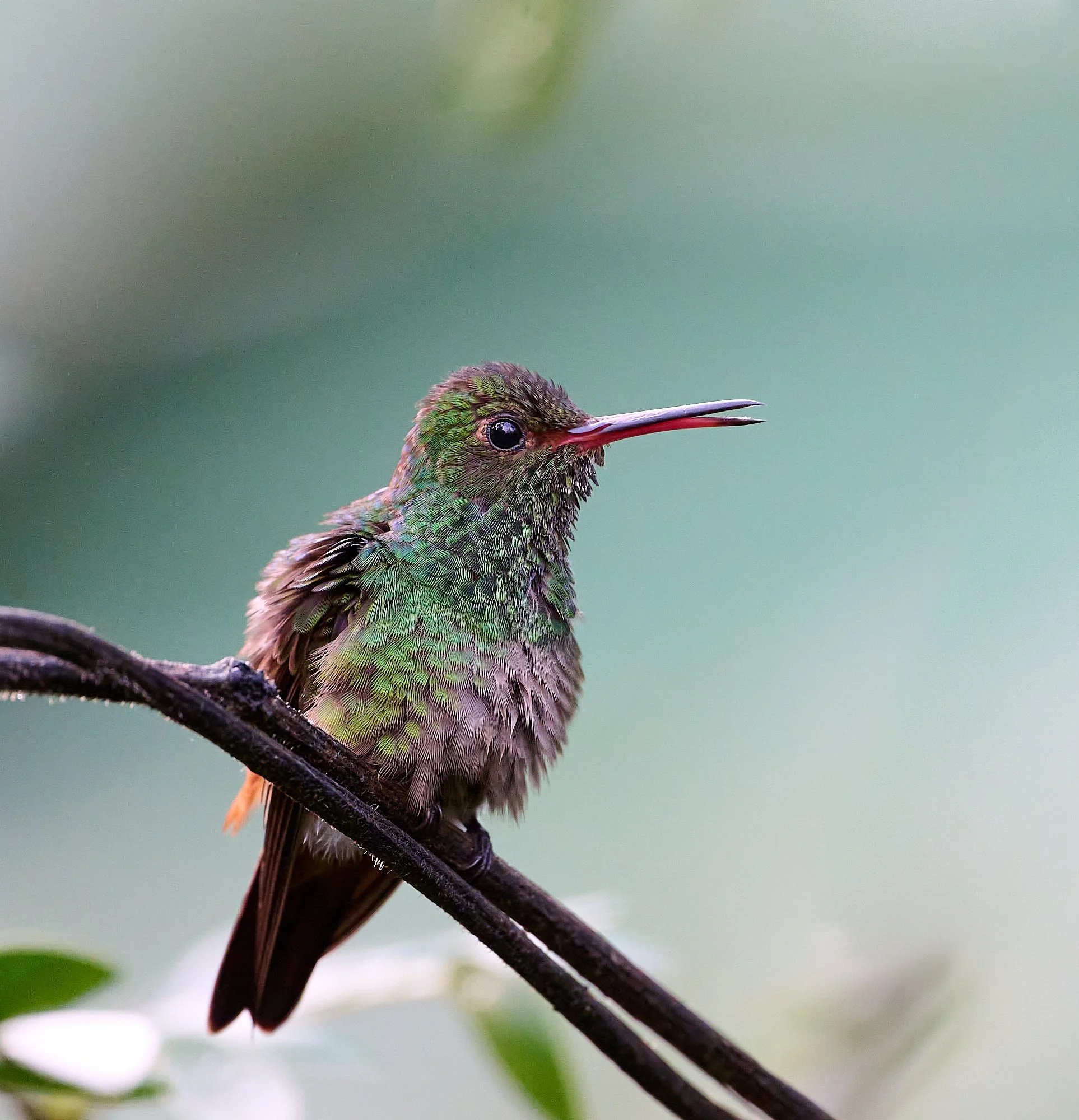
Rufous-tailed Hummingbird
Scarlet-rumped Tanager
Why such Diversity?
Culture
Before 1940, around 75% of the country was covered in forest. However, by 1987, half of the forest cover was lost to logging and farming.
The Costa Rican government then created laws banning deforestation without government approval and created ‘payments for ecological services’, where Costa Ricans receive financial support in return for helping restore forests. As a result, Costa Rica became the first tropical country to entirely reverse deforestation — today, around 60% of the country has returned to forest cover and provides faunal refugia.
Conservation is widely taught at schools. In 2023, ecotourism contributed 8.2% to the national gross domestic product and generated substantial foreign exchange.
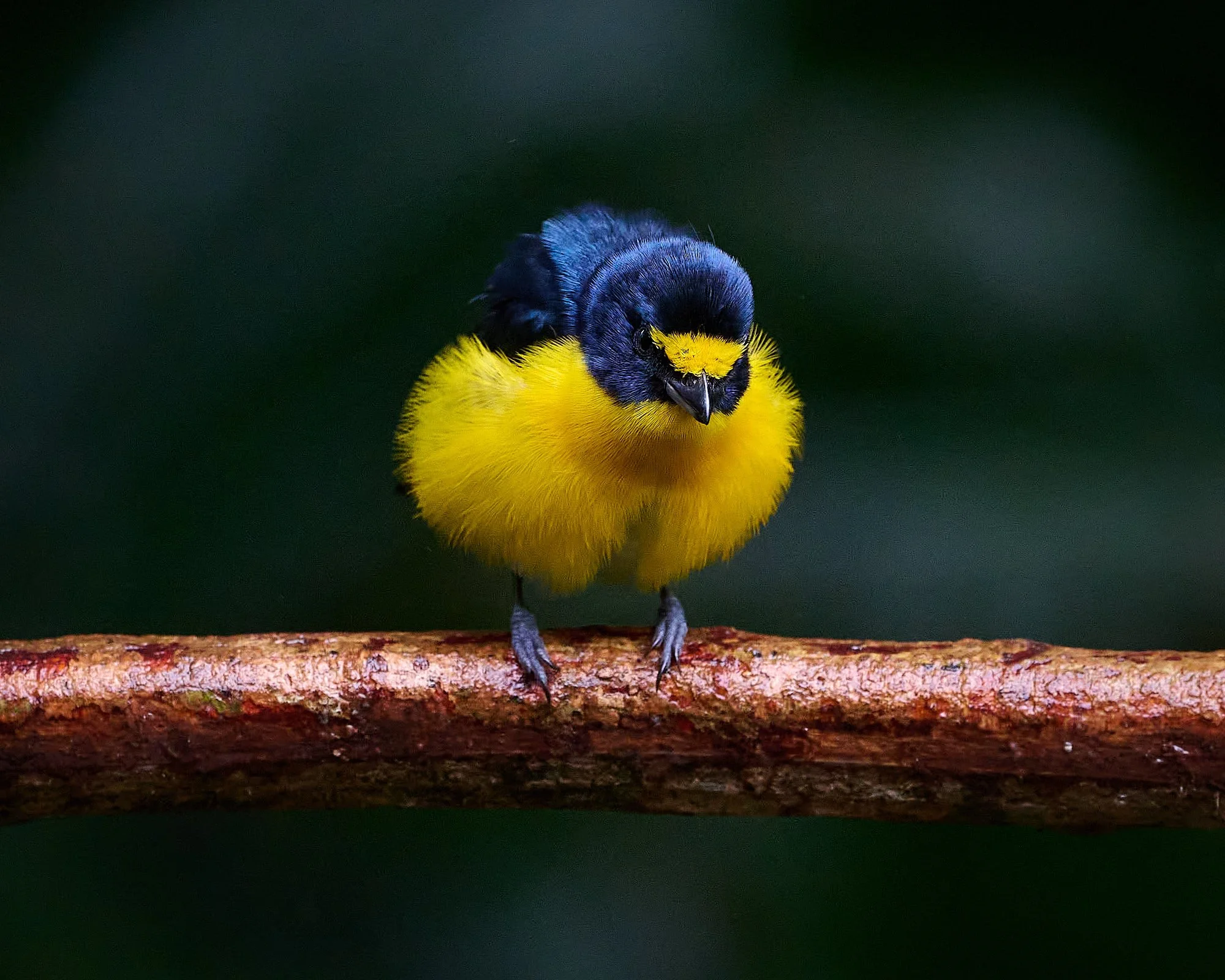
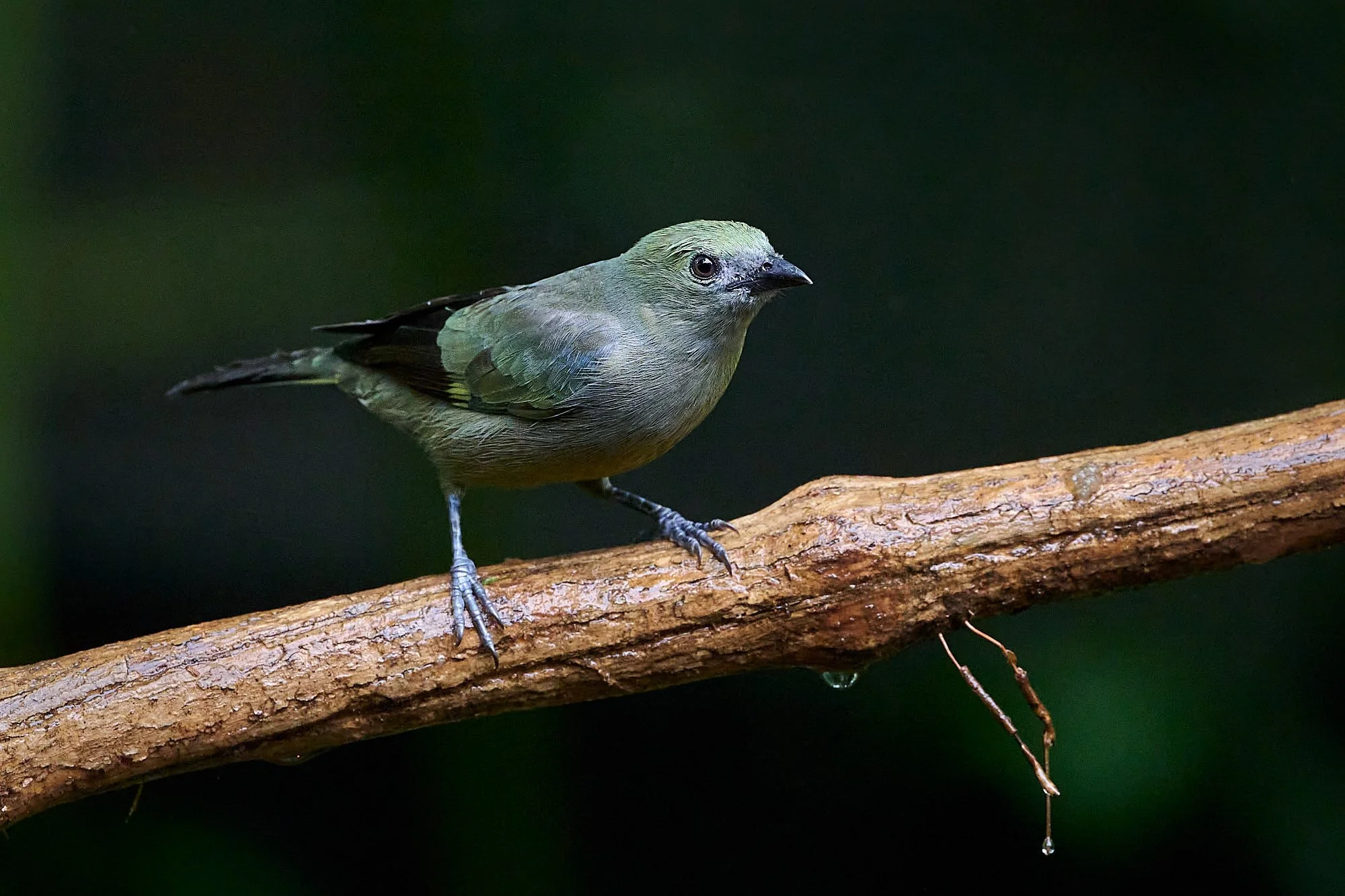
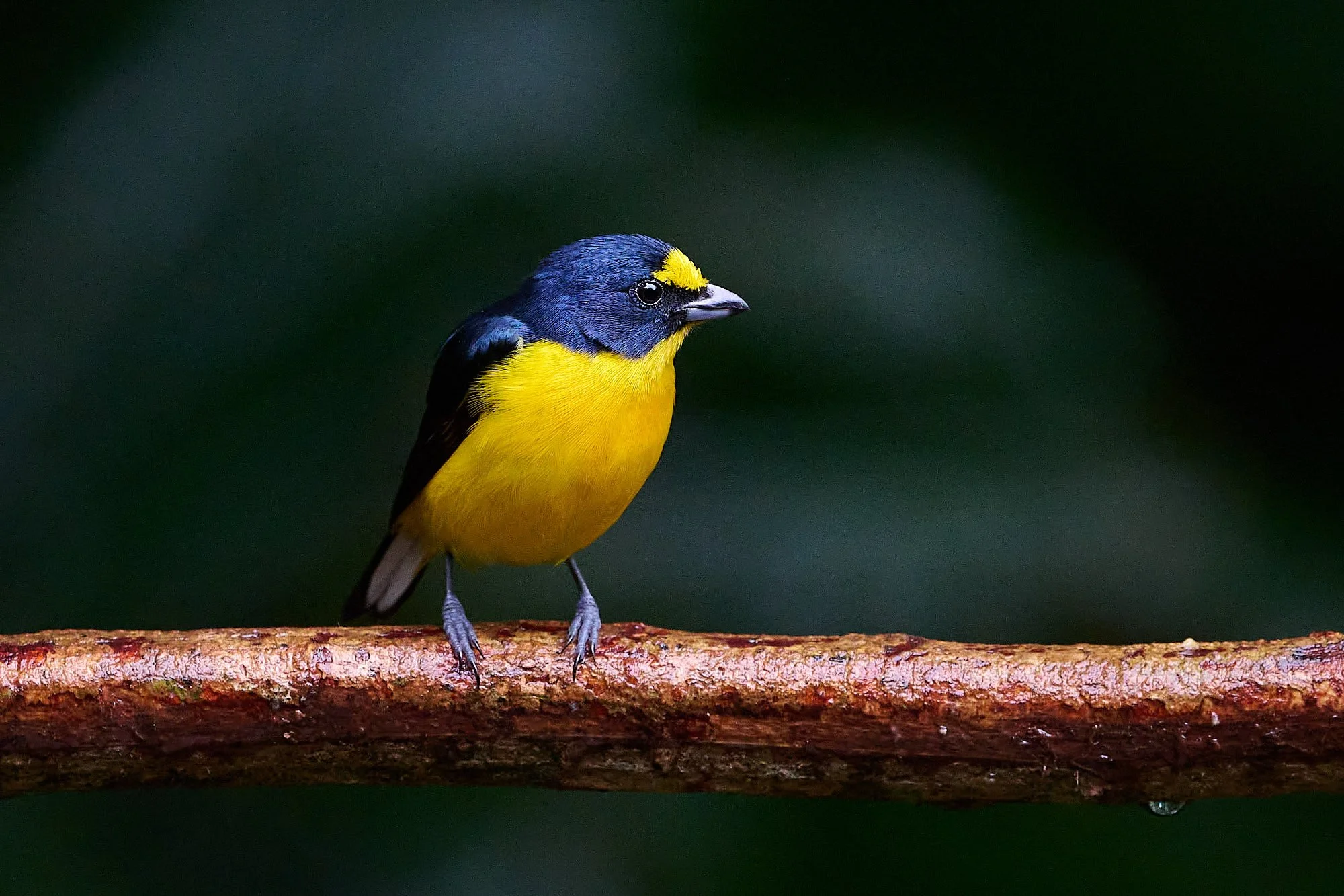
Yellow-throated Euphonia, male
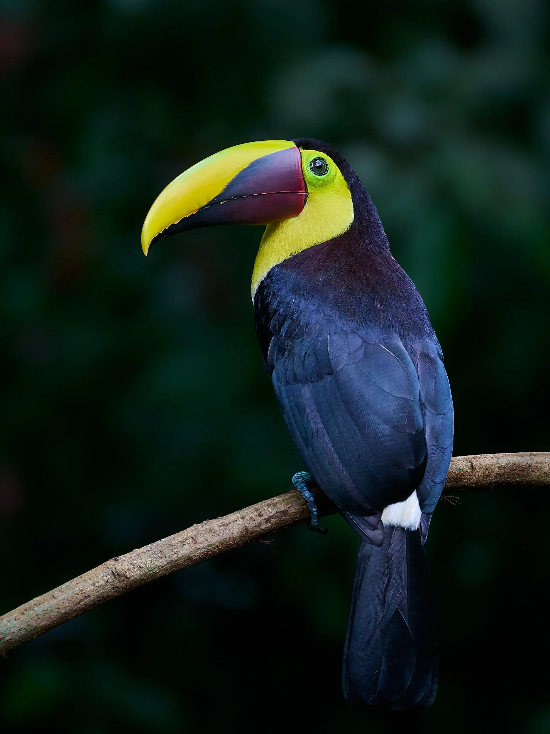
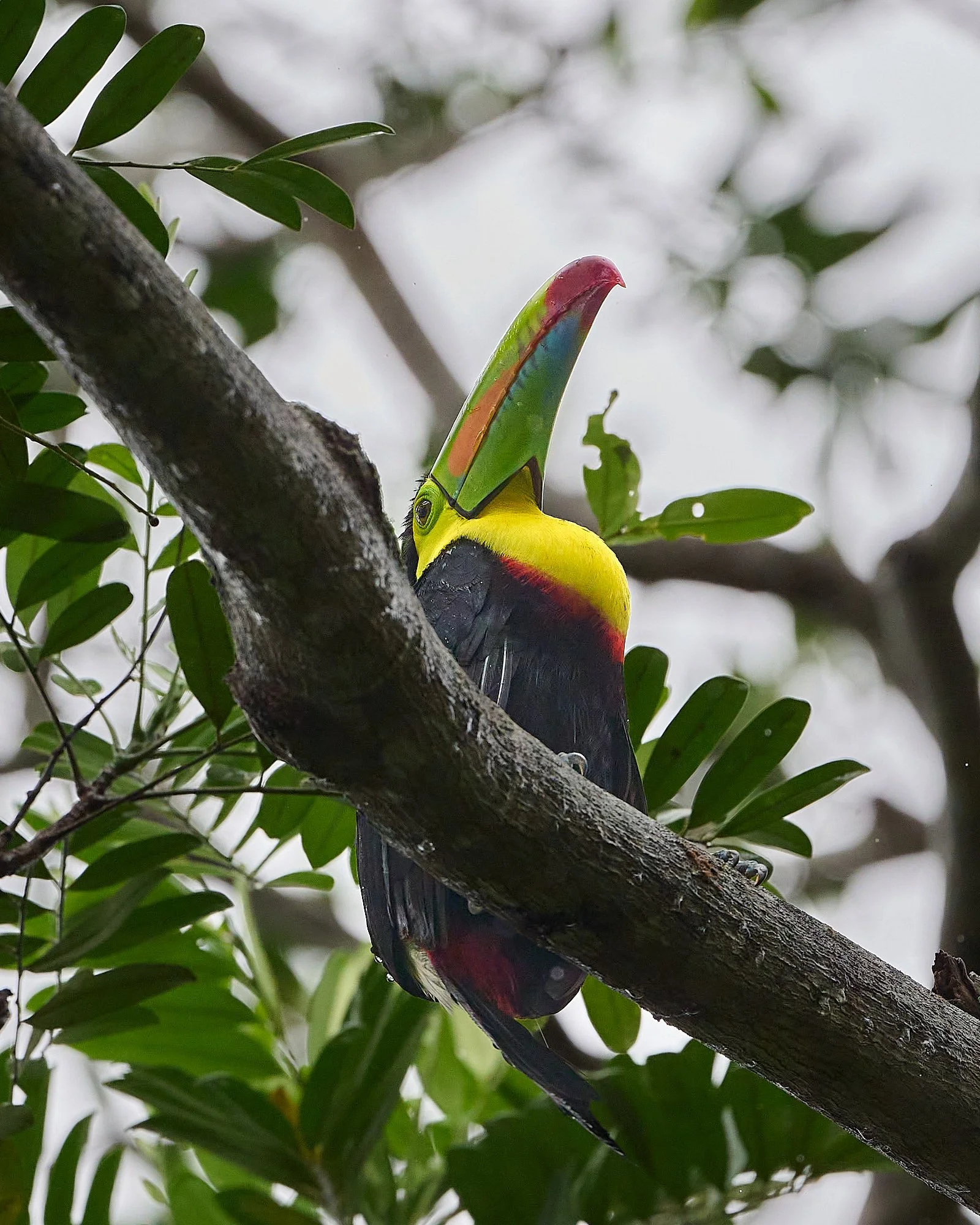
Yellow-throated Toucan
Threats to Diversity
Nothing new here – climate change and loss of habitat.
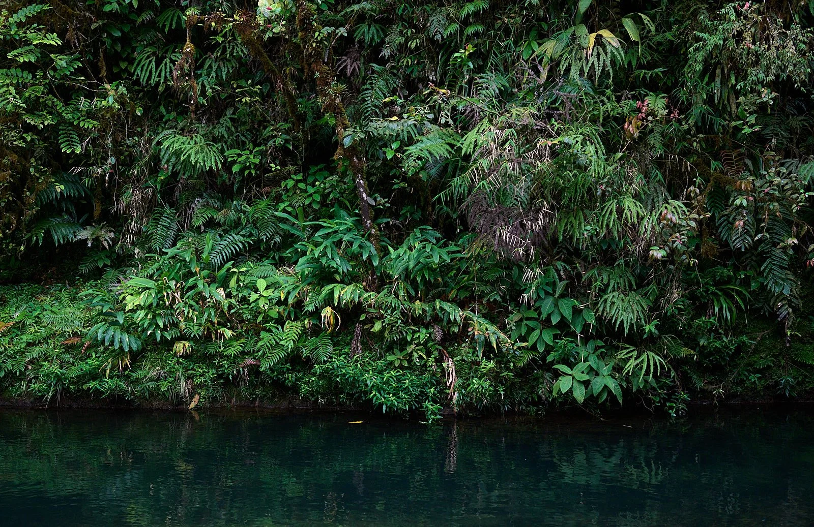
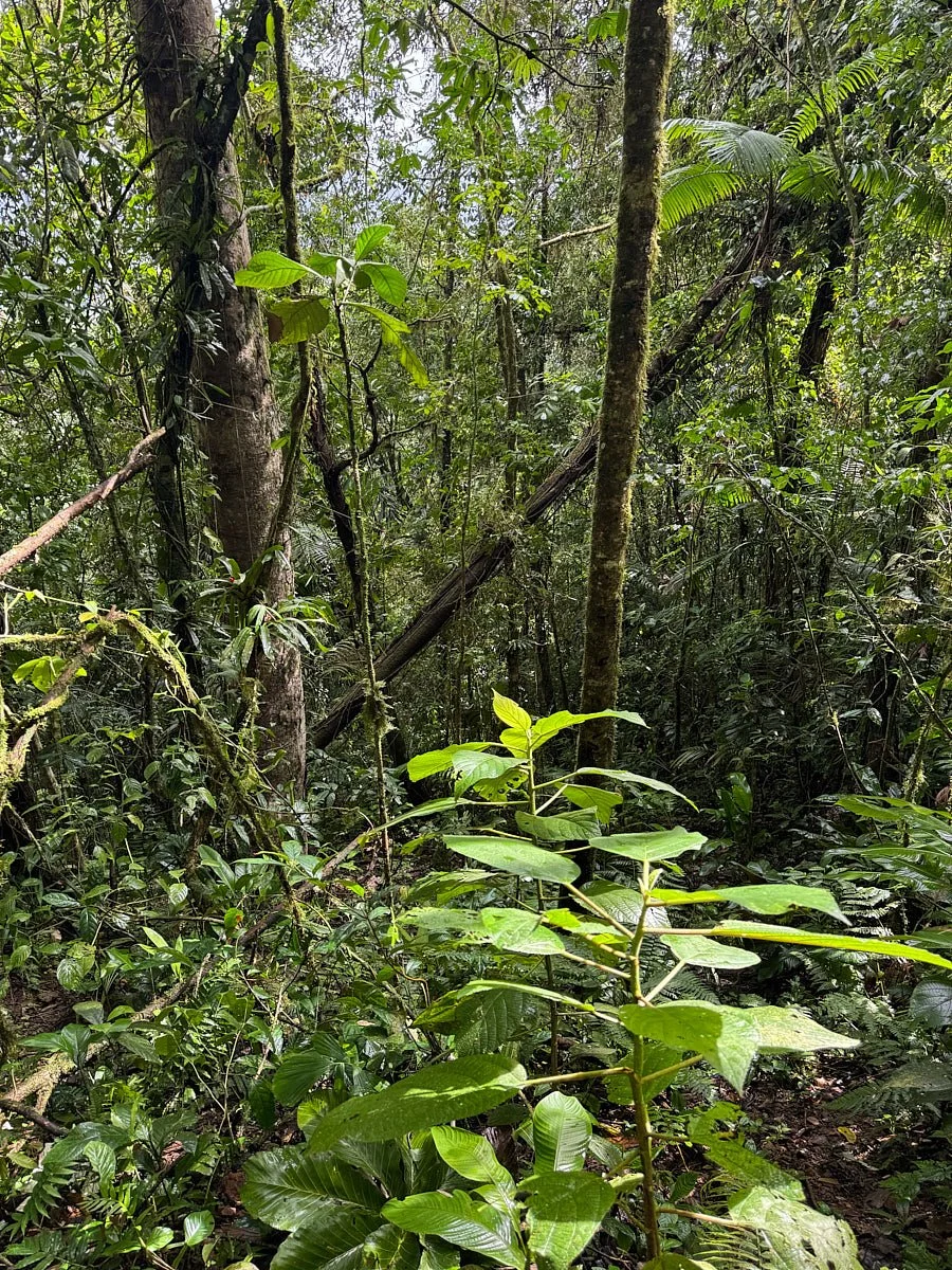
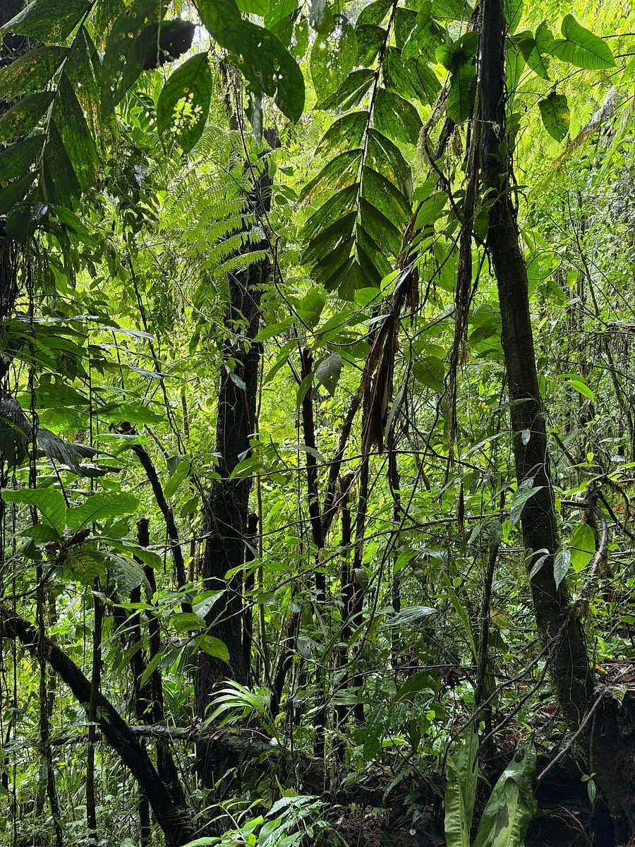
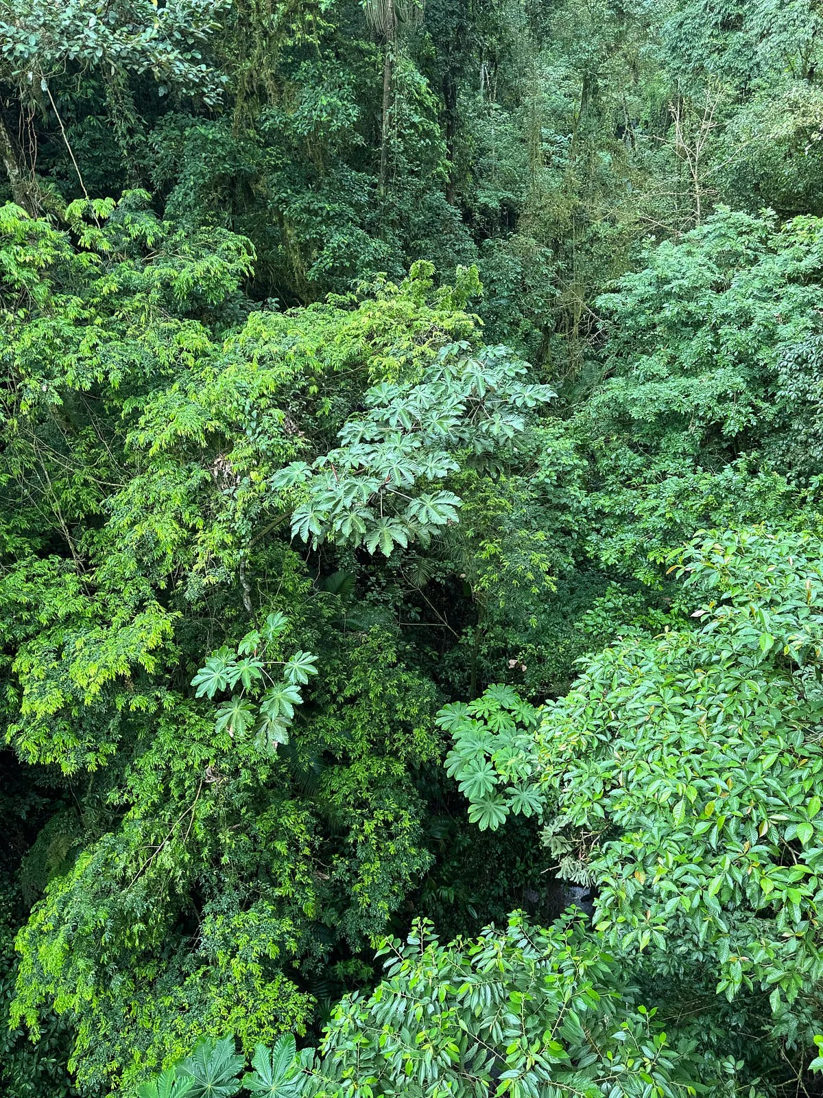
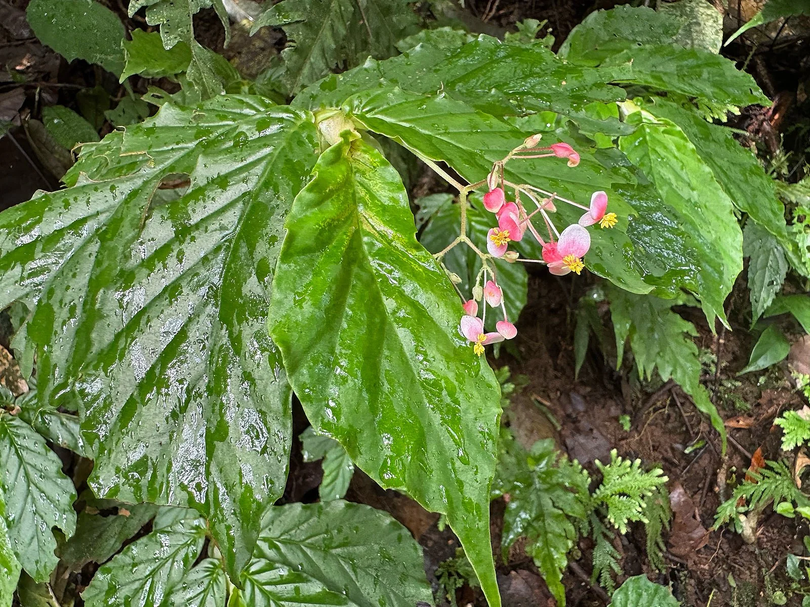
Into the Clouds
The highlands of Costa Rica and western Panama are a region of endemism. Higher altitude and moisture-laden trade winds result in an ethereal, misty and wind-caressed forest - a cloud forest. Isolated for millions of years, these highlands are home to numerous plants and animals that occur nowhere else in the world.
Our group ascended the convoluted mountain roads to the area around Arenal volcano. We stopped at a local organic farm and ended our journey at a complex of hiking trails with hanging bridges that allow one to experience the cloud forest at canopy level. Next day, we visited an impressive grassroots reforestation program.


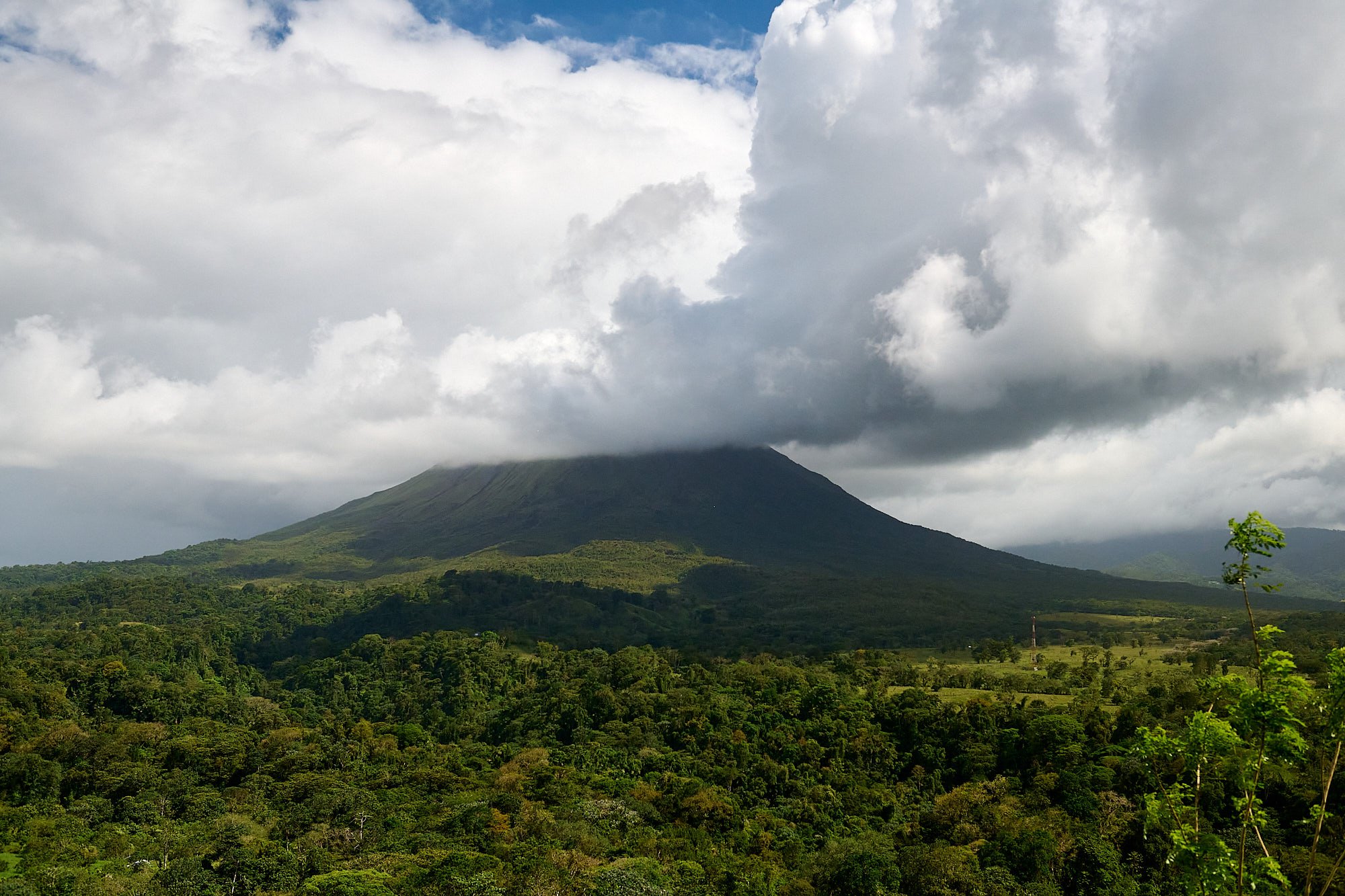
Arenal volcano. Currently dormant, the volcano was active from 1968 to 2010.
A Cloudless Future
Global warming has raised the average height at which clouds form and the cloud forest is now immersed in mist less frequently than it used to be. This is important because the cloud forest typically derives up to half its total moisture from wind-driven clouds passing through the trees.
With less mist there is less moisture to support the lush, diverse vegetation and the animals that inhabit this zone. For example, the golden toad was present in normal numbers in 1987, only one individual was seen in 1989, and it is now considered extinct. Snake and anole (lizard) populations have also crashed and epiphyte numbers are diminishing.
Tropical ecologist Adrian Forsyth concluded: “Protecting habitat was not enough, the skies and the clouds were beyond our reach”.


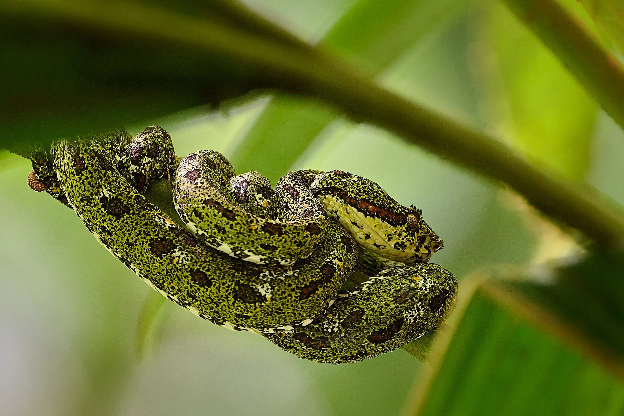
Viper, species unknown.
Broad-billed Motmot. The species specializes in large-sized insect prey.
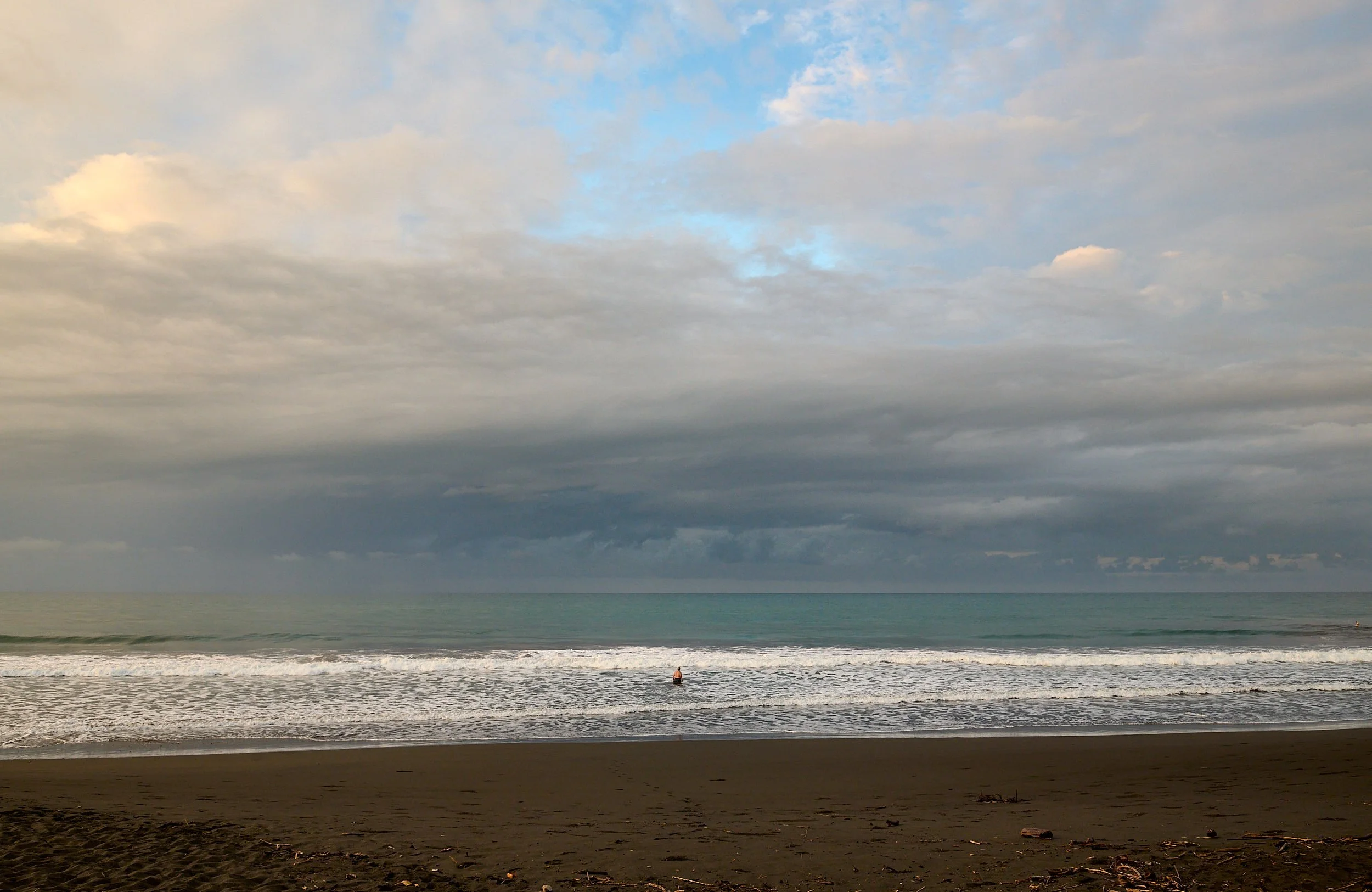
The Great Blue Pacific
For us Californians, it felt weird to put one’s toe in the ocean and realize the water was sublimely warm.
Our beach-side accommodation was within Costa Rica’s Central Pacific coastline. The vegetation in this area transitions from coastal forest to the dry forest typical of the Guanacaste region. During their journey over the highlands, the trade winds from the Caribbean lose much of their moisture. Consequently, the trees growing in the rain shadow are often deciduous, dropping their leaves to conserve moisture and survive.
We spent a few days at the coast, exploring a forest, paddling a outrigger canoe in the ocean, and boating up the mangrove-lined Tarcoles River.
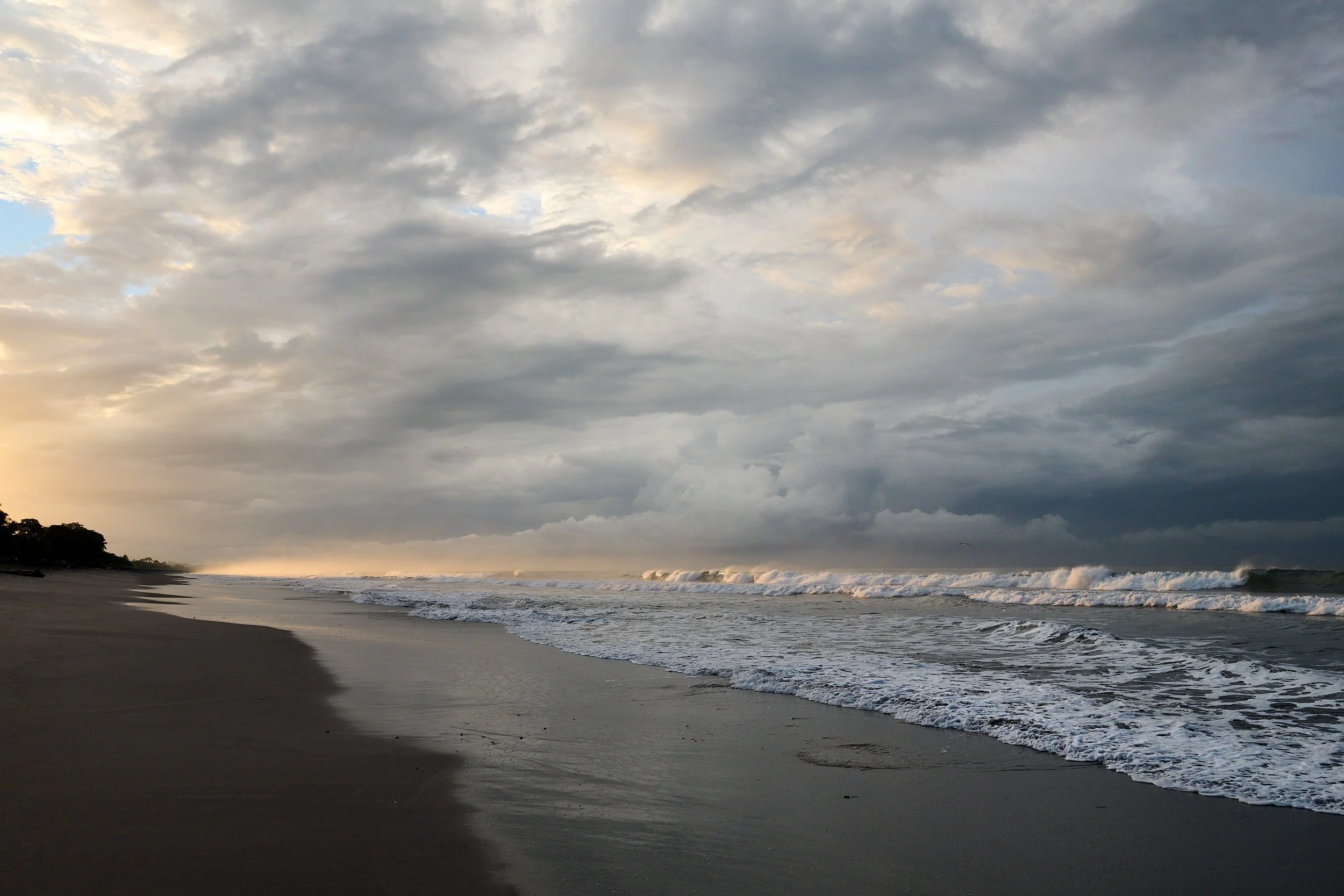
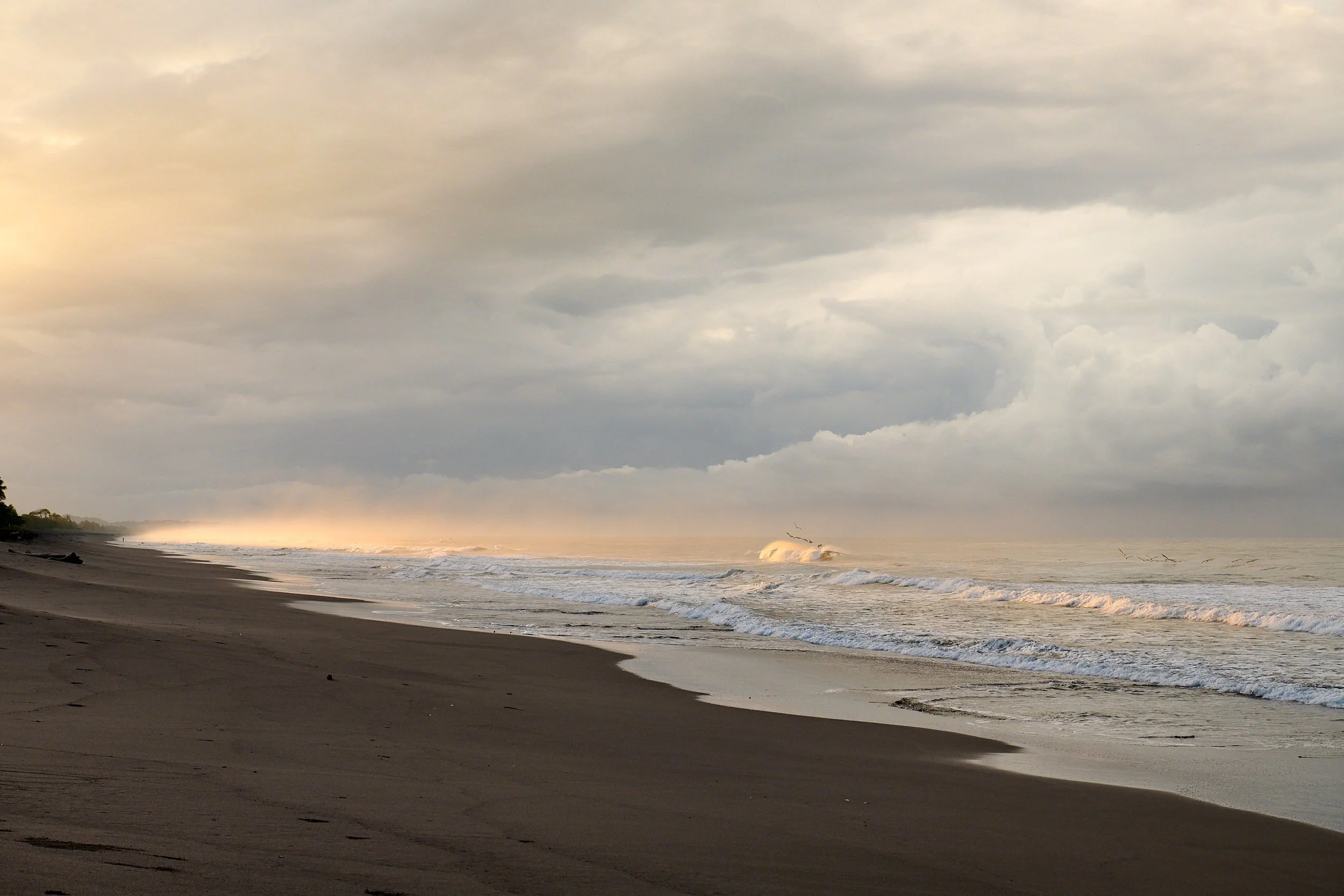
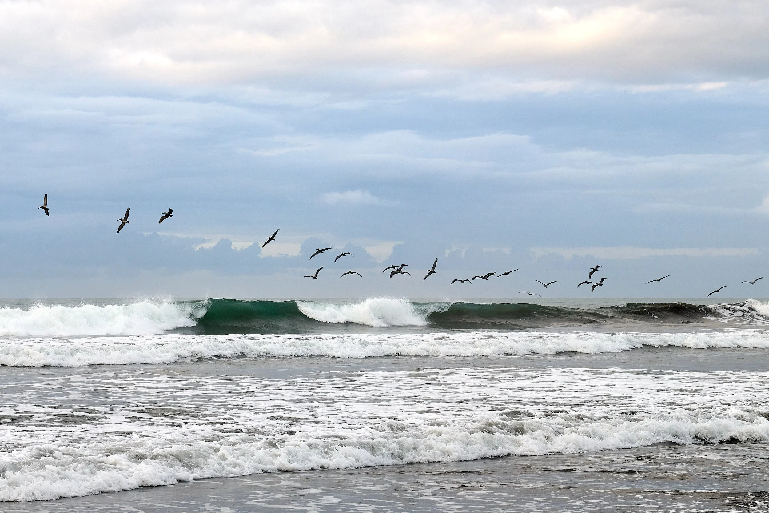
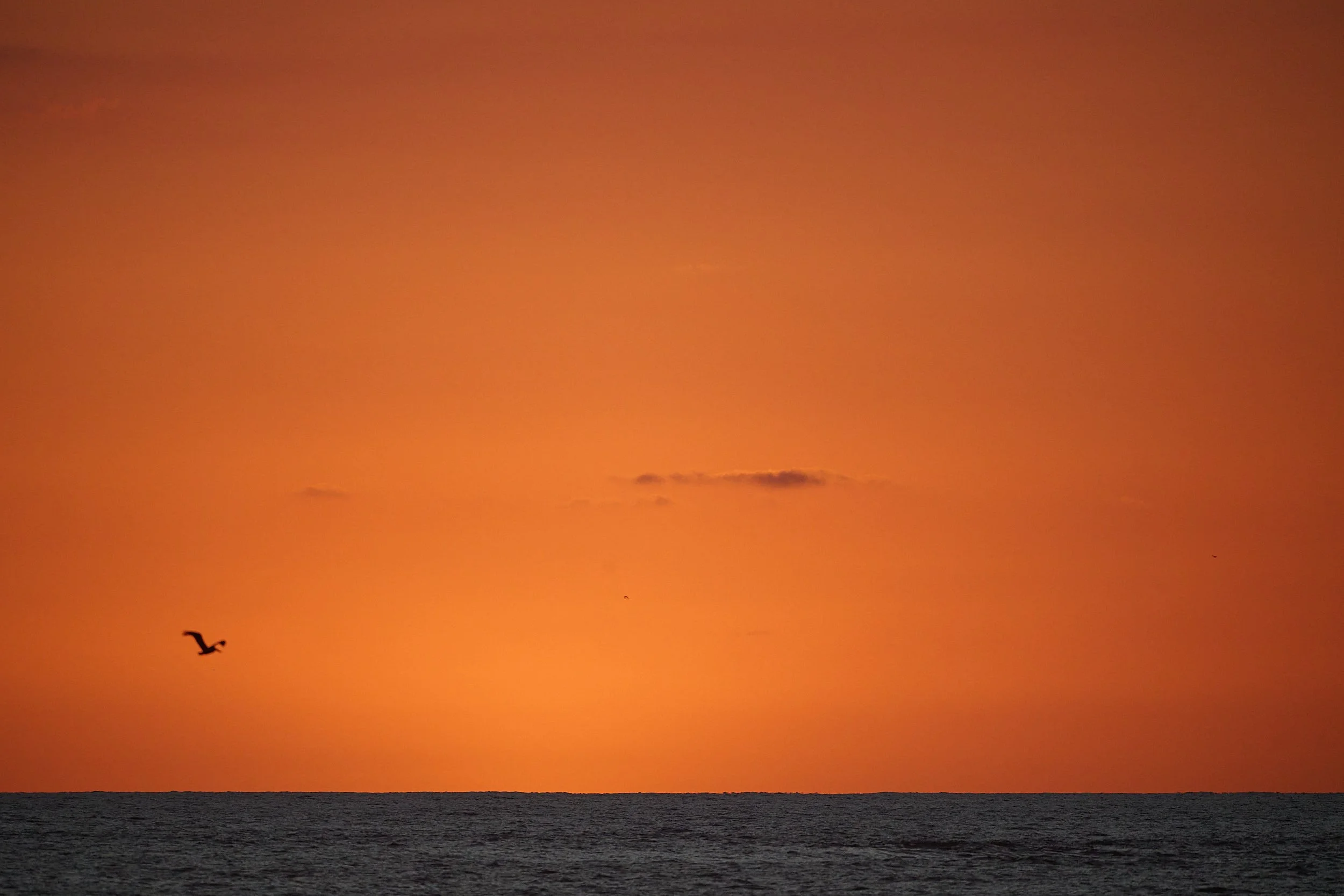
Pacific Ocean at dawn
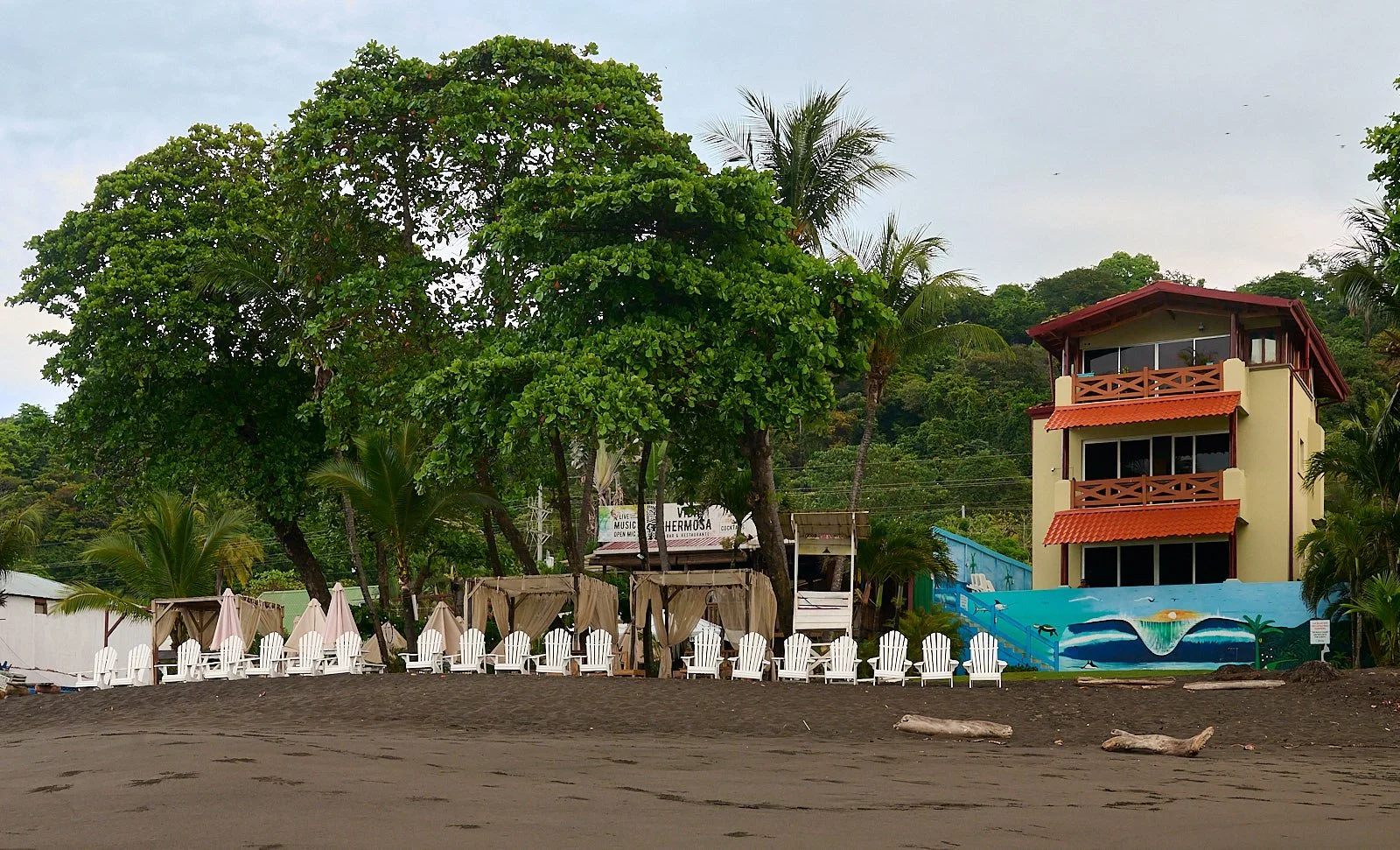
Seaside accommodation
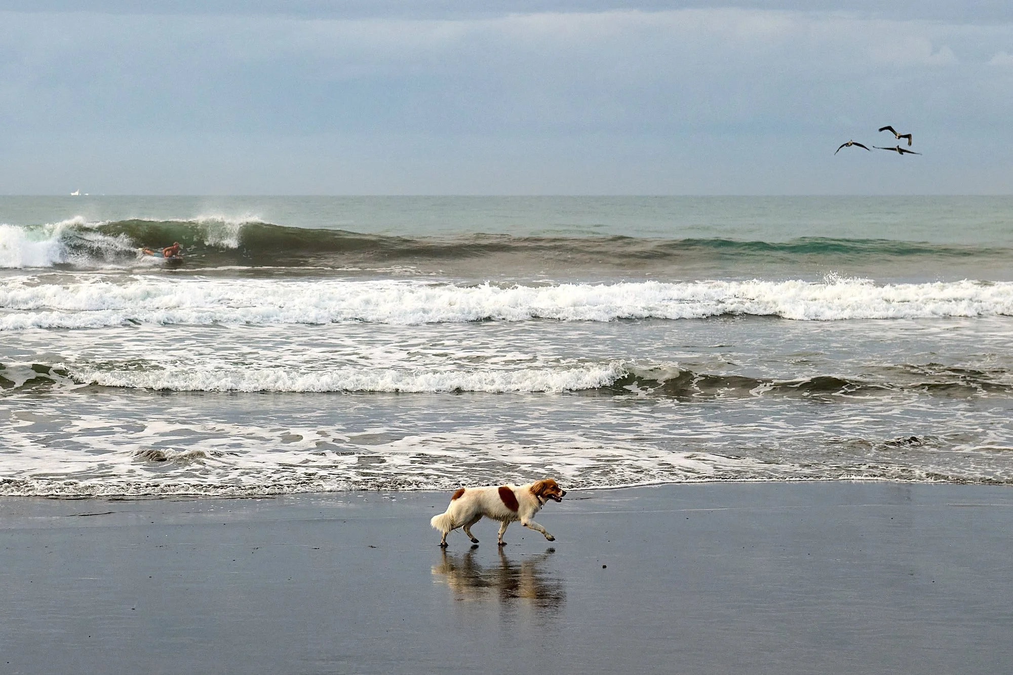
Beach life
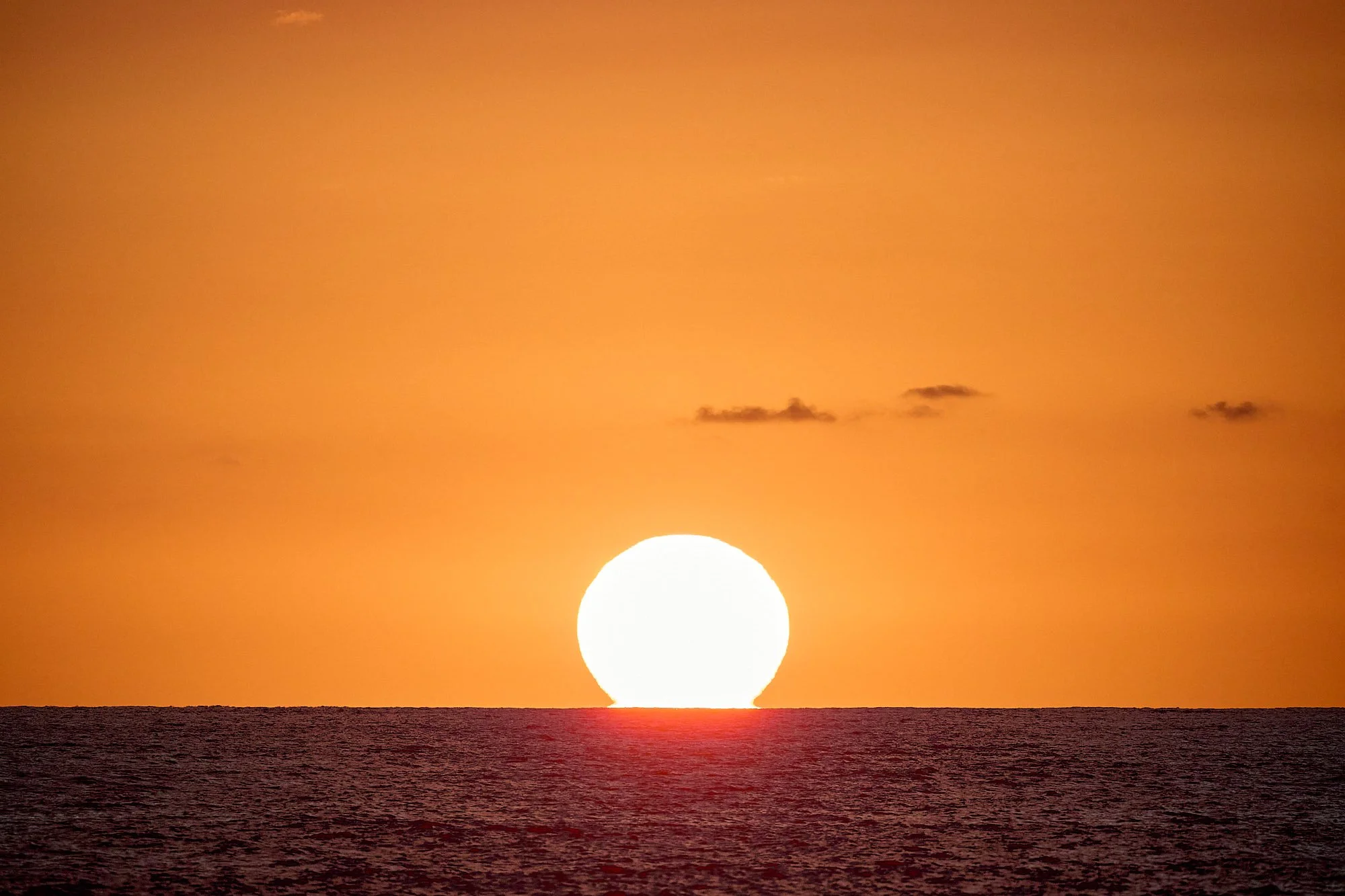
Relaxing at sundown
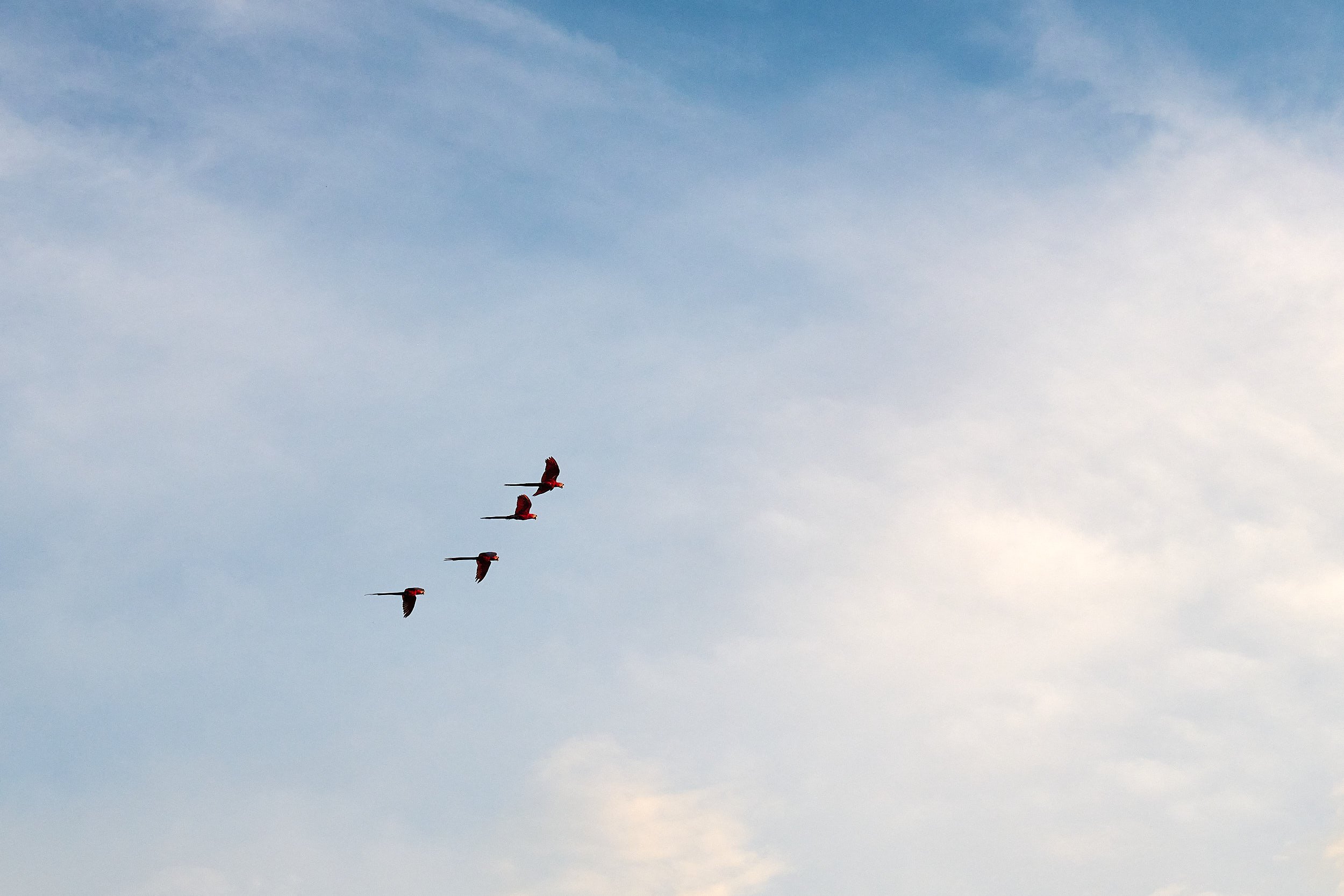
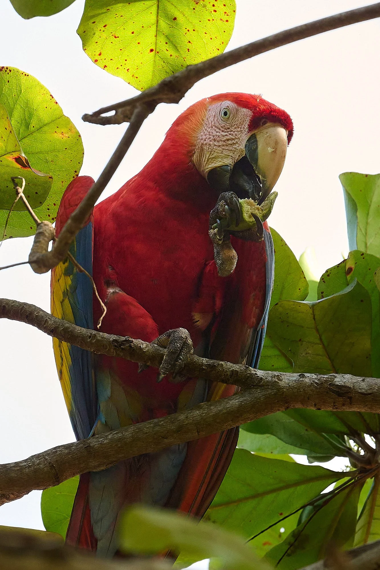
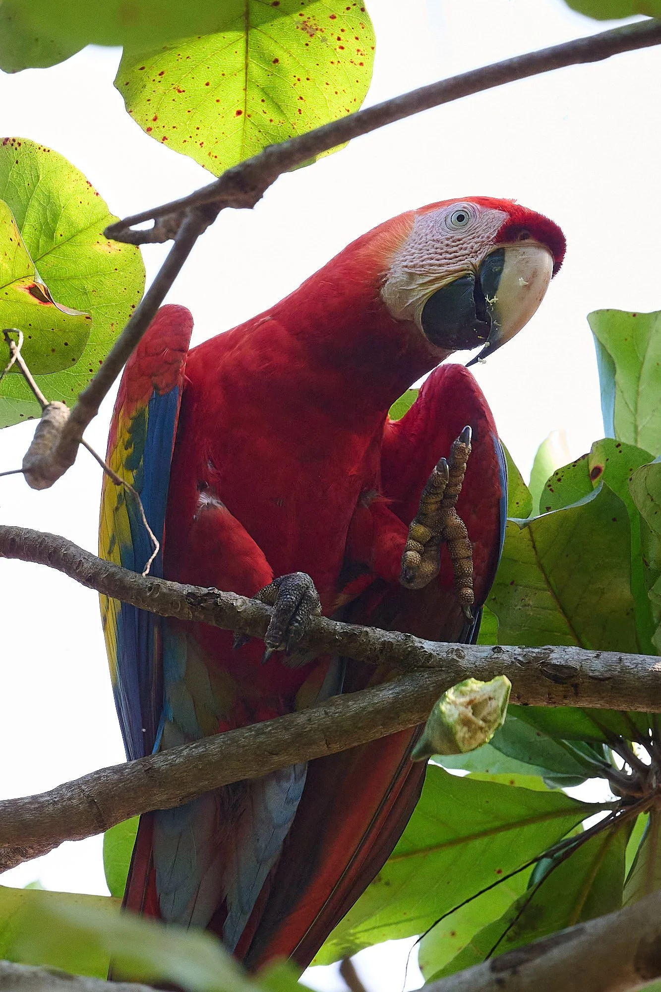
Scarlet macaws
The Scarlet Macaw inhabits the western coastal areas of Costa Rica and the Great Green Macaw lives in the eastern rainforest lowlands. Globally, both species are threatened, primarily because of the removal of chicks from nests by local poachers for sale to the pet trade. Unfortunately, it is a very lucrative practice. Deforestation is also an important factor, as the birds depend on trees for nesting and food.
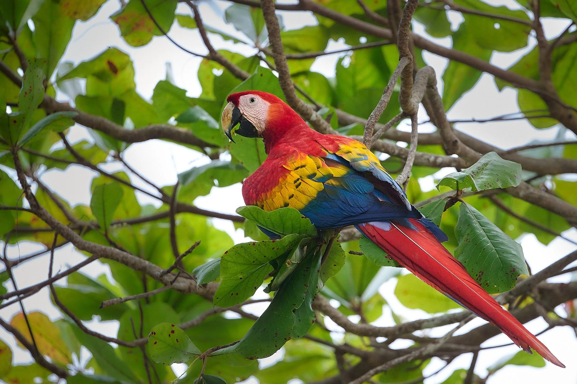
Scarlet Macaws elicit quite a stir among the tourists
In the Central Pacific region of Costa Rica, Scarlet Macaw conservation has become a success story. In response to declining numbers of birds, Dr. Christoper Vaughan (a macaw researcher) and Guillermo Hernández, a local community leader, initiated a local conservation program in 1994. Efforts included educational outreach - especially to school children, enforcing laws prohibiting poaching, and paying ex-poachers to build artificial nest boxes and share their macaw knowledge.
Since the programme was launched, the Scarlet Macaw population in the Central Pacific region has doubled. The macaws have re-established former breeding sites and visitors frequently see them in the trees that fringe the shoreline. Communities are more conscious about the importance of the Scarlet Macaw as a species to the ecosystem, appreciate its iconic value for ecotourism, and no longer tolerate poaching activities.
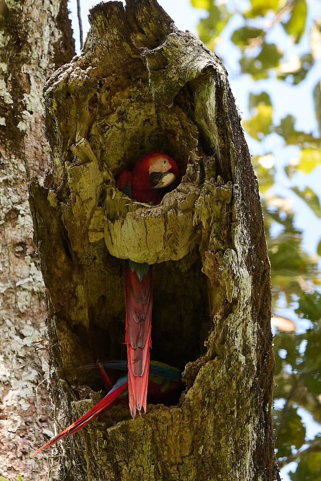
We saw Scarlet Macaws nesting in the Carara National Park and feeding on beach almond fruit near our hotel.
Tarcoles River
The prime attraction of the Tarcoles river delta are the formidable American crocodiles (Crocodylus acutus). Males can reach lengths of more than 20 ft, weighing over 2,200 lb; females are smaller.
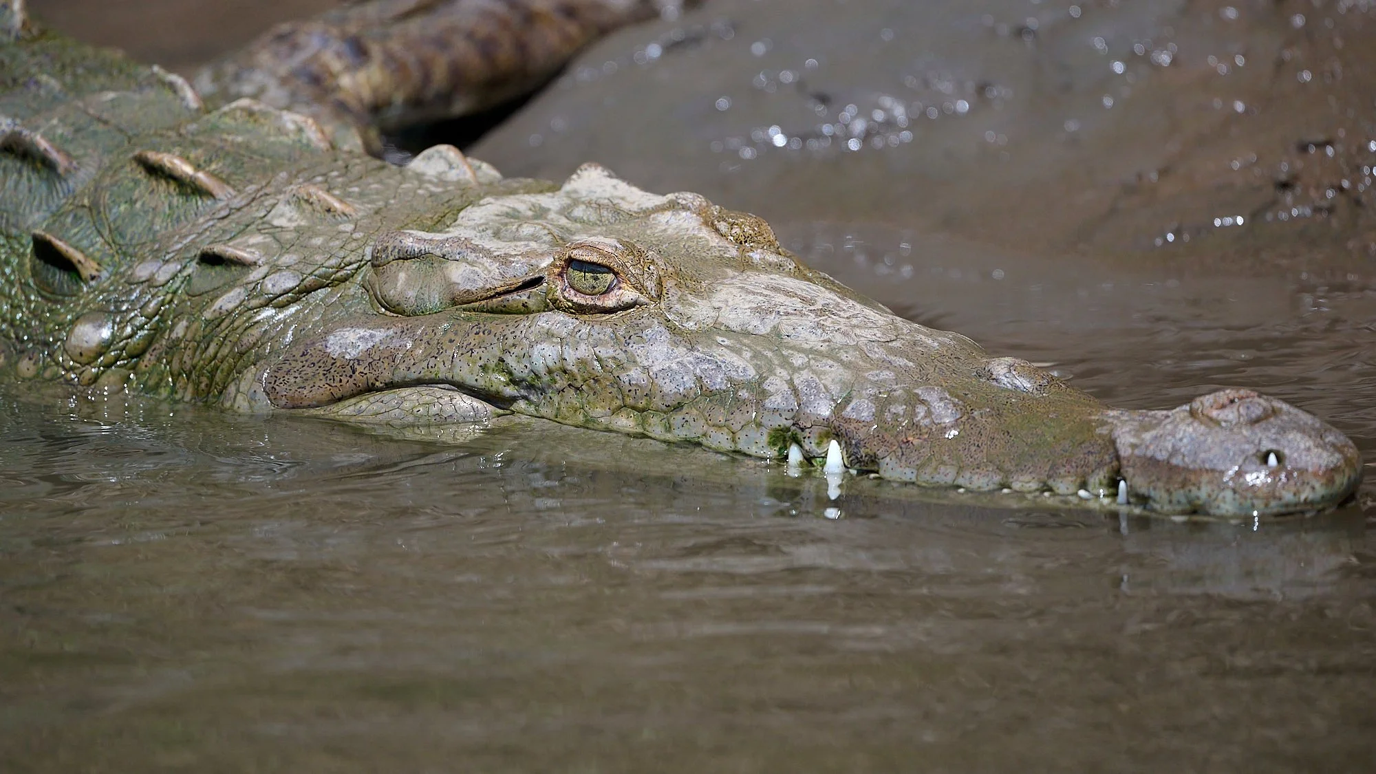
The habitat of the American crocodile consists largely of coastal areas. It is also found in river systems, but tends to prefer salinity, resulting in the species congregating in brackish lakes, mangrove swamps, lagoons, cays, and small islands. Crocodiles have tolerance to saltwater due to salt glands underneath the tongue, but only the American crocodile and saltwater crocodile (Crocodylus porosus) of Asia and Australia commonly live and thrive in saltwater.
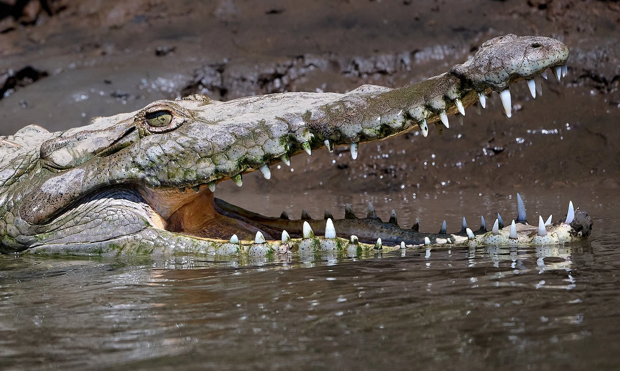
A Miocene fossil discovered in 2020 has helped clarify the evolution of the American crocodile. It is now thought that the genus Crocodylus likely originated in Africa and radiated outward toward Southeast Asia and the Americas.
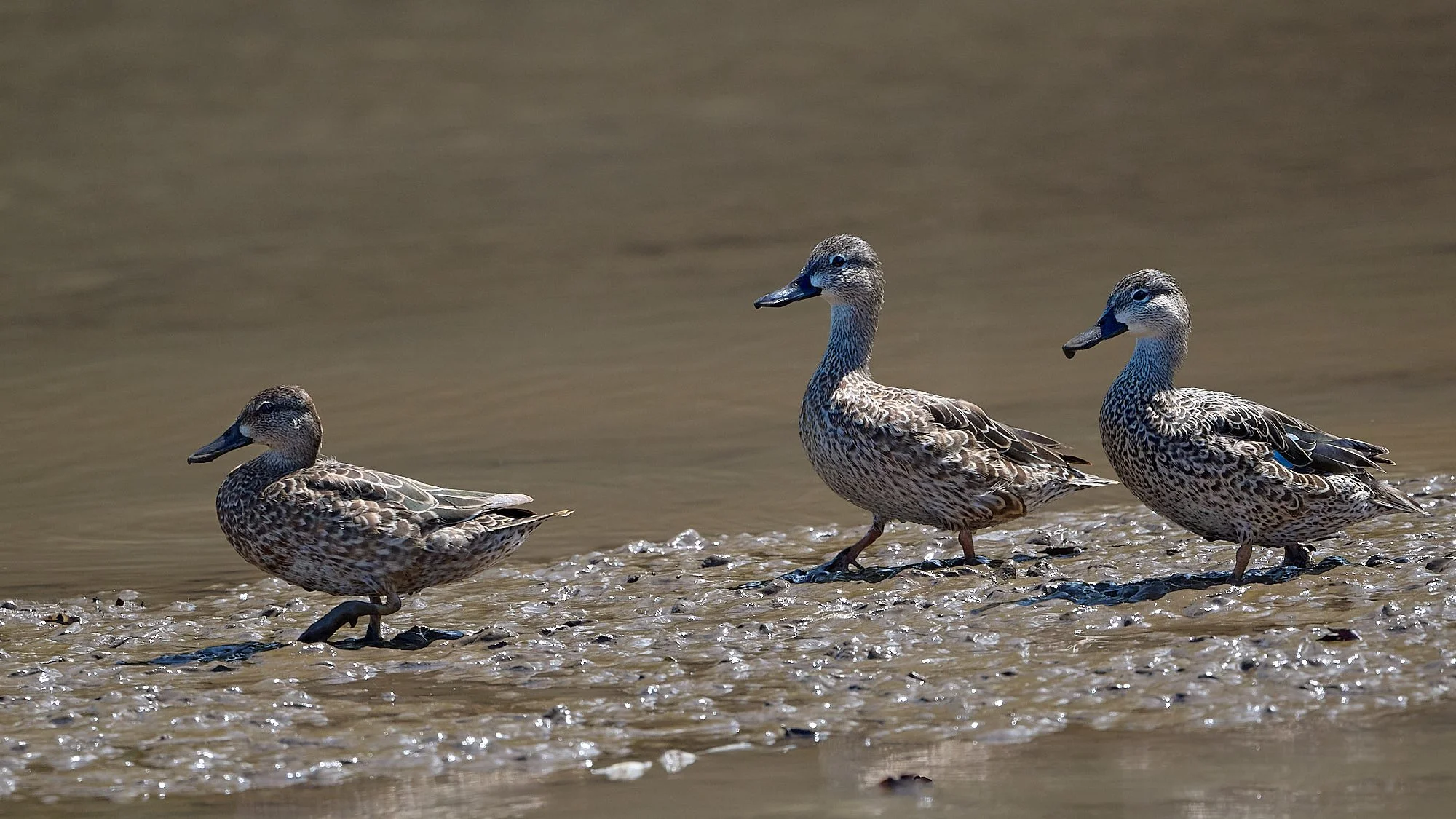
Blue-winged Teal

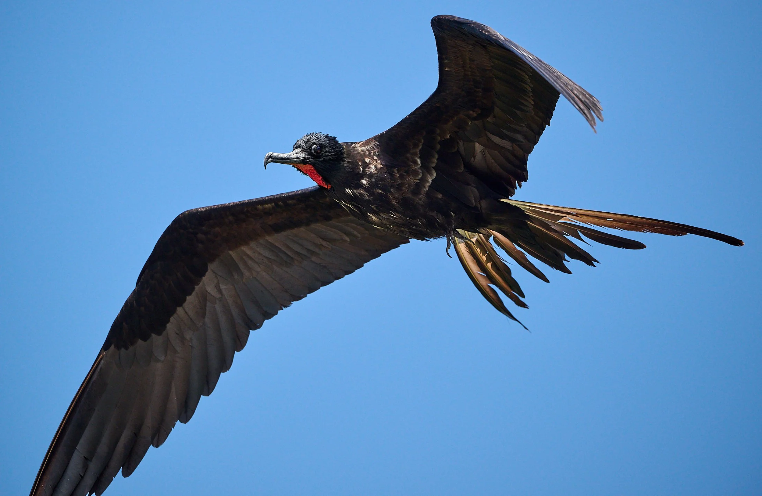
Magnificent Frigatebird, juvenile
Magnificent Frigatebird, male
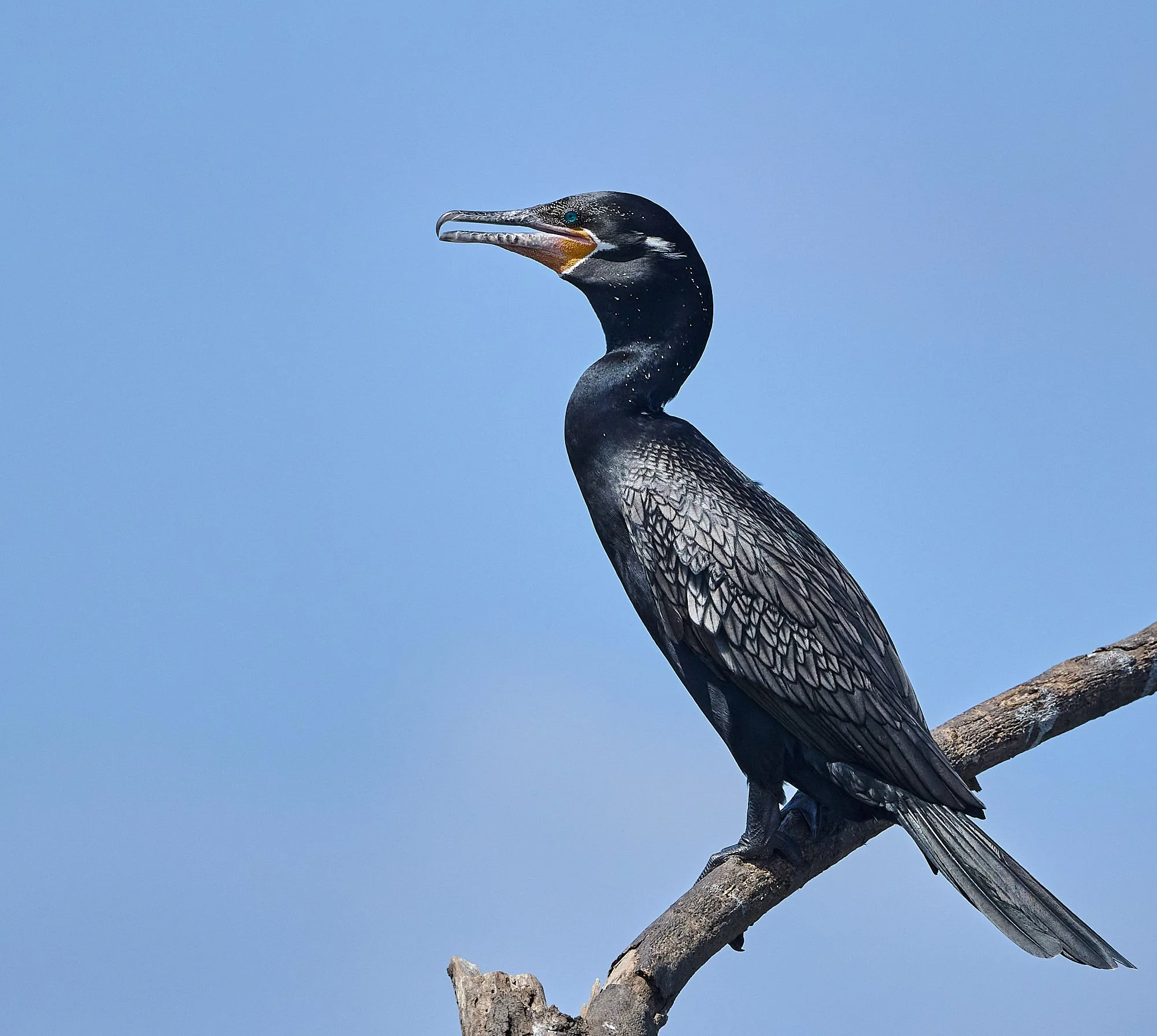
Neotropical Cormorant in breeding plumage
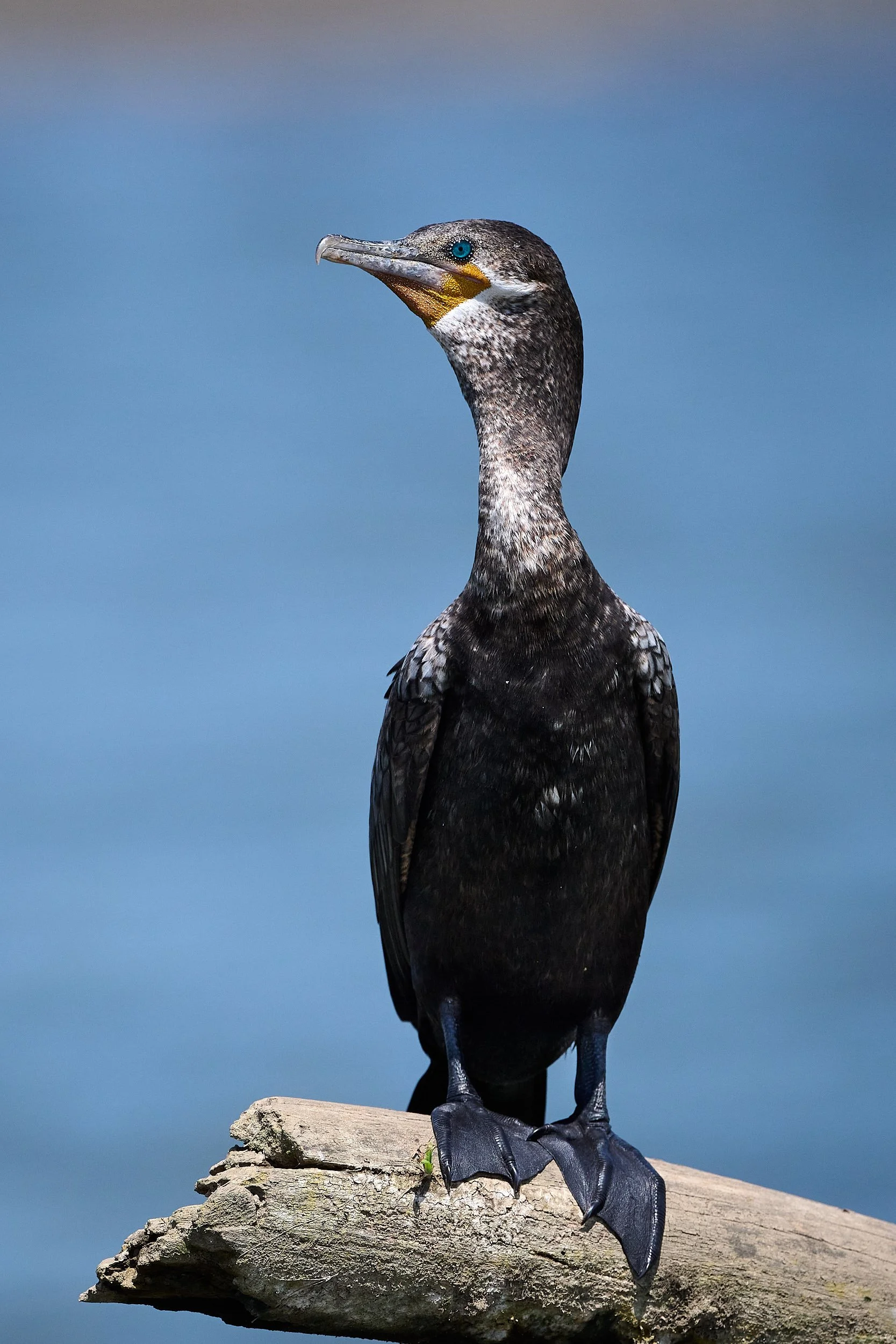
Neotropical Cormorant, non-breeding or juvenile
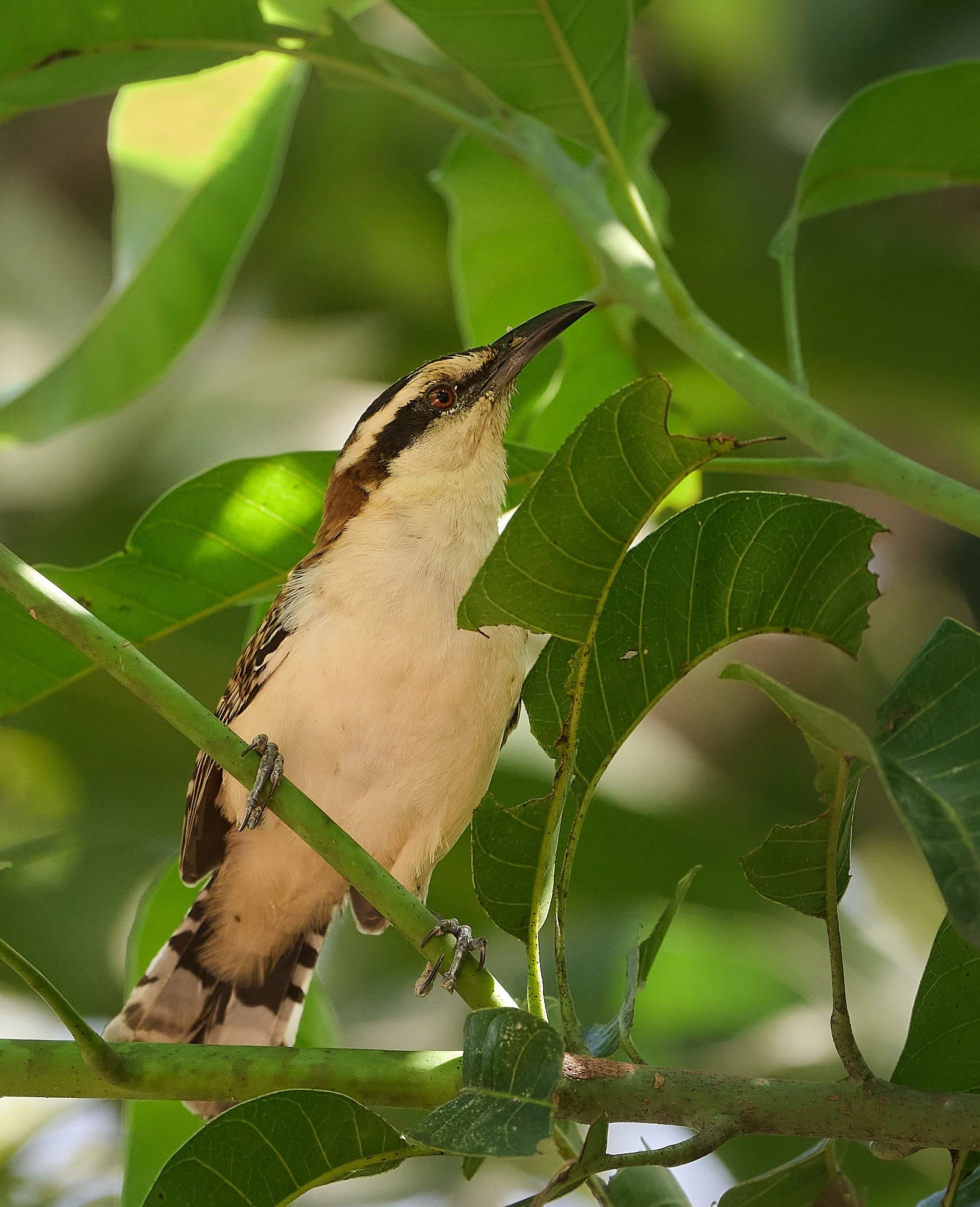
Rufous-backed Wren
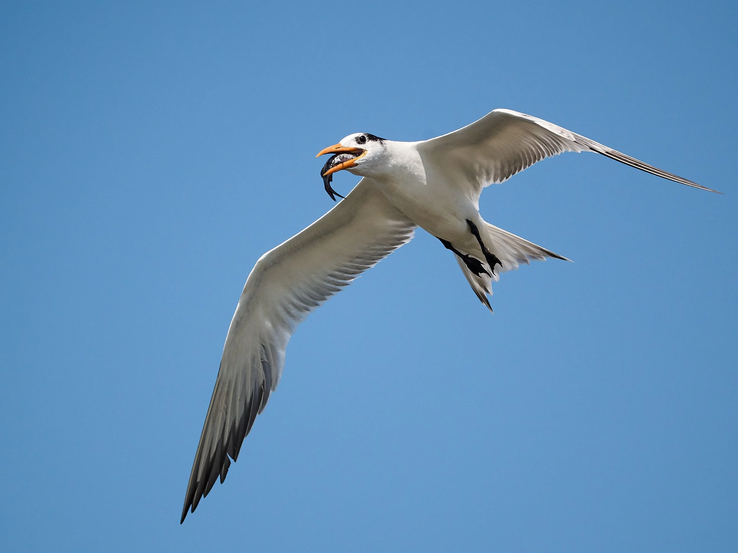
Royal Tern, swallowing dinner while flying
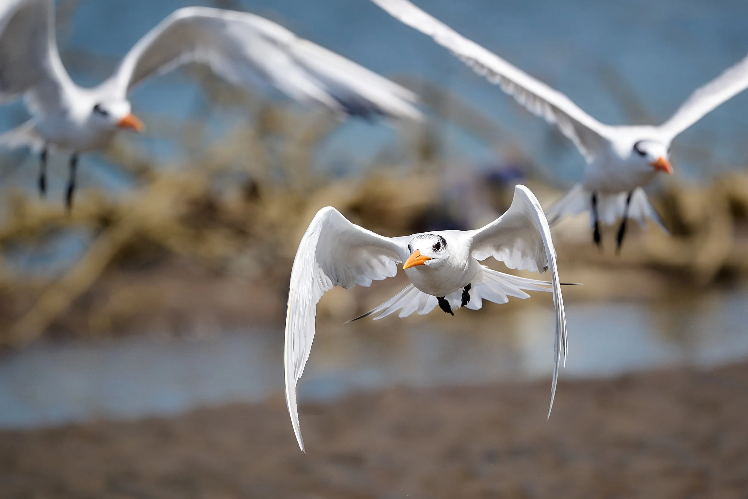
Royal Terns, strictly a coastal species
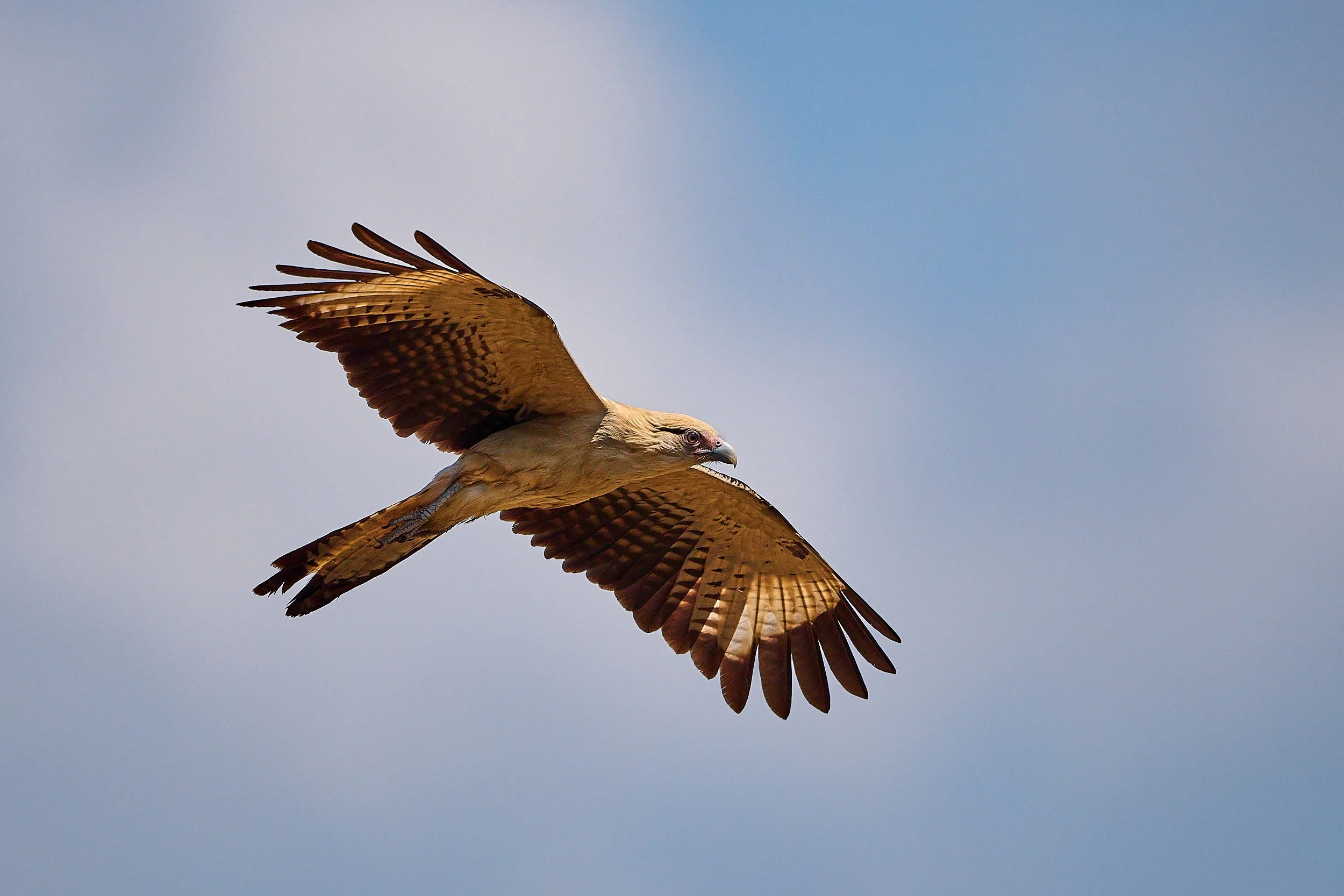
Yellow-headed Caracara
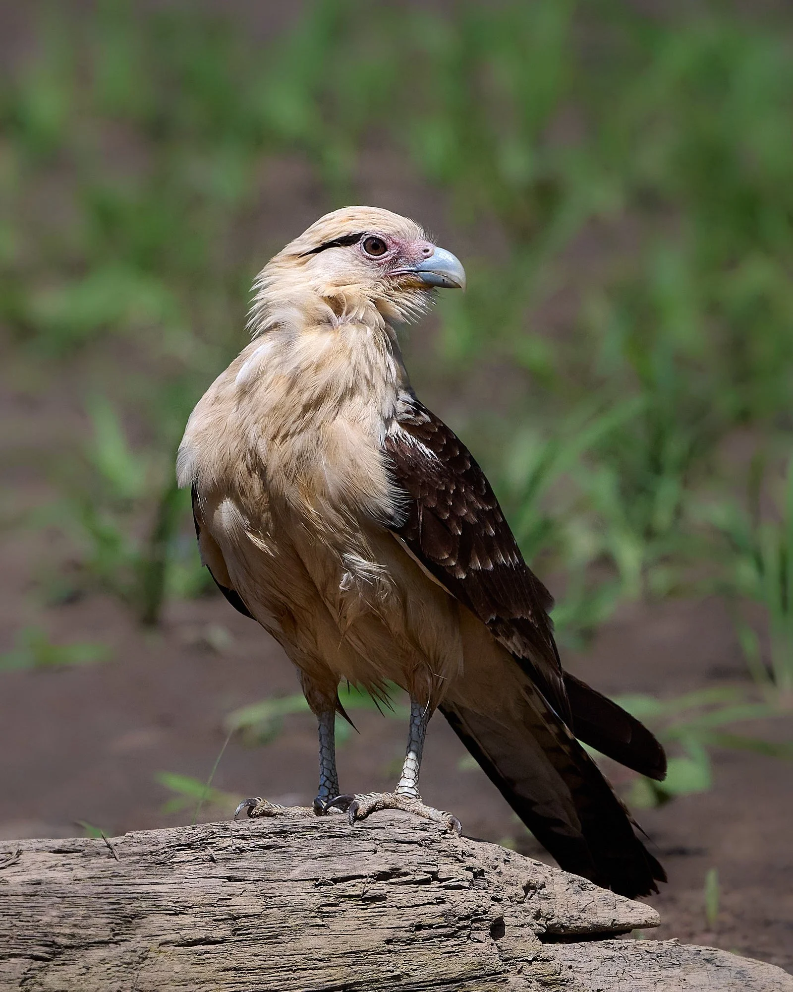
Yellow-headed Caracara, often found in open areas such as fields and river edges

White Ibis
Coffee !!!
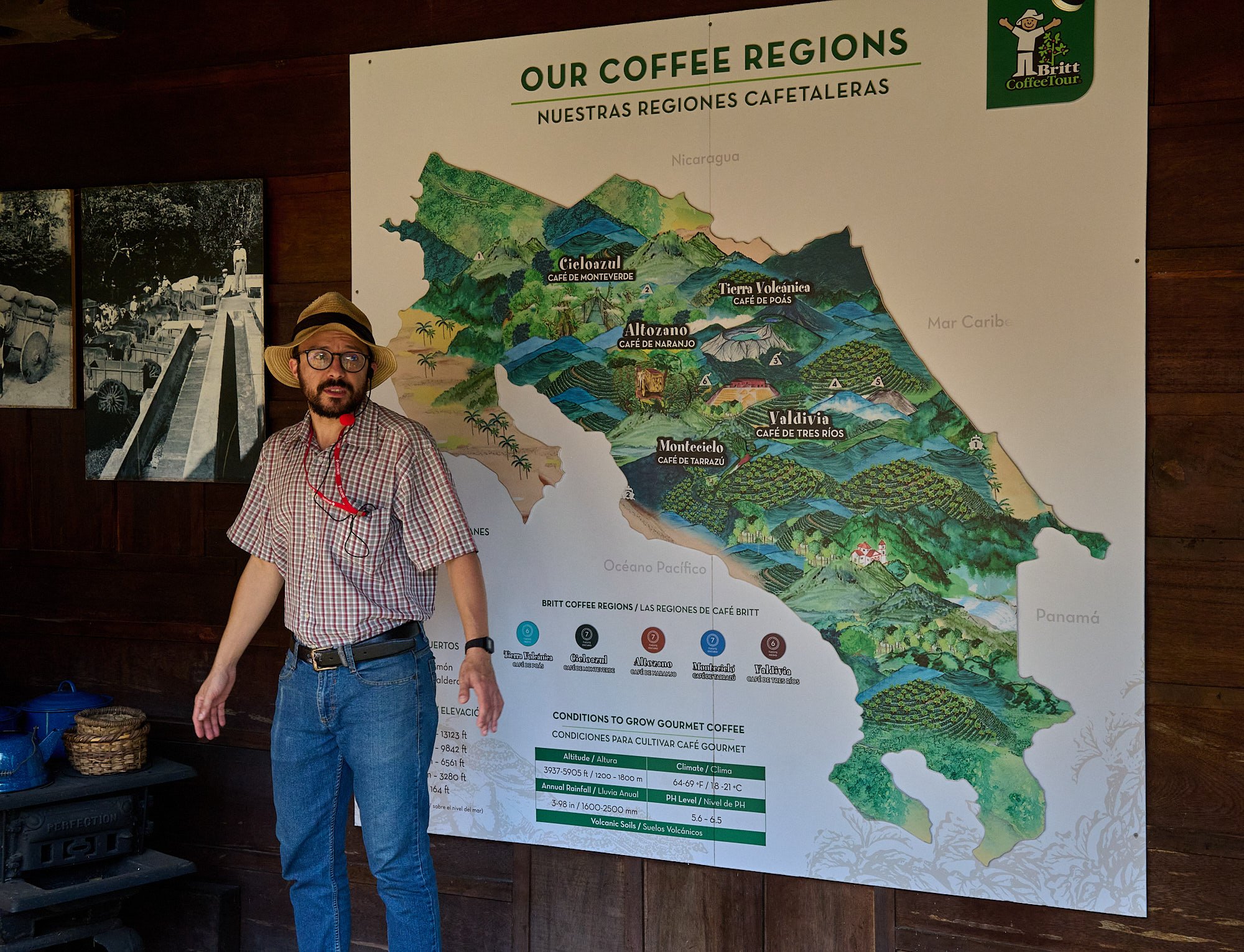
During our time at the capitol city (San José), we visited an old coffee plantation that had been converted into a factory that produced high-quality coffee for export. A company representative took us on an informative and enjoyable ramble among the coffee plants. He stopped at various staged areas to explain the process of manufacturing coffee, starting with nurturing the coffee seedling, through to bean harvesting, preparation, roasting, packaging and finally, the many ways of making a cup of coffee. Of course, we could also taste and buy their products. It was good fun.
Coffee production began in 1779 in Costa Rica and it became the country’s major export for many years.
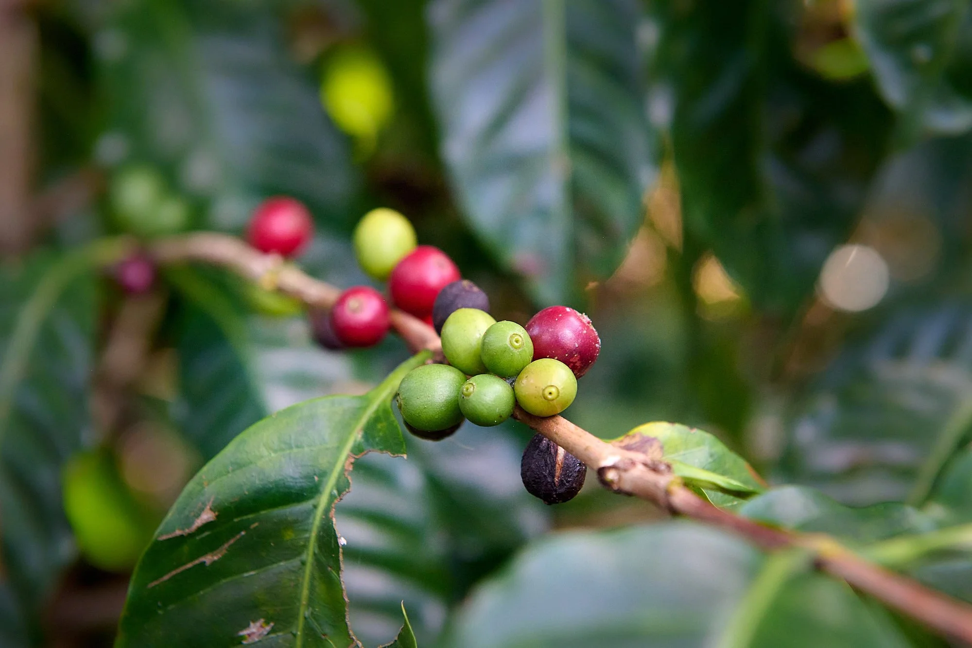
The two most commonly grown coffee bean types are C. arabica and C. robusta. It is thought that both species originated from the Ethiopian highlands.
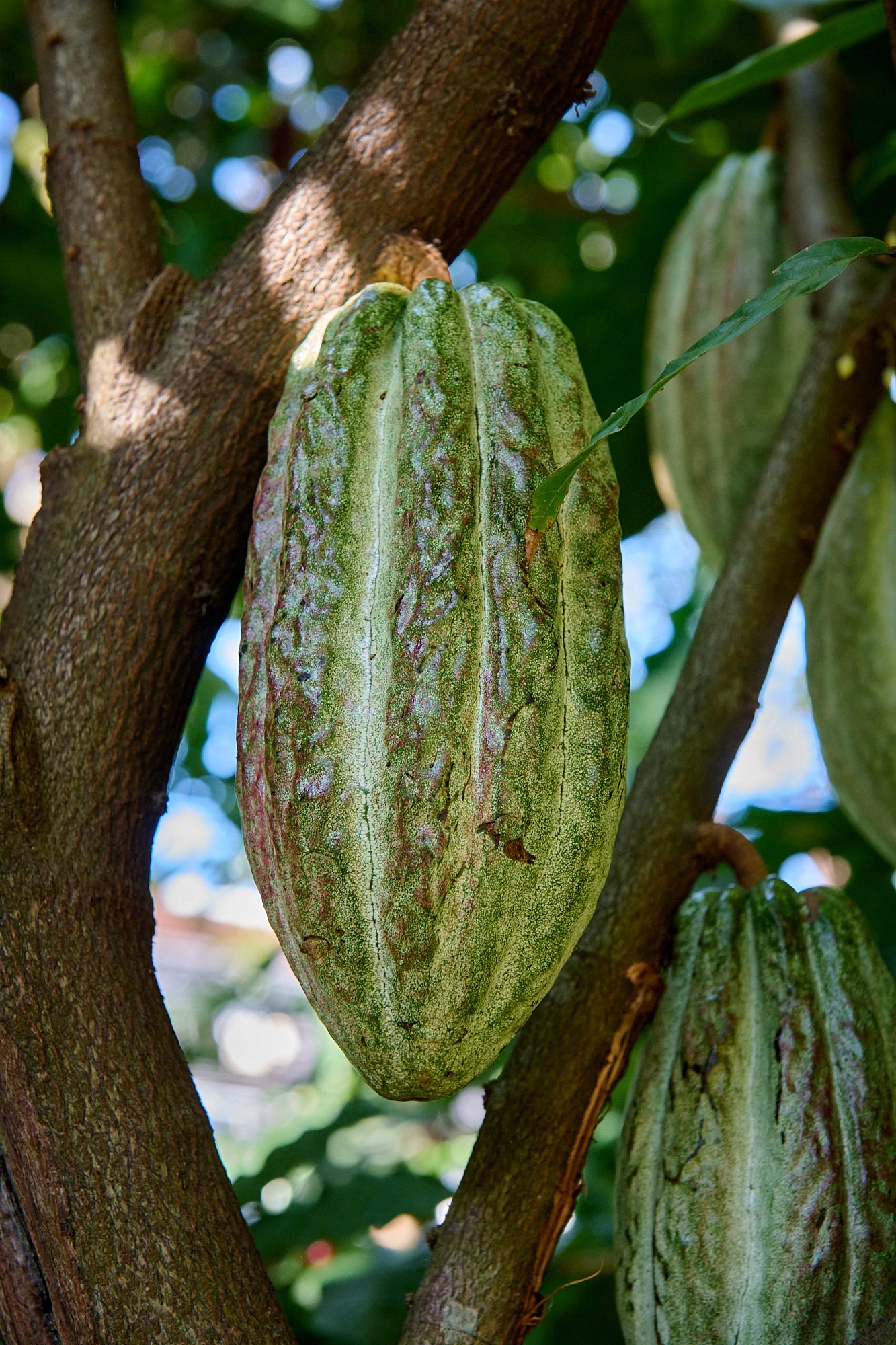
Cacao fruit
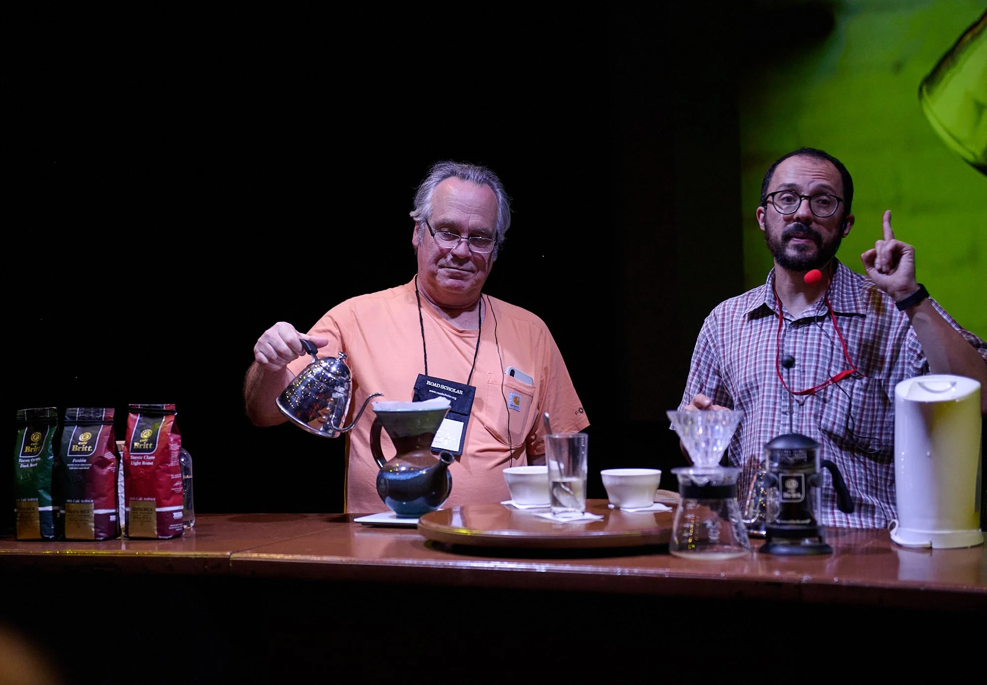
Drip coffee: the angle and ridges in the filter holder are important.

French press: Pour the hot water from up high

Costa Rica, pura vida